Glassford Street

Last updated

Glassford Street
Glasgow's Merchant City - geograph.org.uk - 602364.jpg
TypeCommercial
Maintained by Glasgow City Council
Length0.16 mi (0.26 km)
LocationGlasgow
Postal codeG1
Nearest Glasgow Subway stationSt. Enoch's

Glassford Street is a major thoroughfare in the city of Glasgow, the largest city in Scotland. The street runs north from the junction of Argyle Street and Trongate through the Merchant City until it meets Ingram Street.

Contents

History

Originally this was on the grounds of house of John Glassford; a noted Tobacco Lord. The street was opened in 1793 and originally named Great Glassford Street. Glassford's house, known as the Shawfield Mansion, [1] was removed in 1792 to build the street. [2]

At the time of its opening the street now known as South Frederick Street, to the south of George Square, was known as Little Glassford Street; hence the original Great Glassford Street differentiation. Great Glassford Street was still being used in an advertisement of 1802. [2]

As the new name of South Frederick Street became known instead of Little Glassford Street, there was no need for the differentiation of Great Glassford Street. The street simply became known as Glassford Street. [2]

Public transport

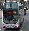
As a street which operates in two directions, unlike many in central Glasgow which are either one-way or fully pedestrianised, Glassford Street forms an important part of the city's taxi and bus corridor network.

Related Research Articles

<span class="mw-page-title-main">Rutherglen</span> Town in Scotland

Rutherglen is a town in South Lanarkshire, Scotland, immediately south-east of the city of Glasgow, three miles from its centre and directly south of the River Clyde. Having previously existed as a separate Lanarkshire burgh, in 1975 Rutherglen lost its own local council and administratively became a component of the City of Glasgow District within the Strathclyde region. In 1996 the towns were reallocated to the South Lanarkshire council area.

<span class="mw-page-title-main">George Square</span> Civic square in Glasgow, Scotland

George Square is the principal civic square in the city of Glasgow, Scotland. It is one of six squares in the city centre, the others being Cathedral Square, St Andrew's Square, St Enoch Square, Royal Exchange Square, and Blythswood Square on Blythswood Hill.

<span class="mw-page-title-main">A728 road</span> Road in Scotland

The A728 is a route number in Glasgow, Scotland applied to two connected roads.

Thomas Hopkirk (1785–1841) was a Scottish botanist and lithographer.

<span class="mw-page-title-main">Trongate</span> Street in Glasgow

Trongate is one of the oldest streets in the city of Glasgow, Scotland. Trongate begins at Glasgow Cross, where the steeple of the old Glasgow Tolbooth is situated, being the original centre of medieval Glasgow, and goes westward changing its name to Argyle Street at Glassford Street. In modern times, it forms the notional southern boundary of the Merchant City area.

<span class="mw-page-title-main">Tobacco Lords</span> Group of 18th-century Scottish merchants

The Tobacco Lords were a group of Scottish merchants active during the Georgian era who made substantial sums of money via their participation in the triangular trade, primarily through dealing in slave-produced tobacco that was grown in the Thirteen Colonies. Concentrated in the port city of Glasgow, these merchants utilised their fortunes, which were also partly made via the direct ownership of slaves, to construct numerous townhouses, churches and other buildings in Scotland.

<span class="mw-page-title-main">A730 road</span> Road in Scotland running from the centre of Glasgow to Cathkin

The A730 road in Scotland runs between the centre of Glasgow and the south-eastern edge of the city's urban area at Cathkin.

Thistle Football Club was a 19th-century football club based in Glasgow. The club was briefly a member of the Scottish Football League Division Two, and has been described as the most insignificant and least successful to have entered the league. They played at Braehead Park during their Scottish League season.

<span class="mw-page-title-main">Royal Exchange Square</span> Public square in Glasgow, Scotland

The Royal Exchange Square is a public square in Glasgow, Scotland. The square lies between Buchanan Street and Queen Street, opening out Queen Street and Ingram Street to the south of George Square. It is also easily accessible from Buchanan Street on the west side of the square, through two prominent archways at Royal Bank Place. The square is a landmark due to its distinguished architecture which attracts many visitors. It is one of six squares in the city centre.

<span class="mw-page-title-main">John Glassford</span> Scottish merchant and planter

John Glassford was a Scottish merchant and planter. One of the most prominent Tobacco Lords of Scotland, Glassford owned tobacco-producing slave plantations in the British North American colonies of Virginia and Maryland, for which he has become controversial in the 21st century.

<span class="mw-page-title-main">Rutherglen Castle</span>

Rutherglen Castle was located where Castle Street meets King Street in Rutherglen, Scotland. It was a large and important castle, having been built in the 13th century; the walls were reportedly 5 feet thick.

Shawfield Amateurs Football Club were a Scottish football team located in the town of Rutherglen that competed in the Scottish Amateur Football League, and also the Scottish Cup in the 1940s and 1950s.

The Hon. John Campbell, of Mamore, was a Scottish Whig politician who sat in the Parliament of Scotland from 1700 to 1707 and in the British House of Commons between 1708 and 1727.

<span class="mw-page-title-main">Shawfield</span> Human settlement in Scotland

Shawfield is an industrial/commercial area of the Royal Burgh of Rutherglen in South Lanarkshire, Scotland, located to the north of the town centre. It is bordered to the east by the River Clyde, to the north by the Glasgow neighbourhood of Oatlands and the adjacent Richmond Park, to the south-west by Glasgow's Polmadie and Toryglen districts, and to the south-east by Rutherglen's historic Main Street and its Burnhill neighbourhood, although it is separated from these southerly areas by the West Coast Main Line railway tracks and the M74 motorway. A road bridge connects Shawfield to the Dalmarnock, Bridgeton and Glasgow Green areas.

<span class="mw-page-title-main">St Andrew's Square, Glasgow</span>

St Andrew's Square is a public square in the city of Glasgow, Scotland and lies to the south east corner of Glasgow Cross, close to Glasgow Green. The square is noted for its immense 18th-century classical church, St Andrew's in the Square, from which the square takes its name. The church was completed in 1758, to the designs of architect Allan Dreghorn and master mason Mungo Naismith and is among the finest of its type anywhere in Britain. The interior has lavish 18th century rococo plasterwork. The building is Category A listed. It is one of six squares in the city centre.

<span class="mw-page-title-main">Rutherglen Bridge</span>

The Rutherglen Bridge or the Shawfield Bridge is a bridge which was built 1893–96, which crosses the River Clyde, in Scotland.

<span class="mw-page-title-main">James White (1812–1884)</span>

James White (1812–1884) was a Scottish lawyer, businessman and chemicals manufacturer. In 1890 he was honoured posthumously with a statue in Glasgow’s Cathedral Square, designed by John Mossman and sculpted by Frank Leslie. It has been designated a Category 'B' listed building by Historic Scotland.

Bridgeton Waverley Football Club was a Scottish football club based in Glasgow. Originally founded in 1904, they competed in the Junior grade from 1923 until folding in 1962.

Cochrane Street is a major thoroughfare in the city of Glasgow, the largest city in Scotland. The street runs east from the junction of George Square and South Frederick Street through the Merchant City until it meets Montrose Street.

<span class="mw-page-title-main">Old Ship Bank</span>

The Ship Bank or more usually Old Ship Bank was an independent bank formed in Glasgow in 1750 becoming Glasgow's first bank. The bank was merged in 1836 and in 1843 the name disappeared altogether, simply becoming the Union Bank of Scotland.

References

  1. "Shawfield Mansion". theglasgowstory.com.
  2. 1 2 3 Glasgow Street Names and Places. James Muir. William Hodge and Company. 1899.

Commons-logo.svg Media related to Glassford Street, Glasgow at Wikimedia Commons

55°51′30.7″N4°14′56.4″W / 55.858528°N 4.249000°W / 55.858528; -4.249000