
National Cycle Route 15 is part of the National Cycle Network in the East Midlands which, when complete, will run from National Cycle Route 1 near Tattershall in Lincolnshire to Castle Donington in Derbyshire via Sleaford, Grantham, and Nottingham.
National Cycle Route 15 is part of the National Cycle Network in the East Midlands which, when complete, will run from National Cycle Route 1 near Tattershall in Lincolnshire to Castle Donington in Derbyshire via Sleaford, Grantham, and Nottingham.
The route is currently opened in a small number of locations and covers a range of roads, cycle paths, and shared use paths.

Wilford | West Bridgford | Radcliffe-on-Trent
From the Wilford Toll Bridge the route follows the River Trent past Trent Bridge before joining lightly trafficked roads between Lady Bay and Radcliffe-on-Trent via the Holme Pierrepont National Watersports Centre.
From Radcliffe-on-Trent to Saxondale the route continues alongside the A52, before continuing alongside the former A52 through Saxondale itself then crossing the duelled A46 on bridleway bridge opened in 2012.
Between Gamston and Radcliffe-on-Trent the route remains signed along its former alignment on the shared use paths adjacent to the A52.
Bingham | Whatton | Aslockton | Orston | Bottesford
This section runs from the A46 Fosse Way on cycle lanes and shared use paths through Bingham and along the A52 to Whatton where it leaves the A52 and runs on lightly trafficked roads through to Bottesford - for half the route between Aslockton and Orston it shared the road with National Cycle Route 64.
This sections runs along the Grantham Canal towpath.

The A52 is a major road in the East Midlands, England. It runs east from a junction with the A53 at Newcastle-under-Lyme near Stoke-on-Trent via Ashbourne, Derby, Stapleford, Nottingham, West Bridgford, Bingham, Grantham, Boston and Skegness to the east Lincolnshire coast at Mablethorpe. It is approximately 147 miles (237 km) long.

Bingham is a market town and civil parish in the Rushcliffe borough of Nottinghamshire, England, 9 miles (14 km) east of Nottingham, 12 miles south-west of Newark-on-Trent and 15 miles west of Grantham. The town had a population of 9,131 at the 2011 census, with the population now sitting at 10,080 from the results of the 2021 census data.

West Bridgford is a town and the administrative centre of the Borough of Rushcliffe, in the county of Nottinghamshire, England. It lies south of Nottingham city centre, east of Wilford, north of Ruddington and west of Radcliffe-on-Trent. It is also southwest of Colwick and southeast of Beeston which are on the opposite bank of the River Trent. The town is part of the Nottingham Urban Area and had a population of 36,487 in a 2021-census.

Aslockton is an English village and civil parish 12 miles (19 km) east of Nottingham and 2 miles (3.2 km) east of Bingham, on the north bank of the River Smite opposite Whatton-in-the-Vale. The parish is also adjacent to Scarrington, Thoroton and Orston and within the Rushcliffe borough of Nottinghamshire. The population was recorded as 974 in the 2011 census, doubling to 1,937 at the 2021 census.

The Vale of Belvoir covers adjacent areas of Leicestershire, Nottinghamshire and Lincolnshire, England. The name derives from the Norman-French for "beautiful view" and dates back to Norman times.

The Nottingham–Grantham line is a branch line between the city of Nottingham and the town of Grantham in the East Midlands of England. For most of its length it runs parallel to the A52.

Bingham was a wapentake of the historic county of Nottinghamshire, England. It was in the south-east of the county, to the south of the River Trent.

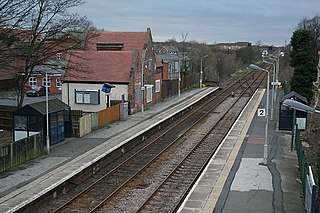
Radcliffe railway station (also known as Radcliffe-on-Trent and Radcliffe (Notts)) serves the village of Radcliffe-on-Trent in Nottinghamshire, England. It lies on the Nottingham to Grantham Line, 5 miles (8 km) east of Nottingham. Services run to Nottingham, Grantham, Boston and Skegness.
Netherfield railway station serves the town of Netherfield in the Borough of Gedling in Nottinghamshire, England. It comprises a single island platform with two tracks, with only a single waiting shelter. Access is via a flight of steps down from Chaworth Road, which crosses the line at a bridge at this point.
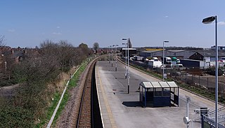
Bingham railway station serves the market town of Bingham, Nottinghamshire, England. The station is 8½ miles (14 km) east of Nottingham on the Nottingham-Skegness Line. The station is operated and served by East Midlands Railway.

Aslockton railway station serves the English villages of Aslockton and Whatton-in-the-Vale in Nottinghamshire. It also draws passengers from other nearby villages. It is 10 miles east of Nottingham on the Nottingham–Skegness Line.

Elton and Orstonrailway station serves the villages of Elton on the Hill and Orston in Nottinghamshire, England. It is owned by Network Rail and managed by East Midlands Railway, but now provides minimal rail services.

Bottesford railway station serves the village of Bottesford in Leicestershire, England. The station is 15 miles east of Nottingham, on the lines to Grantham and Skegness. It is the least used station in Leicestershire.

Orston is an English village and civil parish in the Rushcliffe borough of Nottinghamshire, 15 miles east of Nottingham. It borders the parishes of Scarrington, Thoroton, Flawborough, Bottesford and Elton on the Hill. The population at the 2011 census was 454, increasing to 512 residents at the 2021 census.

Whatton-in-the-Vale is an English village in the Nottinghamshire borough of Rushcliffe. It lies in the Vale of Belvoir, with the River Smite to the west and a subsidiary, the River Whipling to the east, mainly north of the trunk A52 road, 12 miles (19 km) east of Nottingham. It had a population of 843 at the 2011 census, increasing to 874 at the 2021 census.
Saxondale is a small hamlet and civil parish in the Rushcliffe borough of Nottinghamshire, England, situated just off the A52 road near to its junction with the A46 road at the Saxondale roundabout, between the settlements of Bingham and Radcliffe on Trent. There is evidence of an Anglo-Saxon fort with earthworks visible from the main road. 30 residents were recorded at the 2021 census.

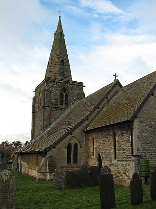
Thoroton is a small English village and civil parish in the borough of Rushcliffe, and the county of Nottinghamshire, with a population of 112 at the 2011 census, and increasing to 130 at the 2021 census. The village has conservation area status. Its Anglican parish church is a Grade I listed building.

Nottingham London Road railway station was opened by the Great Northern Railway on London Road Nottingham in 1857.
Scarrington is an English civil parish and small village in the Rushcliffe borough of Nottinghamshire, adjacent to Bingham, Car Colston, Hawksworth, Orston and Aslockton. Its 968 acres had a population in the 2011 census of 183, falling to 167 at the 2021 census. It lies at Ordnance Survey grid reference SK7341 in the undulating farmland of the Vale of Belvoir, some 2 miles (3.2 km) from the town of Bingham and from a stretch of the Roman Fosse Way (A46) between Newark and Leicester. It is skirted by the A52 road between Nottingham and Grantham.