Aslockton | |
---|---|
Village and civil parish | |
Parish map | |
Location within Nottinghamshire | |
Area | 1.84 sq mi (4.8 km2) |
Population | 1,937 (2021) |
• Density | 1,053/sq mi (407/km2) |
OS grid reference | SK 7440 |
• London | 105 mi (169 km) SSE |
District | |
Shire county | |
Region | |
Country | England |
Sovereign state | United Kingdom |
Post town | Nottingham |
Postcode district | NG13 |
Dialling code | 01949 |
Police | Nottinghamshire |
Fire | Nottinghamshire |
Ambulance | East Midlands |
UK Parliament | |
Website | aslockton-pc |
Aslockton is an English village and civil parish 12 miles (19 km) east of Nottingham and 2 miles (3.2 km) east of Bingham, on the north bank of the River Smite opposite Whatton-in-the-Vale. The parish is also adjacent to Scarrington, Thoroton and Orston and within the Rushcliffe borough of Nottinghamshire. [1] The population was recorded as 974 in the 2011 census, [2] doubling to 1,937 at the 2021 census. [3]
Appearing as Aslachetone in the Domesday Book of 1086, [4] the place name seems to contain an Old Norse personal name Aslakr + tūn (Old English) meaning an enclosure, a farmstead, a village, an estate, etc., so "Farm or settlement of a man called Aslakr". [5] There are 19 such place names (a Scandinavian personal name followed by tūn ) in Nottinghamshire, all of them in the Domesday survey, and all apparently ancient villages. [6]
All that remains of the 12th-century Aslockton Castle are some earthworks. The motte, called Cranmer's Mound, stands about 16 feet (5 m) high.
Thomas Cranmer, Archbishop of Canterbury 1533–1553, was born in Aslockton and lived until the age of 14 in his parents' cottage, which still stands on Main Street. [7] The Archbishop Cranmer Church of England Primary School (an academy since 2014, having opened in 1968), the Cranmer Pre-School, and the local social facility, the Thomas Cranmer Centre, are named after him. (For secondary education, Toot Hill School in Bingham has a sixth form and academy status.) [8] Aslockton originally had its own Holy Trinity Chapel, a peculiar under the collegiate church of Southwell Minster rather than the diocesan bishop, [9] but this fell into ruins and was incorporated into a private house. Some remains of it can still be seen. [10] Cranmer and his father worshipped at the Church of St John of Beverley, Whatton. [11] He has also given his name to a local prospect mound. [12]
John Cranmer, a gentleman, was living in "Aslacton", in 1452. [13]
The population of Aslockton was 171 in 1801, 273 in 1821, and 289 in 1831. [14] The village had a population of 363 in 1936. [15]
The land for Aslockton Cemetery was purchased in 1869, at which time the only place of worship in the village was a Methodist chapel, which has since been converted into flats. [16]
The present Grade II listed St Thomas's Church was designed by the architect Sir Reginald Blomfield and erected in 1890–1892 in memory of a former vicar of Whatton, Thomas K. Hall, who drowned in February 1890 as RMS Quetta was wrecked off Queensland on her way to Thursday Island. [17] His mother, Mrs Sophia E. Hall, paid for the church. The Quetta window on the north wall depicting the shipwreck was designed by Michael Stokes in 2002, as was the east window, dedicated to Cranmer, which has Jesus showing his hands to Doubting Thomas. [18] The church has a single bell in a bell cote at the west end. [19]
The parish forms part of the Cranmer group, with Hawksworth, Scarrington, Thoroton, Whatton and Orston. The incumbent is Rev. Tim Chambers. The vicarage is in Aslockton. [20]
The Thomas Cranmer Centre opened in 2010 and serves as the village hall as well as the church hall. It replaced an earlier village hall and is attached to the parish church on Main Street.
Despite the village's small size, it had two pubs: the Old Greyhound and the Cranmer Arms. The former closed in May 2007, but the new owners submitted a planning application to turn it into a restaurant. [21] The restaurant was not included in the final housing development. The village has a small shop, which includes a post office and a dry-cleaning service. Aslockton Hall houses a nursing and residential home for the elderly. [22]
The Aslockton windmill and bake house stood in Mill Lane (grid reference SK739408 ). [23] The mill was a wooden post mill, weather-boarded on a brick roundhouse, with four single patent sails. The miller and baker in 1864 was Job Heathcote. [24]
The village railway station has regular services to Nottingham, Grantham, Spalding and Skegness. There is a bus service to Bingham and Bottesford for onward connections to Nottingham, Newark and Grantham.
Aslockton has a parish council that belongs under Rushcliffe Borough Council.
The local free quarterly newsletter, delivered to every house, is called The Voice. [25]
Whatton and Aslockton have a joint cricket club said to date back before 1815. [26] It has two senior teams in the South Nottinghamshire Cricket League and a colts team in the Newark Under 15s Premiership League. [27] Aslockton Cranmer Football Club fields several teams for adults and youngsters. [28] There is also a tennis club, [29] and table tennis teams at the Thomas Cranmer Centre. [30]
In birth order
Bingham is a market town and civil parish in the Rushcliffe borough of Nottinghamshire, England, 9 miles (14 km) east of Nottingham, 12 miles (18.8 km) south-west of Newark-on-Trent and 15 miles (23.3 km) west of Grantham. The town had a population of 9,131 at the 2011 census, with the population now sitting at 10,080 from the results of the 2021 census data.
Alverton is an English hamlet and civil parish in the Newark and Sherwood district of Nottinghamshire. It is joined by neighbouring Kilvington to form an area for a parish meeting. It contains 22 houses surrounded by farmland, and reported 61 residents in the 2021 census. The River Devon and its tributary, the Winter Beck, run along its eastern border.
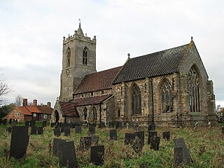
Car Colston is an English village and civil parish in the Rushcliffe borough of Nottinghamshire. The population of the civil parish at the time of the 2011 census was 185, falling to 171 at the 2021 census.
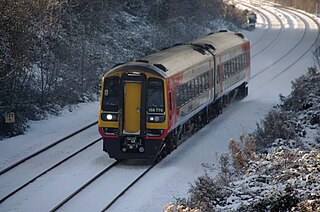
The Nottingham–Grantham line is a branch line between the city of Nottingham and the town of Grantham in the East Midlands of England. For most of its length it runs parallel to the A52.
Bingham was a wapentake of the historic county of Nottinghamshire, England. It was in the south-east of the county, to the south of the River Trent.
Aslockton railway station serves the English villages of Aslockton and Whatton-in-the-Vale in Nottinghamshire. It also draws passengers from other nearby villages. It is 10 miles east of Nottingham on the Nottingham–Skegness Line.
Granby is a small village in the Rushcliffe district of Nottinghamshire, England. It lies in the Vale of Belvoir.
Orston is an English village and civil parish in the Rushcliffe borough of Nottinghamshire, 15 miles east of Nottingham. It borders the parishes of Scarrington, Thoroton, Flawborough, Bottesford and Elton on the Hill. The population at the 2011 census was 454, increasing to 512 residents at the 2021 census.
Whatton-in-the-Vale is an English village in the Nottinghamshire borough of Rushcliffe. It lies in the Vale of Belvoir, with the River Smite to the west and a subsidiary, the River Whipling to the east, mainly north of the trunk A52 road, 12 miles (19 km) east of Nottingham. It had a population of 843 at the 2011 census, increasing to 874 at the 2021 census.
Thoroton is a small English village and civil parish in the borough of Rushcliffe, and the county of Nottinghamshire, with a population of 112 at the 2011 census, and increasing to 130 at the 2021 census. The village has conservation area status. Its Anglican parish church is a Grade I listed building.
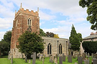
Hawksworth is an English conservation village and civil parish in the Rushcliffe borough of Nottinghamshire. It lies 10 miles (16 km) south of Newark-on-Trent, adjacent to the villages of Flintham, Sibthorpe, Thoroton, Scarrington and Screveton.
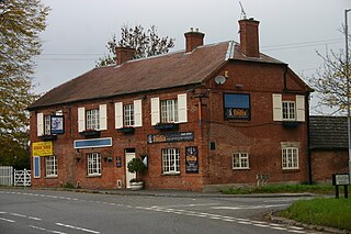
Elton on the Hill is a hamlet and civil parish in Nottinghamshire, England and within the Vale of Belvoir. A population of 114 was reported at the 2021 census.
St. Thomas' Church, Aslockton is a late 19th-century Church of England parish church in the village of Aslockton, Nottinghamshire. The church is Grade II listed by the Department for Digital, Culture, Media and Sport as a building of special architectural or historic interest.
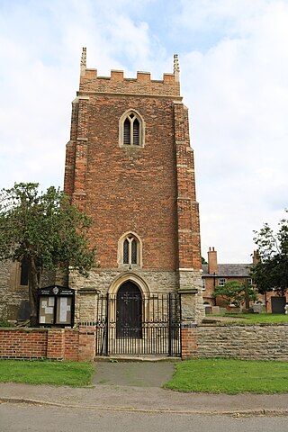
The Church of St Mary and All Saints, Hawksworth is the Church of England parish church in Hawksworth, Nottinghamshire. It is Grade II* listed by the Department for Digital, Culture, Media and Sport as a particularly significant building of more than local interest.
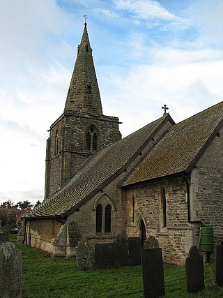
The Church of St John of Beverley is a 13th-century parish church of the Church of England, in the village of Scarrington, Nottinghamshire. It has been Grade I listed by the Department for Digital, Culture, Media and Sport.
The Church of St John of Beverley, Whatton is a parish church in the Church of England in Whatton-in-the-Vale, Nottinghamshire, dedicated to St John of Beverley. The church is Grade II* listed by the Department for Digital, Culture, Media and Sport.
Sutton-cum-Granby is a hamlet in the Borough of Rushcliffe in Nottinghamshire, England. It lies in the Vale of Belvoir.
Screveton is an English civil parish and village in the Rushcliffe borough of Nottinghamshire, with 191 inhabitants at the 2011 census. Screveton singularly reported 164 residents at the 2021 census. It was formerly in Bingham Rural District and before 1894 in Bingham Wapentake. It is adjacent to Kneeton, Flintham, Hawksworth, Scarrington, Little Green and Car Colston.
Scarrington is an English civil parish and small village in the Rushcliffe borough of Nottinghamshire, adjacent to Bingham, Car Colston, Hawksworth, Orston and Aslockton. Its 968 acres had a population in the 2011 census of 183, falling to 167 at the 2021 census. It lies at Ordnance Survey grid reference SK7341 in the undulating farmland of the Vale of Belvoir, some 2 miles (3.2 km) from the town of Bingham and from a stretch of the Roman Fosse Way (A46) between Newark and Leicester. It is skirted by the A52 road between Nottingham and Grantham.