National Cycle Route 61 [1] is part of the National Cycle Network managed by the charity Sustrans. [2] It runs for 34 miles from Maidenhead (Berkshire) to Rye House (Hertfordshire) via Uxbridge, Watford, St Albans, Hatfield, Welwyn Garden City and Hertford in the United Kingdom.
Maidenhead | Windsor | Uxbridge
National Cycle Route 61 starts from a junction with National Cycle Route 4 on the southern outskirts of Maidenhead. It follows the Jubilee River (a River Thames flood relief channel, passing north of Windsor not far from Eton College. [3] Just north of Eton, the route leaves the river to cross Ditton Park and then turns north through Langley. The route then follows country lanes and a section of unsurfaced bridleway before joining National Cycle Route 6 on the towpath of the Grand Union Canal at Cowley in Uxbridge, not far from Brunel University.
Uxbridge | Rickmansworth | Watford | St Albans
From Uxbridge to St Albans, route 61 shares a common section described in the National Cycle Route 6 entry. With a few diversions, the route from Uxbridge to Rickmansworth follows the towpath of the Grand Union Canal in the Colne Valley. At Rickmansworth it joins the Ebury Way, a rail trail which runs along a former line of the Watford and Rickmansworth Railway. After central Watford, the route continues to follow the River Colne north westwards leading to an attractive wooded section at Bricket Wood. Route 61 then climbs up into the village of Chiswell Green, an unsurfaced section leads to the bridge over the A414, the former M10 motorway.
Passing through the southern suburbs of St Albans the route then reaches a level crossing over the railway, known locally as the Abbey Flyer after the nearby St Albans Abbey station. Cyclists wishing to visit Verulamium (Roman St Albans) should use the level crossing and follow the St Albans Green Ring signs to the park and museum. Just after this level crossing, route 61 leaves National Cycle Route 6. The centre of St Albans can be reached by following route 6 north from here.
St Albans | Hatfield | Welwyn Garden City | Hertford | Ware | Rye House, Hoddesdon
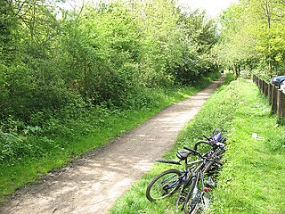
The section of route 61 from St Albans to Hatfield is known as the Alban Way. [4] It is a former railway line. Just after the route pass the former London Road station, it goes under the Midland Main Line and then reaches a zig-zag cycle route up the hill to St Albans City station. At Nast Hyde, Hatfield, a local resident has restored the former station platform sign and provided information about the former railway.
The cycle route then enters Hatfield, passing east of the Galleria shopping centre and curving round to join National Cycle Route 12 just north of Hatfield station.
The combined routes 12 and 61 then pass over the A414 and pass the hamlet of Mill Green where there is a restored water mill, Mill Green Museum. [5] Just before Twentieth Mile Bridge in Welwyn Garden City, route 61 leaves route 12 to head east. At Great Ganett, route 61 becomes the Cole Green Way, [6] mostly following the line of another old railway.
At Hertford, the town is entered at the stadium for Hertford Football Club. Care must be taken when riding through the car park on match days. Central Hertford is particularly attractive and is a good location to stop for refreshments. Hertford Museum is passed and then route 61 crosses the River Lea (or Lee as it becomes at this point) at the start of the Hertford Arm of the Lee and Stort Navigation, a canalised river. The section of the route from Hertford to Ware via Hartham Common and alongside the river is very popular with cyclists and walkers. [7] Along this section you will pass the start of the New River. As the information board by route 61 explains, the New River is not new or a river, it being a man made channel opened in 1613 to carry clean water to central London.
At Ware there is a choice of route either via Ware station or a narrower section of towpath through the town centre. From Ware route 61 is on the towpath of the Lea and Stort Navigation until it reaches its end at Rye House. Part of Rye House, one of the earliest brick buildings in the UK, can be visited just north of the river. Here the cycle route makes a junction with National Cycle Route 1. Turn south to follow the River Lee into London or north for the route via Harlow to Chelmsford.
Hertfordshire is one of the home counties in southern England. It borders Bedfordshire to the north, Cambridgeshire to the north-east, Essex to the east, Greater London to the south, and Buckinghamshire to the west and the south-west. For government statistical purposes, it forms part of the East of England region.
Hertford is the county town of Hertfordshire, England, and is also a civil parish in the East Hertfordshire district of the county. The parish had a population of 26,783 at the 2011 census.
The Ebury Way is a 3.5-mile (5.6 km) rail trail in Hertfordshire between Watford and Rickmansworth. The route crosses the Grand Union Canal and three rivers; the River Colne, the River Chess and the River Gade.
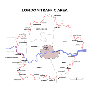
The London Traffic Area was established by the London Traffic Act 1924 to regulate the increasing amount of motor traffic in the London area. The LTA was abolished in 1965 on the establishment of the Greater London Council.
The Alban Way is a traffic free multi-user route along a former railway line in Hertfordshire, England, that has been constructed along the route of the former Hatfield to St Albans railway line. It runs from St Albans, close to St Albans Abbey railway station and the site of Roman Verulamium, through Fleetville and Smallford to Hatfield, ending close to Hatfield railway station. It is 6.3 miles (10.1 km) long. The route is owned by St Albans and City District Council and Welwyn Hatfield Borough Council within its respective boundaries.
National Cycle Route 4 is a route of the National Cycle Network, running from London to Fishguard, Pembrokeshire. Between these, the route runs through Reading, Bath, Bristol, Newport, Swansea and St David's. Within Wales, sections of the route follow branches of the Celtic Trail cycle route.
National Cycle Route 6 is a route of the National Cycle Network, running from London to the Lake District.
The Lea Valley Walk is a 50-mile (80 km) long-distance path located between Leagrave, the source of the River Lea near Luton, and the Thames, at Limehouse Basin, Limehouse, east London. From its source much of the walk is rural. At Hertford the path follows the towpath of the River Lee Navigation, and it becomes increasingly urbanised as it approaches London. The walk was opened in 1993 and is waymarked throughout using a swan logo.
National Cycle Route 12 is part of the National Cycle Network managed by the charity Sustrans. It currently has a length of 121 miles (195 km) but is incomplete. When fully constructed it will run from Enfield Lock (London) to Grimsby (Lincolnshire) in the United Kingdom.
Sele Farm is an area on the north-western edge of Hertford, Hertfordshire.
Green Line route 724 is a bus service currently operated by Arriva Herts & Essex as part of the Green Line Coaches network. It runs on an orbital route round the north and western outskirts of London between Harlow and Heathrow Central bus station, and is partly funded by airport operator Heathrow Airport Holdings.
The Cole Green Way is a rail trail which runs east-west from the eastern edge of Welwyn Garden City to Hertford in Hertfordshire. Part of National Cycle Network Route 61, and the Lea Valley Walk, it runs for more than six miles along the former Hertford, Luton & Dunstable branch line from Welwyn Garden City railway station to Hertford North railway station.
The Hertford and Welwyn Junction Railway is a former railway in Hertfordshire, England, which merged in 1858 with the Luton, Dunstable and Welwyn Railway to form the Hertford, Luton and Dunstable Railway, which was then taken over by the Great Northern Railway in 1861.
The Hatfield and Reading Turnpike, nicknamed the Gout Track, was an English turnpike road created in the 1760s to provide a route that connected the Great North Road with the Holyhead Road (A5) and the Bath Road (A4). It had the advantage that it made it possible for travelers to avoid congested London and was shorter in distance. In 1881 it was one of the last of the turnpikes to have its tolls removed.
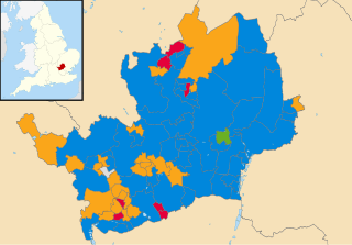
Elections to Hertfordshire County Council took place on 6 May 2021 alongside other local elections in the United Kingdom. All 78 seats to the council were elected.