| Cole Green Way | |
|---|---|
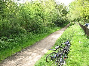 Path at the old Cole Green station | |
| Length | 6 mi (9.7 km) |
| Location | Hertfordshire, England |
| Trailheads | Welwyn Garden City 51°47′27″N0°10′05″W / 51.7908°N 0.1681°W Hertford 51°47′32″N0°05′10″W / 51.7921°N 0.0861°W |
| Use | Hiking, Running, Cycling, Horseriding |
The Cole Green Way is a rail trail which runs east-west from the eastern edge of Welwyn Garden City to Hertford in Hertfordshire. Part of National Cycle Network Route 61, and the Lea Valley Walk, it runs for more than six miles along the former Hertford, Luton & Dunstable branch line from Welwyn Garden City railway station to Hertford North railway station.