National Cycle Route 78 runs from Campbeltown to Inverness. It was officially launched as the Caledonia Way [1] in 2016 as part of the wider redevelopment of Scotland's cycle network. [2] It runs from the Kintyre peninsula to the Great Glen and the route varies from on road to traffic-free forest trails and canal paths. [3]
From Campbeltown, the route follows the sea front northwards, then turns north along George Street and turns right onto the B842 (High Street), which it follows north up the east coast of Kintyre, passing Carradale and Claonaig (where it meets the NCR73), before crossing the peninsula on the B8001, joining the A83 trunk road just south of Kennacraig.
The route follows the A83 to the head of West Loch Tarbert, where it turns left about 2 km before Tarbert onto a short unclassified road, before turning left onto the B8024, which it follows around the west coast of Kintyre, crossing again to the east coast to meet the A83 about 5 km south of Ardrishaig, where it leaves the A83.
North of Lochgilphead, the route is off-road, taking the towpath of the Crinan canal towards Crinan on the west coast, [4] before tracing the West coast of Loch Awe until Kilchrenan. The route then follows the B845 to Taynuilt.
Taynuilt to Oban section runs on minor roads through Glen Lonan, passing Fearnoch. [5]
![]() | This section needs expansion. You can help by adding to it. (June 2008) |
A large proportion of the route from Oban to Ballachulish follows the route of the Ballachulish branch of the Callander and Oban Railway, while the last section from Corran to Fort William uses two ferries to follow the east coast of Ardgour.
From Oban the route follows minor roads to South Connel, where it crosses Connel Bridge and follows Observer Corps Post Road past Oban Airport. It then follows the old railway bed until just north of Benderloch, where it runs on a dedicated cycleway alongside the A828 to Barcaldine. In Barcaldine it runs on minor roads through the back of the village, and emerges to run alongside the A828 again, before rising slightly to follow the old railway bed again, this time on the inland side of the main road. At Creagan, it the A828 to cross a bridge, and then re-joins the railway bed shortly thereafter.
Across the Appin peninsula the main route continues to follow the old railway line, but an alternative route follows the coast of the peninsula on minor roads past the Lismore ferry at Port Appin. After the routes re-join, they follow the railway bed past Castle Stalker. At the foot of Glen Sallachan, the route re-joins the A828 as far as Duror. It follows minor roads and a dedicated path through Duror to Kentallen, from where it follows the old railway bed as far as the Ballachulish Bridge. From here it is possible to reach Ballachulish and Glencoe Village.
The NCN78 itself crosses the bridge and follows alongside the A82 through Onich to Corran, where it cross the Corran Ferry to Ardgour. Here it follows the A861 northwards along the west shore of Loch Linnhe as far as Camusnagaul, from where a passenger / cyclist ferry connects to Fort William.
Between Fort William and Inverness NCR 78 generally follows the Great Glen.
In Fort William the route runs along the seafront by the A82 until the start of the Great Glen Way, which it follows across the River Nevis as it enters the mouth of the River Lochy. It follows Wades Road and Locheil Road through Inverlochy, and then runs alongside the Mallaig railway line and crosses a pedestrian bridge over the River Lochy beside the railway. Turning left onto Kilmallie Road, it passes Lochyside and then turns to run along the head of Loch Linnhe to the sea lock of the Caledonian Canal. From there it follows the canal towpath to Banavie, continues along the south-east side of the canal past Neptune's Staircase and onwards to Gairlochy.
At Gairlochy it crosses the canal and follows the B8005 along the north west shore of Loch Lochy through Bunarkaig to Clunes, where it leaves the B8005 onto a minor road, and then a track which follows close to the shore of Loch Lochy for 12 km. It skirts the head of the loch and crosses the canal, following the towpath for 2.5 km to North Laggan, where it cross the A82 and follows an old railway bed on the south east shore of Loch Oich for 7 km. It then crosses the A82 again, and follows the canal towpath for 8 km to Fort Augustus.
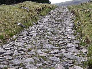
The route leaves Fort Augustus on Glendoe Road, and then climbs to over 300m, following one of General Wade's military roads (the B862) past Whitebridge, and thence by the B852 down to Foyers on the south east shore of Loch Ness. From there it follows the B852 for 19 km to the north end of Loch Ness, where it follows a minor road, the B852 again, and another minor road to enter the outskirts of Inverness at Lochardil Woods. From there it follows Holm Road, Dores Road, Island Bank Road and Haugh Road along the River Ness into Inverness town centre.
![]() | This section needs expansion. You can help by adding to it. (June 2008) |
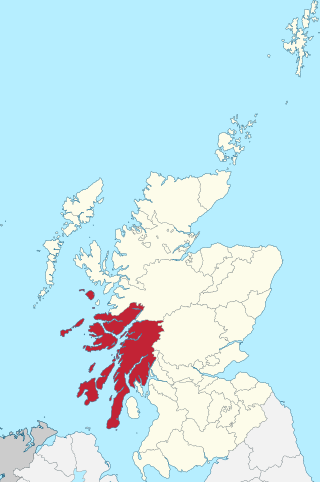
Argyll and Bute is one of 32 unitary council areas in Scotland and a lieutenancy area. The current lord-lieutenant for Argyll and Bute is Jane Margaret MacLeod. The administrative centre for the council area is in Lochgilphead at Kilmory Castle, a 19th-century Gothic Revival building and estate. The current council leader is Councillor Jim Lynch.
The Caledonian Canal connects the Scottish east coast at Inverness with the west coast at Corpach near Fort William in Scotland. The canal was constructed in the early nineteenth century by Scottish engineer Thomas Telford.
The A82 is a major road in Scotland that runs from Glasgow to Inverness via Fort William. It is one of the principal north-south routes in Scotland and is mostly a trunk road managed by Transport Scotland, who view it as an important link from the Central Belt to the Scottish Highlands and beyond. The road passes close to numerous landmarks, including Loch Lomond, Rannoch Moor, Glen Coe, the Ballachulish Bridge, Ben Nevis, the Commando Memorial, Loch Ness, and Urquhart Castle. Along with the A9 and the A90 it is one of the three major north–south trunk roads connecting the Central Belt to the North.
The Crinan Canal is a nine miles (14 km) long navigable canal in Argyll and Bute, west of Scotland. It opened in 1801 and connects the village of Ardrishaig on Loch Gilp with Crinan on the Sound of Jura, providing a navigable route between the Firth of Clyde and the Inner Hebrides, without the need for a long diversion around the Kintyre Peninsula, and in particular the exposed Mull of Kintyre.
Lochgilphead is a town and former burgh in Argyll and Bute, Scotland, with a population of around 2,300 people. It is the administrative centre of Argyll and Bute Council. The village lies at the end of Loch Gilp and lies on the banks of the Crinan Canal. Lochgilphead sits on the A83, with Ardrishaig 2 miles (3 km) to the south and Inveraray 24 miles (39 km) to the north-east; Oban lies 37 miles (60 km) north on the A816.
Argyll, sometimes called Argyllshire, is a historic county and registration county of western Scotland.
The A83 is a major road in the south of Argyll and Bute, Scotland, running from Tarbet, on the western shore of Loch Lomond, where it splits from the A82, to Campbeltown at the southern end of the Kintyre peninsula. The road is best known for its section across the Rest and be Thankful pass through the Arrochar Alps between the heads of Loch Long and Loch Fyne.
Cowal is a rugged peninsula in Argyll and Bute, on the west coast of Scotland. It is connected to the mainland to the north, and is bounded by Loch Fyne to the west, by Loch Long and the Firth of Clyde to the east, and by the Kyles of Bute to the south.
The Great Glen, also known as Glen Albyn or Glen More, is a glen in Scotland running for 62 miles (100 km) from Inverness on the edge of the Moray Firth, in an approximately straight line to Fort William at the head of Loch Linnhe. It follows a geological fault known as the Great Glen Fault, and bisects the Scottish Highlands into the Grampian Mountains to the southeast and the Northwest Highlands to the northwest.
Loch Fyne, is a sea loch off the Firth of Clyde and forms part of the coast of the Cowal Peninsula. Located on the west coast of Argyll and Bute, west of Scotland. It extends 65 kilometres (40 mi) inland from the Sound of Bute, making it the longest of the sea lochs in Scotland. It is connected to the Sound of Jura by the Crinan Canal. Although there is no evidence that grapes have grown there, the title is probably honorific, indicating that the river, Abhainn Fìne, was a well-respected river.
The Callander and Oban Railway company was established with the intention of linking the sea port of Oban to the railway network. This involved a long line from Callander through wild and thinly populated terrain, and shortage of money meant that the line was opened in stages from 1866 to 1880.
Laggan is a small village in the Great Glen, in the Highland region of Scotland. The older, longer Gaelic name is Lagan Achaidh Droma, "hollow at the field of the ridge".
The Great Glen Way is a long distance path in Scotland. It follows the Great Glen, running from Fort William in the southwest to Inverness in the northeast, covering 125 kilometres (78 mi). It was opened in 2002, and is designated as one of Scotland's Great Trails by NatureScot. The Great Glen Way is generally walked from southwest to northeast to follow the direction of the prevailing wind. It can be walked in 5–7 days, or cycled in 2–3 days. The trail is maintained and improved by the Great Glen Ways partnership, which consists of Highland Council, Scottish Canals and Forestry and Land Scotland. About 30,000 people use the path every year, of whom about 4,500 complete the entire route.
Connel is a village in Argyll and Bute, Scotland. It is situated on the southern shore of Loch Etive. The Lusragan Burn flows through the village and into the loch.
National Cycle Route 7 is a route of the National Cycle Network, running from Sunderland to Inverness.
National Cycle Route 75 runs from Edinburgh to Tarbert on the Kintyre peninsula, via Glasgow. It is often known as the Clyde to Forth cycle route.
The Sir William Sutherland Cup, more commonly known simply as the Sutherland Cup, is a trophy in the sport of shinty. It is the national cup competition for junior sides, the equivalent of the Camanachd Cup for those sides in lower league competition. The current (2022) holders are Newtonmore 2nd team, the "junior" level reserves of the successful "senior" club.
The Corran Ferry crosses Loch Linnhe at the Corran Narrows, south of Fort William, Scotland.
A network of military roads, sometimes called General Wade's Military Roads, was constructed in the Scottish Highlands during the middle part of the 18th century as part of an attempt by the British Government to bring order to a part of the country which had risen up in the Jacobite rebellion of 1715.