
The A64 is a major road in North and West Yorkshire, England, which links Leeds, York and Scarborough. The A64 starts as the A64(M) ring road motorway in Leeds, then towards York it becomes a high-quality dual carriageway until it is east of York, where it becomes a single carriageway for most of its route to Scarborough.
The Ainsty or the Ainsty of York was a historic district of Yorkshire, England, west of the city of York. Originally a wapentake or subdivision of the West Riding of Yorkshire it later had a unique status as a rural area controlled by the corporation of the city.
The Pennine Cycleway is a Sustrans-sponsored route in the Pennines range in northern England, an area often called the "backbone of England". The route passes through the counties of Derbyshire, West Yorkshire, Lancashire, North Yorkshire, Cumbria and Northumberland. It is part of the National Cycle Network (NCN). Sustrans founder John Grimshaw calls it 'the best National Cycle Network route of the lot'.

National Cycle Route 1 is a route of the National Cycle Network, running from Dover to Tain. The 1,264 mi-long (2,034-kilometre) cycle-path is located in the United Kingdom.

The Ebor Way is a 70-mile (112 km) long-distance footpath from Helmsley, North Yorkshire to Ilkley, West Yorkshire, England. It takes its name from Eboracum, the Roman name for York.

National Cycle Network (NCN) Route 76 is a Sustrans National Route that runs from Berwick-upon-Tweed to Kirkcaldy. The route is 168 miles (270 km) in length and is fully open and signed in both directions. Between Dunbar and Kirkcaldy the route is known as the Round the Forth.
National Cycle Network (NCN) Route 66 is a Sustrans National Route that runs from Kingston upon Hull to Manchester via Beverley, York and Leeds.

Newton Kyme is a village in the civil parish of Newton Kyme cum Toulston near the River Wharfe, in the Selby district, in the English county of North Yorkshire. The population of the civil parish at the 2011 Census was 275. It is near the town of Tadcaster. For transport there is the A659 road nearby. Newton Kyme has a church and a castle called Kyme Castle.

The Way of the Roses is the newest of Great Britain's coast-to-coast, long-distance cycle routes and is based on minor roads, disused railway lines and specially constructed cycle paths. It lies entirely within the counties of Lancashire and Yorkshire, crossing the Yorkshire Dales and the Yorkshire Wolds in the north of England, passing through the historic cities of Lancaster and York and scenic towns and villages including Settle, Pateley Bridge and Ripon.

National Cycle Route 57 is part of the United Kingdom's National Cycle Network. When complete, it will run west to east from Farmington, Gloucestershire near Northleach to Welwyn Garden City in Hertfordshire.

National Cycle Network (NCN) Route 65 is a Sustrans National Route that runs from Hornsea on the North Sea Coast of The East Riding of Yorkshire via Hull and York to Middlesbrough. It is fully open and signed.
National Cycle Network (NCN) Route 167 is a Sustrans regional route in the Yorkshire Wolds between Kirkham and Huggate. It is one of 5 NCN routes that make up the 146 mile Yorkshire Wolds Cycle Route. Created in 2011 it is fully open and signed.

National Cycle Network (NCN) Route 164 is a Sustrans regional route in the Yorkshire Wolds. The Northern section between Pocklington and Hutton Cranswick is part of the Way of the Roses, opened in 2010. The southern section links Beverley and Kiplingcotes via Newbold. Both sections are key parts of the 146 mile Yorkshire Wolds Cycle Route, opened in 2011. It is fully open and signed.
National Cycle Network (NCN) Route 155 is a Sustrans regional route in Northumberland. Running from the North Sea coast at Newbiggin due west to Morpeth. The 90% of this 8 mile route uses shared cycle/pedstrian verge-side paths. There is a small on road section in Ashington. The route is fully signed and open.
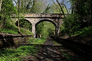
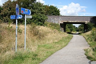
Thorp Arch railway station was a station in the parish of Wetherby, West Yorkshire, on the Harrogate–Church Fenton line. It opened on 10 August 1847 and served nearby Thorp Arch as well as Boston Spa. The station closed to passengers on 6 January 1964 and completely on 10 August 1964.
National Cycle Network (NCN) Route 70 is a Sustrans National Route that runs from Walney Island in Cumbria to Sunderland. The route is fully open and signed. From end to end the route is 149 miles (240 km), but two sections are shared with other NCN routes leaving Route 70 at 128 miles (206 km).

National Cycle Network (NCN) Route 647 is a Sustrans National Route that runs from Clumber Park to Harby 53.233°N 0.683°W. The route is 19.6 miles (31.5 km) in length and is fully open and signed in both directions.
National Cycle Network (NCN) Route 64 is a Sustrans National Route that runs from Market Harborough to Lincoln. The route is 68 miles (109 km) in length and is fully open and signed in both directions. There are three sections to the route, NCN 63 and NCN 15 form the links between these sections.

National Cycle Network (NCN) Route 67 is a Sustrans National Route that runs from Long Whatton to Northallerton. The route is 124 miles (200 km) in length and is open but with sections missing.


