
Aberfoyle is a village in the historic county and registration county of Perthshire and the council area of Stirling, Scotland. The settlement lies 27 miles northwest of Glasgow.

The West Highland Way is a linear long-distance route in Scotland. It is 154 km long, running from Milngavie north of Glasgow to Fort William in the Scottish Highlands, with an element of hill walking in the route. The trail, which opened in 1980, was Scotland's first officially designated Long Distance Route, and is now designated by NatureScot as one of Scotland's Great Trails. It is primarily intended as a long distance walking route, and whilst many sections are suitable for mountain biking and horseriding there are obstacles and surfaces that will require these users to dismount in places.
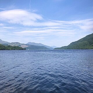
Loch Lomond is a freshwater Scottish loch which crosses the Highland Boundary Fault, often considered the boundary between the lowlands of Central Scotland and the Highlands. Traditionally forming part of the boundary between the counties of Stirlingshire and Dunbartonshire, Loch Lomond is split between the council areas of Stirling, Argyll and Bute and West Dunbartonshire. Its southern shores are about 23 kilometres (14 mi) northwest of the centre of Glasgow, Scotland's largest city. The Loch forms part of the Loch Lomond and The Trossachs National Park which was established in 2002.

Callander is a small town in the council area of Stirling in Scotland, situated on the River Teith. The town is located in the historic county of Perthshire and is a popular tourist stop to and from the Highlands.
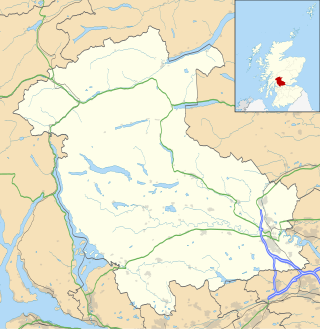
The Stirling council area is one of the 32 council areas of Scotland, and has an estimated population of 92,530 (2022). It was created in 1975 as a lower-tier district within the Central region. The district covered parts of the historic counties of Stirlingshire and Perthshire, which were abolished for local government purposes. In 1996 the Central region was abolished and Stirling Council took over all local government functions within the area.

Luss is a village in Argyll and Bute, Scotland, on the west bank of Loch Lomond. The village is within the Loch Lomond and The Trossachs National Park.
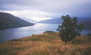
Loch Lomond and The Trossachs National Park is a national park in Scotland centred on Loch Lomond and the hills and glens of the Trossachs, along with several other ranges of hills. It was the first of the two national parks established by the Scottish Parliament in 2002, the second being the Cairngorms National Park. The park extends to cover much of the western part of the southern highlands, lying to the north of the Glasgow conurbation, and contains many mountains and lochs. It is the fourth-largest national park in the British Isles, with a total area of 1,865 km2 (720 sq mi) and a boundary of some 350 km (220 mi) in length. It features 21 Munros and 20 Corbetts.

The Arrochar Alps are a group of mountains located around the heads of Loch Long, Loch Fyne, and Loch Goil. They are part of the Grampian mountains range, which stretch across Scotland. The villages of Arrochar and Lochgoilhead are the nearest settlements. Many of the mountains are located on the Cowal Peninsula in Argyll and Bute, west of Scotland.

Balloch is a village in West Dunbartonshire, Scotland, at the foot of Loch Lomond.
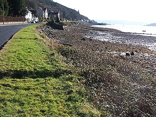
Kilmun is a linear settlement on the north shore of the Holy Loch, on the Cowal Peninsula in Argyll and Bute, Scottish Highlands. It takes its name from the 7th-century monastic community founded by an Irish monk, St Munn. The ruin of a 12th-century church still stands beside the Kilmun Parish Church and Argyll Mausoleum.
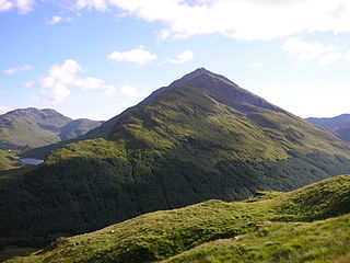
Beinn an Lochain is a mountain in the Arrochar Alps in western Scotland. A Corbett, reaching 901.7 metres (2,958 ft), Beinn an Lochain is situated within the Argyll Forest Park, which is itself within the Loch Lomond and the Trossachs National Park.
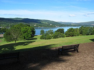
Balloch Country Park is a 200-acre (0.81 km2) country park on the southern tip of Loch Lomond in West Dunbartonshire, Scotland. It was recognised as a country park in 1980, and it is the only country park in the Loch Lomond and the Trossachs National Park, Scotland's first national park. Balloch Country Park features nature trails, guided walks, a walled garden, and picnic lawns with views of the Loch. It was originally developed in the early 19th century by John Buchanan, a partner in the Glasgow and Ship Bank, and the gardens were significantly improved by the Dennistoun-Browns, who bought the estate in 1851. Buchanan also built Balloch Castle, which now serves as the park's visitors' center.

Killearn – is a small village of approximately 1700 people in the Stirling council area of Scotland.
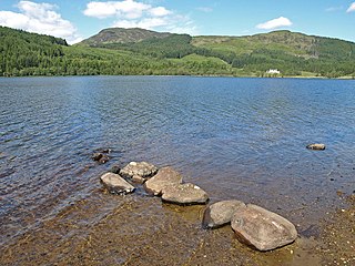
Loch Chon is a freshwater loch situated west of the village of Aberfoyle, near the small village of Kinlochard, Stirling, Scotland, UK. Loch Chon lies upstream of Loch Ard and to the south of Loch Katrine.

Balfron High School is a secondary school situated in the village of Balfron, approximately 18 miles (29 km) west of Stirling and 16 miles (26 km) north of Glasgow. The catchment area extends over most of West Stirlingshire including the villages of Arnprior, Balfron, Balmaha, Blanefield, Buchlyvie, Croftamie, Drymen, Fintry, Killearn, Kippen, Milton of Buchanan and Strathblane, along with the hamlets of Balfron Station, Boquhan, Buchanan Smithy, Dumgoyne, Gartness and Mugdock. The school also has pupils attending from other nearby areas of Dunbartonshire and Stirlingshire.

The Rob Roy Way is a Scottish long distance footpath that runs from Drymen in Stirling to Pitlochry in Perth and Kinross. The path was created in 2002, and takes its name from Rob Roy MacGregor, a Scottish folk hero and outlaw of the early 18th century. It traverses countryside that he knew and travelled frequently. The route crosses the Highland Boundary Fault, a geological fault where the Highlands meet the Lowlands. Views from the trail overlook Loch Lubnaig, Loch Earn, Loch Venachar and Loch Tay. The way is 127 kilometres (79 mi) in length if the direct route along the southern shore of Loch Tay and the River Tay is followed between Ardtalnaig and Aberfeldy. An optional loop also links these places via Amulree: choosing this option increases the length by a further 27 kilometres (17 mi) to 154 kilometres (96 mi).

Falls of Falloch is a waterfall and local beauty spot on the river Falloch off the A82. It is 7 km (4 mi) south-west of the village of Crianlarich in the county of Stirling in Scotland. It is also on the West Highland Way.
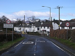
Milton of Buchanan is a small village in Stirling, Scotland, within the parish of Buchanan. Historically, the village was in the Registration County of Stirlingshire. It was the main village of the parish of Buchanan. However, the village is now a quiet collection of houses along with a school, village hall, and church.

Carrick Castle is a village on the western shore of Loch Goil, 7 km (4.3 mi) south of Lochgoilhead by a minor road along the loch shore, on the Cowal Peninsula, in Argyll and Bute, west of Scotland. It is within the Argyll Forest Park, and also within the Loch Lomond and The Trossachs National Park.

The Great Trossachs Path is a 48-kilometre (30 mi) long-distance footpath through the Trossachs, in the Stirling council area of Scotland. It runs between Callander in the east and Inversnaid on the banks of Loch Lomond in the west, passing along the northern shores of Loch Katrine and Loch Arklet. The path is suitable for walkers and cyclists; much of the route is also suitable for experience horse riders, although the middle section along the shoreline of Loch Katrine is tarmacked and so may not be ideal for horses.


