Headley, Surrey

Last updated

Headley
Grotto at St Mary's Church, Headley (Remains of Old Church) (Geograph Image 2225767 8ebdbdcc).jpg
The grotto at St Mary's Church, Headley, was constructed in the 19th century using materials from the demolished medieval church.
Cricket pavilion at Headley Heath - geograph.org.uk - 24501.jpg
Cricket is played in the village.
Surrey UK location map.svg
Red pog.svg
Headley
Location within Surrey
Area6.75 km2 (2.61 sq mi)
Population643 (Civil Parish 2011) [1]
  Density 95/km2 (250/sq mi)
OS grid reference TQ205545
Civil parish
District
Shire county
Region
Country England
Sovereign state United Kingdom
Post town Epsom
Postcode district KT18
Dialling code 01372
Police Surrey
Fire Surrey
Ambulance South East Coast
UK Parliament
List of places
UK
England
Surrey
51°16′37″N0°16′16″W / 51.277°N 0.271°W / 51.277; -0.271

Headley is a village and civil parish in the North Downs in Surrey, England. The nearest settlements are, to the west, Mickleham and Leatherhead; to the north, Ashtead and Langley Vale; to the east, Walton-on-the-Hill; and to the south, Box Hill. It is just outside the M25 motorway encircling London.

Contents

History

The Romans had an influence nearby, with the Roman Road to Noviomagus Reginorum, called by the Saxons Stane Street, some 2 km from the village, and a considerable Roman presence in the neighbouring village of Walton-on-the-Hill with its scheduled ancient monument villa and other finds.

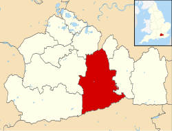
Headley's land lay in the Saxons' Copthorne Hundred. As Saxon records are scant and the church and population were smaller, no church in Headley was known during this period; the first records of a church are after the Norman Conquest. Next to the present 19th-century church is a grotto, constructed using materials from the earlier 15th-century church and placed over the grave of the Revd Ferdinand Faithful. [3]

Headley appears in Domesday Book of 1086 as the manor of Hallega. It was held by Radulfus (Ralph) de Felgeres. Its domesday assets were: 2 hides; 6 ploughs, woodland worth 15 hogs. It rendered £5 per year to its overlords. The survey records that the manor was held before the conquest by Countess Goda and it had been granted to her by her brother King Edward the Confessor. [4] Halle(g)a means a clearing in the heather, which is appropriate considering the village's position on a large patch of acidic topsoil of the generally alkaline North Downs. [5]

The church, dedicated to St Mary[ which one? ] and designed by Anthony Salvin, was built in 1855, with an added tower of 1859 by G. E. Street. It is built from relatively local flint rubble and is listed Grade II. [6] The triptych (1895) on the altar is by Charles Edgar Buckeridge.

Walter Cunliffe, later 1st Baron Cunliffe and the Governor of the Bank of England, was given the original farmhouse estate, formerly the main manor, and its remaining 300 acres (1.2 km2), Headley Court, in 1880 by his father on the condition that he would make a career in banking rather than become a farmer. He redeveloped it in 1898. The family fortune had been made by Walter's grandfather, James Cunliffe, with his development of the North Eastern Railway. [7]

Land use and Headley Heath

There has been little new housing built in the late 20th century and early 21st century as the village is part of the London Green Belt and the Surrey Hills Area of Outstanding Natural Beauty. Substantially, the steep and quick-draining land is covered by woods. A large minority of field land in the village is used primarily for grazing by the many riding establishments in the area. Headley Heath is managed by the National Trust, and other nearby areas are controlled by the Surrey Wildlife Trust and other nature reserves. The heath is part of the Mole Gap to Reigate Escarpment Site of Special Scientific Interest.

Economy

Most of the population work outside the village: care and rehabilitation work, maintenance, extension work, equestrian work and agriculture being the main categories of work within the village.

Headley Court

There is a military hospital (previously run by the RAF Hospital) at Headley Court in the parish, once the manor house, the main building being a reconstruction that took place in 1899. [7] Its playing fields can be used for helicopters. This unit closed in September 2018 and the site was bought for redevelopment in May 2019 by Angle Property.

Amenities

The village has an active church, shop, village hall and pub.

County-supported schools are in Leatherhead, Ashtead, Mickleham and Dorking. Some children attend private schools.

Headley is known for its large heath lands, which are owned by the National Trust, leading out towards Box Hill. The Heath was used by Canadian troops during World War II as tank and combat training grounds.

Transport

A typically two-hourly bus service (number 21) between Crawley and Epsom connects Headley to Box Hill, Dorking and Leatherhead. A service was provided by Surrey County Council for local children of 5–11 years of age, to the primary schools terminated on 1 September 2006. [8]

A bus service is also provided by St. Andrew's Catholic School, Leatherhead for its pupils (aged 11 to 18).

The nearest station by road is Betchworth, which is served by trains to Redhill, Guildford and Reading. Box Hill & Westhumble station, which has trains to London Victoria and London Waterloo, is also nearby.

Social life and sport

The village has a Parish Council and its hall hosts clubs including: a computer club, cricket club, gardening club and other activities. [9]

The Cock Inn, formerly for a few years the Cock Horse, is the only public house in the village. There is also the RAF Headley Club which is open only to servicemen and women, plus their families of Headley Court.

The Headley Cricket Club was founded in 1893, and now incorporating the Old Freemen's side from nearby City of London Freemen's School. The team play on the ground opposite the main Heath car park, to the south of the village centre and have played in the Surrey Downs League since 2002 on Saturdays and have a Sunday team.

Tyrrells Wood Golf Club is a large private golf course and grounds to the west of the village and partially within the bounds of the parish.

Headley was on the London-Surrey Cycle Classic over the opening weekend of the 2012 London Olympic Games as part of the Box Hill loop, which was covered nine times in the men's event and twice in the women's. With long distance routes in various directions, the roads in and around Headley have become very popular for leisure cycling.

Demography and housing

2011 Census Homes
Output areaDetachedSemi-detachedTerracedFlats and apartmentsCaravans/temporary/mobile homesshared between households [1]
(Civil Parish)103120131000

The average level of accommodation in the region composed of detached houses was 28%, the average that was apartments was 22.6%.

2011 Census Key Statistics
Output areaPopulationHouseholds% Owned outright% Owned with a loanhectares [1]
(Civil Parish)64324632.9%25.6%675

The proportion of households in the civil parish who owned their home outright compares to the regional average of 35.1%. The proportion who owned their home with a loan compares to the regional average of 32.5%. The remaining % is made up of rented dwellings (plus a negligible % of households living rent-free).

Emergency services

Headley is served by these emergency services:

Location

Related Research Articles

<span class="mw-page-title-main">Dorking</span> Market town in Surrey, England

Dorking is a market town in Surrey in South East England, about 21 mi (34 km) south of London. It is in Mole Valley District and the council headquarters are to the east of the centre. The High Street runs roughly east–west, parallel to the Pipp Brook and along the northern face of an outcrop of Lower Greensand. The town is surrounded on three sides by the Surrey Hills Area of Outstanding Natural Beauty and is close to Box Hill and Leith Hill.

<span class="mw-page-title-main">Effingham, Surrey</span> Human settlement in England

Effingham is a small English village in the Borough of Guildford in Surrey, reaching from the gently sloping northern plain to the crest of the North Downs and with a medieval parish church. The village has been chosen as the home of notable figures, such as Sir Barnes Wallis who was buried here and Toni Mascolo. The M25 motorway is 4 miles (6.4 km) north-west of the middle of the village, which consists of new build homes and green space in the Metropolitan Green Belt.

<span class="mw-page-title-main">Ashtead</span> Village in Surrey, England

Ashtead is a large village in the Mole Valley district of Surrey, England, approximately 15.5 mi (25 km) south of central London. Primarily a commuter settlement, Ashtead is on the single-carriageway A24 between Epsom and Leatherhead. The village is on the northern slopes of the North Downs and is in the catchment area of The Rye, a tributary of the River Mole.

<span class="mw-page-title-main">Leatherhead</span> Human settlement in England

Leatherhead is a town in the Mole Valley district of Surrey, England, about 17 mi (27 km) south of Central London. The settlement grew up beside a ford on the River Mole, from which its name is thought to derive. During the late Anglo-Saxon period, Leatherhead was a royal vill and is first mentioned in the will of Alfred the Great in 880 AD. The first bridge across the Mole may have been constructed in around 1200 and this may have coincided with the expansion of the town and the enlargement of the parish church.

<span class="mw-page-title-main">Fetcham</span> Human settlement in England

Fetcham is a suburban village in Surrey, England west of the town of Leatherhead, on the other side of the River Mole and has a mill pond, springs and an associated nature reserve. The housing, as with adjacent Great Bookham, sits on the lower slopes of the North Downs north of Polesden Lacey (NT). Fetcham Grove has Leatherhead and the village's main leisure centre and football club, between the two settlements. Fetcham has two short parades of shops and services, several sports teams and parks and a small number of large pubs and food premises.

<span class="mw-page-title-main">Great Bookham</span> Village in England

Great Bookham is a village in Surrey, England, one of six semi-urban spring line settlements between the towns of Leatherhead and Guildford. With the narrow strip parish of Little Bookham, it forms part of the Saxon settlement of Bocham. The Bookhams are surrounded by common land, and Bookham railway station in Church Road, Great Bookham, serves both settlements.

<span class="mw-page-title-main">River Mole</span> Tributary of the River Thames in southern England

The River Mole is a tributary of the River Thames in southern England. It rises in West Sussex near Gatwick Airport and flows northwest through Surrey for 80 km to the Thames at Hampton Court Palace. The river gives its name to the Surrey district of Mole Valley.

<span class="mw-page-title-main">Mole Valley</span> Non-metropolitan district in England

Mole Valley is a local government district in Surrey, England. Its council is based in Dorking.

<span class="mw-page-title-main">Box Hill, Surrey</span> Hill in Surrey, England

Box Hill is a summit of the North Downs in Surrey, approximately 31 km (19 mi) south-west of London. The hill gets its name from the ancient box woodland found on the steepest west-facing chalk slopes overlooking the River Mole. The western part of the hill is owned and managed by the National Trust, whilst the village of Box Hill lies on higher ground to the east. The highest point is Betchworth Clump at 224 m (735 ft) above OD, although the Salomons Memorial overlooking the town of Dorking is the most popular viewpoint.

<span class="mw-page-title-main">A24 road (England)</span> Major road in southern England

The A24 is a major road in England that runs for 53.2 miles (85.6 km) from Clapham in south-west London to Worthing on the English Channel in West Sussex via the suburbs of south-west London, as well as through the counties of Surrey and West Sussex.

<span class="mw-page-title-main">Tadworth</span> Human settlement in England

Tadworth is a large suburban village in Surrey, England in the south-east of the Epsom Downs, part of the North Downs. It forms part of the Borough of Reigate and Banstead. At the 2011 census, Tadworth had a population of 7,123

<span class="mw-page-title-main">Mickleham, Surrey</span> Village in Surrey, England

Mickleham is a village in south east England, between the towns of Dorking and Leatherhead in Surrey. The civil parish covers 7.31 square kilometres and includes the hamlet of Fredley. The larger ecclesiastical parish includes the majority of the neighbouring village of Westhumble, from which Mickleham is separated by the River Mole.

<span class="mw-page-title-main">Walton-on-the-Hill</span> Human settlement in England

Walton-on-the-Hill, Surrey, is a village in England midway between the market towns of Reigate and Epsom. The village is a dispersed cluster on the North Downs centred less than one mile inside of the M25 motorway. The village hosts the Walton Heath Golf Club, whose former members include King Edward VIII, Winston Churchill and David Lloyd George.

<span class="mw-page-title-main">Westhumble</span> Village in Surrey, England

Westhumble is a village in south east England, approximately 2 km (1.2 mi) north of Dorking, Surrey. The village is not part of a civil parish, however the majority of the settlement is in the ecclesiastical Parish of Mickleham.

Langley Vale is a village in the Borough of Epsom and Ewell, in Surrey, England, approximately 15 miles (24 km) south of central London. As its name suggests, the village is in a dry valley between Epsom Downs and Walton Downs. Historically part of the Ashtead Park estate, Langley Vale was the location of a farm in Medieval times. The modern village began to develop in the late 19th and early 20th centuries.

<span class="mw-page-title-main">Norbury Park</span>

Norbury Park is a swathe of mixed wooded and agricultural land associated with its Georgian manor house near Leatherhead and Dorking, Surrey, which appears in the Domesday Book of 1086. It occupies mostly prominent land reaching into a bend in the Mole in the parish of Mickleham.

Copthorne was a hundred of Surrey, England, an area above the level of the parishes and manors, where the local wise, wealthy and powerful met periodically in Anglo-Saxon England for strategic purposes. After the Norman Conquest the lords of the manor took to annual hundred meetings and their status became eroded by royal-approved transactions of land, as meanwhile the manorial courts and moreover royal courts seized jurisdiction over the Hundred Courts.

<span class="mw-page-title-main">Pixham</span> Human settlement in England

Pixham is a chapelry within the parish of Dorking, Surrey on the near side of the confluence of the River Mole and the Pipp Brook to its town, Dorking, which is centred 1 km (0.6 mi) southwest. The town as a whole, uniquely in Surrey, has three railway stations; Pixham adjoins or is the location of two of the three; and is near the junction of the A24 and A25 main roads.

References

  1. 1 2 3 Key Statistics; Quick Statistics: Population Density Archived 11 February 2003 at the Wayback Machine United Kingdom Census 2011 Office for National Statistics Retrieved 21 November 2013
  2. "Welcome to Headley Parish Council | Headley Parish Council in Surrey". Archived from the original on 22 June 2019. Retrieved 22 June 2019.
  3. 'Grotto' (Church remains) Historic England. "Details from listed building database (1293378)". National Heritage List for England . Retrieved 28 November 2013.
  4. Surrey Domesday Book Archived 15 July 2007 at the Wayback Machine
  5. "Headley village history". Archived from the original on 11 April 2007. Retrieved 13 April 2007.
  6. St Mary's Church Historic England. "Details from listed building database (1378152)". National Heritage List for England . Retrieved 28 November 2013.
  7. 1 2 Headley Court – mansion or club house Historic England. "Details from listed building database (1389265)". National Heritage List for England . Retrieved 28 November 2013.
  8. "Leatherhead Trinity". Archived from the original on 8 April 2010. Retrieved 30 June 2010.
  9. "Headley.org". Archived from the original on 11 April 2007. Retrieved 13 April 2007.