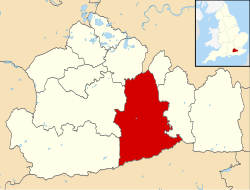
Fetcham

Last updated

Fetcham
Bridleway on Fetcham Downs - geograph.org.uk - 1394767.jpg
Bridleway on Fetcham Downs
Suburban Leatherhead - geograph.org.uk - 690416.jpg
20th-century houses in Fetcham
Surrey UK location map.svg
Red pog.svg
Fetcham
Location within Surrey
Area9.72 km2 (3.75 sq mi)
Population7,996 (2011 census) [1]
  Density 823/km2 (2,130/sq mi)
OS grid reference TQ1455
Civil parish
  • n/a
District
Shire county
Region
Country England
Sovereign state United Kingdom
Post town Leatherhead
Postcode district KT22
Dialling code 01372
Police Surrey
Fire Surrey
Ambulance South East Coast
UK Parliament
List of places
UK
England
Surrey
51°17′24″N0°21′07″W / 51.290°N 0.352°W / 51.290; -0.352

Fetcham is a suburban village in Surrey, England west of the town of Leatherhead, on the other side of the River Mole and has a mill pond, springs and an associated nature reserve. The housing, as with adjacent Great Bookham, sits on the lower slopes of the North Downs north of Polesden Lacey (NT). Fetcham Grove has Leatherhead and the village's main leisure centre and football club, between the two settlements. Fetcham has two short parades of shops and services, several sports teams and parks and a small number of large pubs and food premises.

Contents

Neighbouring Bookham and Leatherhead have railway stations [n 1] and a junction of the M25 London Orbital Motorway is a 3-mile (4.8-km) journey from it passing alongside the River Mole beyond a brief upland made up of most of Fetcham's remaining farms and wooded Great Bookham Common demarcating Fetcham's northern border. The northern few square miles and the larger North Downs are protected Green Belt, forming a buffer between Stoke D'Abernon (the south of Cobham post town) and Dorking respectively.

History

The name Fetcham is derived from the Anglo-Saxon "Fecca's ham" – Fecca's settlement. Fetcham lay within the Copthorne hundred.

Indeed, there is evidence that there were even earlier settlements, with the discovery of Stone and Bronze Age tools and Roman artefacts, as well as three ancient burial grounds.

Fetcham appears in Domesday Book of 1086 as Feceham. It was held partly by William the Conqueror; partly by Richard from the Bishop of Bayeux partly by Oswald the Thegn. Its Domesday assets were: 7 hides; 5½ mills worth 17s; 10½ ploughs; 2 oxen; 30 acres (12 ha) of meadow; woodland, herbage and pannage worth 23 hogs. It rendered £10 10s 0d per year to its feudal system overlords per year. [2] Fetcham, therefore, was referenced in the Domesday survey as three manors; one known as King's Manor was probably Fetcham Park; another was given to Odo, Bishop of Bayeux after the Norman conquest. The third was an Augustinian foundation from Merton Priory, at Cannon Court, which Henry VIII dissolved in 1538. [3]

Its small manorial farming community numbered 176 in the survey, but halved as a result of the Black Death in 1349. In the first half of the nineteenth century the population was still only around 370 [4] . In the 1931 census it had reached 1,318 and by 1972 was 7,331. [5]

St Mary's Church has been a place of Christian worship for over 1000 years. Built during Anglo-Saxon and early Norman periods, it is probably on the site of an even earlier timber church. There are many hints of its past in its structure. These include the south-west quoin of the nave, and a single splay window high on the south wall with traces of Roman brick as well as arches that are presumed to pre-date 1066.

Topography

The village of Fetcham is slightly larger than the English non-city parish average; extending from the River Mole at the village's east side, it is bounded by the neighbouring villages of Great Bookham and Little Bookham on its west.

Amenities and landmarks

Although at the eastern extreme, the historic B2122 Guildford Road/Waterlow Road which has mixed use splits north and east with two bridges to Leatherhead, Fetcham is centred on its own road The Street, with wide-ranging convenience shops, some small restaurants/take-aways, community halls, large public houses as well as nearby churches.

Fetcham Park House
front elevation Fetcham Park House.jpg
Fetcham Park House
front elevation

The Fetcham Conservation Area includes the impressive 18th-century mansion of Fetcham Park House. The Salt Box, The Well House, The Dower House and Ballands Hall [6] are four of a cluster of old buildings in that area. Others are sparingly strewn throughout Fetcham including at Grade II*: Le Pelerin [7] and Thorncroft Manor. [8]

The Mill Pond springs are a large number of chalk springs, still used to supply potable tap water . These springs continued to supply water during the droughts of 1976 and 2006.

There are four Christian congregations in the village:

To its south are the Fetcham and Leatherhead Downs, which are a part of the North Downs.

Education

There are two village schools:

Culture, sport and social life

Fetcham's sole pub, The Bell was built in brick in the 1930s on the site of an earlier pub, opposite Fetcham Infants School. It changed ownership several times in the late 20th century until it was bought by the Youngs brewery chain in 2004, when it had a major refit, followed by another in late 2007. The Bell is mentioned in The Good Food Guide and holds a pub quiz on Mondays. [13]

The large Village Hall in The Street is home to several organisations, including Fetcham Village Women's Institute. It was also the venue for several early performances by the influential band John's Children, which included sometime frontman Marc Bolan. [14]

There is also a small reading room that can be hired for private functions, on Cobham Road just north of the railway.

There was a social club, called the Fetcham Sports and Social Club, but this closed in 2001 after the membership dwindled. The building is now used as offices.

1st Fetcham Scout Group, headquartered in Cock Lane, has three Cub Scout packs and two Scout Troops, as well as Beavers. Fetcham Explorers share the 1st Fetcham Scout Group hall and facilities.

Fetcham FC football club no longer exists, Fetcham Park United formed in 1971 is now an adult amateur Charter Standard football club affiliated with the Surrey FA. Its two teams play in Division 1 and Division 5 of the Leatherhead & District Sunday Football League. The home ground was formerly the Cock Lane Recreation Ground in Fetcham but the teams now play home games at Priest Hill Playing Fields, in Epsom.

Transport

All parts of the large village are within 1.5 miles (2.4 km) of a railway station giving easy access to London. The M25 motorway's nearest access is J9, just after the one-way square in Leatherhead town centre (enclosing public gardens) or from the south of the village via the Leatherhead bypass and A246. Guildford, Cobham, Epsom and Leatherhead can be reached by the A-road network that has a choice of routes through and around the village.

Roads

The main village thoroughfare is the A245 Cobham Road and is partly bounded by and contains partly in the south the east-west, part-dualled A246.

Local bus operator Falcon Buses provides hourly route 479 between Epsom and Guildford through the village. [15]

Rail

The New Guildford Line skirts the north of most of the houses in Fetcham, but there is currently no station in the village. There were proposals for a station in the village centre during the 1930s/40s which would have served the main village centre and been located at what is now Hilley Field Lane [16] . The nearest stations are Leatherhead, Cobham & Stoke D'Abernon and Bookham.

Emergency services

Fetcham is served by the following emergency services:

Demography and housing

2011 Census Homes
WardDetachedSemi-detachedTerracedFlats and apartmentsCaravans/temporary/mobile homes/houseboatsShared between households [1]
Fetcham East8524405715900
Fetcham West8076151206110

The average level of accommodation in the region composed of detached houses was 28%, the average that was apartments was 22.6%.

2011 Census Households
WardPopulationHouseholds% Owned outright% Owned with a loanhectares [1]
Fetcham East3,83615085036429
Fetcham West416016044646543

The proportion of households who owned their home outright compares to the regional average of 35.1%. The proportion who owned their home with a loan compares to the regional average of 32.5%. The remaining % is made up of rented dwellings (plus a negligible % of households living rent-free).

See also

EnglandSurrey.png   Surreyportal

Notes and references

Notes
  1. Bookham railway station is served by half-hourly Effingham Junction services, part of an original route from London to Portsmouth via Guildford, by which London is less than 1 hour away, Leatherhead's typical scheduled time is c. 40 minutes to Central London.
References
  1. 1 2 3 Key Statistics; Quick Statistics: Population Density Archived 11 February 2003 at the Wayback Machine United Kingdom Census 2011 Office for National Statistics Retrieved 20 December 2013
  2. Surrey Domesday Book Archived 30 October 2007 at the Wayback Machine
  3. "British History – A History of Parliament Trust/University of Portsmouth project". Archived from the original on 10 May 2012. Retrieved 23 June 2012.
  4. "Fetcham - Fincham | British History Online". Archived from the original on 11 July 2007. Retrieved 18 September 2007.
  5. http://archiver.rootsweb.com/th/read/ENG-SURREY/1999-04/0924853766 [ dead link ]
  6. Historic England. "Ballands Hall (1188828)". National Heritage List for England . Retrieved 23 June 2012.
  7. Historic England. "Le Pelerin (1028662)". National Heritage List for England. Retrieved 23 June 2012.
  8. Historic England. "Thorncroft Manor (1389370)". National Heritage List for England. Retrieved 23 June 2012.
  9. Historic England. "Church of St Mary (1378187)". National Heritage List for England. Retrieved 23 June 2012.
  10. "Fetcham Infants School - History". Archived from the original on 26 February 2018. Retrieved 25 February 2018.
  11. Celebrating 50 years at Oakfield! Archived 26 February 2018 at the Wayback Machine , Leatherhead Guardian, 17 March 2014
  12. "Oakfield Junior School". Archived from the original on 11 May 2018. Retrieved 29 February 2012.
  13. "The Bell, Fetcham". Archived from the original on 3 April 2016. Retrieved 21 March 2016.
  14. John's Children official site
  15. https://www.falconbuses.co.uk/timetables/479/
  16. Leatherhead & District Local History Society: Potted Histories No 103 - Proposed Fetcham Railway Station

Related Research Articles

<span class="mw-page-title-main">Effingham, Surrey</span> Human settlement in England

Effingham is a small English village in the Borough of Guildford in Surrey, reaching from the gently sloping northern plain to the crest of the North Downs and with a medieval parish church. The village has been chosen as the home of notable figures, such as Sir Barnes Wallis who was buried here and Toni Mascolo. The M25 motorway is 4 miles (6.4 km) north-west of the middle of the village, which consists of new build homes and green space in the Metropolitan Green Belt.

<span class="mw-page-title-main">Leatherhead</span> Human settlement in England

Leatherhead is a town in the Mole Valley district of Surrey, England, about 17 mi (27 km) south of Central London. The settlement grew up beside a ford on the River Mole, from which its name is thought to derive. During the late Anglo-Saxon period, Leatherhead was a royal vill and is first mentioned in the will of Alfred the Great in 880 AD. The first bridge across the Mole may have been constructed in around 1200 and this may have coincided with the expansion of the town and the enlargement of the parish church.

<span class="mw-page-title-main">Cobham, Surrey</span> Village in the Borough of Elmbridge in Surrey, England

Cobham is a large village in the Borough of Elmbridge in Surrey, England, centred 17 miles (27 km) south-west of London and 10 miles (16 km) northeast of Guildford on the River Mole. It has a commercial/services High Street, a significant number of primary and private schools and the Painshill landscape park.

<span class="mw-page-title-main">Great Bookham</span> Village in England

Great Bookham is a village in Surrey, England, one of six semi-urban spring line settlements between the towns of Leatherhead and Guildford. With the narrow strip parish of Little Bookham, it forms part of the Saxon settlement of Bocham. The Bookhams are surrounded by common land, and Bookham railway station in Church Road, Great Bookham, serves both settlements.

<span class="mw-page-title-main">River Mole</span> Tributary of the River Thames in southern England

The River Mole is a tributary of the River Thames in southern England. It rises in West Sussex near Gatwick Airport and flows northwest through Surrey for 80 km to the Thames at Hampton Court Palace. The river gives its name to the Surrey district of Mole Valley.

<span class="mw-page-title-main">East Horsley</span> Village in Surrey, England

East Horsley is a village and civil parish in Surrey, England, 21 miles southwest of London, on the A246 between Leatherhead and Guildford. Horsley and Effingham Junction railway stations are on the New Guildford line to London Waterloo. The two-halves of ancient Horsley are similar in having substantial woodland and some chalky lower slopes, in the south, of the North Downs.

<span class="mw-page-title-main">Little Bookham</span> Human settlement in England

Little Bookham is a small, historic village in Surrey, England between Great Bookham and Effingham. It is home to several listed historical buildings, included in a large conservation area, along with Ye Olde Windsor Castle public house, Manor House School, and All Saints' Church. The village is centred immediately north of the North Downs and is contiguous with Great Bookham, the two divisions of Bookham having been made in the early medieval period.

<span class="mw-page-title-main">Borough of Elmbridge</span> Local government district in Surrey, England

Elmbridge is a local government district with borough status in Surrey, England. Its principal towns and villages are Esher, Cobham, Walton-on-Thames, Weybridge and Molesey. It directly borders the London Borough of Richmond upon Thames and the London Royal Borough of Kingston upon Thames. Some areas of the borough form a continuation of the Greater London Built-up Area, formerly falling into the Metropolitan Police District.

<span class="mw-page-title-main">Tadworth</span> Human settlement in England

Tadworth is a large suburban village in Surrey, England in the south-east of the Epsom Downs, part of the North Downs. It forms part of the Borough of Reigate and Banstead. At the 2011 census, Tadworth had a population of 7,123

<span class="mw-page-title-main">Oxshott</span> Human settlement in England

Oxshott is a suburban village in the borough of Elmbridge in Surrey, England. Oxshott includes hilly acidic heath which is partly wooded and occupies the land between the large towns of Esher and Leatherhead. The Oxshott section of the single carriageway north-south A244 runs through its middle and briefly forms its high street, centred two miles from the A3 and the M25.

<span class="mw-page-title-main">Stoke d'Abernon</span> Human settlement in England

Stoke d'Abernon is a village and former civil parish in the borough of Elmbridge in Surrey, England. It is on the right bank of the River Mole contiguously south of Cobham, a larger settlement which is a post town and is east-southeast of Oxshott a large village founded in the 19th century from the higher, sandy forested part of its formerly expansive area. It shares a railway station with Cobham and is inside the M25 motorway. Cobham Training Centre, the training ground of Chelsea F.C., is within its traditional boundaries.

<span class="mw-page-title-main">Sutton and Mole Valley lines</span>

The Sutton and Mole Valley lines were constructed between 1847 and 1868 by the London, Brighton and South Coast Railway, the London and South Western Railway and the LBSCR-sponsored Horsham, Dorking and Leatherhead Railway.

<span class="mw-page-title-main">Westhumble</span> Village in Surrey, England

Westhumble is a village in south east England, approximately 2 km (1.2 mi) north of Dorking, Surrey. The village is not part of a civil parish, however the majority of the settlement is in the ecclesiastical Parish of Mickleham.

<span class="mw-page-title-main">Headley, Surrey</span> Human settlement in England

Headley is a village and civil parish in the North Downs in Surrey, England. The nearest settlements are, to the west, Mickleham and Leatherhead; to the north, Ashtead and Langley Vale; to the east, Walton-on-the-Hill; and to the south, Box Hill. It is just outside the M25 motorway encircling London.

<span class="mw-page-title-main">Leatherhead railway station</span> Railway station in Surrey, England

Leatherhead railway station is in Leatherhead, Surrey, England. It is managed by Southern, with services provided by them and South Western Railway. It is 18 miles 2 chains (29 km) from London Waterloo.

Copthorne was a hundred of Surrey, England, an area above the level of the parishes and manors, where the local wise, wealthy and powerful met periodically in Anglo-Saxon England for strategic purposes. After the Norman Conquest the lords of the manor took to annual hundred meetings and their status became eroded by royal-approved transactions of land, as meanwhile the manorial courts and moreover royal courts seized jurisdiction over the Hundred Courts.