| Betchworth Castle | |
|---|---|
 Ruins of Betchworth Castle | |
| Type | Castle |
| Location | Betchworth |
| Coordinates | 51°14′15.04″N0°17′46.28″W / 51.2375111°N 0.2961889°W |
| OS grid reference | TQ 19029 50065 |
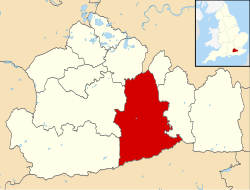
| Area | Surrey |
| Built | 1449 |
| Demolished | 1819 |
| Rebuilt |
|
| Official name | Betchworth Castle |
| Designated | 9 May 1951 |
| Reference no. | 1017996 |
Listed Building – Grade II | |
| Official name | Ruins of Betchworth Castle |
| Designated | 28 November 1951 |
| Reference no. | 1378073 |
 Location of Betchworth Castle in Surrey | |
Betchworth Castle is a mostly crumbled ruin of a fortified medieval stone house with some tall, two-storey corners strengthened in the 18th century, in the north of the semi-rural parish of Brockham. It is built on a sandstone spur overlooking the western bank of the River Mole in Surrey in England.
Contents
- History
- Medieval period
- Browne landowners
- Post-Restoration of monarchy and the enlightenment
- Access
- Future
- References
- External links
The ruin is a Scheduled monument and is in the lowest category of listed architecture, Grade II, 1.2 miles (1.9 km) due east of Dorking railway station in Dorking and 4 miles (6.4 km) due west of Reigate. Although close to the river and edge of the course it is surrounded by "Betchworth Park" Golf Course named after the village 1 mile (1.6 km) east.
In 1798, Henry Peters bought Betchworth Castle and spent considerable money renovating it to be a comfortable family home. Henry lived at Betchworth Castle with his wife, Charlotte Mary Morrison, and his twelve children until his death in 1827. After Henry’s death, Betchworth Castle was not inherited by his children and therefore was bought by David Barclay and later by Henry Hope, who demolished large parts of the castle and left it in ruin, as is seen today.