| Name | Length | Region | Endpoint one | Endpoint two | Description |
|---|
| mi | km |
|---|
| Angles Way | 92 | 148 | Norfolk and Suffolk | Great Yarmouth | Barnhamcross Common, Thetford | Largely follows the county border; originally 15 miles shorter and ending in Knettishall Heath. |
| Bishop Bennet Way | 34 | 55 | Southwest Cheshire | Beeston | Wirswall | Named after William Bennet who carried out detailed surveys of Roman roads in the area. |
| Boudica's Way | 36 | 58 | East Anglia | Diss railway station, Diss | Norwich railway station, Norwich | Parallel to the old Roman Pye Road, now the A140 road. |
| Centenary Way | 99 | 159 | Warwickshire | Kingsbury Water Park | Lower Quinton | Devised to celebrate 100 years of Warwickshire County Council. [51] |
| Cheshire Ring | 97 | 156 | Cheshire and Greater Manchester | N/A | N/A | Circular walk alongside six canals, via Dukinfield and Marple. |
| Coventry Way | 40 | 64 | Coventry | Meriden, West Midlands | N/A | Circular route around the city of Coventry in West Midlands and Warwickshire. |
| Dane Valley Way | 48 | 77 | Derbyshire, Staffordshire, Cheshire | Buxton, Derbyshire | Northwich, Cheshire | Along or near the course of the River Dane, past its source at Dane Head in Derbyshire and down to its end at its confluence with the River Weaver in Cheshire |
| D'Arcy Dalton Way | 66 | 106 | Gloucestershire, Oxfordshire, Warwickshire | Wormleighton Reservoir, Warwickshire | Wayland's Smithy Long Barrow | Links four long-distance footpaths: Oxford Canal Walk, Thames Path, The Ridgeway and Oxfordshire Way. Follows the western boundary of Oxfordshire in unspoilt countryside. [52] |
| Derwent Valley Heritage Way | 55 | 89 | Derbyshire | Ladybower Reservoir, north of Bamford | Shardlow | Runs around the Derbyshire Dales through Chatsworth, Derbyshire and the Derwent Valley Mills World Heritage Site. |
| Fen Rivers Way | 50 | 80 | Eastern England | Cambridge | King's Lynn, Norfolk | Runs alongside the River Cam and on to the River Great Ouse. |
| Geopark Way | 109 | 175 | West Midlands and South West England | Bridgnorth Castle | Gloucester Cathedral | Links a series of geologically and historically important sites. [53] |
| Gloucestershire Way | 100 | 161 | Gloucestershire | Tutshill | Tewkesbury | Routes through the Forest of Dean, Cotswolds and the Severn Plain. |
| Gritstone Trail | 35 | 56 | Cheshire East and Staffordshire | Disley railway station, Disley | Mow Cop, Kidsgrove | Mostly through the western section of the Peak District National Park. |
| Heart of England Way | 100 | 161 | Midlands | Milford, Staffordshire | Bourton-on-the-Water, Gloucestershire | Links the Cannock Chase Area of Outstanding Natural Beauty with the Cotswolds Area of Outstanding Natural Beauty; officially recognised by the four councils it passes through. [54] |
| Herefordshire Trail | 154 | 248 | Herefordshire | Ledbury, Herefordshire | N/A | Circular route linking the market towns of Leominster, Bromyard, Ledbury, Ross-on-Wye and Kington. Waymarks planned but not yet in place. |
| Hereward Way | 110 | 177 | East Anglia | Oakham | East Harling | Through Thetford Forest linking the Viking Way and the Peddars Way long-distance footpaths. The Stamford to Peterborough section is not fully waymarked, but walkers travelling between those two places can follow the waymarked Torpel Way. |
| Hertfordshire Way | 194 | 312 | Hertfordshire | N/A | N/A | Circular walk in open countryside, although some parts are within 20 miles of London. Passes through the county town of Hertford and the towns of Royston and Bishop's Stortford. |
| Icknield Way Path | 110 | 177 | Buckinghamshire, Cambridgeshire, Norfolk | Ivinghoe Beacon | Knettishall Heath | Prehistoric pathways passing through many sites of archaeological remains. [55] |
| Jack Mytton Way | 93 | 150 | Shropshire | Bridgnorth | Much Wenlock | Runs through the Shropshire Hills and the Clee Hills including parts of Wenlock Edge. |
| Jurassic Way | 88 | 142 | The Midlands | Banbury, Oxfordshire | Stamford, Lincolnshire | Mostly follows a Jurassic limestone ridge, from where its name derives. [56] |
| Lea Valley Walk | 50 | 80 | South East England | Leagrave, Bedfordshire | Limehouse Basin, Limehouse, East London | Follows the River Lea from its source and along the Lee Navigation to the East India Docks in London. |
| Limestone Way | 50 | 80 | Derbyshire, Staffordshire | Castleton | Rocester | Through the limestone Derbyshire Dales finishing in Dove Valley. |
| Leicestershire Round | 102 | 164 | Leicestershire, Rutland | Bradgate Park | Circular | Encircles Leicester, including Foxton Locks, Bosworth Battlefield and Burrough Hill. [57] [58] |
| Limey Way | 40 | 64 | Derbyshire | Castleton | Dovedale | In the White Peak area in limestone countryside visiting twenty dales. |
| Maelor Way | 24 | 39 | Shropshire, Cheshire and into Wrexham, Wales | Grindley Brook | Bronygarth | Links six long-distance footpaths, the Offa's Dyke Path National Trail, while travelling through meadows and woodland. [59] |
| Mercian Way | 230 | 370 | The Midlands and Northern England | Salisbury | Chester | Part of National Cycle Route 4, but also well used by walkers. |
| Midshires Way | 230 | 370 | South-East England, the Midlands and Northern England | Chiltern Hills near Bledlow, Buckinghamshire | Stockport, Greater Manchester | Footpath and bridleway linking the Ridgeway with the Pennine Way across Middle England. |
| Mortimer Trail | 30 | 48 | Shropshire and Herefordshire | Ludlow | Kington | Runs through the Welsh Marches on the English side of the Anglo-Welsh border and named after the Mortimer family of ruling Marcher Lords. [60] |
| Nar Valley Way | 34 | 55 | Norfolk | King's Lynn | Gressenhall | Through the watershed of the River Nar. [61] |
| Nene Way | 110 | 177 | Northamptonshire, Cambridgeshire and Lincolnshire | Badby | Lincolnshire | Follows the course of the River Nene. |
| New River Path | 28 | 45 | Hertfordshire and North London | New Gauge, Hertford | New River Head, Islington | Follows the course of the New River aqueduct. |
| North Worcestershire Path | 35 | 56 | Worcestershire | Kinver | Major's Green | Links four country parks in the north-east area of the historic county. |
| Ouse Valley Way | 150 | 241 | The Midlands and the East of England | Syresham, Northamptonshire | The Wash | Follows the River Great Ouse from its source to the sea. |
| Pathfinder March | 46 | 74 | Cambridgeshire | N/A | N/A | Annual circular route around former RAF Pathfinder airfields in Cambridgeshire, held on the Saturday closest to Midsummers Day. |
| Peak District Boundary Walk | 190 | 306 | Derbyshire, Cheshire, Yorkshire, Staffordshire | Buxton Market Place | Buxton Market Place | A circular walking trail, broadly following the boundary of the Peak District national park. The route was developed by the Friends of the Peak District (a branch of the Campaign to Protect Rural England). |
| Robin Hood Way | 104 | 167 | The Midlands | Nottingham Castle | Edwinstowe, Sherwood Forest | Commemorates the folklore of Robin Hood. |
| Sabrina Way | 203 | 327 | The Midlands and Central England | Hartington, Derbyshire | Great Barrington, Gloucestershire | Bridleway providing a link between the Ridgeway and the Pennine Bridleway. |
| Saffron Trail | 70 | 113 | Essex | Southend-on-Sea | Saffron Walden | Traverses the county from the south-east to the north-west. [62] [63] |
| Sandlings Walk | 60 | 97 | Suffolk | Ipswich | Southwold | Has eleven sculptures along the route and passes through the Suffolk Coast and Heaths Area of Outstanding Natural Beauty. [64] |
| Sandstone Trail | 32 | 51 | Cheshire and Shropshire | Frodsham | Whitchurch | Mostly follows the Mid Cheshire Ridge but in places, also passes through the Cheshire Plain. |
| Severn Way | 210 | 338 | Mid Wales and Western England | Plynlimon, the Cambrian Mountains | Bristol | Follows the course of the River Severn from its source to the Severn Estuary. |
| Shakespeare's Way | 146 | 235 | Southern England | Stratford-Upon-Avon | Globe Theatre on the South Bank, London | Replicates the route William Shakespeare would take from his home and playhouse. |
| Sheffield Country Walk | 53 | 85 | City of Sheffield | Eckington | N/A | Circular walk around the city boundary. [65] [66] |
| Shropshire Way | 202 | 325 | Shropshire | Shrewsbury | Whitchurch | Re-waymarked in 2017 to 2019, the Main Route South (122 miles) and Main Route North (70 miles) are circulars from Shrewsbury, with a further 10-mile northern spur to Whitchurch. [67] |
| South Cheshire Way | 32 | 51 | Cheshire, Shropshire and Staffordshire | Grindley Brook | Mow Cop | Connects with several other long-distance paths, including the Maelor Way, the Staffordshire Way and the Sandstone and Gritstone Trails. |
| Staffordshire Way | 92 | 148 | Staffordshire | Mow Cop | Kinver Edge | Opened in three stages by Staffordshire County Council between 1977 and 1983. [68] |
| Stour Valley Path | 60 | 97 | East Anglia | Newmarket | Cattawade, Manningtree | Follows the catchment area of the River Stour and the majority of the route forms part of European Path E2. |
| St Edmund Way | 79 | 127 | Essex, Suffolk and Norfolk | Manningtree | Brandon | Follows Stour Valley Path; not waymarked but on OS mapping. [69] |
| St. Kenelm's Trail | 95 | 153 | Gloucestershire and Worcestershire | Clent Hills | Winchcombe | Originally devised by John Price, linking the two places most commonly associated with the legend of St Kenelm. |
| St Peter's Way | 45 | 72 | Essex | Chipping Ongar | Chapel of St Peter-on-the-Wall, Bradwell-on-Sea | Runs across the agricultural land of Essex passing Hanningfield Reservoir and the inlets of the Blackwater Estuary going on to reach the coast. [70] |
| Suffolk Coast Path | 50 | 80 | Suffolk | Felixstowe | Lowestoft | Follows the Heritage coast. |
| Swan's Way | 65 | 105 | Northamptonshire, Buckinghamshire and Oxfordshire | Salcey Forest, Milton Keynes | Goring-on-Thames | Bridleway forming the Buckinghamshire section of the Midshires Way. |
| Tas Valley Way | 25 | 40 | Norfolk | Cringleford | Attleborough | Follows the course of the River Tas to the source near New Buckenham. [71] |
| Telford T50 | 50 | 80 | Telford | Telford Town Park | n/a | A waymarked 50-mile route created in 2018 to celebrate Telford's 50th birthday. Many rural sections. [72] |
| Three Forests Way | 60 | 97 | Essex and Hertfordshire | Harlow | N/A | Circular route through Epping, Hainault and Hatfield forests on the borders of Essex and Greater London. [73] |
| Three Shires Way | 49 | 79 | East Anglia | Grafham Water, Cambridgeshire | Tathall End, Milton Keynes | Bridleway through rural landscape and ancient woodland. It originally ended in Salcey Forest but the Grafham Water Circular Ride, of 12.4 miles around the reservoir, has now been added to the route. [74] |
| Trent Valley Way | 116 | 187 | Derbyshire, Nottinghamshire and Lincolnshire | Trent Lock | Alkborough | Follows the River Trent; originally created in 1998. |
| Viking Way | 147 | 237 | Lincolnshire and Rutland | Barton-upon-Humber | Oakham | Links other major routes including the Macmillan Way and the Yorkshire Wolds Way; most is designated as part of the European E2 footpath. |
| Way for the Millennium | 41 | 66 | Staffordshire | Newport, Shropshire | Burton upon Trent | East–west route across Staffordshire, designed for easy walking. |
| Weavers' Way | 61 | 98 | Norfolk | Cromer | Great Yarmouth | Can be combined with the Peddars Way to make a circuit around Norfolk; links with the North Norfolk Coastal Path and the Angles Way. [75] |
| Wherryman's Way | 35 | 56 | Norfolk | Norwich | Great Yarmouth | Follows the River Yare for the most part. |
| Wild Edric's Way | 49 | 79 | Shropshire | Church Stretton | Ludlow | Shares much of its route with the Shropshire Way. |
| Worcestershire Way | 31 | 50 | Worcestershire | Bewdley | Malvern | When created it was partly into Herefordshire, being 48 miles long (77 km). |
| Wychavon Way | 40 | 64 | Worcestershire and Gloucestershire | Droitwich Spa | Winchcombe | Originally opened in 1977 to commemorate the Silver Jubilee of Elizabeth II. [76] |
| Wychwood Way | 37 | 60 | Oxfordshire | Market Street, Woodstock | N/A | Circular walk around the heart of the ancient royal forest of Wychwood. |
| Wysis Way | 55 | 89 | Gloucestershire and Monmouthshire | Monmouth | Kemble station | Runs from the Offa's Dyke Path National Trail at Monmouth to the Thames Path National Trail at Kemble. |
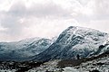
 Ivinghoe Beacon (the eastern trailhead) seen looking north from the Ridgeway
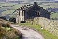
 The paved surface of the Pennine Way on Black Hill