
The South Downs Way is a long distance footpath and bridleway running along the South Downs in southern England. It is one of 16 National Trails in England and Wales. The trail runs for 160 km (100 mi) from Winchester in Hampshire to Eastbourne in East Sussex, with about 4,150 m (13,620 ft) of ascent and descent.

Kent Wildlife Trust (KWT) is a conservation charity in the United Kingdom that was founded in 1958, previously known as the Kent Trust for Nature Conservation. It aims to "work with people to restore, save and improve our natural spaces" and to "ensure that 30% of Kent and Medway – land and sea – is managed to create a healthy place for wildlife to flourish". In 2023, they have reported over 30,000 members and an annual income of £8 million. KWT manages over ninety nature reserves in Kent, of which thirty-seven are Sites of Special Scientific Interest, three are national nature reserves, five are Special Areas of Conservation, four are Special Protection Areas, six are local nature reserves, thirty-eight are in Areas of Outstanding Natural Beauty and one is a scheduled monument.

The Itchen Way is a 31.80-mile (51.18 km) long-distance footpath following the River Itchen in Hampshire, England, from its source near Hinton Ampner House to its mouth at Woolston. The walk finishes at Sholing railway station. The route has been promoted by the Eastleigh Group of the Ramblers with grant aid from Hampshire County Council and Eastleigh Borough Council. The route was altered and improved in 2008.

The London Borough of Croydon has over 120 parks and open spaces within its boundaries, ranging from the 200 acre (80ha) Selsdon Wood Nature Reserve to many recreation grounds and sports fields scattered throughout the Borough. Croydon covers an area of 86.52 km², the 256th largest district in England. Croydon's physical features consist of many hills and rivers that are spread out across the borough and into the North Downs, Surrey and the rest of South London. Some of the open spaces in Croydon form part of the well-known London LOOP walks where the first section was opened on 3 May 1996 with a ceremony on Farthing Downs in Coulsdon. As a borough in Outer London it also contains some open countryside in the form of country parks. Croydon Council is associated with several other boroughs who are taking part in the Downlands Countryside Management Project. These boroughs are Sutton; and by Surrey County Council; the City of London Corporation; the Surrey districts of Reigate and Banstead and Tandridge; and the Countryside Agency. An additional partner is Natural Britain.
The following are lists of recreational walks in Hampshire, England:
The following are lists of recreational walks in Norfolk, England.
The following are lists of recreational walks in East Sussex, England
The Wealdway, Kent and East Sussex, is a public footpath that runs for 83 miles / 134 km from Gravesend, Kent on the Thames estuary, to the A259 at Eastbourne, 3 km north of Beachy Head.

The Sussex Border Path is a long-distance footpath around the borders of Sussex, a historic county and former medieval kingdom in southern England. The main path is 150 miles (240 km) long and stays close to Sussex's borders with Hampshire, Surrey and Kent, connecting Thorney Island to Rye. There is also an additional 33-mile (53 km) spur known as the Mid Sussex Link, which links East Grinstead with Fishersgate and Mile Oak on the western boundary of the city of Brighton and Hove.

Tegg's Nose is a hill east of Macclesfield in Cheshire, England. It has a short ridge with a high point of 380 metres (1246 feet) at SJ947725, terminating in a promontory at the southern end. It lies on the western edge of the Peak District, although outside the boundary of the national park. Much of the hill's area falls within the Tegg's Nose Country Park, managed by Cheshire East Council Countryside Management Service; Tegg's Nose is also part of the Environmentally Sensitive Area Scheme.
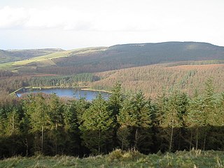
Macclesfield Forest is an area of woodland, predominantly conifer plantation, around 3 mi (5 km) south east of Macclesfield in the civil parish of Macclesfield Forest and Wildboarclough, in Cheshire, England.

The Forest Way is a linear Country park providing walking, cycling, horse riding and the quiet enjoyment of the countryside. It runs for around 16 km from East Grinstead to Groombridge.
The Wandle Trail is a 12.5-mile (20 km) walking and cycling trail that follows the River Wandle from Croydon to Wandsworth in south-west London.

The waymarked path Darent Valley Path is 19 miles (31 km) long, following the River Darent from the banks of the River Thames at Dartford through the Kent Downs Area of Outstanding Natural Beauty to the Greensand Hills above Sevenoaks. It runs through the villages of Shoreham and Otford.

The Canning River Regional Park is the largest of eight regional parks within the Perth metropolitan area. The park covers approximately 6 km (3.7 mi) on both sides of the Canning River between the bridges carrying Nicholson Road and Leach Highway over the Canning River. Canning River is a major tributary of the Swan River in south western Western Australia.

Baggeridge Country Park is located within the South Staffordshire district of Staffordshire, England. Its entrance is on the A463 just west of Gospel End, a small Staffordshire village just beyond the borders of the Wolverhampton, Gornal and the surrounding Metropolitan Borough of Dudley.

Trosley Country Park is in Trottiscliffe, near Vigo, in Kent, England. Once part of a large woodland estate then after many changes, it was passed to Kent County Council, who turned it into a large country park.

Shorne Woods Country Park is located between Strood and Gravesend, in the English county of Kent. It was once part of a large estate, later passed to the county council to be used as a country park.
