
Medway is borough and unitary authority area in Kent, South East England. It had a population of 278,016 in 2019. The unitary authority was formed in 1998, when the boroughs of Rochester-upon-Medway and Gillingham were merged to form Medway Towns. The borough is governed by Medway Council, a unitary authority which is independent of Kent County Council, but remains part of the ceremonial county of Kent.
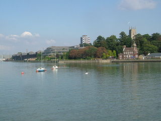
The River Medway is a river in South East England. It rises in the High Weald, West Sussex and flows through Tonbridge, Maidstone and the Medway conurbation in Kent, before emptying into the Thames Estuary near Sheerness, a total distance of 70 miles (113 km). About 13 miles (21 km) of the river lies in East Sussex, with the remainder being in Kent.
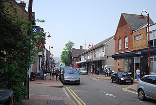
Snodland is a town in the borough of Tonbridge and Malling in Kent, England. It lies on the River Medway, between Rochester and Maidstone, and 27 miles (43 km) from central London. At the 2011 Census, it had a population of 10,211.

Tonbridge and Malling is a local government district with borough status in Kent, England. The council is based at Kings Hill. The borough also includes the towns of Tonbridge and Snodland along with numerous villages including Aylesford, West Malling and surrounding rural areas.

Four major rivers drain the county of Kent, England.

Yalding is a village and civil parish in the Borough of Maidstone in Kent, England. The village is situated 6 miles (9.7 km) south west of Maidstone at a point where the Rivers Teise and Beult join the River Medway. At the 2001 census, the parish, which includes the villages of Benover, Laddingford and Queen Street, had a population of 2,236. increasing to 2,418 at the 2011 Census.

The Medway Valley line is the name given to the railway line linking Strood in the Medway Towns via Maidstone West to Tonbridge. High Speed services also link between Maidstone West, Snodland, Strood and London St Pancras International. The section from Maidstone West to Paddock Wood passes through some of Kent's most picturesque countryside along the narrower sections of the River Medway.

Maidstone West railway station is one of three railway stations which serve the town of Maidstone, in Kent, England. It is on the Medway Valley Line, 42 miles 36 chains (68.3 km) from London Charing Cross via Strood and situated between Maidstone Barracks and East Farleigh. The station and all trains that serve the station are operated by Southeastern.

Maidstone Barracks railway station is one of three railway stations which serve the town of Maidstone in Kent, England. Originally opened as Barracks station, it is named after the nearby Invicta Park Barracks and lies on the Medway Valley Line, 42 miles (68 km) from London Charing Cross via Strood between Aylesford and Maidstone West. The station and all trains that serve the station are operated by Southeastern.

East Farleigh railway station is on the Medway Valley Line in Kent, England, located to the south-west of Maidstone and close to the village of East Farleigh, on the opposite (south) bank of the River Medway, though the station is actually located in Barming parish. It is 42 miles 75 chains (69.1 km) down the line from London Charing Cross via Paddock Wood. The station and all trains that serve the station are operated by Southeastern.

Chatham and Aylesford is a constituency in Kent represented in the House of Commons of the UK Parliament since 2010 by Tracey Crouch, a Conservative.

Walderslade is a large suburb in Kent in Chatham split between the unitary authority of Medway and the boroughs of Maidstone and Tonbridge & Malling in South East England. It was, until 1998, fully part of Kent and is still ceremonially associated via the Lieutenancies Act. It encompasses almost all the ME5 postcode district.

Blue Bell Hill is a chalk hill between Maidstone and Rochester in the English county of Kent. It overlooks the River Medway and is part of the North Downs. Settlements on the hill include the Walderslade suburb of Chatham and the villages of Blue Bell Hill and Kit's Coty. During the eighteenth and nineteenth centuries much of the hill was quarried for chalk.
The following is a list of recreational walks in Kent, England.

The A228 road is an important transport artery in Kent, England. It begins at the Isle of Grain and runs in a south-westerly direction to connect eventually with the A21 trunk road at Pembury. It serves existing communities and new and proposed housing developments and commercial enterprises. The most influential force on the recent upgrading of the road has been the development of Kings Hill near West Malling.
Transportation needs within the county of Kent in South East England has been served by both historical and current transport systems.

The River Bourne rises in the parish of Ightham, Kent and flows in a generally south easterly direction through the parishes of Borough Green, Platt, Plaxtol, West Peckham, Hadlow, and East Peckham where it joins the River Medway. In the 18th century the river was known as the Busty or Buster, the Shode or Sheet, but is not known by these names nowadays. A bourne is a type of stream, while shode means a branch of a river.
The Headcorn and Maidstone Junction Light Railway was a proposed railway in Kent. An Act of Parliament authorised its construction, but only a short branch at Tovil, opened to goods only, was built.
MidKent College is a further education college in Kent, England. It runs courses from two separate campuses in Maidstone and Medway, including a number of higher education courses.

