Shorne Woods Country Park

Last updated

Shorne Woods Country Park is located between Strood and Gravesend, in the English county of Kent. It was once part of a large estate, later passed to the county council to be used as a country park.

Contents

Shorne Woods Country Park
Footpath in Shorne Woods Country Park - geograph.org.uk - 1364604.jpg
Footpath in Shorne Woods
Shorne Woods Country Park
Coordinates 51°24′13″N0°25′12″E / 51.4036°N 0.4200°E / 51.4036; 0.4200
Created1987 (1987)
Operated by Kent County Council,
StatusOpen 7 days a week, dawn until dusk
Website Kent Country page
Kent UK location map.svg
Red pog.svg
Shorne Woods Country Park shown within Kent (grid reference TQ684700 )

History

This park was once part of the large Cobham Hall Estate. The main entrance to the Hall leads through the park, with various other carriage rides around the estate. Then from the 1930s to the 1970s, part of the estate was leased by Lord Darnley, and was used for clay extraction by a cement company, drawing from a clay pit beneath the ancient woodland. [1] Then in 1987, Kent County Council took ownership of the 288 acres (117 ha) of land, and with the help of Gravesham Borough Council, it was turned into a country park and opened to the public.

Facilities

It has large areas of ancient woodland and heathland meadows. The former claypit is being returned to nature (with woodland and wetland areas). The wetland ponds have many species of dragonflies, which breed in the park. A large part of the park is a Site of Special Scientific Interest (SSSI) with the designation Shorne and Ashenbank Woods. [2]

The park also is accredited with a Green Flag Award by Natural England. [3]

The country park has many colour-coded waymarked paths around the country park. These include; Purple Route - Easy 1.4 km, Red Route - Medium, Explorer Trail - 3.7 miles (6.0 km), Heritage Trail - 2.2 miles (3.5 km). A longer trail (the Darmley Trail - 6.2 miles (10.0 km)) has also been developed taking area outside of Shorne Woods park, including Darnley Mausoleum, Jeskyns (a one-time farm of 360 acres (150 ha), which is being turned into a greenspace area and country park by the Forestry Commission ), Ranscombe Farm and Cobham Hall. [4] There is also a horse riding and cycle path route around the park. As well as a Sensory Garden for the less abled. Disabled visitors can also use 4*4 electro-scooters (called a Tramper), which can be hired from the visitor centre.

The park also has an eco-friendly visitor centre designed by Lee Evans Partnership and costing £1.6m. It as runner up in 2007 Kent Design Awards. [5] It was the first structure to be constructed using Sweet chestnut in the UK. The mainly sweetchestnut structure, [6] also used Oak thinnings were used from Park Wood, Kent near Appledore, as the window and roof joinery. [7]

Shorne Woods Country Park Visitor Centre Wind Turbine Shorne Wood Country Park - geograph.org.uk - 1364641.jpg
Shorne Woods Country Park Visitor Centre

It is mostly powered by a wind turbine. The centre has a shop, display boards and cafe.

To the east of the park, are the Furzey Leas Lakes. Steps Lake is 0.5 acres (2,000 m2), and Long Lake is 0.65 acres (2,600 m2) These are used as angler permitted lakes, on Day Tickets (obtained from the visitor centre). [8]

Since 2006, the park has had a Community Archaeologist as funded by the Heritage Lottery. Finds from the Stone Age (flint tools) to World War II items have been found. [9] Most work has been taken place around the remains of Randall Manor. This was the home of Sir Henry de Cobham who lived there in 1360 to 1400. The house would have been similar to Ightham Mote but without a moat. The excavations show that it was a substantial timber-framed hall house with a stone built end. It had a garderobe and a separate kitchen making it a high status building. It had outbuildings and three fishponds. It was demolished in 1500 and the building materials re-used in the nearby Cobham Hall, now a girls' school. [10] [11]

More details of what was found in the park can be seen at the Kent County Council website. [12] One of the '100 Walks in Kent' Book starts in the country park, before heading towards Owletts (a National Trust House), Cobham and Cobham Hall and then returning to the park. [13]

How to get there

Situated off the A2 Dual carriageway between Gravesend and Rochester. The main entrance for cars is along Brewer's Road leading to Shorne.

Parkrun

Shorne Woods Country park is also home to a parkrun which is a free timed 5k event fully staffed by volunteers. [14] The first Shorne Woods parkrun took place on 30 March 2013.

Images

Related Research Articles

<span class="mw-page-title-main">Gravesend</span> Town in Kent, England

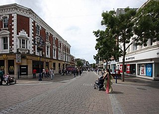
Gravesend is a town in northwest Kent, England, situated 21 miles (35 km) east-southeast of Charing Cross on the south bank of the River Thames and opposite Tilbury in Essex. Located in the diocese of Rochester, it is the administrative centre of the Borough of Gravesham. Gravesend marks the eastern limit of the Greater London Built-up Area, as defined by the UK Office for National Statistics.

<span class="mw-page-title-main">Gravesham</span> Borough and non-metropolitan district in England

Gravesham is a local government district with borough status in north-west Kent, England. The council is based in its largest town of Gravesend. The borough is indirectly named after Gravesend, using the form of the town's name as it appeared in the Domesday Book of 1086. The district also contains Northfleet and a number of villages and surrounding rural areas.

<span class="mw-page-title-main">Earl of Darnley</span> Hereditary title in the Peerage of Scotland

Earl of Darnley is a hereditary title that has been created three times, twice in the Peerage of Scotland and once in the Peerage of Ireland.

<span class="mw-page-title-main">Cobham, Kent</span> Village and civil parish in England

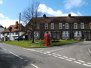
Cobham is a village and civil parish in the borough of Gravesham in Kent, England. The village is located 6 miles (10 km) south-east of Gravesend, and just south of Watling Street, the Roman road from Dover to London. The parish, which includes the hamlet of Sole Street, covers an area of 1,240 hectares and had a population of 1,469 at the 2011 Census, increasing from 1,328 at the 2001 Census.

<span class="mw-page-title-main">Sandwell Valley Country Park</span>

Sandwell Valley Country Park is a country park, run by Sandwell Metropolitan Borough Council, in Sandwell Valley, on the River Tame in the middle of the urban conurbation between Birmingham and West Bromwich in West Midlands, England.

<span class="mw-page-title-main">Shorne</span> Human settlement in England

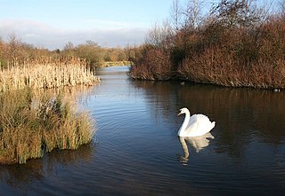
Shorne is a village and civil parish in the borough of Gravesham in Kent, England. The parish lies 3 miles (4.8 km) east of Gravesend. Most of the land is well-drained but its marshes, the Shorne Marshes reach down to the Thames Estuary and are an SSSI amid the North Kent Marshes on the Hoo Peninsula proper.

<span class="mw-page-title-main">Meopham</span> Human settlement in England

Meopham is a large linear village and civil parish in the Borough of Gravesham in north-west Kent, England, lying to the south of Gravesend. The parish covers 6.5 square miles (17 km2), and comprises two villages and two smaller settlements; it had a population of 6,795 at the 2021 census. Meopham village is sometimes described as the longest settlement in England although others such as Brinkworth and Sykehouse make the same claim. Meopham is one of the longest linear settlements in Europe, being 7 miles (11 km) in length.

<span class="mw-page-title-main">Chalk, Kent</span> Human settlement in England

Chalk is a village and since 1935 a former civil parish which adjoins the east of Gravesend, Kent, England. As is intuitive, its name comes from the Saxon word cealc meaning a chalkstone. In 1931 the parish had a population of 563.

<span class="mw-page-title-main">Cliffe Woods</span> Human settlement in England

Cliffe Woods is a small estate on the Hoo Peninsula in the unitary authority of Medway in South East England. It was, until 1998, part of Kent and is still ceremonially associated via the Lieutenancies Act. It forms part of the parish of Cliffe and Cliffe Woods.

<span class="mw-page-title-main">Cobham Hall</span> A manor house in Kent

Cobham Hall is an English country house in the county of Kent, England. The grade I listed building is one of the largest and most important houses in Kent, re-built as an Elizabethan prodigy house by William Brooke, 10th Baron Cobham (1527–1597). The central block was rebuilt 1672–82 by Charles Stewart, 3rd Duke of Richmond, 6th Duke of Lennox (1639–1672).

Cobham Hall School is a private day and boarding school in the English parish of Cobham, Kent, for girls only in Years 7 to 11 and co-educational in the Sixth Form. It is a Round Square school and a member of the Girls' Schools Association. The school is housed in Cobham Hall, a Tudor era Grade I listed manor house situated in 150 acres of historic parkland on the edge of the Kent Downs. The school featured in the film Wild Child in 2008, as the fictional school that the characters attended, called Abbey Mount.

The following is a list of recreational walks in Kent, England.

<span class="mw-page-title-main">Wepre Park</span> Public park in Flintshire, Wales, UK

Wepre Park is a 160 acres (65 ha) country park near Connah's Quay in Flintshire, Wales. The park is home to Ewloe Castle and contains a children's playground, outdoor gym, football playing pitches and a visitor centre.

<span class="mw-page-title-main">Cobham Woods</span>

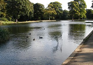
Cobham Woods is a 242.7 hectares biological Site of Special Scientific Interest on the western outskirts of Rochester in Kent. It is in the Kent Downs Area of Outstanding Natural Beauty and part of it is managed by the National Trust.

<span class="mw-page-title-main">Middleton Park</span>

Middleton Park is a public park in Middleton, Leeds, West Yorkshire, England. It covers an area of 630 acres (255.0 ha), nearly a square mile of which 200 acres (80.9 ha) are ancient woodland. There is also a small lake, recreational areas and a former golf course. The reclaimed site of "Middleton Broom" Colliery has been incorporated into the park. By its northern boundary is the South Leeds Stadium, home of rugby league club Hunslet. The Middleton Railway runs between Moor Road, Hunslet and Park Halt railway station. It is also the site of Leeds Urban Bike Park. It is known locally as 'Miggy Park'.

<span class="mw-page-title-main">Darnley Mausoleum</span> Mausoleum in Cobham Woods, Kent

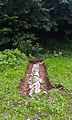
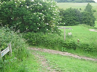
The Darnley Mausoleum, or Cobham Mausoleum as it is often now referred to, is a Grade I Listed building, now owned by the National Trust and situated in Cobham Woods, Kent. It was designed by James Wyatt for the 4th Earl of Darnley of Cobham Hall according to detailed instructions in the will of the 3rd Earl of Darnley. It was never used for interments. The woodland is part of the parkland laid out by Humphry Repton, and is 1.6 km from the North Downs Way.

<span class="mw-page-title-main">Jeskyns</span>

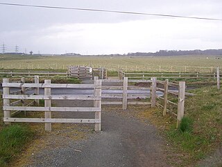
Jeskyns is a park near Cobham, in Kent, England. A former farm, it was reopened as a large open-space recreational area in 2007, with areas being developed as new wildlife habitats.

<span class="mw-page-title-main">Beacon Wood Country Park</span>

Beacon Wood Country Park is a public woodland in Bean near Dartford, in Kent, England. It was previously an industrial claypit then re-claimed as woodland park open to the public, currently owned by Lafarge.

<span class="mw-page-title-main">Camer Park Country Park</span>

Camer Country Park is in Meopham, in Kent, England. It is a former estate landscape, with grassland and woodland.

<span class="mw-page-title-main">Lullingstone Country Park</span>

Lullingstone Country Park is near Eynsford, in Kent, England. A former deer park of a large estate, it was later sold to become an open-space and woodland park. The park and Lullingstone Castle are a Scheduled Monument, and an area of 66.4-hectare (164-acre) is a biological Site of Special Scientific Interest Kent.

References

  1. "Archived copy" (PDF). Archived from the original (PDF) on 27 September 2011. Retrieved 28 June 2011.{{cite web}}: CS1 maint: archived copy as title (link)
  2. "Natural England: SSSI citation" (PDF). Sssi.naturalengalnd.org.uk.
  3. "Country Parks in the South East". Naturalengland.org.uk. Natural England. 2013. Retrieved 2 December 2013.
  4. "Archived copy" (PDF). Archived from the original (PDF) on 21 March 2012. Retrieved 11 March 2011.{{cite web}}: CS1 maint: archived copy as title (link)
  5. "Shorne Wood Visitors' Centre". Lee-evans.co.uk. Retrieved 12 November 2017.
  6. "How we cracked it 31: Shorne Wood, Gravesend". Bdonline.co.uk. 4 August 2006. Retrieved 12 November 2017.
  7. "Shorne Wood's Sweet chestnut cruck frame -". Fourthdoor.org.
  8. "Shorne Country Park - fishing lakes". Archived from the original on 26 March 2012. Retrieved 28 June 2011.
  9. "Community archaeology". Archived from the original on 22 October 2011. Retrieved 28 June 2011.
  10. "Plaxtol Local History Group - 2011 Meeting Reports". Plaxtolhistory.org.uk.
  11. "Randall Manor - Discover Gravesham". Discovergravesham.co.uk.
  12. "Randall Manor Dig Blog 2010". Archived from the original on 21 October 2011. Retrieved 28 June 2011.
  13. Shean, Jim (1995). 100 Walks in Kent. London. pp. 174–175. ISBN   1-85223-872-0.{{cite book}}: CS1 maint: location missing publisher (link)
  14. "Kent parkruns and clubs to get fit-in 2018". Kentonline.co.uk. Retrieved 14 July 2018.