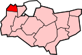
Bean, Kent

Last updated

Bean
The Black Horse, Bean - geograph.org.uk - 2088928.jpg
The Black Horse
Kent UK location map.svg
Red pog.svg
Bean
Location within Kent
Population1,643 (civil parish 2011) [1]
OS grid reference TQ590722
Civil parish
  • Bean
District
Shire county
Region
Country England
Sovereign state United Kingdom
Post town Dartford
Postcode district DA2
Dialling code 01474
Police Kent
Fire Kent
Ambulance South East Coast
UK Parliament
List of places
UK
England
Kent
51°25′38″N0°17′10″E / 51.4273°N 0.286°E / 51.4273; 0.286

Bean is a village and civil parish in the Borough of Dartford, Kent, England. It is located 4.4 miles south east of Dartford and 5.4 miles south west of Gravesend. In 2011 the parish had a population of 1643.

Contents

The Area

The parish is bounded on the north by the A2 road (the Roman Watling Street), and on the other three sides by ancient woodlands. It is the most recently formed of Kent parishes, although the village itself has been recorded since at least the 13th century. Bean was formerly part of the parish of Stone, but the boundary was such that it was connected to the rest of Stone by only a narrow neck of land at Watling Street (A2). In 1797 this part of the parish of Stone is described as having great tract of woodland which reached almost to Green Street Green, [2] adjoining to Darenth parish. Along the northern boundary of these woods, runs the ancient Roman road to Rochester (now the A2) and not far from this road were the two small hamlets of Bean and Stonewood. On the hill above Green Street Green, among the woods, were the remains of a camp and fortifications, thrown up in ancient times, but then so overgrown with wood and rubbish, as to be impenetrable. [3]

Transport

Rail

The nearest National Rail stations to Bean are Longfield, located 2.2 miles away and Greenhithe, located 2.4 miles away.

Buses

Bean is served by Go Coach's Connect1 bus service, connecting it with Bluewater.

Related Research Articles

<span class="mw-page-title-main">London Borough of Bexley</span> London borough in United Kingdom

The London Borough of Bexley is a London borough in south-east London, forming part of Outer London. It has a population of 248,287. The main settlements are Sidcup, Erith, Bexleyheath, Crayford, Welling and Old Bexley. The London Borough of Bexley is within the Thames Gateway, an area designated as a national priority for urban regeneration. The local authority is Bexley London Borough Council.

<span class="mw-page-title-main">Watling Street</span> Historic route in England

Watling Street is a historic route in England that crosses the River Thames at London and which was used in Classical Antiquity, Late Antiquity, and throughout the Middle Ages. It was used by the ancient Britons and paved as one of the main Roman roads in Britannia. The route linked Dover and London in the southeast, and continued northwest via St Albans to Wroxeter. The line of the road was later the southwestern border of the Danelaw with Wessex and Mercia, and Watling Street was numbered as one of the major highways of medieval England.

<span class="mw-page-title-main">A2 road (England)</span> Road in southern England

The A2 is a major road in south-east England, connecting London with the English Channel port of Dover in Kent. This route has always been of importance as a connection between London and sea trade routes to Continental Europe. It was originally known as the Dover Road. The M2 motorway has replaced part of the A2 as the strategic route.

<span class="mw-page-title-main">Borough of Dartford</span> Borough & Non-metropolitan district in England

The Borough of Dartford is a local government district in the north-west of the county of Kent, England. Its council is based in the town of Dartford. It is part of the contiguous London urban area. It borders the borough of Gravesham to the east, Sevenoaks District to the south, the London Borough of Bexley to the west, and the Thurrock unitary authority in Essex to the north, across the River Thames. The borough was formed on 1 April 1974 by the merger of the Municipal Borough of Dartford, the Swanscombe Urban District, and part of the Dartford Rural District. According to the 2011 Census, its population was 97,365, increasing to 116,800 in the 2021 census.

<span class="mw-page-title-main">Rainham, Kent</span> Town in England

Rainham is a town in the unitary authority of Medway, in Kent, South East England. The town forms a conurbation with neighbouring towns Chatham, Rochester, Strood and Gillingham.

<span class="mw-page-title-main">Swanscombe</span> Human settlement in England

Swanscombe /ˈswɒnzkəm/ is a village in the Borough of Dartford in Kent, England, and the civil parish of Swanscombe and Greenhithe. It is 4.4 miles west of Gravesend and 4.8 miles east of Dartford.

<span class="mw-page-title-main">Pembury</span> Human settlement in England

Pembury is a large village in Kent, in the south east of England, with a population of 6,128 at the 2011 Census. It lies just to the north-east of Royal Tunbridge Wells.

Stone is a village in the Borough of Dartford in Kent, England. It is located 2.5 miles east of Dartford.

<span class="mw-page-title-main">Greenhithe</span> Village in the Borough of Dartford, Kent, England

Greenhithe is a village in the Borough of Dartford in Kent, England, and the civil parish of Swanscombe and Greenhithe. It is located 4 miles east of Dartford and 5 miles west of Gravesend.

Southfleet is a small village and civil parish in the borough of Dartford in Kent, England. The village is located three miles southwest of Gravesend, while the parish includes within its boundaries the hamlets of Betsham and Westwood.

<span class="mw-page-title-main">Wilmington, Kent</span> Human settlement in England

Wilmington is a village and civil parish in the Borough of Dartford in Kent, England. It is located 2.7 miles south of Dartford, 3.5 miles north of Swanley and 4.3 miles south east of Bexleyheath, adjacent to the Kent border with Greater London.

Upper Harbledown is a village in Harbledown and Rough Common civil parish about 2 miles (3 km) west of Canterbury, Kent, England. The population is roughly 400.

<span class="mw-page-title-main">Fawkham</span> Human settlement in England

Fawkham is a village and civil parish in the Sevenoaks District of Kent, England. Fawkham is defined as a hamlet by Sevenoaks District Council, with a population of 429. Fawkham is a low density, linear settlement along the bottom of a dry chalk valley some 3 mi (5 km) in length, with secondary lanes intersecting. There is no discernible village centre, although clusters of buildings occur near the Church/junction with Castle Hill, and around the village green and public house at the junction with Fawkham Green Road. There are around 220 houses.

<span class="mw-page-title-main">Ospringe</span> Human settlement in England

Ospringe is a village and area of Faversham in the English county of Kent. It is also the name of a civil parish, which since 1935 has not included the village of Ospringe.

<span class="mw-page-title-main">Newington, Swale</span> Human settlement in England

Newington is a village and civil parish in the borough of Swale in Kent, England. The parish is located beside the A2 road between Rainham to the west and Sittingbourne to the east. The population of the parish in 2011 was 2,551.

<span class="mw-page-title-main">East Wickham</span> Human settlement in England

East Wickham is a district in south-east London, England, within the London Borough of Bexley. It is situated north of Welling, east of Shooter's Hill, south of Plumstead, south-west of Abbey Wood and west of West Heath, and 10.5 miles (16.9 km) east-southeast of Charing Cross. Prior to the creation of Greater London in 1965, East Wickham was in the administrative county of Kent.

<span class="mw-page-title-main">Betsham</span> Human settlement in England

Betsham is a hamlet in the parish of Southfleet in Kent, England.

<span class="mw-page-title-main">Norton, Buckland and Stone</span> Human settlement in England

Norton, Buckland and Stone is a small rural civil parish 1 mile (1.6 km) east of Teynham and 3 miles (4.8 km) west of the centre of Faversham in the borough of Swale, Kent, England. It is bypassed by the M2 to the south and traverses the historic A2, on the route of the Roman road of Watling Street.

<span class="mw-page-title-main">Little and Lesnes Hundred</span>

Little and Lesnes was a hundred, a historical land division, in the county of Kent, England. It occupied the northern part of the Lathe of Sutton-at-Hone, within in the west division of Kent. Little and Lesnes was the northernmost hundred in the whole county of Kent. The hundred existed since ancient times, before the Domesday Book of 1086, until it was made obsolete with the creation of new districts at the end of the nineteenth century.

<span class="mw-page-title-main">Leyton Cross</span>

Leyton Cross is a small semi-rural area in Kent, England, that largely falls within the parish of Wilmington in the borough of Dartford, although north of Oakfield Lane the area is administered directly by Dartford Borough Council. The boundaries of Leyton Cross are ill-defined but the residential area is generally said to include the neighbourhood around Leyton Cross Road, Clayton Croft Road, Tredegar Road, Manor Close and Wilmington Court Road, the western tip of Common Lane, plus the section of Oakfield Lane between Heath Lane (Upper) and Old Bexley Lane. Leyton Cross also includes areas of heathland to the immediate north and west of this district, which are parts of Dartford Heath. Leyton Cross may also sometimes be referred to as Heath Side.

References

  1. "Civil Parish population 2011". Neighbourhood Statistics. Office for National Statistics. Retrieved 11 September 2016.
  2. Vision of Britain http://www.visionofbritain.org.uk/place/23341
  3. The History and Topographical Survey of the County of Kent: Volume 2 (1797),by Edward Hasted. See section on the parish of Stone under Axstane Hundred