Betsham

Last updated

Betsham
The Hop House, Betsham - geograph.org.uk - 145092.jpg
The Hop House, Betsham
Kent UK location map.svg
Red pog.svg
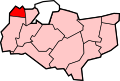
Betsham
Location within Kent
District
Shire county
Region
Country England
Sovereign state United Kingdom
Post town Gravesend
Postcode district DA13
Police Kent
Fire Kent
Ambulance South East Coast
UK Parliament
List of places
UK
England
Kent
51°25′12″N0°18′27″E / 51.42°N 0.3075°E / 51.42; 0.3075 Coordinates: 51°25′12″N0°18′27″E / 51.42°N 0.3075°E / 51.42; 0.3075

Betsham is a hamlet in the parish of Southfleet in Kent, England. [1] [2]

Betsham is a mile north-west from the village of Southfleet, which is situated nearly in the middle of the parish. The hamlet was formerly called Bedesham and lies on the road that leads from Green Street Green (formerly Greensted-green) in the parish of Darenth to Southfleet railway station and thence to Wingfield-bank, Northfleet where it meets the ancient Roman highway Watling Street (A2 motorway), which runs along the northern side of this parish. [3]

Westwood Road links Betsham with Westwood to the south.

Related Research Articles

Stepney Human settlement in England

Stepney, also known as Stepney Green, is a district in the East End of London in the London Borough of Tower Hamlets that grew out of a merging of both a medieval village around St Dunstan's church and a 15th-century ribbon development of Mile End Road called Stepney Green. The district is not officially defined, and is usually used to refer to a relatively small area, however for much its history the place name applied to a much wider area.

Wadhurst Human settlement in England

Wadhurst is a market town in East Sussex, England. It is the centre of the civil parish of Wadhurst, which also includes the hamlets of Cousley Wood and Tidebrook. Wadhurst is twinned with Aubers in France.

Northfleet Human settlement in England

Northfleet is a town in the borough of Gravesham in Kent, England. It is located immediately west of Gravesend, and on the border with the Borough of Dartford. Northfleet has its own railway station on the North Kent Line, just east of Ebbsfleet International railway station on the High Speed 1 line.

Greenhithe Village in the Borough of Dartford, Kent, England

Greenhithe is a village in the Borough of Dartford in Kent, England. It is located east of Dartford, in the civil parish of Swanscombe and Greenhithe.

Cranbrook, Kent Human settlement in England

Cranbrook is a small town in the civil parish of Cranbrook and Sissinghurst, in the Weald of Kent in South East England. It lies roughly half-way between Maidstone and Hastings, about 38 miles (61 km) southeast of central London.

Meopham Human settlement in England

Meopham is a large linear village and civil parish in the Borough of Gravesham in Kent, England, lying to the south of Gravesend. The parish covers 6.5 square miles (17 km2), and comprises two villages and two smaller settlements; it has a population of 6,427 increasing slightly to 6,722 at the 2011 census. Meopham is sometimes described as the longest settlement in England although others such as Brinkworth, Wiltshire make the same claim. Meopham is one of the longest linear settlements in Europe, being 7 miles (11 km) in length.

Longfield Human settlement in England

Longfield is a village in the civil parish of Longfield and New Barn, in the Dartford district in Kent, England. It is located 6 miles (10 km) south-east of Dartford and the same distance south-west of Gravesend.

Southfleet Human settlement in England

Southfleet is a small village and civil parish in the borough of Dartford in Kent, England. The village is located three miles southwest of Gravesend, while the parish includes within its boundaries the hamlets of Betsham and Westwood.

Chartham Human settlement in England

Chartham is a village and civil parish in the Canterbury district of Kent, England. It is situated on the Ashford side of the city, and is in the North Downs area of Outstanding Natural Beauty, 2.3 miles (4 km) south west of Canterbury, England. The Great Stour Way path passes through the village. A paper mill in the village has specialised in the production of tracing paper since 1938. There are numerous arable farms and orchards in the parish. The village has an unmanned station, Chartham, and a manned level crossing. It has an outlying locality sharing in many of the community resources, Chartham Hatch.

Caddington Human settlement in England

Caddington is a village and civil parish in the Central Bedfordshire district of Bedfordshire, England. It is between the Luton/Dunstable urban area, and Hertfordshire.

Bean, Kent Human settlement in England

Bean is a village and civil parish in the borough of Dartford in Kent, England. It is located around three miles southeast of the town of Dartford.

North End, Bexley Human settlement in England

North End is a name for a neighbourhood in the London Borough of Bexley and the term is of fading use. It was originally a hamlet or farmstead towards the north of the parish of Crayford, a parish founded by the early middle ages and which continues in the Church of England.

Fawkham Human settlement in England

Fawkham is a village and civil parish in the Sevenoaks District of Kent, England. Fawkham is defined as a hamlet by Sevenoaks District Council, with a population of 429. Fawkham is a low density, linear settlement along the bottom of a dry chalk valley some three miles in length, with secondary lanes intersecting. There is no discernible village centre, although clusters of buildings occur near the Church/junction with Castle Hill, and around the village green and public house at the junction with Fawkham Green Road. There are around 220 houses.

Weavering Human settlement in England

Weavering is a village, mainly consisting of parts of the Grove Green and Bearsted Park housing Estates, centred on Weavering Street, within the borough of Maidstone, Kent in South East England that was formerly farmland. At the 2014 Census the population of the village was included in the civil parish of Thurnham.

Green Street Green Human settlement in England

Green Street Green is a village in South East London, in the London Borough of Bromley. It is located south of Orpington. It is within the historic boundaries of Kent and has been administered as part of London since 1965.

New Barn Human settlement in England

New Barn is a compact residential area surrounded by open fields which lies four miles southwest of Gravesend in Kent, England. It is in the local government district of Dartford. The villages of New Barn and Longfield are within and give their names to the civil parish of Longfield and New Barn. New Barn is larger in population than Longfield, although has little in the way of services, being a recent development and purely residential in nature

Northfleet Green Human settlement in England

Northfleet Green is a hamlet in the borough of Gravesham in Kent, England. It is located around two miles southwest of Gravesend and just east of Southfleet in the neighbouring borough of Dartford. The High Speed 1 railway line passes just to the north of the hamlet. The population of the hamlet is included in the ward of Istead Rise.

Longfield Halt railway station

Longfield Halt was a railway station on the Gravesend West Line which served the settlement of Grubb Street in Kent, England.

Southfleet was a railway station on the Gravesend West Line which served the small village of Southfleet in Kent, England.

Westwood, Southfleet Human settlement in England

Westwood is a hamlet in the parish of Southfleet in Kent, England, in the west of the parish.

References

  1. Parish of Southfleet in Imperial Gazetteer of England and Wales, by John Marius Wilson,publ. Fullarton, London, 1870-72
  2. Parish Council web site www.southfleetpc.kentparishes.gov.uk/history-of-the-parish-of-southfleet/ retrieved Sept 2018
  3. see Edward Hasted (1797). The History and Topographical Survey of the County of Kent: Volume 1.

Commons-logo.svg Media related to Betsham at Wikimedia Commons