Temple Hill, Kent

Last updated

Temple Hill
Public Open Space, Temple Hill, Dartford, Kent - geograph.org.uk - 30749.jpg
Public open space in Temple Hill
Kent UK location map.svg
Red pog.svg
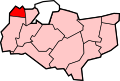
Temple Hill
Location within Kent
District
Shire county
Region
Country England
Sovereign state United Kingdom
Post town Dartford
Postcode district DA1
Police Kent
Fire Kent
Ambulance South East Coast
UK Parliament
List of places
UK
England
Kent
51°26′59″N0°13′31″E / 51.449720°N 0.225170°E / 51.449720; 0.225170

Temple Hill is a suburb of Dartford in Kent, England. It takes its name from the Knights Templar order. Temple Hill extends from the west of the A282 (Dartford Crossing) in the east to Dartford town centre in the west. It is one of the largest suburban regions of Dartford. Temples Manor, known as the manor of Dartford Temples, took its name from the Knights Templars who were the original landowners. The manor appears to have included the whole of the lands from Temple Hill on the north eastern edge of the town, right down to the River Thames. The manor also incorporated the Waterside district of Dartford and the area around the River Cranpit on the south side of the High Street, at the junction of Lowfield Street. The prior of St John of Jerusalem was the principal landholder within the manor.

Transport

Temple Hill is served by the Fastrack bus system.

Related Research Articles

<span class="mw-page-title-main">Witham</span> Human settlement in England

Witham is a town in the county of Essex in the East of England, with a population of 25,353. It is part of the District of Braintree and is twinned with the town of Waldbröl, Germany. Witham stands between the city of Chelmsford and the City of Colchester, on the Roman road between the two. The River Brain runs through the town and joins the River Blackwater just outside.

<span class="mw-page-title-main">Borough of Dartford</span> Borough & Non-metropolitan district in England

The Borough of Dartford is a local government district in the north-west of the county of Kent, England. Its council is based in the town of Dartford. It is part of the contiguous London urban area. It borders the borough of Gravesham to the east, Sevenoaks District to the south, the London Borough of Bexley to the west, and the Thurrock unitary authority in Essex to the north, across the River Thames. The borough was formed on 1 April 1974 by the merger of the Municipal Borough of Dartford, the Swanscombe Urban District, and part of the Dartford Rural District. According to the 2011 Census, its population was 97,365.

<span class="mw-page-title-main">Hackney Marshes</span> Open space in London

Hackney Marshes is an area of open space in London's Lower Lea Valley, lying on the western bank of the River Lea. It takes its name from its position on the eastern boundary of Hackney, the principal part of the London Borough of Hackney, and from its origin as an area of true marsh.

<span class="mw-page-title-main">Coleshill, Warwickshire</span> Market town in Warwickshire, England

Coleshill is a market town and civil parish in the North Warwickshire district of Warwickshire, England, taking its name from the River Cole, on which it stands. It had a population of 6,897 in the 2021 Census, and is situated 10 miles (16 km) east-northeast of Birmingham, 9 miles (14 km) southeast of Sutton Coldfield, 11 miles (18 km) south of Tamworth, 13 miles (21 km) northwest of Coventry by road and 13 miles (21km) west of Nuneaton.

<span class="mw-page-title-main">Templecombe</span> Human settlement in England

Templecombe is a village in Somerset, England, situated on the A357 road five miles south of Wincanton, 12 miles (19 km) east of Yeovil, and 30 miles (48 km) west of Salisbury. It is located within the Blackmore Vale. The village has a population of 1,560. Along with the hamlet of Combe Throop, it forms the parish of Abbas and Templecombe.

<span class="mw-page-title-main">Dartford</span> Human settlement in England

Dartford is the principal town in the Borough of Dartford, Kent, England. It is located 18 mi (29 km) south-east of Central London and is situated adjacent to the London Borough of Bexley to its west. To its north, across the Thames estuary, is Thurrock in Essex, which can be reached via the Dartford Crossing. To its east lies the Borough of Gravesham and to the south the district of Sevenoaks.

<span class="mw-page-title-main">Eagle, Lincolnshire</span> Village in the North Kesteven district of Lincolnshire, England

Eagle is a village in the North Kesteven district of Lincolnshire, England. It is situated 7 miles (11 km) south-west from Lincoln and 2 miles (3.2 km) east from North Scarle. Eagle is part of the civil parish of Eagle and Swinethorpe. The population of the civil parish taken at the 2011 census was 793.

<span class="mw-page-title-main">Temple, London</span> One of the main legal districts in London, England

The Temple is an area of the City of London surrounding Temple Church. It is one of the main legal districts in London and a notable centre for English law, since the middle ages to the present day. It consists of the Inner Temple and the Middle Temple, which are two of the four Inns of Court and act as local authorities in place of the City of London Corporation as to almost all structures and functions. The Temple was the precinct of the Knights Templar until they were suppressed in 1312, and the area has retained the name from that time. It became a centre of the legal profession soon thereafter.

<span class="mw-page-title-main">Bottesford Preceptory</span> Community of the Knights Templar in Lindsey, England

Bottesford Preceptory was sited at Bottesford, just to the south of Scunthorpe, in Lindsey, England. It was on low-lying land, near the Bottesford Beck, about 3 miles (5 km) to the west of the escarpment of the Lincoln Cliff limestone upland, and about the same distance to the east of the River Trent. A preceptory was a community of the Knights Templar who lived on one of that order's estates in the charge of its preceptor. A preceptory also referred to the estate and its buildings. The present Bottesford Manor is believed to have been the gatehouse to the preceptory.

<span class="mw-page-title-main">Rothley Temple</span> Preceptory in Leicestershire, England

Rothley Temple, or more correctly Rothley Preceptory, was a preceptory in the village of Rothley, Leicestershire, England, associated with both the Knights Templar and the Knights Hospitaller.

<span class="mw-page-title-main">Kirkliston</span> Human settlement in Scotland

Kirkliston is a small town and parish to the west of Edinburgh, Scotland, historically within the county of West Lothian but now within the City of Edinburgh council area limits. It lies on high ground immediately north of a northward loop of the Almond, on the old road between Edinburgh and Linlithgow, having a crossroads with the road from Newbridge to Queensferry and beyond to Fife. The B800 is variously named Path Brae, High Street, Station Road, and Queensferry Road as it passes through the town. The B9080 is named Main Street and Stirling Road as it passes through.

<span class="mw-page-title-main">Sandford-on-Thames</span> Human settlement in England

Sandford-on-Thames, also referred to as simply Sandford, is a village and Parish Council beside the River Thames in Oxfordshire just south of Oxford. The village is just west of the A4074 road between Oxford and Henley.

<span class="mw-page-title-main">Temple Grafton</span> Human settlement in England

Temple Grafton is a village and civil parish in the Stratford-on-Avon district of Warwickshire, England, situated about 4 miles (6.4 km) east of Alcester and 14 miles (23 km) west of the county town of Warwick. The place name is misleading, the Knights Templar never having any association with the place but owing to a naming error made in the time of Henry VIII the mistake has been perpetuated. During the reign of Richard I the estate in fact belonged to the Knights Hospitaller. During the reign of Edward III in 1347 the village was recorded as Grafton Superior while neighbouring Ardens Grafton was named Inferior.

<span class="mw-page-title-main">Temple Ewell</span> Human settlement in England

Temple Ewell is a civil parish and historic village in the county of Kent, England. The village is part of the Dover district of Kent, and forms part of the Dover urban area. It is situated three miles North West of the town of Dover.

Redcliffe, also known as Redcliff, is a district of the English port city of Bristol, lying south-east of the city centre. It is bounded by the loop of the Floating Harbour to the west, north and east, together with the New Cut of the River Avon to the south. Most of Redcliffe lies within the city ward of Lawrence Hill, although the westernmost section, including the cliffs and hill from which the area takes its name, is in Cabot ward. Bristol Temple Meads station is located in Redcliffe.

<span class="mw-page-title-main">Temple, Midlothian</span> Human settlement in Scotland

Temple is a village and civil parish in Midlothian, Scotland. Situated to the south of Edinburgh, the village lies on the east bank of the river South Esk.

The history of the Knights Templar in England began when the [English]] nobleman Hughes de Payens, the founder and Grand Master of the order of the Knights Templar, visited the country in 1128 to raise men and money for the Crusades.

<span class="mw-page-title-main">Temple Manor</span> Grade I listed historic house museum in Strood, England

Temple Manor is a scheduled ancient monument and grade I listed building in Strood, Kent. The Manor has been owned by various religious, national and farming owners over 600 years. The building has been added to and adapted over the centuries, but the basic structure is now clearly visible.

<span class="mw-page-title-main">Witham Preceptory</span> Historic site in Temple Hill

Withham Preceptory, one of the smallest Knights Templar preceptories in England, was founded, before 1164, at Temple Hill, near South Witham, Lincolnshire, and was abandoned in the early 14th century. The site of the former preceptory at Temple Hill, South Witham. It 'has been largely under pasture' since the Knights Templar left in 1308.

<span class="mw-page-title-main">Temple Hirst</span> Village and civil parish in North Yorkshire, England

Temple Hirst is a village and civil parish in the Selby District of North Yorkshire, England. It was formerly in the wapentake of Barkston Ash in the West Riding of Yorkshire. The village is located on the north bank of the River Aire. In the 2011 census the population was 117.

References