
The South Downs Way is a long distance footpath and bridleway running along the South Downs in southern England. It is one of 16 National Trails in England and Wales. The trail runs for 160 km (100 mi) from Winchester in Hampshire to Eastbourne in East Sussex, with about 4,150 m (13,620 ft) of ascent and descent.

The North Downs Way National Trail is a long-distance path in southern England, opened in 1978. It runs from Farnham to Dover, past Guildford, Dorking, Merstham, Otford and Rochester, along the Surrey Hills Area of Outstanding Natural Beauty (AONB) and Kent Downs AONB.

The South Downs are a range of chalk hills in the south-eastern coastal counties of England that extends for about 260 sq mi (670 km2) across the south-eastern coastal counties of England from the Itchen valley of Hampshire in the west to Beachy Head, in the Eastbourne Downland Estate, East Sussex, in the east. The Downs are bounded on the northern side by a steep escarpment, from whose crest there are extensive views northwards across the Weald. The South Downs National Park forms a much larger area than the chalk range of the South Downs, and includes large parts of the Weald.

The North Downs are a ridge of chalk hills in south east England that stretch from Farnham in Surrey to the White Cliffs of Dover in Kent. Much of the North Downs comprises two Areas of Outstanding Natural Beauty (AONBs): the Surrey Hills and the Kent Downs. The North Downs Way National Trail runs along the North Downs from Farnham to Dover.

Tonbridge and Malling is a local government district with borough status in Kent, England. The council is based at Kings Hill. The borough also includes the towns of Tonbridge and Snodland along with numerous villages including Aylesford, West Malling and surrounding rural areas.
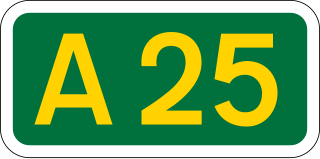
The A25 road is an east–west main road in the South-East of England. Its carries traffic east from Guildford, Surrey, eastward through Surrey and into mid-west Kent, to the town of Sevenoaks, and then on to Wrotham Heath where it connects with the A20.

Meopham is a large linear village and civil parish in the Borough of Gravesham in north-west Kent, England, lying to the south of Gravesend. The parish covers 6.5 square miles (17 km2), and comprises two villages and two smaller settlements; it had a population of 6,795 at the 2021 census. Meopham village is sometimes described as the longest settlement in England although others such as Brinkworth which is one village make the same claim. Meopham is one of the longest linear settlements in Europe, being 7 miles (11 km) in length.
Vigo Village is a village and a civil parish in the Gravesham district in Kent, England. It takes its name from a 15th-century public house, which was renamed in the 18th century after the Battle of Vigo Bay. While a nearby hamlet named Vigo was recorded on an 18th-century map, the present village was built in the mid-20th century, on a site that was previously a disused World War II army camp. The civil parish was created on 1 April 2000 from the parish of Meopham.
Cuckmere Valley is a civil parish in the Wealden District of East Sussex, England. As its name suggests, the parish consists of a number of small settlements in the lower reaches of the River Cuckmere.

Hartley is a village and civil parish in the Sevenoaks district of Kent, England. It is located 7 miles (11 km) south west of Gravesend and the same distance south east of Dartford.

Sir Sydney Hedley Waterlow, 1st Baronet, was a British philanthropist and Liberal Party politician, principally remembered for donating Waterlow Park to the public as "a garden for the gardenless".

Trottiscliffe is a village in Kent, England about 2.5 miles (4 km) north west of West Malling.
The following is a list of recreational walks in Kent, England.
The Wealdway, Kent and East Sussex, is a public footpath that runs for 83 miles / 134 km from Gravesend, Kent on the Thames estuary, to the A259 at Eastbourne, 3 km north of Beachy Head.
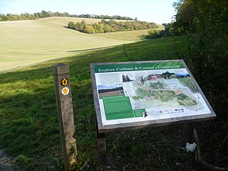
Ranscombe Farm, in Cuxton in North Kent, is a Plantlife Nature Reserve and working farm. Part of the site is included in the Cobham Woods Site of Special Scientific Interest, and the whole farm is within the Kent Downs Area of Outstanding Natural Beauty.

Istead Rise is an estate in the borough of Gravesham in Kent, England, 3 miles (5 km) south of Gravesend. It had a population of 3,437 at the 2011 Census.

Shorne Woods Country Park is located between Strood and Gravesend, in the English county of Kent. It was once part of a large estate, later passed to the county council to be used as a country park.

Camer Country Park is in Meopham, in Kent, England. It is a former estate landscape, with grassland and woodland.

Halling to Trottiscliffe Escarpment is a 600.6-hectare (1,484-acre) biological Site of Special Scientific Interest which runs from Cuxton to Wrotham, west of Rochester in Kent. It is a Nature Conservation Review site, Grade I. and a Special Area of Conservation.


