Recreational walks in Derbyshire

Last updated

This is a partial list of recreational walks in the county of Derbyshire in England. The list includes walks that are wholly inside Derbyshire and also those that pass through to other counties. The walks are generally through countryside on a variety of trails and footpaths. Small walks of only local interest are not included. There are over 3,000 miles (4,800 km) of public rights of way in Derbyshire.

Contents

List of walking trails in Derbyshire

NameImageRouteLengthNotesRefs
Dane Valley Way Dane Valley Way at Three Shires Head.jpg Buxton to Northwich, Cheshire 48 miles

(77km)

Between Derbyshire and Cheshire, partly alongside the River Dane. The Derbyshire section runs from Buxton to Three Shires Head [1]
Derwent Valley Heritage Way Leawood Pump House and Cromford Canal Aqueduct.jpg Ladybower Reservoir, Bamford, to River Trent at Shardlow 55 miles (89 km)Alongside the River Derwent, through the Derwent Valley Mills World Heritage Site and Derby [2]
Five Pits Trail Five Pits Trail - geograph.org.uk - 364424.jpg Grassmoor to Tibshelf 5.5 miles (8.9 km)Former railway line [3]
Goyt Way Path Junction (geograph 5567138).jpg Whaley Bridge to Etherow Country Park, Greater Manchester 10 miles (16 km)Part of the Midshires Way [4]
High Peak Trail High Peak Trail - geograph.org.uk - 804883.jpg Buxton to Cromford 17 miles (27 km)Former railway line [5]
Limestone Way Limestone Way - geograph.org.uk - 413641.jpg Castleton to Rocester, Staffordshire 50 miles (80 km)The Derbyshire section goes between Castleton and the River Dove near Thorpe [6]
Longdendale Trail The Trans Pennine Trail through Longendale - geograph.org.uk - 656711.jpg Hadfield to Woodhead Tunnel 6.2 miles (10 km)Former railway line [7]
Midshires Way Fernilee Reservoir in the Goyt Valley.jpg Bledlow, Buckinghamshire, to Stockport, Greater Manchester 230 miles (370 km)The Derbyshire section starts at Sawley near Long Eaton, on to Buxton and through the Goyt Valley towards Stockport. [8]
Monsal Trail Monsal Head Headstone viaduct.jpg Wye Dale, Buxton, to Coombs viaduct, Bakewell 8.5 miles (13.7 km)Former railway line [9]
Peak District Boundary Walk Peak District Boundary Walk at Dam Dale.jpg Buxton circular190 miles (310 km)The Derbyshire sections are between: [10]
Pennine Bridleway (National Trail) Pennine Bridleway, Rushop - geograph.org.uk - 379120.jpg Middleton-by-Wirksworth to Hebden Bridge 130 miles (210 km)The Derbyshire section is between Middleton-by-Wirksworth and Tintwistle (near Glossop) [11]
Pennine Cycleway (Sustrans-sponsored route) Back road from Buxton to Whaley Bridge - geograph.org.uk - 130219.jpg Derby to Berwick-upon-Tweed 335 miles (539 km)The Derbyshire section runs from Derby up to along the Woodhead Pass valley towards Holmfirth [12]
Pennine Way (National Trail) Black Hill (Peak District).jpg Edale to Kirk Yetholm 268 miles (431 km)The Derbyshire section is from Edale to Black Hill [13]
Sabrina Way Hartington Signalbox at hartington station site.jpg Hartington to Great Barrington, Gloucestershire 203 miles (327 km)The short Derbyshire section is between Hartington and the River Dove (towards Alstonefield) [14]
Sett Valley Trail Gate at the end of the Sett Valley trail - geograph.org.uk - 1343297.jpg Hayfield to New Mills 2.2 miles (3.6 km)Former railway line [15]
Tissington Trail Tissington Trail near Tissington - geograph.org.uk - 1311395.jpg Buxton to Parsley Hay 13 miles (21 km)Former railway line [16]
Trans Pennine Trail Trans Pennine Trail towards Broadbottom (geograph 3216453).jpg Southport to Hornsea 207 miles (333 km)From Merseyside to East Yorkshire. The Derbyshire section runs from the border with Greater Manchester at Broadbottom Bridge to the edge of Barnsley Metropolitan District east of Woodhead; from Padfield it coincides with the Longdendale Trail, above. A spur runs from Chesterfield past Killamarsh (towards Sheffield). [17]
White Peak Loop Trail White Peak Loop sign at Harpur Hill.jpg Circular via Buxton, Bakewell and Matlock 60 miles (97 km)The trail combines sections of the High Peak Trail and the Monsal Trail. As of 2020 some sections are not yet complete. [18]

See also

Related Research Articles

Abbott's Hike is a long distance footpath in Northern England in the United Kingdom.

<span class="mw-page-title-main">Pennine Way</span> Long distance footpath in England

The Pennine Way is a National Trail in England, with a small section in Scotland. The trail stretches for 268 miles (431 km) from Edale, in the northern Derbyshire Peak District, north through the Yorkshire Dales and Northumberland National Park and ends at Kirk Yetholm, just inside the Scottish border. The path runs along the Pennine hills, sometimes described as the "backbone of England". Although not the United Kingdom's longest National Trail, it is, according to The Ramblers, "one of Britain's best known and toughest".

<span class="mw-page-title-main">Kinder Scout</span> Mountain in northern England, UK

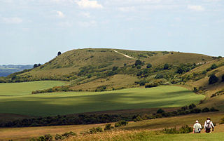
Kinder Scout is a moorland plateau and National Nature Reserve in the Dark Peak of the Derbyshire Peak District in England. Part of the moor, at 636 metres (2,087 ft) above sea level, is the highest point in the Peak District, in Derbyshire and the East Midlands.

<span class="mw-page-title-main">Midshires Way</span> Long-distance footpath in England

The Midshires Way is a long-distance footpath and bridleway that runs for 230 miles (370 km) from the Chiltern Hills from near Bledlow in Buckinghamshire, through the Midlands counties of Northamptonshire, Leicestershire, Nottinghamshire and Derbyshire, to Stockport, Greater Manchester. It also links several other long-distance walking routes or trackways including The Ridgeway, the Pennine Bridleway and the Trans Pennine Trail.

<span class="mw-page-title-main">Limestone Way</span> Long-distance footpath in England

The Limestone Way is a waymarked long-distance footpath in Derbyshire, England. It runs for 46 miles (74 km) through the White Peak of the Peak District National Park, from Castleton south to Rocester over the county boundary into Staffordshire. The trail is named for the limestone scenery along its route. It was devised by Brian Spencer of Matlock Rotary Club and developed and opened in 1986 by the West Derbyshire District Council. It originally ran to Matlock, but was extended to its current, longer route in 1992 to join up with the Staffordshire Way.

The Ribble way is a long-distance walk between the Lancashire coast and the Yorkshire Dales National Park largely following the course of the River Ribble.

<span class="mw-page-title-main">Sabrina Way</span> Long-distance footpath and bridleway in England

The Sabrina Way is a waymarked long-distance footpath and bridleway in England.

<span class="mw-page-title-main">Derwent Valley Heritage Way</span> Long distance footpath in England

The Derwent Valley Heritage Way (DVHW) is a 55 miles (89 km) waymarked footpath along the Derwent Valley through the Peak District. The walk starts from Ladybower Reservoir in the Peak District National Park via Chatsworth, the scenery around the Derbyshire Dales, and through the Derwent Valley Mills World Heritage Site. It follows the Riverside Path through Derby and continues onwards to the historic inland port of Shardlow. Journey's end is at Derwent Mouth where the River Derwent flows into the River Trent.

<span class="mw-page-title-main">Walking in the United Kingdom</span> Aspect of outdoor activities in the UK

Walking is one of the most popular outdoor recreational activities in the United Kingdom, and within England and Wales there is a comprehensive network of rights of way that permits access to the countryside. Furthermore, access to much uncultivated and unenclosed land has opened up since the enactment of the Countryside and Rights of Way Act 2000. In Scotland the ancient tradition of universal access to land was formally codified under the Land Reform (Scotland) Act 2003. In Northern Ireland, however, there are few rights of way, or other access to land.

<span class="mw-page-title-main">Long-distance trail</span> Long trail used for walking, backpacking, cycling, horse riding or cross-country skiing

A long-distance trail is a longer recreational trail mainly through rural areas used for hiking, backpacking, cycling, horse riding or cross-country skiing. They exist on all continents except Antarctica.

The Long Distance Walkers Association (LDWA) is a British not for profit, volunteer-led association whose aim is "to further the common interests of those who enjoy Long Distance Walking" in rural, urban, mountainous, coastal and moorland areas. The LDWA is recognised as the sports governing body for the discipline of "long distance walking" in England, Wales and Scotland.

<span class="mw-page-title-main">Yorkshire Water Way</span> 104-mile footpath in northern England

The Yorkshire Water Way is a 104-mile (167 km) path that runs from Kettlewell in North Yorkshire to Langsett in South Yorkshire. It was devised by Mark Reid in conjunction with Yorkshire Water (YW) and it passes by over more than 20 reservoirs which are operated by Yorkshire Water.

<span class="mw-page-title-main">Peak District Boundary Walk</span> Long distance footpath in England

The Peak District Boundary Walk is a circular 190-mile (310 km) walking trail, starting and finishing at Buxton and broadly following the boundary of the Peak District, Britain's first national park. The route was developed by the Friends of the Peak District and was launched on 17 June 2017.

<span class="mw-page-title-main">Dane Valley Way</span> Long-distance footpath in England

The Dane Valley Way is a long-distance footpath through Derbyshire, Staffordshire and Cheshire, England. It runs from the Pavilion Gardens in Buxton to the end of the River Dane, where it enters the River Weaver in Northwich.

<span class="mw-page-title-main">Peter Dale (Derbyshire)</span> Valley in the Derbyshire Peak District

Peter Dale is a short dry crag-sided valley near Buxton, Derbyshire, in the Peak District of England. There is a farmland plateau on either side. The northern end of the valley leads into Hay Dale at Dale Head and the foot of the valley leads into Monk's Dale. Hay Dale and Monk's Dale are both part of the Derbyshire Dales National Nature Reserve managed by Natural England. The Carboniferous limestone rocks of all these dales were formed 350 million years ago from the shells and sediments of a tropical sea. The landscape was then sculpted by the ice sheets from the last Ice Age 20,000 years ago.

<span class="mw-page-title-main">Peak & Northern Footpaths Society</span> Charity protecting footpaths in England

The Peak & Northern Footpaths Society (PNFS) is a UK registered charity which was formed in 1894. The purpose of PNFS is to monitor, protect, and improve the footpath network of the North Midlands and North West of England, including the Peak District National Park. The organisation is the oldest existing regional footpath society in the England.

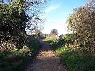
The Frome Valley Trail is a long-distance footpath in Dorset, England which follows the River Frome from Evershot to Dorchester and will, when completed, extend to Poole Harbour.

This is a partial list of long distance footpaths and multi-use trails in the Peak District of England. The list includes trails that are wholly inside the Peak District and also those that pass through it. The walks are generally through countryside on a variety of footpaths, lanes and bridle paths. Short walks of only local interest are not included.

References

  1. "Dane Valley Way - LDWA Long Distance Paths". www.ldwa.org.uk.
  2. "HOME". Derwent Valley Trust. Retrieved 11 November 2020.
  3. "Five Pits Trail - Derbyshire County Council". www.derbyshire.gov.uk. Retrieved 11 November 2020.
  4. "Goyt Way". Long Distance Walkers Association. Retrieved 11 November 2020.
  5. "High Peak trail". Peak District National Park. Retrieved 11 November 2020.
  6. "Limestone Way". Long Distance Walkers Association. Retrieved 11 November 2020.
  7. "Longendale Trail". Long Distance Walkers Association. Retrieved 11 November 2020.
  8. "Midshires Way". Long Distance Walkers Association. Retrieved 11 November 2020.
  9. "Monsal trail". Peak District National Park. Retrieved 11 November 2020.
  10. "Boundary Walk". Friends of the Peak District. 12 October 2017. Retrieved 11 November 2020.
  11. "Pennine Bridleway Information". National Trail. Retrieved 11 November 2020.
  12. "Route 68". Sustrans. Retrieved 11 November 2020.
  13. "Pennine Way". National Trail. Retrieved 11 November 2020.
  14. "Sabrina Way". Long Distance Walkers Association. Retrieved 11 November 2020.
  15. "Sett Valley Trail - Derbyshire County Council". www.derbyshire.gov.uk. Retrieved 11 November 2020.
  16. "Tissington trail". Peak District National Park. Retrieved 11 November 2020.
  17. "Trans Pennine Trail - Official Website" . Retrieved 11 November 2020.
  18. "White Peak Loop - Derbyshire County Council". www.derbyshire.gov.uk. Retrieved 11 November 2020.