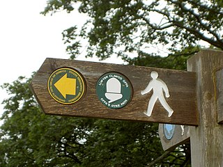
Glyndŵr's Way is a long-distance footpath in mid Wales. It runs for 135 miles (217 km) in an extended loop through Powys between Knighton and Welshpool, and anchored on Machynlleth to the west.

Offa's Dyke Path is a long-distance footpath broadly following the Wales–England border. Officially opened on 10 July 1971, by Lord Hunt, it is one of Britain's National Trails and draws walkers from throughout the world. About 60 miles (97 km) of the 177-mile (285 km) route either follows, or keeps close company with, the remnants of Offa's Dyke, an earthwork, most of which was probably constructed in the late 8th century on the orders of King Offa of Mercia.

Bolton Abbey in Wharfedale, North Yorkshire, England, takes its name from the ruins of the 12th-century Augustinian monastery now known as Bolton Priory. The priory, closed in the 1539 Dissolution of the Monasteries ordered by King Henry VIII, is in the Yorkshire Dales, next to the village of Bolton Abbey.

The River Wharfe is a river in Yorkshire, England. For much of its length it is the county boundary between West Yorkshire and North Yorkshire.

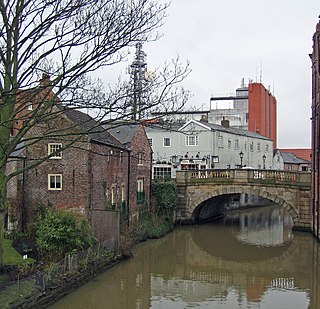
The River Foss is in North Yorkshire, England. It is a tributary of the River Ouse. It rises in the Foss Crooks Woods near Oulston Reservoir close to the village of Yearsley and runs south through the Vale of York to the Ouse in the centre of York. The name most likely comes from the Latin word Fossa, meaning ditch. It is mentioned in the Domesday Book. The York district was settled by Norwegian and Danish people, so parts of the place names could be old Norse. Referring to the etymological dictionary "Etymologisk ordbog", ISBN 82-905-2016-6 dealing with the common Danish and Norwegian languages – roots of words and the original meaning. The old Norse word Fos (waterfall) meaning impetuous. The River Foss was dammed, and even though the elevation to the River Ouse is small, a waterfall was formed. This may have led to the name Fos which became Foss.

The Heart of England Way is a long-distance walk of around 160 km (100 mi) through the Midlands of England. The walk starts from Milford Common on Cannock Chase and ends at Bourton on the Water in the Cotswolds linking south Staffordshire through Warwickshire to east Gloucestershire.

The Dales Way is an 78.5-mile (126.3 km) long-distance footpath in Northern England, from Ilkley, West Yorkshire, to Bowness-on-Windermere, Cumbria. This walk was initially devised by the West Riding Ramblers' Association with the 'leading lights' being Colin Speakman and Tom Wilcock. The route was announced to the public in 1968 and the first recorded crossing was by a group of Bradford Grammar School Venture Scouts in 1969.

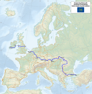
The E8 European long distance path or E8 path is one of the European long-distance paths, leading 4,700 km across Europe, from Cork in Ireland to Bulgaria.

The Southern Upland Way is a 344-kilometre (214 mi) coast-to-coast long-distance footpath in southern Scotland. The route links Portpatrick in the west and Cockburnspath in the east via the hills of the Southern Uplands. The Way is designated as one of Scotland's Great Trails by NatureScot and is the longest of the 29 Great Trails. The Southern Upland Way meets with seven of the other Great Trails: the Annandale Way, the Berwickshire Coastal Path, the Borders Abbeys Way, the Cross Borders Drove Road, the Mull of Galloway Trail, the Romans and Reivers Route and St Cuthbert's Way.

The Staffordshire Way is a long-distance walk in Staffordshire, England. The path links with the Cheshire Gritstone Trail, the Heart of England Way and the North Worcestershire Path.

The Wessex Ridgeway is a long-distance footpath in southwest England. It runs 136 miles (219 km) from Marlborough in Wiltshire to Lyme Regis in Dorset, via the northern edge of Salisbury Plain and across Cranborne Chase AONB. The footpath was opened in 1994.

The Sandstone Trail is a 55-kilometre (34 mi) long-distance walkers' path, following sandstone ridges running north–south from Frodsham in central Cheshire to Whitchurch just over the Shropshire border. The path was created in 1974 and extended in the 1990s. Much of the route follows the Mid Cheshire Ridge but in places the trail also passes through the Cheshire Plain, including farmland, woodland and canal towpaths.

The Three Castles Walk is a waymarked long distance footpath and recreational walk located in north-east Monmouthshire, Wales.
The Oxfordshire Way is a long-distance walk in Oxfordshire, England, with 6 miles in Gloucestershire and very short sections in Buckinghamshire. The path links with the Heart of England Way and the Thames Path.

The Borders Abbeys Way is a long-distance footpath in the Scottish Borders area of Scotland. It is a circular walkway and is 109 kilometres (68 mi) in length. The theme of the footpath is the ruined Borders abbeys along its way: Kelso Abbey, Jedburgh Abbey, Melrose Abbey and Dryburgh Abbey. These abbeys were homes to monks, who lived there between the 12th and 16th centuries. The route also passes through the towns of Hawick and Selkirk, and close to Abbotsford House, the home of Sir Walter Scott. Along the Borders Abbeys Way there are several rivers: Jed Water, River Teviot, River Tweed, Ale Water, and Rule Water.
The Roman Heritage Way is a long-distance path in England and Scotland. It covers parts of Cumbria, Northumberland, the Scottish Borders, and Tyneside.
Ushaw Moor railway station, was a station on the Deerness Valley Railway, south of the village of Ushaw Moor in County Durham, was opened on 1 September 1884 by the North Eastern Railway.

The Grafton Way is a 13-mile (21 km) footpath in Northamptonshire, England. It runs south east from Greens Norton to Cosgrove, where it meets the Knightley Way. It is named after the Dukes of Grafton, major land-owners in the area in the 18th and 19th centuries.

The Ullswater Way is a 20-mile (32 km) waymarked walking route around Ullswater in the English Lake District. It was created by a partnership which included The Lake District National Park Authority, the National Trust, Eden District Council, and Ullswater 'Steamers' and was opened on 25 April 2016 by broadcaster and film-maker Eric Robson. The idea of a path circumnavigating the lake had been considered for many years, but the 2015 Cumbria floods which devastated the area gave an incentive for the completion of the project.

The Northumberland Coast Path is a long distance path in Northumberland in northern England. It now forms part of the England Coast Path.


