River Tas

Last updated
Tas
River Tas, Caistor St Edmund - geograph.org.uk - 87346.jpg
The river at Caistor St. Edmund
Norfolk UK relief location map.jpg
Red pog.svg
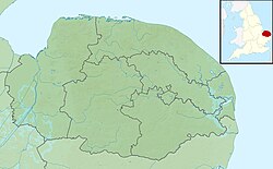
Location of the river mouth within Norfolk
Location
Country England
Region Norfolk
Physical characteristics
Source 
  location Carleton Rode
  coordinates 52°29′06″N1°06′08″E / 52.4849°N 1.1021°E / 52.4849; 1.1021
  elevation51 m (167 ft)
Mouth River Yare
  location
Trowse
  coordinates
52°36′32″N1°18′25″E / 52.6089°N 1.3069°E / 52.6089; 1.3069
  elevation
3 m (9.8 ft)
Basin features
River system River Yare
Tributaries 
  rightHempnall Beck
The River Tas and its tributaries in South Norfolk. River-tas-map-overlay.png
The River Tas and its tributaries in South Norfolk.
River Tas
BSicon uexKHSTa.svg
Source near Carleton Rode
BSicon uexSKRZ-Yu.svg
B1113
BSicon uexBHF.svg
Carleton Fen
BSicon uexSKRZ-Yu.svg
Old Hall Bridge
BSicon uexSKRZ-Yu.svg
Hall Road
BSicon uexSKRZ-Yu.svg
Bridge Road
BSicon uexSKRZ-E.svg
Low Common Road Ford
BSicon uexSKRZ-Yu.svg
Moulton Bridge
BSicon uexSKRZ-Yu.svg
Wash Lane
BSicon uexSKRZ-Yu.svg
Station Road, Forncett St. Peter
BSicon uexBHF.svg
Horsenford Water
BSicon uexSKRZ-Yu.svg
Long Lane
BSicon uexABZg+l.svg
BSicon uexKHSTeq.svg
Tacolneston tributary
BSicon uexWMILL L.svg
Tharston Mill
BSicon uexSKRZ-Yu.svg
The Street
BSicon CONTgq.svg
BSicon uxmKRZu.svg
BSicon CONTfq.svg
Great Eastern Main Line
BSicon uexSTR+FEATURE@r.svg
Low Tharston
BSicon uexCONTgq.svg
BSicon uexABZg+r.svg
Hempnall Beck
BSicon uexSKRZ-Yu.svg
Low Road, Lower Tasburgh
BSicon uexSKRZ-Ru.svg
A140, Newton Flotman
BSicon uexSTR+FEATURE@r.svg
BSicon uexdSTR2.svg
BSicon uexcSTRc3.svg
Smockmill Common, Saxlingham
BSicon uexdSTRc12.svg
BSicon uexdSTR.svg
BSicon uexSTR3+4.svg
Shotesham Park
BSicon uexWMILL L.svg
BSicon uexdSTR+1.svg
BSicon uexcSTRc4.svg
Shotesham Mill
BSicon uexSKRZ-E.svg
Shotesham ford
BSicon uexKHSTaq.svg
BSicon uexABZg+r.svg
Shotesham tributary
BSicon uexSKRZ-Yu.svg
Mill Road, Stoke Holy Cross
BSicon uexWMILL R.svg
Stoke Mill
BSicon uexSTR+FEATURE@r.svg
Venta Icenorum
BSicon uexSKRZ-Yu.svg
Markshall Lane, Caistor St Edmund
BSicon uexSKRZ-Ru.svg
A47
BSicon uexCONTgq.svg
BSicon uexABZqr.svg
BSicon uexCONTgeq.svg
River Yare

The River Tas is a river which flows northwards through South Norfolk in England - towards Norwich. The area is named the Tas Valley after the river. The name of the river is back-formed from the name of village of Tasburgh [1] .

Tributaries which have their sources at Hempnall and Carleton Rode converge at Tasburgh. The river then flows on through Newton Flotman and Smockmill Common. In Shotesham Park the river splits into two channels which rejoin just above Shotesham ford. The pool here is a popular location in summer time for paddling, swimming and fishing. From Shotesham the river flows northwards through Stoke Holy Cross, Dunston, Caistor St Edmund, Markshall and Arminghall. It joins the River Yare at Trowse - just south of Norwich. [2]

The Tas valley contains many interesting historical sites including: an Iron Age hill fort at Tasburgh, the old Roman settlement of Venta Icenorum (now Caistor St Edmund) and the site of a woodhenge at Arminghall. The mill at Stoke Holy Cross was the first location of the Colman's mustard business.

In Roman times the River Tas was considerably larger and provided a major transport route for the inhabitants of Venta Icenorum. Today it is a small river which winds through farmland.

It contains roach, dace, occasional trout, small pike and some chub. One of the largest roach ever caught in the river was a 2.6  pound specimen landed by local angler Bill Coleman in 1972.[ citation needed ] The best dace was probably one of 1.2 pounds caught by W. Comer in 1943.[ citation needed ]
Related Research Articles

<span class="mw-page-title-main">Iceni</span> Roman-era British tribe

The Iceni or Eceni were an ancient tribe of eastern Britain during the Iron Age and early Roman era. Their territory included present-day Norfolk and parts of Suffolk and Cambridgeshire, and bordered the area of the Corieltauvi to the west, and the Catuvellauni and Trinovantes to the south. In the Roman period, their capital was Venta Icenorum at modern-day Caistor St Edmund.

<span class="mw-page-title-main">South Norfolk</span> Non-metropolitan district in England

South Norfolk is a local government district in Norfolk, England. The largest town is Wymondham, and the district also includes the towns of Costessey, Diss, Harleston, Hingham, Loddon and Long Stratton. The council was based in Long Stratton until 2023 when it moved to the Broadland Business Park near Norwich, in the neighbouring Broadland district, as part of a shared facility with Broadland District Council. Some of the district's urban areas form part of the Norwich built-up area. The district also includes numerous villages and surrounding rural areas. Some eastern parts of the district lie within The Broads.

<span class="mw-page-title-main">River Chew</span> River in Somerset, United Kingdom

The River Chew is a small river in England that flows for some 17 miles (27 km) through the North Somerset countryside to form the Chew Valley before merging with the River Avon.

<span class="mw-page-title-main">Arminghall</span> Human settlement in England

Arminghall is a village and former civil parish, now in the parish of Caistor St Edmund and Bixley, in the South Norfolk district, in the county of Norfolk, England. It is around 3 miles (4.8 km) southeast of Norwich. Most of the houses in the village are located close to the church, which lies just west of the B1332 road from Norwich to Poringland. Syfer Technology, an electronic components manufacturer, is based at Old Stoke Road, close to the River Tas. In 1931 the parish had a population of 108.

<span class="mw-page-title-main">Diocese of Norwich</span> Diocese of the Church of England

The Diocese of Norwich is an ecclesiastical jurisdiction or diocese of the Church of England that forms part of the Province of Canterbury in England.

<span class="mw-page-title-main">South Norfolk (UK Parliament constituency)</span> Parliamentary constituency in the United Kingdom, 1868 onwards

South Norfolk is a constituency represented in the House of Commons of the UK Parliament since 2001 by Richard Bacon, a Conservative.

<span class="mw-page-title-main">Caistor St Edmund</span> Human settlement in England

Caistor St Edmund is a village and former civil parish on the River Tas, now in the parish of Caistor St Edmund and Bixley, in the South Norfolk district, in Norfolk, England. The parish covered an area of 6.55 square kilometres (2.53 sq mi) and had a population of 270 people in 116 households at the 2001 Census which increased to 289 people by the 2011 Census.

<span class="mw-page-title-main">Tasburgh</span> Human settlement in England

Tasburgh is a civil parish and a village in the south of Norfolk, England, located approximately 8 miles south of Norwich. It lies on the A140 road, north of Long Stratton and south of Newton Flotman. The River Tas flows nearby and Tasburgh Hall lies to the west of the village. The local church is dedicated to St. Mary the Virgin. The village is made up of Upper Tasburgh and Lower Tasburgh. The majority of Lower Tasburgh contains buildings from the early days of the village whilst Upper Tasburgh is made up of more modern housing.

The civil parish of Tharston and Hapton lies in the south of the county of Norfolk, England. It encompasses the two villages of Tharston and Hapton, covering 9.26 km2 (3.58 sq mi). The parish had a population of 599 in 231 households at the 2001 census, increasing to 793 at the 2011 census.

<span class="mw-page-title-main">Venta Icenorum</span>

Venta Icenorum was the civitas or capital of the Iceni tribe, located at modern-day Caistor St Edmund in the English county of Norfolk. The Iceni inhabited the flatlands and marshes of that county and are famous for having revolted against Roman rule under their queen Boudica in the winter of 61 CE.

<span class="mw-page-title-main">Newton Flotman</span> Human settlement in England

Newton Flotman, meaning new farm or settlement, is a village and civil parish in the English county of Norfolk, lies about 7 miles south of Norwich on the A140 road between Tasburgh and Swainsthorpe. The River Tas flows through the village. The area of 4.87 km2 (1.88 sq mi) had 1,197 inhabitants in 497 households at the 2001 census, increasing to 1,489 at the 2011 census. For local government it lies in the district of South Norfolk.

<span class="mw-page-title-main">Swainsthorpe</span> Human settlement in England

Swainsthorpe is a village in Norfolk, England. It lies on the A140 road, approximately 5 miles south of Norwich, and just north of Newton Flotman. It covers an area of 3.38 km2 (1.31 sq mi) and had a population of 374 in 159 households at the 2001 census, the population reducing to 360 at the 2011 Census. The village had two Churches, St.Peter's and St. Mary's, the latter is now in ruins.

<span class="mw-page-title-main">A140 road</span> Road in England

The A140 is an 'A-class' road in Norfolk and Suffolk, East Anglia, England partly following the route of the Roman Pye Road. It runs from the A14 near Needham Market to the A149 south of Cromer. It is of primary status for the entirety of its route. It is approximately 56 miles (90 km) in length.

<span class="mw-page-title-main">Trowse</span> Human settlement in England

Trowse, also called Trowse with Newton, is a village in South Norfolk which lies about 2 miles (3.2 km) south-east of Norwich city centre on the banks of the River Yare. It covers an area of 4.49 km2 (1.73 sq mi) and had a population of 479 in 233 households at the 2001 census, the population increasing to 862 in 374 households at the 2011 Census. There are approved plans to build a further 770 houses on the outskirts of the village, at White Horse Lane* and the Deal Ground sites.

<span class="mw-page-title-main">Stoke Holy Cross</span> Human settlement in England

Stoke Holy Cross is a village in South Norfolk which lies approximately 4 miles (6.4 km) south of Norwich.

<span class="mw-page-title-main">Dunston, Norfolk</span> Human settlement in England

Dunston is a village in the civil parish of Stoke Holy Cross, in the South Norfolk district, in the county of Norfolk, England. It is located in the valley of the River Tas between Stoke Holy Cross and Caistor St. Edmund, approximately 3 miles south of Norwich. It has a common which is popular with walkers. In 1931 the parish had a population of 63. On 1 April 1935 the civil parish was abolished and merged with Stoke Holy Cross.

<span class="mw-page-title-main">Dickleburgh</span> Human settlement in England

Dickleburgh is a village and former civil parish, now in the parish of Dickleburgh and Rushall, in the South Norfolk district of the English county of Norfolk. The village is located 3.5 miles east of Diss and 17 miles south-west of Norwich. In 2021 it had a population of 1166.

<span class="mw-page-title-main">Coddenham</span> Village and civil parish in Suffolk, England

Coddenham is a village and civil parish in the Mid Suffolk district of Suffolk in eastern England. Located to the north of the A14 road, 8 miles north of Ipswich, the parish also includes the hamlet of Coddenham Green. In 2005 its population was 570, increasing to 620 at the 2011 Census. Village facilities include a community village shop & café, a country club offering themed evenings, darts, pool & snooker and the Coddenham Centre.

Pye Road is a Roman road running from the capital of the Iceni at Venta Icenorum to the original Roman provincial capital and legionary base at Camulodunum (Colchester). The road was later extended, connecting it to the new provincial capital north of the bridge over the Thames at Londinium (London), although that part of the route is also known by the name the Great Road.

References

  1. E. Ekwall, 1928, English-River-names, p. 393
  2. Ordnance Survey of Great Britain