Panford Beck

Last updated

Panford Beck
Headwaters of Panford Beck feeding into Black Water - geograph.org.uk - 523448.jpg
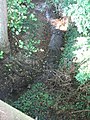
The headwaters of Panford Beck
Norfolk UK relief location map.jpg
Red pog.svg
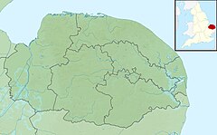
Panford Beck within Breckland
Location
Country England
State Norfolk
Region East of England
District Breckland
Physical characteristics
Source1 mile north east of the village of Brisley
Mouth Merges with the Black Water
  coordinates
52°44′8.8″N0°54′34.6″E / 52.735778°N 0.909611°E / 52.735778; 0.909611
Length2.5 mi (4.0 km)

Panford Beck is a minor watercourse that is entirely in the county of Norfolk, eastern England. [1] This small short beck rises within the Parish of North Elmham a mile north east of the village of Brisley (grid reference TF956228 ). The beck is a tributary of the Black Water which eventually joins the River Wensum. The headwater is a small pool by the side of a lane. From here the beck flows south across open farmland where various streams and ditches contribute to its flow. After a distance of 2.5 miles (4.0 km) it joins the Black Water.

Related Research Articles

<span class="mw-page-title-main">River Derwent, Yorkshire</span> River in Yorkshire, England

The Derwent is a river in Yorkshire in the north of England. It flows from Fylingdales Moor in the North York Moors National Park, east then southwards as far as its confluence with the River Hertford then westwards through the Vale of Pickering, south through Kirkham Gorge and the Vale of York, joining the River Ouse at Barmby on the Marsh. The confluence is unusual in that the Derwent converges on the Ouse at a shallow angle in an upstream direction.

<span class="mw-page-title-main">River Monnow</span> River in Herefordshire and Monmouthshire, United Kingdom

The River Monnow marks the England–Wales border for much of its 42 miles (68 km) length. After flowing through southwest Herefordshire, England, and eastern Monmouthshire, Wales, its confluence with the River Wye is approximately 13 mile (0.54 km) south of Monmouth.

<span class="mw-page-title-main">River Wyre</span> River in Lancashire, England

The River Wyre in Lancashire, England, flows into the Irish Sea at Fleetwood. It is 28 miles (45 km) long and has a sheltered estuary which penetrates deep into the Fylde peninsula.

<span class="mw-page-title-main">River Itchen, Warwickshire</span> River in east Warwickshire, England

The River Itchen flows through east Warwickshire in England. It is a small river, about 18 miles (29 km) long, and its general course is from south to north.

<span class="mw-page-title-main">River Brathay</span>

The Brathay is a river of north-west England. Its name comes from Old Norse and means broad river. It rises at a point 1289 feet above sea level near the Three Shire Stone at the highest point of Wrynose Pass in the Lake District. Its catchment area includes the northern flanks of Wetherlam, Great Carrs and others of the Furness Fells, as well as a substantial area of the Langdale Fells.

<span class="mw-page-title-main">River Dwyryd</span> River in Gwynedd, Wales

The River Dwyryd, is a river in Gwynedd, Wales which flows principally westwards; draining to the sea into Tremadog Bay, south of Porthmadog.

<span class="mw-page-title-main">River Rothay</span> River in Cumbria, England

The Rothay is a spate river of the Lake District in north-west England. Its name comes from Old Norse and translates literally as the red one. This has come to mean trout river. It rises close to Rough Crag above Dunmail Raise at a point about 1542 feet above sea level. Its catchment area covers Grasmere Common including Easedale Tarn, the southern flanks of Fairfield, and several of the fells to the east of Dunmail Raise, including Great Rigg, Rydal Fell, Scandale Fell and Heron Pike.

<span class="mw-page-title-main">River Penk</span> River in Staffordshire, England

The River Penk is a small river flowing through Staffordshire, England. Its course is mainly within South Staffordshire, and it drains most of the northern part of that district, together with some adjoining areas of Cannock Chase, Stafford, Wolverhampton, and Shropshire. It flows into the River Sow, which is a tributary of the River Trent, so its waters flow ultimately into the North Sea via the Humber Estuary.

Lake Pickering was an extensive proglacial lake of the Devensian glacial. It filled the Vale of Pickering between the North York Moors and the Yorkshire Wolds, when the ice blocked the drainage, which had flowed north-eastwards past the site of Filey towards the Northern North Sea basin. The lake surface rose until it overflowed southwards and cut an exit between the Howardian Hills and the Yorkshire Wolds at Kirkham Priory between Malton and Stamford Bridge, so creating the River Derwent.

<span class="mw-page-title-main">River Hayle</span> River in west Cornwall, England

The River Hayle is a small river in West Cornwall, England, United Kingdom which issues into St Ives Bay at Hayle on Cornwall's Atlantic coast.

<span class="mw-page-title-main">River Irt</span> River in Cumbria, England

The River Irt is a river in the county of Cumbria in northern England. It flows for 14 miles (22 km) from the south-western end of Wast Water, the deepest lake in England, leaving the lake at the foot of Whin Rigg, the southern peak of the famous Wastwater Screes. The name of the river is believed to derive either from the Old English gyr which means "mud", or from the Brittonic words *ar, "flowing", or *īr, "fresh, clean, pure", suffixed with -ed, a nominal suffix meaning "having the quality of...".

<span class="mw-page-title-main">Artle Beck</span> River in Lancashire, England

Artle Beck is a minor river of Lancashire, England.

Birker Fell, also known as Birker Moor, is an upland wilderness area in the western portion of the Lake District National Park, in Cumbria, England. Rather than being formed of one single high peak, the fell is a broad, undulating area, approximately 6 km square, with numerous crags and prominences scattered across its area. The highest point of the fell is at Green Crag. The fell is bordered by the Duddon Valley to the south-east, Ulpha Fell to the south-west, Harter Fell to the north-east, and Eskdale to the north-west.

<span class="mw-page-title-main">Skirden Beck</span> Minor river in Lancashire, England

Skirden Beck is a minor river in Lancashire, England. It is approximately 4.3 miles (6.85 km) long and has a catchment area of 18.87 square miles (48.882 km2).

<span class="mw-page-title-main">Penny Spot Beck</span> Watercourse in Norfolk, England

Penny Spot Beck is a minor watercourse that is entirely in the county of Norfolk. The beck rises within the parish of Dereham ½ mile south of the village of Swanton Morley. The beck is a tributary of the River Wensum. The headwater is a small pool in a field 50 feet (15 m) south-west of the intersection of Tuddenham and Norwich roads, from here the beck flows east and then north-east across open farmland where various streams and ditches contribute to its flow. After a distance of 2.6 miles (4.2 km) it joins the River Wensum.

<span class="mw-page-title-main">River Ottery</span> River in northeast Cornwall, England

The River Ottery is a small river in northeast Cornwall, England, United Kingdom. The river is about twenty miles (32 km) long from its source southeast of Otterham to its confluence with the River Tamar at Nether Bridge, two miles (3.2 km) northeast of Launceston.

<span class="mw-page-title-main">Eller Beck</span> River in North Yorkshire, England

The Eller Beck is a small river in North Yorkshire, England, that flows through the town of Skipton and is a tributary of the River Aire. Its channel was heavily modified to supply water to mills in the 18th and 19th centuries, and although all the mills have closed, the water now supplies power to the National Grid, generated by a turbine at High Corn Mill. The beck flows through several underground culverts in Skipton that contribute to the flood risk. To alleviate flooding in Skipton town centre, a scheme involving two flood water storage reservoirs was designed and eventually completed in 2017.

<span class="mw-page-title-main">Sea Cut (Scalby Beck)</span> River in North Yorkshire, England

The Sea Cut (Scalby Beck) is a small river that enters the North Sea at Scalby Mills, Scarborough, North Yorkshire, England. The beck is fed from local streams in Scalby, Newby and Burniston and other watercourses draining off the nearby hills. It is also a bypass channel for the upper reaches of the River Derwent when it is under flood conditions.

<span class="mw-page-title-main">Pickering Beck</span> River in North Yorkshire, England

Pickering Beck is a river that runs for over 18 miles (29 km) from its source in the North York Moors National Park through the town of Pickering and on to its confluence with Costa Beck at Kirby Misperton. It is a meandering river that is fed by numerous named and unnamed becks and streams which flow over sandstone and limestone beds and an alluvia of sand, clay silt and gravel. The beck is known for flooding and in recent times has been a beneficiary of funding and experimental flood protection schemes.

References

  1. ”OS Explorer Map” 238, Dereham & Aylsham, ISBN   0-319-23810-5