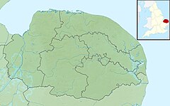
Sheringham is a seaside town and civil parish in the county of Norfolk, England. The motto of the town, granted in 1953 to the Sheringham Urban District Council, is Mare Ditat Pinusque Decorat, Latin for "The sea enriches and the pine adorns".
A watermill or water mill is a mill that uses hydropower. It is a structure that uses a water wheel or water turbine to drive a mechanical process such as milling (grinding), rolling, or hammering. Such processes are needed in the production of many material goods, including flour, lumber, paper, textiles, and many metal products. These watermills may comprise gristmills, sawmills, paper mills, textile mills, hammermills, trip hammering mills, rolling mills, wire drawing mills.
The River Eden is a tributary of the River Medway in south east England. It rises at the foot of the North Downs escarpment near Titsey in Surrey and runs initially southwards through Oxted before turning eastwards to enter Kent. After flowing through Edenbridge and passing Hever Castle, the Eden meets the Medway at Penshurst.
The Darent is a Kentish tributary of the River Thames and takes the waters of the River Cray as a tributary in the tidal portion of the Darent near Crayford. 'Darenth' is frequently found as the spelling of the river's name in older books and maps, Bartholomew's Canals and River of England being one example. Bartholomew's Gazetteer (1954) demonstrates that Darent means "clear water", a result of it springing from and running through chalk. The purity of the water was a major factor in the development of paper and pharmaceuticals in the area.
Beeston Regis is a village and civil parish in the North Norfolk district of Norfolk, England. It is about a mile (2 km) east of Sheringham, Norfolk and near the coast. The village is 2 miles (3 km) west of Cromer and 16 miles (26 km) north of the city of Norwich. According to the 2011 census, it had a population of 1,062. There is a frequent bus service on the coast road A149 and a rail service from the nearby stations of Sheringham to the west and West Runton to the east, where the Bittern Line runs a frequent service between Norwich, Cromer and Sheringham. The nearest airport is Norwich International Airport.
West Runton is a village in North Norfolk, England, on the North Sea coast.
Weybourne is a village on the coast of North Norfolk, England. The village is surrounded by arable fields, woodland and heathland; it straddles the A149 coast road, 3 miles (5 km) west of Sheringham, within the Norfolk Coast AONB. The area is popular for its local countryside and coastline, particularly for walking, wildlife and bird-watching.
Briningham is a village and a civil parish in the English county of Norfolk. The village is 9.9 miles east north east of the town of Fakenham, 13.3 miles west south west of Cromer, 22.3 miles north north west of the city of Norwich, and 124 miles north north east of London.
The River Glaven in the eastern English county of Norfolk is 10.5 mi (16.9 km) long and flows through picturesque North Norfolk countryside to the North Sea. Rising from a tiny headwater in Bodham the river starts 2+1⁄2 miles before Selbrigg Pond where three small streams combine. The scenic value of the Glaven valley is important to the tourist industry in North Norfolk. The river is one of over 200 chalk rivers in the world and one of 160 in the UK.
The River Babingley is a chalk stream and minor river in the northwest of Norfolk in England. It runs 12.2 miles (19.6 km) from its source at Flitcham to the River Great Ouse at Wootton Marshes where it terminates.
The River Mun or Mundesley Beck is a river in the north of the county of Norfolk, England. Its source is in the parish of Northrepps. The river finally runs into the North Sea in the village of Mundesley.
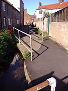
Spring Beck is a minor watercourse flowing near and through the village of Weybourne in the north of the county of Norfolk.
Scarrow Beck is a minor watercourse which rises in the north of the English county of Norfolk. It is a tributary of the River Bure. Its spring is in the North Norfolk village of Aylmerton west of the main street. It eventually merges, after 7.7 miles (12.4 km) with the River Bure at Ingworth just north of the Blickling Hall estate. There are two watermills on the beck, both of which are no longer in working order. A third windmill at Gresham stands on Gur Beck, a small tributary of Scarrow Beck.
The River Bourne rises in the parish of Ightham, Kent and flows in a generally south easterly direction through the parishes of Borough Green, Platt, Plaxtol, West Peckham, Hadlow, and East Peckham where it joins the River Medway. In the 18th century the river was known as the Busty or Buster, the Shode or Sheet, but is not known by these names nowadays. A bourne is a type of stream, while shode means a branch of a river.
The Loose Stream sometimes called the River Loose or Langley Stream is a tributary of the River Medway notable for the number of watermills that it powered in its short length. It rises in Langley, flows through Boughton Monchelsea, Loose and enters the Medway at Tovil. The river valley is deep sided, and there is much evidence of the paper and wool trades which once flourished here: the stream has been dammed in many places, resulting in many mill ponds.
The River Len is a river in Kent, England. It rises at a spring in Bluebell Woods to the southeast of the village centre of Lenham 0.6 miles (0.97 km) from the source of the River Great Stour; both rise on the Greensand Ridge. Its length is c10 miles (16 km). It enters the River Medway at Maidstone.
The Wateringbury stream is a tributary of the River Medway in Kent, England. It rises at Swanton, West Peckham parish, flows south east towards Mereworth and then flows in a generally easterly direction to join the River Medway at Wateringbury. It is some four miles (6 km) long and powered a number of watermills.
The Medway and its tributaries and sub-tributaries have been used for over 1,150 years as a source of power. There are over two hundred sites where the use of water power is known. These uses included corn milling, fulling, paper making, iron smelting, pumping water, making gunpowder, vegetable oil extraction, and electricity generation. Today, there is just one watermill working for trade. Those that remain have mostly been converted. Such conversions include a garage, dwellings, restaurants, museums and a wedding venue. Some watermills are mere derelict shells, lower walls or lesser remains. Of the majority, there is nothing to be seen. A large number of tributaries feed into the River Medway. The tributaries that powered watermills will be described in the order that they feed in. The mills are described in order from source to mouth. Left bank and right bank are referred to as though the reader is facing downstream. This article covers the watermills on the tributaries that feed in below Penshurst and above Yalding.
The River Medway and its tributaries and sub-tributaries have been used for more than 1,150 years as a source of power. There are over two hundred sites where the use of water power is known. Many different processes were performed by the use of water power:- corn milling, fulling, paper making, iron smelting, pumping water, making gunpowder, vegetable-oil extraction, and electricity generation. Today, there is just one watermill working for trade. Those that remain have mostly been converted. Such conversions include a garage, dwellings, restaurants, museums and a wedding venue. Some watermills are mere derelict shells, lower walls or lesser remains. Of the majority, there is nothing to be seen. A large number of tributaries feed into the River Medway. The tributaries that powered watermills will be described in the order that they feed in. The mills are described in order from source to mouth. Left bank and right bank are referred to as though the reader is facing downstream. This article deals with the watermills on the tributaries that feed in below Yalding.
Calthorpe is a small village and former civil parish, now in the parish of Erpingham, in the North Norfolk district, in the county of Norfolk, England. The village is located 0.5 miles (0.80 km) west of the village of Erpingham, 3.4 miles (5.5 km) north of the nearest town of Aylsham and is 15.8 miles (25.4 km) north of the nearest city of Norwich. The nearest railway station is at Gunton for the Bittern Line which runs between Sheringham, Cromer and Norwich and is 7.8 miles (12.6 km) from the village. The nearest airport is Norwich International 14.2 miles (22.9 km) south of the village. In 1931 the parish had a population of 143.