The Broads is a network of mostly navigable rivers and lakes in the English counties of Norfolk and Suffolk. Although the terms "Norfolk Broads" and "Suffolk Broads" are correctly used to identify specific areas within the two counties respectively, the whole area is frequently referred to as the Norfolk Broads.

The River Waveney is a river which forms the boundary between Suffolk and Norfolk, England, for much of its length within The Broads. The "ey" part of the name means "river" thus the name is tautological.
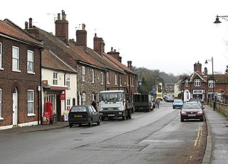
Loddon is a small town and civil parish in Norfolk, England, about 12 miles (19 km) south-east of Norwich. The town lies on the River Chet, a tributary of the River Yare within The Broads. The name "Loddon" is thought to mean muddy river in Celtic in reference to the Chet.
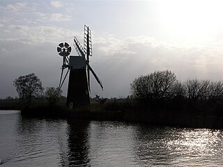
The River Ant is a tributary river of the River Bure in the county of Norfolk, England. It is 27 kilometres (17 mi) long, and has an overall drop of 27 metres from source to mouth. It is said that the Ant was formerly known as the River Smale and that this is the origin of the name of the village of Smallburgh.

The River Yare is a river in the English county of Norfolk. In its lower reaches it is one of the principal navigable waterways of The Broads and connects with the rest of the network.
The River Little Ouse is a river in the east of England, a tributary of the River Great Ouse. For much of its length it defines the boundary between Norfolk and Suffolk.

The A47 is a major road in England linking Birmingham to Lowestoft, Suffolk. Most of the section between Birmingham and Nuneaton is now classified as the B4114. From Peterborough eastwards, it is a trunk road.

Thorpe St Andrew is a town and civil parish in the Broadland district of Norfolk, England. It is situated on the River Yare, two miles east of the centre of Norwich, and is outside the boundary of the city. The civil parish has an area of 708 ha and had a population of 14,556 at the 2011 census; this was an increase from the 2001 figure of 13,762. It is the administrative headquarters of the Broadland district council.

Haddiscoe is a village and civil parish in the South Norfolk district of Norfolk, England, about 16 miles (26 km) southeast of Norwich. The parish is on the county boundary with Suffolk, about 7 miles (11 km) west-northwest of Lowestoft. The parish includes the hamlet of Thorpe-next-Haddiscoe, about 1 mile (1.6 km) north of Haddiscoe village.

Surlingham is a village and civil parish in the South Norfolk district of Norfolk situated on the Broads in eastern United Kingdom. It lies approximately 6½ miles south-east of Norwich on the south bank of the River Yare between Bramerton and Rockland St Mary. In the 2001 census it contained 266 households and a population of 637, increasing to 725 at the 2011 census. Although Surlingham is part of South Norfolk District, as in other broadland villages those areas of the village adjacent to the river and broads fall into the executive area of the Broads Authority.

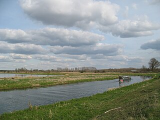
Wherryman's Way is a long-distance footpath in the English county of Norfolk.

The A149 is commonly known as "The Coast Road" to local residents and tourists, as this road runs along the North Norfolk coast from King's Lynn to Cromer, via coastal villages.

The A146 is an A road that connects Norwich in Norfolk and Lowestoft in Suffolk, two of East Anglia's largest population centres. It is around 27 miles (43 km) in length and has primary classification along its entire route. It is mainly single carriageway throughout its route, with the exception of a section of dual carriageway on the southern edge of Norwich.
Bramerton is a village in South Norfolk 4¾ miles south-east of Norwich, just north of the main A146 Norwich-Lowestoft road and on the south bank of the River Yare.
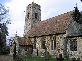
Rockland St Mary is a village in South Norfolk which lies about 6 miles southeast of Norwich between Surlingham, Bramerton, Claxton and Hellington. In the 2001 census it contained 325 households and a population of 824, falling to 810 at the 2011 Census. Although Rockland is part of South Norfolk District, those parts of the village lying adjacent to the river and broads fall under the administration of the Broads Authority. The Street (pictured) runs east to west through the centre of the village.
Trowse, also called Trowse with Newton, is a village in South Norfolk which lies about 1+1⁄2 miles (2.4 km) south-east of Norwich city centre on the banks of the River Yare. It covers an area of 4.49 km2 (1.73 sq mi) and had a population of 479 in 233 households at the 2001 census, the population increasing to 862 in 374 households at the 2011 Census. There are approved plans to build a further 770 houses on the outskirts of the village, at White Horse Lane and the Deal Ground sites.
Langley with Hardley is a parish in the county of Norfolk, England, about a mile east of Loddon. It covers an area of 15.09 km2 (5.83 sq mi) and had a population of 489 in 161 households at the 2001 census, reducing marginally to 488 at the 2011 Census.
Hardley may refer to the following places in England:
This article describes the geology of the Broads, an area of East Anglia in eastern England characterised by rivers, marshes and shallow lakes (‘broads’). The Broads is designated as a protected landscape with ‘status equivalent to a national park’.