River Mun

Last updated

Mun
Mundesley Beck
3 River Mun at Mundesley Hospital (6).JPG
River Mun Gauging Station
Norfolk UK relief location map.jpg
Red pog.svg
Location of the river mouth within Norfolk
Location
Country England
Region Norfolk
Physical characteristics
Source 
  location Northrepps
  coordinates 52°54′00″N1°20′25″E / 52.9000°N 1.3404°E / 52.9000; 1.3404
  elevation45 m (148 ft)
Mouth North Sea
  location
Mundesley
  coordinates
52°52′36″N1°26′28″E / 52.8767°N 1.4410°E / 52.8767; 1.4410
  elevation
0 m (0 ft)
Length8.9 km (5.5 mi)

The River Mun or Mundesley Beck is a river in the north of the county of Norfolk, England. [1] Its source is in the parish of Northrepps. The river finally runs into the North Sea in the village of Mundesley.

Contents

Course

River Mun Passing through Osier Carr Downstream, River Mun at Sidestrand lane 5th October 2007.JPG
River Mun Passing through Osier Carr
A footbridge over the River Mun at Frogshall 1 The River Mun Close to its source at Frogshall (1).JPG
A footbridge over the River Mun at Frogshall

The river's source is next to Craft Lane, close to Furyhill plantation between Northrepps and the hamlet of Frogshall. It runs in a southeasterly direction through a wooded valley and passes under Craft Lane close to Frogshall Farm House. From here it runs through woodland for a short distance and into a large pool called Little Broad. From Little Broad, still in woodland, the river falls over a weir and into marshy woodland known as Osier Carr, where freshwater mussels can be found.

The river then passes under another lane from Sidestrand. From here the river feeds ponds and sluices in an area known as the Grove. Many drains feed into the river here. The river then turns almost south and passes under Cromer Road, then crosses countryside towards Ash Tree Farm and Ash Plantation. It widens slightly and begins to cross open countryside, slowly turning southeast again. Along this section, the Mun runs adjacent to several small reservoirs, ponds and drains.

Gimingham watermill

Gimingham mill pond Gimingham mill pond River Mun (1).JPG
Gimingham mill pond
The Diesel mill Engine at Gimingham The old Diesel Mill engine at Gimingham, Norfolk.jpg
The Diesel mill Engine at Gimingham

At Gimingham the river flows into a series of mill ponds. The ponds once fed a watermill, [2] whose dam held back a 20-acre (81,000 m2) broad fed by the River.

There has been a mill at the location since the time of the Domesday Book. The watermill was worked in conjunction with the nearby Gimingham postmill until 1877. The original waterwheel was later supplemented by steam, then replaced by a turbine in 1912 and later by diesel engines, although water was still used for cooling them. It milled animal feedstuffs until 30 November 1976. The diesel engine has been preserved and stands on Mill Street.

Gimingham Mill Lake is a popular fishing location. Bream, carp, tench and roach can be caught.In the lake, pit and river, From Gimingham the river cross more open farm land now heading east, passing on its left Mundesley Hospital which was refurbished in 1997 and is now the Diana Princess of Wales Treatment Centre for Drug and Alcohol Problems. Where the road leading up to the hospital crosses the River Mun, the Environment Agency has a Water Resource Management gauging station. From here the river begins to skirt the southern side of the coastal village of Mundesley.

Mun valley and Mundesley golf course

River Mun or Mundesley Beck 3 River Mun at Mundesley Hospital (8).JPG
River Mun or Mundesley Beck
Road Bridge over the River in Mundesley Village River Mun at the crossing in the village of Mundesley (2).JPG
Road Bridge over the River in Mundesley Village

The valley here is part of Mundesley Golf Club. The golf club was established in 1901, and was designed with the help of one of the sport's legends, 6-times Open winner Harry Vardon (1870–1937), built on the rolling hillside of the River Mun valley. Today its nine holes, with 18 tees, offer a satisfying challenge to players of all abilities. Harry Vardon's association with Mundesley Golf Club spanned many years, from consultation, in 1900 to his misfortune to contract tuberculosis in 1903, and it was to Mundesley's sanatorium that he went for treatment. While recuperating in 1904, still at the sanatorium, he ventured along the lane which bisects the course to enjoy a round of golf. Here he experienced his only career hole-in-one, on what is now the sixth, a feat which no doubt contributed to the success of his convalescence.

From the golf course the river travels a short distance due east and enters the village under Trunch Road close to its junction with High Street and Heath Road. Just past Trunch Road the river falls over another weir before turning north into the eastern side of the village.

Mundesley Watermill

Mundesley mill pond Waterwheel and millpond at Mudesley (2).JPG
Mundesley mill pond
The Waterwheel at Mundesley Waterwheel at Mudesley fed by the waters of the river Mun, 5th October 2007.JPG
The Waterwheel at Mundesley

The river now fills another mill pond where once the second mill on the river worked. Mundesley watermill [3] was built c.1723 and consisted of two brick floors supporting a weather boarded upper floor and roof space under a Norfolk pantiled roof. Seen from the roadside, Mundesley Mill has five floors but if you took the public pathway round to the back, only two would have been visible. This is because the mill pool lying behind was level with the third floor. The builders set the mill deep into a high bank, over which the water would have fallen freely in the old days before findings its way to the beach, although it is quite possible the water was diverted to this point for the purpose of driving the mill. Unusually the mill had an overshot waterwheel. The only way to provide a sufficient head of water was to dam the river to form the mill pond we see today which is some considerable height above the road. When the mill was working, 8 million gallons of water flowed through per day. When the mill was worked by the Larter family in the 1920s, the deeds stated that anyone interfering with the river had to pay dues to the millers. The Larter family also used the mill to generate electricity, which also supplied power to some of the surrounding properties including a Bell's grocery shop, Larter & Rudran's bicycle garage and a property at The Dell. The mill burnt down in November 1956. Some of the cog wheels were still visible in their mountings within the shell of the building in 1959. The remains of the building were finally pulled down in the summer of 1965. The waterwheel was large with a diameter of 26 feet (7.9 m) and the owner of the Mill House decided to enclose the wheel behind a grill and to leave it as a showpiece. The wooden spokes and the rim can still be seen, and some of the metal scoops and some wooden cogs have been replaced. For many years it still turned whenever enough water was available. The river's water flowed over the wheel and then under the road and into the North sea through a pipe.

Related Research Articles

<span class="mw-page-title-main">River Eden, Kent</span> River in Surrey and Kent, England

The River Eden is a tributary of the River Medway in south east England. It rises at the foot of the North Downs escarpment near Titsey in Surrey and runs initially southwards through Oxted before turning eastwards to enter Kent. After flowing through Edenbridge and passing Hever Castle, the Eden meets the Medway at Penshurst.

<span class="mw-page-title-main">River Burn, Norfolk</span> River in northwest Norfolk, England

The River Burn is a river in the northwest of the County of Norfolk, in the East of England. From its source to its mouth on the North Coast of Norfolk it is 12.3 kilometres (7.6 mi). The river has a fall of 36 metres to the sea.

<span class="mw-page-title-main">Mundesley</span> Human settlement in England

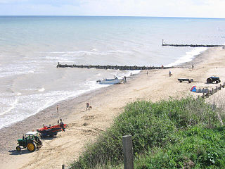
Mundesley /ˈmʌn.dzli/ is a coastal village and a civil parish in the English county of Norfolk. The village is 20.3 miles (32.7 km) north-north east of Norwich, 7.3 miles (11.7 km) south east of Cromer and 136 miles (219 km) north east of London. The village lies 5.6 miles (9.0 km) north-north east of the town of North Walsham. The nearest railway station is at North Walsham, for the Bittern Line which runs between Sheringham and Norwich. The nearest airport is Norwich Airport. The village sits astride the B1159 coast road that links Cromer and Caister-on-Sea, and is at the eastern end of the B1145 a route which runs between King's Lynn and Mundesley. Mundesley is within the Norfolk Coast AONB. It has a resident population of around 2,695, measured at 2,758 in the 2011 Census. The River Mun or Mundesley Beck flows into the sea here. On 5 September 2022 Mundesley beach won the North Norfolk District Council Battle of the Beaches to be recognised as the top beach in North Norfolk in a close run off against West Runton beach.

<span class="mw-page-title-main">Gimingham</span> Human settlement in England

Gimingham is a village and civil parish in the English county of Norfolk. Gimingham has no shops, but has a Church, a pond and a preserved Water Mill. The village is 4.1 miles (6.6 km) north of North Walsham and 6.1 miles (9.8 km) south east of Cromer. It is 21.6 miles (34.8 km) north of the city of Norwich. Nearby road communications with Gimingham are the A140 to Norwich, the A148 (direct) and A149 to King's Lynn, and the A149 into the Norfolk Broads and Great Yarmouth. The B1159 is a coastal road between Cromer and Mundesley. The nearest airport is Norwich International Airport.

<span class="mw-page-title-main">Heacham River</span> River in Norfolk, England

Heacham River is a small river in the King's Lynn and West Norfolk district of the English County of Norfolk. Its source is near the village of Bircham Newton grid reference TF762 339, 25 metres above sea level. The river is 16.4 kilometres (10.2 mi) long from the source to the outfall on Heacham beach, which discharges into The Wash at low tide.

<span class="mw-page-title-main">River Babingley</span> River in northwest Norfolk, England

The Babingley is a minor river in the northwest of the county Norfolk in England. It runs 12.2 miles (19.6 km) from its source at the village of Flitcham to the River Great Ouse at Wootton Marshes where it terminates.

<span class="mw-page-title-main">Gaywood River</span> River in Norfolk, England

Gaywood River is a tributary of the River Great Ouse in the west of the county of Norfolk. Its source is 11 metres above sea level, northwest of the village of Gayton in Derby Fen, Map Reference TF 705 209. It runs for 6.7 miles (10.8 km) to its outflow into the River Great Ouse in the town of King's Lynn.

<span class="mw-page-title-main">Spring Beck</span> Minor watercourse in Norfolk, England

Spring Beck is a minor watercourse flowing near and through the village of Weybourne in the north of the county of Norfolk.

<span class="mw-page-title-main">Beeston Beck (Norfolk)</span> Minor watercourse in the north of the county of Norfolk, England

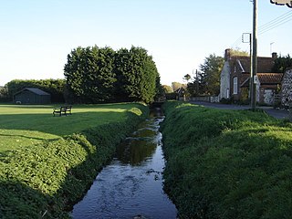
Beeston Beck is a minor watercourse in the north of the county of Norfolk, England.

<span class="mw-page-title-main">Northrepps</span> Human settlement in England

Northrepps is a village and a civil parish in the English county of Norfolk. It is 3.4 miles (5.5 km) southeast of Cromer, 22.2 miles (35.7 km) north of Norwich and 137 miles (220 km) north of London. The village lies west of the A149 which runs between Kings Lynn and Great Yarmouth. The nearest railway station is at Cromer for the Bittern Line which runs between Sheringham, Cromer and Norwich. The nearest airport is Norwich International Airport. The village and parish of Northrepps had in the 2001 census a population of 839, increasing to 886 at the 2011 Census. For the purposes of local government, the village falls within the district of North Norfolk.

<span class="mw-page-title-main">Scarrow Beck</span> River in England

Scarrow Beck is a minor watercourse which rises in the north of the English county of Norfolk. It is a tributary of the River Bure. Its spring is in the North Norfolk village of Aylmerton west of the main street. It eventually merges, after 7.7 miles (12.4 km) with the River Bure at Ingworth just north of the Blickling Hall estate. There are two watermills on the beck, both of which are no longer in working order. A third windmill at Gresham stands on Gur Beck, a small tributary of Scarrow Beck.

<span class="mw-page-title-main">River Bourne, Kent</span> River in Kent, England

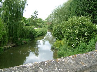
The River Bourne rises in the parish of Ightham, Kent and flows in a generally south easterly direction through the parishes of Borough Green, Platt, Plaxtol, West Peckham, Hadlow, and East Peckham where it joins the River Medway. In the 18th century the river was known as the Busty or Buster, the Shode or Sheet, but is not known by these names nowadays. A bourne is a type of stream, while shode means a branch of a river.

<span class="mw-page-title-main">Loose Stream</span> Stream in Kent, England

The Loose Stream sometimes called the River Loose or Langley Stream is a tributary of the River Medway notable for the number of watermills that it powered in its short length. It rises in Langley, flows through Boughton Monchelsea, Loose and enters the Medway at Tovil. The river valley is deep sided, and there is much evidence of the paper and wool trades which once flourished here: the stream has been dammed in many places, resulting in many mill ponds.

<span class="mw-page-title-main">River Len</span> River in Kent, England

The River Len is a river in Kent, England. It rises at a spring in Bluebell Woods to the southeast of the village centre of Lenham 0.6 miles (0.97 km) from the source of the River Great Stour; both rise on the Greensand Ridge. Its length is c10 miles (16 km). It enters the River Medway at Maidstone.

<span class="mw-page-title-main">River Beult</span> River in Kent, England

The River Beult is a tributary of the River Medway in South East England.

<span class="mw-page-title-main">Paston Way</span> Long-distance footpath in Norfolk, England

The Paston Way is a footpath. It is entirely within the English county of Norfolk in the United Kingdom. The footpath is twenty miles in length, the portals to the path are Cromer at its northwestern end and North Walsham at it southeastern end.

<span class="mw-page-title-main">Letheringsett Watermill</span> Watermill in Letheringsett, England

Letheringsett watermill is situated on the River Glaven in the village of Letheringsett within the English county of Norfolk. Letheringsett is in the district of North Norfolk and is 1.4 miles (2.3 km) west of the town of Holt. The watermill is a Grade II* listed building and is the last fully operational watermill in Norfolk that produces flour. See inside and explore the watermill here

<span class="mw-page-title-main">Glandford Watermill</span> Watermill in Glandford, England

Glandford watermill is situated on the River Glaven a little north of the village of Glandford within the English county of Norfolk. Glandford is in the civil parish of Wiveton within the district of North Norfolk.

<span class="mw-page-title-main">Letheringsett Brewery watermill</span>

The remains of Letheringsett Brewery Watermill are located in the centre of the village of Letheringsett in the county of Norfolk. The watermill of 1784 was housed within the maltings and brewery complex founded and run by John Brereton of Letheringsett Hall from before 1721. Much of this complex still stands on the south side of the A148 Cromer to King’s Lynn road, which bisects the village on an east–west axis, and on the west bank of the River Glaven, which bisects the village south–north.

The Medway and its tributaries and sub-tributaries have been used for over 1,150 years as a source of power. There are over two hundred sites where the use of water power is known. These uses included corn milling, fulling, paper making, iron smelting, pumping water, making gunpowder, vegetable oil extraction, and electricity generation. Today, there is just one watermill working for trade. Those that remain have mostly been converted. Such conversions include a garage, dwellings, restaurants, museums and a wedding venue. Some watermills are mere derelict shells, lower walls or lesser remains. Of the majority, there is nothing to be seen. A large number of tributaries feed into the River Medway. The tributaries that powered watermills will be described in the order that they feed in. The mills are described in order from source to mouth. Left bank and right bank are referred to as though the reader is facing downstream. This article covers the watermills on the tributaries that feed in below Penshurst and above Yalding.

References

  1. "OS Explorer Map" 25, Norfolk Coast East, ISBN   0-319-21727-2
  2. Norfolk Mills - Gimingham watermill
  3. Norfolk Mills - Mundesley watermill