This article needs additional citations for verification .(March 2008) |
| Bittern Line | |||
|---|---|---|---|
 | |||
 | |||
| Overview | |||
| Status | Operational | ||
| Owner | Network Rail | ||
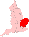
| Locale | Norfolk, England | ||
| Termini | |||
| Stations | 10 | ||
| Service | |||
| Type | Heavy rail | ||
| System | National Rail | ||
| Operator(s) | Greater Anglia | ||
| Rolling stock | Class 755 | ||
| History | |||
| Opened | 1874–77 | ||
| Technical | |||
| Line length | 30 miles 22 chains (48.7 km) | ||
| Number of tracks | 1–2 | ||
| Character | Rural line | ||
| Track gauge | 4 ft 8+1⁄2 in (1,435 mm) standard gauge | ||
| |||

Bittern Line | |||||||||||||||||||||||||||||||||||||||||||||||||||||||||||||||||||||||||||||||||||||||||||||||||||||||||||||||||||||||||||||||||||||||||||||||||||||||||||||||||||||||||||||||||||||||||||||||||||||||||||||||
|---|---|---|---|---|---|---|---|---|---|---|---|---|---|---|---|---|---|---|---|---|---|---|---|---|---|---|---|---|---|---|---|---|---|---|---|---|---|---|---|---|---|---|---|---|---|---|---|---|---|---|---|---|---|---|---|---|---|---|---|---|---|---|---|---|---|---|---|---|---|---|---|---|---|---|---|---|---|---|---|---|---|---|---|---|---|---|---|---|---|---|---|---|---|---|---|---|---|---|---|---|---|---|---|---|---|---|---|---|---|---|---|---|---|---|---|---|---|---|---|---|---|---|---|---|---|---|---|---|---|---|---|---|---|---|---|---|---|---|---|---|---|---|---|---|---|---|---|---|---|---|---|---|---|---|---|---|---|---|---|---|---|---|---|---|---|---|---|---|---|---|---|---|---|---|---|---|---|---|---|---|---|---|---|---|---|---|---|---|---|---|---|---|---|---|---|---|---|---|---|---|---|---|---|---|---|---|---|
| |||||||||||||||||||||||||||||||||||||||||||||||||||||||||||||||||||||||||||||||||||||||||||||||||||||||||||||||||||||||||||||||||||||||||||||||||||||||||||||||||||||||||||||||||||||||||||||||||||||||||||||||
The Bittern Line is a railway branch line in Norfolk, England, that links Norwich to Sheringham. [1] It passes through the Broads on its route to an Area of Outstanding Natural Beauty on the north Norfolk coast. [2] It is named after the bittern, a rare bird found in the reedy wetlands of Norfolk.
Contents
- History
- Stations
- Services
- Infrastructure
- Proposed developments
- Rackheath station
- References
- External links
The line is 30 miles 22 chains (48.7 km) in length and there are 10 stations. It is part of Network Rail Strategic Route 7, SRS 07.11, and is classified as a rural line. [3]
Passenger services are operated by Greater Anglia, which also manages all of the stations.

