Yarmouth Vauxhall
The Bill for the Yarmouth and Norwich Railway (Y&NR) received Royal Assent on 18 June 1842. Work started on the line in April 1843;the line and its stations were opened on 1 May 1844. Great Yarmouth station was originally named Yarmouth Vauxhall. [1] The Y&NR line to Norwich through Reedham was the first railway in the county to open. [2]
On 30 June 1845,a Bill authorising the amalgamation of the Yarmouth &Norwich Railway with the Norwich &Brandon Railway came into effect and Yarmouth Vauxhall station became a Norfolk Railway (NR) asset. [1] [3]
The Eastern Counties Railway (ECR) and its rival the Eastern Union Railway (EUR) were both sizing up the NR to acquire and expand their railway empire. The ECR trumped the EUR by taking over the NR,including Yarmouth Vauxhall station on 8 May 1848.
By the 1860s,the railways in East Anglia were in financial trouble;most were leased to the Eastern Counties Railway,which wished to amalgamate formally but could not obtain government agreement for this until an Act of Parliament on 7 August 1862,when the Great Eastern Railway (GER) was formed by the amalgamation. Actually,Yarmouth Vauxhall became a GER station on 1 July 1862,when the GER took over the ECR and the EUR,before the Bill received Royal Assent.
Two decades into GER ownership,the latter decided to build a shorter route between Yarmouth Vauxhall to Norwich Thorpe. Work started in the early 1880s. The GER started the new line about one mile west of Yarmouth Vauxhall and the junction was named Breydon. The first part of the new line opened on 1 March 1883 as far as the first station at Acle.
The system settled down for the next four decades,apart from the disruption of World War I. The difficult economic circumstances that existed after the war led the government to pass the Railways Act 1921,which led to the creation of the Big Four. The GER amalgamated with several other companies to form the London and North Eastern Railway (LNER). Yarmouth Vauxhall became an LNER station on 1 January 1923.
In May 1943,the station was badly damaged during an air raid. The upper floor of the station building had to be demolished,but train services continued to operate during this period. [5] The remainder of the original station building was demolished and rebuilt in 1960. [6]
On nationalisation in 1948,the station and its services became part of the Eastern Region of British Railways. The station was renamed Yarmouth by British Railways at some point between 1953 and 1962. [1]
Before rail closures of the 1950s and the later Beeching Axe,it was the largest of the three railway stations in the town. [7] The three stations had been linked together since 1882 by the Yarmouth Union Railway. [8] The station is now the sole surviving station in the town. [9]
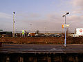
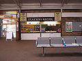
The station was renamed Great Yarmouth on 16 May 1989. There were large sidings and an engine shed,before they were demolished to make way for an Asda superstore and bypass.
Historical services
With the closure of Yarmouth Beach station in early 1959,Vauxhall became the focus of the summer Saturday traffic for the town. The station had always had a number of summer Saturday trains up to this point,but this hike in numbers had led to some remodelling of the station layout - platform lengthening and changes to carriage stabling - in order to cope with the additional traffic.
A typical summer Saturday in 1959 saw an additional 24 timetabled passenger trains from locations including York,Derby,Sheffield,Manchester,Leicester and Sunderland. In addition,on 25 July 1959,there were an extra eight holiday relief workings. Some local services were cancelled to cope with this influx of trains,but it indicates the significant numbers of British holidaymakers still travelling by train and holidaying in Great Yarmouth at this time. [10]