
The Mid-Norfolk Railway (MNR) is a 17+1⁄2 miles (28.2 km) preserved standard gauge heritage railway,one of the longest in Great Britain. Preservation efforts began in 1974,but the line re-opened to passengers only in the mid-1990s as part of the "new generation" of heritage railways. The MNR owns and operates most of the former Wymondham-Fakenham branch line of the Norfolk Railway. The branch opened in 1847,was closed to passengers in stages from 1964 to 1969 as part of the Beeching cuts,and was finally fully closed to goods traffic in 1989.

Berney Arms railway station is a stop on the Wherry Lines in the East of England,serving the settlement of Berney Arms on the Halvergate Marshes in Norfolk. It is located 15 miles 71 chains (25.6 km) east of Norwich and is the only station on a short stretch of single line between Reedham and Great Yarmouth. The station is managed by Greater Anglia,which also operates all trains serving it.

Reedham railway station is a stop on the Wherry Lines in the East of England,serving the village of Reedham,Norfolk. It is 12 miles 13 chains (19.6 km) down the line from Norwich;it is situated between Cantley to the west and,to the east,Berney Arms on the branch to Great Yarmouth or Haddiscoe on the branch to Lowestoft. It is commonly suffixed as Reedham (Norfolk) in order to distinguish it from the station of the same name in south London. Its three-letter station code is REE.

Great Yarmouth railway station is one of two eastern termini of the Wherry Lines in the East of England,serving the seaside town of Great Yarmouth,Norfolk. The other terminus at the eastern end of the lines is Lowestoft and the western terminus,to which all trains run,is Norwich.

Norwich railway station is the northern terminus of the Great Eastern Main Line in the East of England,serving the cathedral city of Norwich,Norfolk. It is 114 miles 77 chains (185 km) down the main line from London Liverpool Street,the western terminus.

Cantley railway station is a stop on the Wherry Lines in the East of England,serving the village of Cantley,Norfolk. It is 10 miles (16 km) down the line from Norwich on the routes to Lowestoft and Great Yarmouth;it is situated between Buckenham and Reedham. Its three-letter station code is CNY.

The Breckland line is a secondary railway line in the east of England that links Cambridge in the west to Norwich in the east. The line runs through three counties:Cambridgeshire,Suffolk and Norfolk. It takes its name from the Breckland region of Norfolk and passes through Thetford Forest.
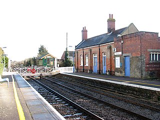
Harling Road railway station is on the Breckland line in the east of England,serving the villages of Larling,Roudham and East Harling,Norfolk. The line runs between Cambridge in the west and Norwich in the east.
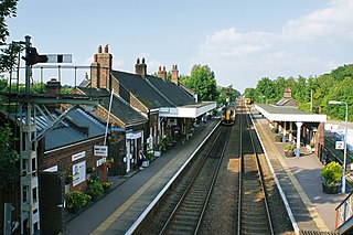
Wymondham railway station is a stop on the Breckland Line in the East of England,serving the market town of Wymondham,Norfolk. The line runs between Cambridge in the west and Norwich in the east. It is situated between Spooner Row and Norwich,113 miles 72 chains (183.3 km) from London Liverpool Street via Ely.
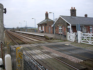
Buckenham railway station is a stop on the Wherry Lines,which serves the village of Buckenham in Norfolk,England. It is 7 miles 62 chains (12.5 km) down the line from Norwich on the routes to Lowestoft and Great Yarmouth;it is situated between Brundall and Cantley. Its three-letter station code is BUC.
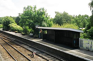
Brundall railway station is on the Wherry Lines in the east of England,serving the village of Brundall,Norfolk. It is 5 miles 60 chains (9.3 km) down the line from Norwich on the route to Great Yarmouth and Lowestoft. Its three-letter station code is BDA.

Eccles Road railway station is on the Breckland line in the east of England,serving the villages of Eccles,Quidenham and Wilby in Norfolk. The line runs between Cambridge in the west and Norwich in the east.

Thetford railway station is on the Breckland line in the east of England,serving the market town of Thetford,Norfolk. The line runs between Cambridge in the west and Norwich in the east.

Attleborough railway station is on the Breckland line in the east of England,serving the market town of Attleborough,Norfolk. The line runs between Cambridge in the west and Norwich in the east. Attleborough is situated between Eccles Road and Spooner Row,108 miles 19 chains (174.2 km) from London Liverpool Street via Ely.

Diss railway station is on the Great Eastern Main Line in the East of England,serving the market town of Diss,Norfolk. It is 94 miles 43 chains (152.1 km) down the line from London Liverpool Street and is situated between Stowmarket to the south and Norwich to the north. It is approximately 20 miles (32 km) south of Norwich. Its three-letter station code is DIS.
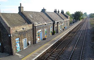
Brandon railway station is on the Breckland Line in the East of England,serving the town of Brandon,Suffolk,although the station is actually situated across the county boundary in Norfolk. The line runs between Cambridge in the west and Norwich in the east.
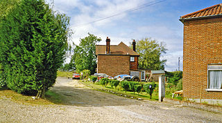
Forncett railway station was a railway station in Forncett,South Norfolk located 104 miles from London Liverpool Street. It was opened in 1849 when Norwich and Ipswich were connected by the Eastern Union Railway in 1849. Between 1881 and 1951 it was a junction for a short route to Wymondham and was closed as a result of the Beeching Axe with other smaller stations between Norwich and Ipswich.

Hethersett was a railway station near Hethersett,Norfolk.

Haughley railway station was located in Haughley,Suffolk on the Great Eastern Main Line between Liverpool Street Station and Norwich. It opened on 2 July 1849 named Haughley Junction and was a replacement for a station named Haughley Road which had been in service from 1846 to 1849 at location TM 02981 63319 on the line to Elmswell.
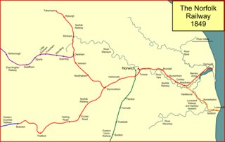
The Norfolk Railway was an early railway company that controlled a network of 94 miles around Norwich,England. It was formed in 1845 by the amalgamation of the Yarmouth and Norwich Railway opened in 1844,and the Norwich and Brandon Railway,not yet opened. These lines were built out of frustration that the Eastern Counties Railway line that was expected to connect Norwich to London failed to be completed. The Norfolk Railway also leased the Lowestoft Railway and Harbour Company,and built a branch to Dereham and Fakenham,opened in 1846 and 1849 respectively.


