Cheshunt is a town in the Borough of Broxbourne in Hertfordshire, England, 13 miles (21 km) north of Central London on the River Lea and Lee Navigation and directly south of Broxbourne. It contains a section of the Lee Valley Park, including much of the River Lee Country Park. To the north lies Broxbourne and Wormley, Waltham Abbey to the east, Waltham Cross and Enfield to the south, and Cuffley to the west.
The Northern & Eastern Railway (N&ER) was an early British railway company, that planned to build a line from London to York. Its ambition was cut successively back, and it was only constructed from Stratford, east of London, to the towns of Bishop's Stortford and Hertford. It was always short of money, and it got access to London over the Eastern Counties Railway (ECR). It was built at the track gauge of 5 ft, but it converted to standard gauge in 1844.

Tottenham Hale is an interchange station located in Tottenham Hale, North London for London Underground and National Rail services.

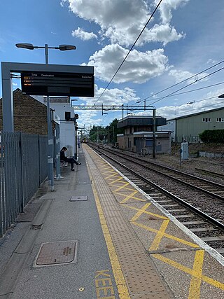
Northumberland Park railway station is on the Lea Valley line that forms part of the West Anglia Main Line, serving the ward of Northumberland Park in Tottenham, north London. It is 6 miles 73 chains (11.1 km) down the line from London Liverpool Street and is situated between Tottenham Hale and Meridian Water. Its three-letter station code is NUM and it is in Travelcard zone 3. It is one of the stations that can be used to access Tottenham Hotspur Stadium.

Clapton is a railway station on the Chingford branch of the Lea Valley lines, located in Clapton in the London Borough of Hackney, in north-east London. It is 3 miles 78 chains (6.4 km) down the line from London Liverpool Street and is situated between Hackney Downs and St. James Street. The station has been operated by London Overground since 2015.
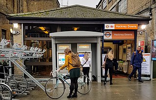
Hackney Downs is a London Overground and National Rail station in Hackney Central and serves the old common land of Hackney Downs in Lower Clapton in the London Borough of Hackney, it is on the Lea Valley lines and West Anglia Main Line. It is 2 miles 78 chains (4.8 km) down the line from London Liverpool Street and has a direct passenger link to Hackney Central station, providing interchange with the North London line of the Overground network.

Enfield Lock railway station is on the West Anglia Main Line, it is in Enfield Lock in the London Borough of Enfield, London. It is 11 miles 65 chains (19.0 km) down the line from London Liverpool Street and is situated between Brimsdown and Waltham Cross. Its three-letter station code is ENL and it is in Travelcard zone 6.

The Lea Valley lines are two commuter lines and three branches in East London, North London and Hertfordshire, so named because they run along the valley of the River Lea. They were part of the Great Eastern Railway, now part of the Anglia Route of Network Rail.

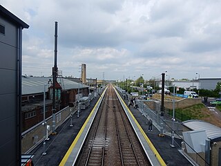
Cheshunt is a National Rail and London Overground station on the Lea Valley Lines in Cheshunt, Hertfordshire, England. On the West Anglia Main Line, it is 14 miles 1 chain (22.6 km) from London Liverpool Street and situated between Waltham Cross and Broxbourne. One of three northern termini on the Lea Valley section of the London Overground network, it is also the final station on the Southbury Loop after Theobalds Grove.

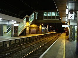
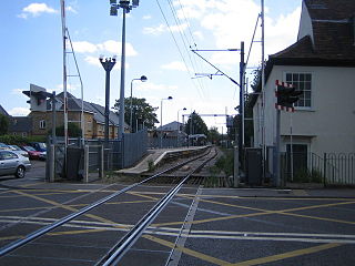
Waltham Cross railway station is on the Lea Valley Lines, serving the suburban town of Waltham Cross in Hertfordshire, and the neighbouring Waltham Abbey in Essex, England. It is 12 miles 63 chains (20.6 km) down the line from London Liverpool Street and is situated between Enfield Lock and Cheshunt. Its three-letter station code is WLC and it is in London fare zone 7.

The West Anglia Main Line is one of the two main line railways that operate out of Liverpool Street. It runs generally north through Cheshunt, Broxbourne, Harlow, Bishop's Stortford and Audley End to Cambridge, with branches between serving Stratford, Hertford and Stansted Airport. The line runs along the boundary between Hertfordshire and Essex for much of its length.
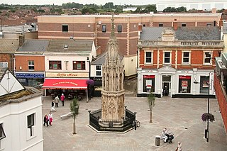
Waltham Cross is a town in the Borough of Broxbourne, Hertfordshire, England, located 12 miles (19 km) north of central London. In the south-eastern corner of Hertfordshire, it borders Cheshunt to the north, Waltham Abbey to the east, and Enfield to the south.
Enfield Lock is an area in the London Borough of Enfield, north London. It is approximately located east of the Hertford Road between Turkey Street and the Holmesdale Tunnel overpass, and extends to the River Lee Navigation, including the Enfield Island Village. The locality gains its name from the lock on the River Lee Navigation. Today's Enfield Lock was rebuilt in 1922. The area forms part of the Lee Valley Park and the Enfield Lock Conservation Area. On its eastern boundary Enfield Lock has marshland formerly used as a testing site between the Royal Small Arms Factory and the Gunpowder Mills, beyond this is the village of Sewardstone and the Epping forest boundary. To the south is Brimsdown, the north Waltham Cross and to the west Bullsmoor and Freezywater. Enfield Lock forms part of the London boundary.
Lea Bridge is a railway station on the line between Stratford and Tottenham Hale on the Lea Valley Lines, which reopened on 15 May 2016 with the full service beginning on 16 May 2016, operated by Greater Anglia.

Bishop's Stortford railway station is on the West Anglia Main Line serving the town of Bishop's Stortford in Hertfordshire, England. It is 30 miles 27 chains (48.8 km) down the line from London Liverpool Street and is situated between Sawbridgeworth and Stansted Mountfitchet stations. Its three-letter station code is BIS. The station and all trains serving it are operated by Greater Anglia, including the half-hourly Stansted Express service.

Sawbridgeworth railway station is on the West Anglia Main Line serving the town of Sawbridgeworth in Hertfordshire, England. It is 26 miles 57 chains (43.0 km) down the line from London Liverpool Street and is situated between Harlow Mill and Bishop's Stortford stations. Its three-letter station code is SAW.
Harlow Mill railway station is on the West Anglia Main Line serving the eastern part of Harlow in Essex, England. It is 24 miles 36 chains (39.3 km) down the line from London Liverpool Street and is situated between Harlow Town and Sawbridgeworth stations. Its three-letter station code is HWM.
Harlow Town railway station is on the West Anglia Main Line serving the town of Harlow in Essex, England. It is 22 miles 59 chains (36.6 km) down the line from London Liverpool Street and is situated between Roydon and Harlow Mill stations. Its three-letter station code is HWN.
Roydon railway station is on the West Anglia Main Line serving the village of Roydon in Essex, England. It is 20 miles 9 chains (32.4 km) down the line from London Liverpool Street and is situated between Broxbourne and Harlow Town stations. Its three-letter station code is RYN.
The Hertford East branch line is a railway line in Hertfordshire, England running between Hertford East and Broxbourne. The line follows the route of the Lea Valley, serving intermediate towns and villages. It branches off the West Anglia Main Line north of Broxbourne, and could be seen as part of the Lea Valley lines—a collection of commuter routes into London. It is 5 miles 64 chains (9.33 km) in length.