
Stoke Newington is a London Overground station on the Lea Valley lines, serving the Stoke Newington area of the London Borough of Hackney. It is 4 miles 16 chains (6.8 km) down the line from London Liverpool Street and is situated between Rectory Road and Stamford Hill. Its three-letter station code is SKW and it is in Travelcard zone 2.

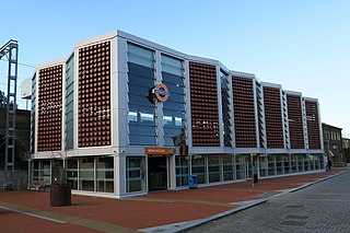
Seven Sisters is an interchange station located in the Seven Sisters area of the London Borough of Haringey, North London for London Underground, London Overground and National Rail services.
White Hart Lane is a London Overground station on the Lea Valley lines located in Tottenham of the London Borough of Haringey in North London. It is 7 miles 11 chains (11.5 km) from London Liverpool Street and is situated between Bruce Grove and Silver Street. It is in Travelcard zone 3.

Bruce Grove is a London Overground station on the Lea Valley lines located in central Tottenham in the London Borough of Haringey, north London. It is 6 miles 28 chains (10.2 km) down the line from London Liverpool Street and is situated between Seven Sisters and White Hart Lane. Its three-letter station code is BCV and it is in Travelcard zone 3.

Clapton is a railway station on the Chingford branch of the Lea Valley lines, located in Clapton in the London Borough of Hackney, in north-east London. It is 3 miles 78 chains (6.4 km) down the line from London Liverpool Street and is situated between Hackney Downs and St. James Street. The station has been operated by London Overground since 2015.

Highams Park is a railway station on the Chingford branch of the Lea Valley lines, located in Highams Park in the London Borough of Waltham Forest, north-east London. It is 8 miles 52 chains (13.9 km) down the line from London Liverpool Street and is situated between Wood Street and Chingford. It has been operated by London Overground since 2015.

Silver Street is a London Overground station on the Lea Valley lines located in Edmonton in the London Borough of Enfield, north London. It is 7 miles 75 chains (12.8 km) down the line from London Liverpool Street and is situated between White Hart Lane and Edmonton Green.

Bethnal Green is a London Overground station on the Lea Valley lines in the southern part of Bethnal Green, in East London. The station is 1 mile 10 chains down the line from London Liverpool Street; the next station is either Hackney Downs or Cambridge Heath. It is an interchange station between three services operated by London Overground. Its three-letter station code is BET and it is in Travelcard zone 2.

Cambridge Heath is a railway station operated by London Overground in Cambridge Heath, East London. The station is 1 mile 61 chains (2.8 km) down the line from London Liverpool Street and is situated between Bethnal Green and London Fields on the Lea Valley lines to Cheshunt and Enfield Town. Its three-letter station code is CBH and it is in Travelcard zone 2.

London Fields is a London Overground station on the Lea Valley Lines, serving the district of London Fields in the London Borough of Hackney, east London. It is 2 miles 35 chains (3.9 km) down-line from London Liverpool Street and is situated between Cambridge Heath and Hackney Downs. Its three-letter station code is LOF and it is in Travelcard zone 2.
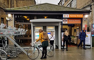
Hackney Downs is a London Overground and National Rail station in Hackney Central and serves the old common land of Hackney Downs in Lower Clapton in the London Borough of Hackney, it is on the Lea Valley lines and West Anglia Main Line. It is 2 miles 78 chains (4.8 km) down the line from London Liverpool Street and has a direct passenger link to Hackney Central station, providing interchange with the North London line of the Overground network.

Enfield Lock railway station is on the West Anglia Main Line, it is in Enfield Lock in the London Borough of Enfield, London. It is 11 miles 65 chains (19.0 km) down the line from London Liverpool Street and is situated between Brimsdown and Waltham Cross. Its three-letter station code is ENL and it is in Travelcard zone 6.

Bush Hill Park is a London Overground station on the Enfield Town branch of the Lea Valley lines, serving the neighbourhood of Bush Hill Park in the London Borough of Enfield, north London. It is 9 miles 69 chains (15.9 km) down the line from London Liverpool Street and is situated between Edmonton Green and Enfield Town, the terminus.

Edmonton Green is a London Overground station on the Lea Valley lines which formerly was a part of the West Anglia Main Line, located in Edmonton in the London Borough of Enfield, north London. It is 8 miles 45 chains (13.8 km) down the line from London Liverpool Street and is situated between Silver Street to the south and Bush Hill Park and Southbury to the north.

Stamford Hill is a London Overground station on the Lea Valley Lines, serving Stamford Hill and neighbouring areas. It is 5 miles 3 chains (8.1 km) down the line from London Liverpool Street and situated between Stoke Newington and Seven Sisters stations. Its three-letter station code is SMH and it is in Travelcard zone 3.

Southbury is a London Overground station on the Southbury Loop section of the Lea Valley lines, located on the easterly side of Enfield in north London. It is 10 miles 32 chains (16.7 km) down the line from London Liverpool Street and is situated between Edmonton Green and Turkey Street.

Turkey Street is a London Overground station on the Southbury Loop section of the Lea Valley lines, located in the Bullsmoor area to the north of Enfield in north London. It is 12 miles 16 chains (19.6 km) down the line from London Liverpool Street and is situated between Southbury and Theobalds Grove.

The Lea Valley lines are two commuter lines and two branches in north-east London, so named because they run along the Lower Lea Valley of the River Lea. They were part of the Great Eastern Railway, now part of the Anglia Route of Network Rail.

Broxbourne railway station is on the West Anglia Main Line serving the towns of Broxbourne and Hoddesdon in Hertfordshire, England. It is 17 miles 17 chains (27.7 km) down the line from London Liverpool Street and is situated between Cheshunt and Roydon. Its three-letter station code is BXB and it is in fare zone B.

Theobalds Grove is a London Overground station on the Southbury Loop section of the Lea Valley lines, located in Waltham Cross, Hertfordshire. The station is named after the nearby Theobalds Palace grounds. It is 13 miles 45 chains (21.8 km) down the line from London Liverpool Street and is situated between Turkey Street and Cheshunt, the northern terminus.

