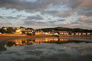
The Suffolk & Essex Coast & Heaths National Landscape is an Area of Outstanding Natural Beauty in Suffolk and Essex, England.

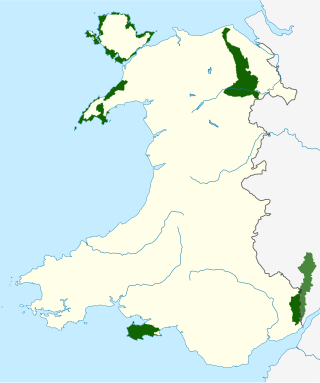
There are five Areas of Outstanding Natural Beauty (AONBs) in Wales, known from November 2023 as National Landscapes. AONBs are areas of countryside that have been designated for statutory protection, due to their significant landscape value, by initially the Government of the United Kingdom and later Welsh devolved bodies. Of the current five areas designated, four are wholly in Wales, with another spanning the Wales-England border, and in total AONBs account for 4% of Wales' land area.

The Derwent is a river in Yorkshire in the north of England. It flows from Fylingdales Moor in the North York Moors National Park, east then southwards as far as its confluence with the River Hertford then westwards through the Vale of Pickering, south through Kirkham Gorge and the Vale of York, joining the River Ouse at Barmby on the Marsh. The confluence is unusual in that the Derwent converges on the Ouse at a shallow angle in an upstream direction.

The Mendip Hills is a range of limestone hills to the south of Bristol and Bath in Somerset, England. Running from Weston-super-Mare and the Bristol Channel in the west to the Frome valley in the east, the hills overlook the Somerset Levels to the south and the Chew Valley and other tributaries of the Avon to the north. The highest point, at 325 metres above sea level, is Beacon Batch which is the summit area atop Black Down. The hills gave their name to the former local government district of Mendip, which administered most of the local area until April 2023. The higher, western part of the hills, covering 198 km2 (76 sq mi) has been designated an Area of Outstanding Natural Beauty (AONB), which gives it a level of protection comparable to a national park.

The Chiltern Hills or the Chilterns are a chalk escarpment in southern England, northwest of London, covering 660 square miles (1,700 km2) across Oxfordshire, Buckinghamshire, Hertfordshire, and Bedfordshire, stretching 45 miles (72 km) from Goring-on-Thames in the southwest to Hitchin in the northeast. The hills are 12 miles (19 km) at their widest.

The Lincolnshire Wolds are a range of low hills in the county of Lincolnshire, England which run roughly parallel with the North Sea coast, from the Humber Estuary in the north-west to the edge of the Lincolnshire Fens in the south-east. A large part of the Wolds are a designated Area of Outstanding Natural Beauty (AONB), and form the highest land in eastern England between Yorkshire and Kent.

The Surrey Hills National Landscape is a 422 km2 (163 sq mi) National Landscape in Surrey, England. It comprises around one quarter of the land area of the county and principally covers parts of the North Downs and Greensand Ridge. It was designated as an Area of Outstanding Natural Beauty in May 1958 and was redesignated as a National Landscape in 2023. The Surrey Hills National Landscape borders the Kent Downs AONB to the east and the South Downs National Park to the south west.

The Vale of Pickering is a low-lying flat area of land in North Yorkshire, England. It is drained by the River Derwent. The landscape is rural with scattered villages and small market towns. It has been inhabited continuously from the Mesolithic period. The present economy is largely agricultural with light industry and tourism playing an increasing role.

Slingsby is a village and civil parish in North Yorkshire, England, 6 miles (10 km) west of Malton on the B1257 road. At the 2001 Census, it had a population of 634, increasing to 665 at the 2011 Census.
Lake Pickering was an extensive proglacial lake of the Devensian glacial. It filled the Vale of Pickering between the North York Moors and the Yorkshire Wolds, when the ice blocked the drainage, which had flowed north-eastwards past the site of Filey towards the Northern North Sea basin. The lake surface rose until it overflowed southwards and cut an exit between the Howardian Hills and the Yorkshire Wolds at Kirkham Priory between Malton and Stamford Bridge, so creating the River Derwent.

Arnside and Silverdale National Landscape in England, is on the border between Lancashire and Cumbria, adjoining Morecambe Bay. One of the smallest National Landscapes, it covers 29 square miles (75 km2) between the Kent Estuary, the River Keer and the A6 road. It was designated in 1972.

The Wye Valley is a valley in Wales and England. The River Wye is the fourth-longest river in the United Kingdom.

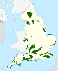
The North Devon Coast is a designated Area of Outstanding Natural Beauty in Devon, England, designated in September 1959. The AONB contributes to a family of protected landscapes in the Southwest of England and a total of 38% of the region is classified by the International Union for Conservation of Nature as Category V Protected Landscapes. The twelve Areas of Outstanding Natural Beauty extend to 30% of the region, twice the proportion covered by AONBs in England as a whole and a further two National Parks, Dartmoor and Exmoor, cover an additional 7%.

The River Rye in the English county of North Yorkshire rises just south of the Cleveland Hills, east of Osmotherley, and flows through Hawnby, Rievaulx, Helmsley, Nunnington, West and East Ness, Butterwick, Brawby, and Ryton, before joining the River Derwent at 54°10′N00°44′W near Malton.

Crambe is a village and civil parish in the Ryedale district of North Yorkshire, England. It is near the River Derwent and 6 miles (10 km) south-west of Malton. The population as of the 2011 census was less than 100. Details are included in the civil parish of Whitwell-on-the-Hill. The village is located in the Howardian Hills Area of Outstanding Natural Beauty. The father of the renowned mathematician Karl Pearson was born in the village.

Stonegrave is a village and civil parish in North Yorkshire, England. At the 2011 Census the population was less than 100 and so the details are included in the civil parish of Nunnington. By 2015, North Yorkshire County Council estimated the population as 110. It is situated in the Howardian Hills Area of Outstanding Natural Beauty (AONB) and 5 miles (8 km) south east of Helmsley on the Helmsley to Malton road.

Hovingham is a large village and civil parish in the Ryedale district of North Yorkshire, England. It is on the edge of the Howardian Hills and about 7 miles (11 km) south of Kirkbymoorside.

Westow is a village and civil parish in North Yorkshire, England. Westow is situated in the lee of Spy Hill, bordering the Howardian Hills Area of Outstanding Natural Beauty, 3 miles (4.8 km) from the A64 road linking Leeds to the East Coast, 5 miles (8 km) west of the town of Malton, and 15 miles (24 km) east of the city of York.

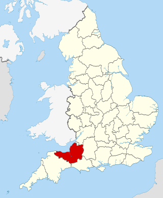
The county of Somerset is in South West England, bordered by the Bristol Channel and the counties of Bristol and Gloucestershire to the north, and Wiltshire to the east, Dorset to the south, and Devon to the west. The climate, influenced by its proximity to the Atlantic Ocean and the prevailing westerly winds, tends to be mild, damp and windy.

Dorset National Landscape is a National Landscape area in Dorset, southern England, formerly known as and still legally designated as the Dorset Area of Outstanding Natural Beauty (AONB). The conservation designation means that the area is protected and promoted for its landscape value. The area was established in 1959, one of the early wave of National Landscapes to receive the designation.


