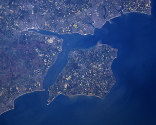
The Solent is a strait between the Isle of Wight and mainland Great Britain; the major historic ports of Southampton and Portsmouth lie inland of its shores. It is about 20 miles long and varies in width between 2+1⁄2 and 5 mi, although the Hurst Spit which projects 1+1⁄2 mi (2.4 km) into the Solent narrows the sea crossing between Hurst Castle and Colwell Bay to just over 1 mi (1.6 km).

The Beaulieu River, formerly known as the River Exe, is a small river draining much of the central New Forest in Hampshire, southern England. The river has many small upper branches and its farthest source is 8 miles (13 km) from its 4 miles (6 km)-long tidal estuary. Unusually, the river, including its bed, is owned by Lord Montagu of Beaulieu.
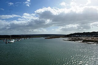
The River Yar on the Isle of Wight, England, rises near the beach at Freshwater Bay, on the south coast, and flows only a few miles north to Yarmouth where it meets the Solent. Most of the river is a tidal estuary. Its headwaters have been truncated by erosion of the south coast.

Chessel Bay is a 12.9-hectare (32-acre) Local Nature Reserve on the east bank of the River Itchen in Southampton in Hampshire. It is owned and managed by Southampton City Council. It is part of Solent and Southampton Water Ramsar site and Special Protection Area, and of Lee-on-The Solent to Itchen Estuary, which is a Site of Special Scientific Interest. It has been a local nature reserve since 1989

Bartley Water is a two-branch small river in the New Forest district of Hampshire, England. It drains the north and north-east of the New Forest National Park up to the A31 road, a watershed and two villages against the north-east side of the park.

Newtown River is a large natural inland harbour located on the Isle of Wight's northwestern coast, named after the nearby village of Newtown. It is sometimes also referred to as Newtown Creek.
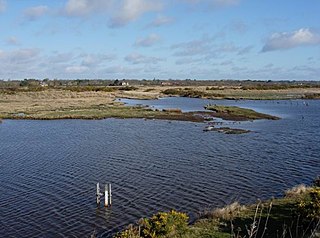
Keyhaven, Pennington, Oxey and Normandy Marshes, also known as the North Solent Marshes, are three areas of saltmarsh in Hampshire, England. The haven outpost of Milford-on-Sea, Keyhaven sits to the west, the village of Pennington to the north, and the town of Lymington to the northeast. The marshes lie behind Hurst Spit and fall within the Hurst Castle And Lymington River Estuary Site of Special Scientific Interest.
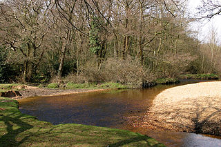
Avon Water is a small river draining some of the southwest of the New Forest in Hampshire to The Solent. West of the upper part of its archetypally dendritic drainage basin, which has formed due to the forest's heath soil, is the due south, much larger River Avon, rising in Wiltshire.

Eling and Bury Marshes is a 112.3-hectare (277-acre) biological Site of Special Scientific Interest between Totton and Southampton in Hampshire. It is part of Solent and Southampton Water Ramsar site and Special Protection Area, and of Solent Maritime Special Area of Conservation.

Hurst Castle and Lymington River Estuary is a 1,077.3-hectare (2,662-acre) biological and geological Site of Special Scientific Interest near Lymington in Hampshire. It is a Nature Conservation Review site and two areas are Geological Conservation Review sites. Three areas are local nature reserves, Boldre Foreshore, Sturt Pond and Lymington and Keyhaven Marshes; the latter site is managed by the Hampshire and Isle of Wight Wildlife Trust. Part of it is North Solent National Nature Reserve. It is part of Solent and Southampton Water Ramsar site and Special Protection Area. Parts of it are in Solent Maritime and Solent and Isle of Wight Lagoons Special Areas of Conservation.

Lee-on-The Solent to Itchen Estuary is a 585.9-hectare (1,448-acre) biological and geological Site of Special Scientific Interest which stretches along the coast between Southampton and Gosport in Hampshire. It is a Geological Conservation Review site. It is part of Solent and Southampton Water Ramsar site and Special Protection Area, and of Solent Maritime Special Area of Conservation. Three areas are Local Nature Reserves, Chessel Bay, Hook with Warsash and Mercury Marshes. One area is Hamble Common, a Scheduled Monument and public common.
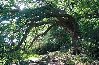
Lincegrove and Hackett's Marshes is a 37.8-hectare (93-acre) biological Site of Special Scientific Interest on the west bank of the River Hamble between Southampton and Fareham in Hampshire. It is part of Solent and Southampton Water Ramsar site and Special Protection Area, and of Solent Maritime Special Area of Conservation. Hackett's Marsh is a 20.4 hectares Local Nature Reserve.

Lymington River Reedbeds is a 41.7-hectare (103-acre) biological Site of Special Scientific Interest in Lymington in Hampshire. It is a nature reserve managed by the Hampshire and Isle of Wight Wildlife Trust. It is part of Solent and Southampton Water Ramsar site and Special Protection Area.
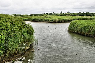
Titchfield Haven is a 134.5-hectare (332-acre) biological Site of Special Scientific Interest north-west of Gosport in Hampshire. Most of it is a local nature reserve and a national nature reserve. It is part of Solent and Southampton Water Ramsar site and Special Protection Area.

Upper Hamble Estuary and Woods is a 151.2-hectare (374-acre) biological Site of Special Scientific Interest east of Southampton in Hampshire. It is part of Solent and Southampton Water Ramsar site and Special Protection Area, and of Solent Maritime Special Area of Conservation. Part of the site is in Manor Farm Country Park, which is a Local Nature Reserve.
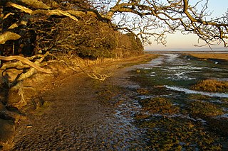
Boldre Foreshore is a 193.3-hectare (478-acre) Local Nature Reserve east of Lymington in Hampshire. It is owned by New Forest District Council and managed by the Hampshire and Isle of Wight Wildlife Trust. It is part of Solent and Southampton Water Ramsar site and Special Protection Area, Solent Maritime Special Area of Conservation, Hurst Castle and Lymington River Estuary Site of Special Scientific Interest and Lymington and Keyhaven Marshes, a nature reserve managed by the Hampshire and Isle of Wight Wildlife Trust.

Hook with Warsash is a 251.6-hectare (622-acre) Local Nature Reserve west of Fareham in Hampshire. It is owned by Hampshire County Council and managed by Hampshire Countryside Service. It is part of Solent and Southampton Water Ramsar site and Special Protection Area, of Solent Maritime Special Area of Conservation, and of Lee-on-The Solent to Itchen Estuary Site of Special Scientific Interest.

Lymington and Keyhaven Marshes is a 738-hectare (1,820-acre) nature reserve which stretches from Keyhaven along the south coast across the Lymington River in Hampshire. It is managed by the Hampshire and Isle of Wight Wildlife Trust. It is part of Solent and Southampton Water Ramsar site and Special Protection Area. Some areas are part of two Special Areas of Conservation, Solent and Isle of Wight Lagoons and Solent Maritime and Solent. It is also part of Hurst Castle and Lymington River Estuary, which is a Site of Special Scientific Interest, and of North Solent Marshes Nature Conservation Review site, Grade 2. Two areas are Geological Conservation Review sites, and two are Local Nature Reserves, Boldre Foreshore and Lymington-Keyhaven Marshes.

Mercury Marshes is a 6.4-hectare (16-acre) Local Nature Reserve in Hamble-le-Rice in Hampshire. It is owned by Hampshire County Council and managed by Hampshire Countryside Service. It is part of Solent and Southampton Water Ramsar site and Special Protection Area, of Solent Maritime Special Area of Conservation, and of Lee-on-The Solent to Itchen Estuary, which is a Site of Special Scientific Interest.

Sturt Pond is a 10.9-hectare (27-acre) Local Nature Reserve in Milford on Sea in Hampshire. It is owned and managed by Milford On Sea Parish Council. It is part of Solent and Southampton Water Ramsar site and Special Protection Area, of Solent Maritime Special Area of Conservation and of Hurst Castle and Lymington River Estuary, which is a Site of Special Scientific Interest.

