
Northumberland is a ceremonial county in North East England, bordering Scotland. It is bordered by the Scottish Borders to the north, the North Sea to the east, Tyne and Wear and County Durham to the south, and Cumbria to the west. The town of Blyth is the largest settlement.

Berwick-upon-Tweed, sometimes known as Berwick-on-Tweed or simply Berwick, is a town and civil parish in Northumberland, England, 2+1⁄2 mi (4 km) south of the Anglo-Scottish border, and the northernmost town in England. The 2011 United Kingdom census recorded Berwick's population as 12,043.

The Scottish Borders is one of 32 council areas of Scotland. It is bordered by West Lothian, Edinburgh, Midlothian, and East Lothian to the north, the North Sea to the east, Dumfries and Galloway to the south-west, South Lanarkshire to the west, and the English ceremonial counties of Cumbria and Northumberland to the south. The largest settlement is Galashiels, and the administrative centre is Newtown St Boswells.

Berwickshire is a historic county, registration county and lieutenancy area in south-eastern Scotland, on the English border. The county takes its name from Berwick-upon-Tweed, its original county town, which was part of Scotland at the time of the county's formation in the twelfth century, but became part of England in 1482 after several centuries of swapping back and forth between the two kingdoms. After the loss of Berwick, Duns and Greenlaw both served as county town at different periods.
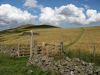
St Cuthbert's Way is a 100-kilometre (62 mi) long-distance trail between the Scottish Borders town of Melrose and Lindisfarne off the coast of Northumberland, England. The walk is named after Cuthbert, a 7th-century saint, a native of the Borders who spent his life in the service of the church. The route links Melrose Abbey, where Cuthbert began his religious life, with his initial burial place on Holy Island. Cuthbert achieved the status of bishop, and was called a saint eleven years after his death, when his coffin was opened and his remains found to be perfectly preserved.

The Monarch's Way is a 625-mile (1,006 km) long-distance footpath in England that approximates the escape route taken by King Charles II in 1651 after being defeated in the Battle of Worcester. It runs from Worcester via Bristol and Yeovil to Shoreham, West Sussex.

Berwick-upon-Tweed is a railway station on the East Coast Main Line, which runs between London King's Cross and Edinburgh Waverley. The station, situated 67 miles (108 km) north-west of Newcastle, serves the border town of Berwick-upon-Tweed in Northumberland, England. It is owned by Network Rail and managed by London North Eastern Railway.

Cockburnspath is a village in Berwickshire in the Scottish Borders. It lies near the North Sea coast between Berwick-upon-Tweed and Dunbar. Cockburnspath is the eastern terminus of the Southern Upland Way as well as the northern terminus of the Berwickshire Coastal Path. At the nearby village of Cove, there is a small fishing harbour.

Whiteadder Water is a river in East Lothian and Berwickshire, Scotland. It also flows for a very short distance through Northumberland before joining the River Tweed. In common with the headwaters of the Biel Water it rises on the low hillside of Clints Dod in the Lammermuir Hills, just ESE of Whitecastle Hillfort and 3 km (1.9 mi) south-east of the village of Garvald.

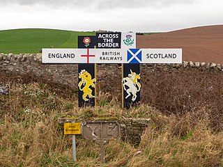
The Anglo-Scottish border is a border separating Scotland and England which runs for 96 miles (154 km) between Marshall Meadows Bay on the east coast and the Solway Firth in the west.
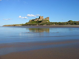
The Northumberland Coast National Landscape is a designated Area of Outstanding Natural Beauty (AONB) covering 40 miles (64 km) of coastline from Berwick-Upon-Tweed to the River Coquet estuary in the Northeast of England. Features include: Alnmouth, Bamburgh, Beadnell, Budle Bay, Cocklawburn Beach, Craster, Dunstanburgh Castle, the Farne Islands, Lindisfarne and Seahouses. It lies within the natural region of the North Northumberland Coastal Plain.

National Cycle Network (NCN) Route 76 is a Sustrans National Route that runs from Berwick-upon-Tweed to Kirkcaldy. The route is 168 miles (270 km) in length and is fully open and signed in both directions. Between Dunbar and Kirkcaldy the route is known as the Round the Forth.

Scremerston is a village in Northumberland, England. The village lies on the North Sea coast just under 2.5 miles (4 km) south of Berwick-upon-Tweed and 4.3 miles (7 km) from the Anglo-Scottish border. It is adjacent to the A1, providing access to Newcastle upon Tyne to the south, and to Edinburgh to the north.
The Scottish Coastal Way is a proposed national long-distance trail that goes around the coastline of mainland Scotland. The idea was first proposed by walkers, and in November 2009 Scottish Natural Heritage (SNH) hosted a conference on the subject. In 2010 SNH estimated that around 2,700 km of coastal paths and routes were existence, compared to a total coastline length of 10,192 km. The existing coastal paths were predominantly in the more populous parts of the country, and few coastal paths exist in more remote areas such as Highlands and Islands. It was recognised that a coastal route, along the lines of the Wales Coast Path, would have many positives, but that development of a fully waymarked route would conflict with conservation aims such as the preservation of the "wild land" qualities of much of the Scottish coast.

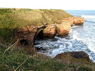
The North Northumberland Coastal Plain is a major natural region that lies on England's northeasternmost stretch of coastline on the North Sea. To the west lie the Cheviot Fringe, the Northumberland Sandstone Hills and Mid Northumberland; to the south it is continued by the South East Northumberland Coastal Plain.
The Berwickshire Coastal Path is a walking route some 48 kilometres (30 mi) long. It follows the eastern coastline of Scotland from Cockburnspath in the Scottish Borders to Berwick upon Tweed, just over the border in England. At Cockburnspath the path links with the Southern Upland Way and the John Muir Way.
Marshall Meadows Bay is the northernmost point of England. It is located on the Northumberland coast, 2+1⁄2 miles north of Berwick-upon-Tweed, and just to the south of the Anglo-Scottish border. Across the border in Scotland is the county of Berwickshire in the Borders region. The hamlet of Marshall Meadows lies to the west of the bay, and is the most northerly inhabited place in England. The Marshall Meadows Manor House Hotel is here, along with a farm and a caravan site. There is a disused tunnel from the caravan site to the bay below, and there is a small cave 300 m (1,000 ft) north of this tunnel, plus another small cave just around the corner of Marshall Meadows Point. Nearby is the A1 trunk road and the East Coast Main Line railway.

The King Charles III England Coast Path (KCIIIECP), originally known as the England Coast Path, is a proposed long-distance National Trail that will follow the coastline of England. When complete, it will be around 2,700 miles (4,300 km) long.
The geology of Northumberland in northeast England includes a mix of sedimentary, intrusive and extrusive igneous rocks from the Palaeozoic and Cenozoic eras. Devonian age volcanic rocks and a granite pluton form the Cheviot massif. The geology of the rest of the county is characterised largely by a thick sequence of sedimentary rocks of Carboniferous age. These are intruded by both Permian and Palaeogene dykes and sills and the whole is overlain by unconsolidated sediments from the last ice age and the post-glacial period. The Whin Sill makes a significant impact on Northumberland's character and the former working of the Northumberland Coalfield significantly influenced the development of the county's economy. The county's geology contributes to a series of significant landscape features around which the Northumberland National Park was designated.
