The Lyke Wake Walk is a 40-mile (64km) challenge walk across the highest and widest part of the North York Moors National Park in North Yorkshire, England. The route remembers the many corpses carried over the moors on old coffin routes and the ancient burial mounds encountered on the way; the name derives from a lyke, the corpse and the wake - watching over the deceased. Its associated club has a social structure, culture and rituals based on the walk and Christian and folklore traditions from the area through which it passes.
The idea of a walk originated from an article in the Dalesman magazine in August 1955. Its author, Bill Cowley, described a 40 miles (64km) walk across the North York Moors from east to west (or vice versa) on heather all the way except for when crossing one or two roads. Given the remoteness of the area, a lone walker might not encounter another during the one to two day journey. Cowley issued a challenge to see if anyone could walk from Scarth Wood Moor at the western extremity of the moors to Ravenscar on the coast, keeping on or close to the main watershed of the moorland, in a twenty-four-hour period. The first crossing was completed shortly afterwards on 1 and 2 October 1955. Cowley was in the party that made the crossing in 23 hours and he wrote a book, Lyke Wake Walk,[1] which he kept up to date by frequent revision. The book ran to twelve editions in the author's lifetime and sold many thousands of copies.[2] It was revised in 2001 by Paul Sherwood.[3]
Cowley's idea developed over the years before he issued the challenge in 1955. He wrote a poem in 1935/6, Storming Along, describing traversing the moors and mentions a number of the walk's landmarks.[4] His early contributions to the Dalesman, appear in retrospect, to hint at the idea of the walk[5] drawing on his appreciation of the works of the archaeologist Frank Elgee,[6][7] antiquarian and folklore expert Canon John Christopher Atkinson[8] and author and rambler Alfred J. Brown.[9][10]
Route
Scarth Wood Moor
The walk is usually done from west to east although it can be done in either direction. A successful crossing must be completed within 24 hours. There is no exact route but the Lyke Wake Club and its successor have rules regarding what can be considered a successful crossing. For record purposes the walk starts at its original departure point, the Ordnance SurveyTrig point on Scarth Wood Moor, near Osmotherley[11] (NGR: SE 459 997) and finishes in the bar of the Raven Hall Hotel in Ravenscar (NGR: NZ 981 018).[12] For practical purposes the acceptable end points are the Lyke Wake Stone adjacent to Sheep Wash car park at Cod Beck Reservoir at the western end (NGR: SE 467 992) and Beacon Howes car park where there is a second Lyke Wake Stone at the eastern end (NGR: NZ 969 012). Successful crossings must stick to the moorland summits as far as practicable and walkers straying into Eskdale are disqualified. The route crosses the Stokesley-Helmsley road (B1257) between Point 842 (Clay Bank Top) and Point 503 (Orterley Lane end), the Whitby-Pickering road (A169) between Point 945 (Sil Howe) and Point 701 (near Saltergate) and the Scarborough-Whitby road (A171) between Point 538 (Evan Howe) and Point 579 (Falcon Inn).[13] Point numbers are the height in feet above sea level as given on the one inch Ordnance Survey Tourist Map of the North York Moors (1970 edition); the metric equivalents are identified on the Landranger and Explorer Series maps.
The Wainstones on Hasty Bank
The original route began at Scarth Wood Moor trig point, followed the Alum/Jet Miners Track from Live Moor to Hasty Bank, then to Smuggler's Trod, Bloworth, Ironstone Railway, Esklets, White Cross (Fat Betty), Shunner Howe, Hamer, Blue Man-i'-th'-Moss, Wheeldale Stepping Stones, Fen House, Tom Cross Rigg, Snod Hill, Lilla Howe, Jugger Howe ravine, Helwath, Pye Howe Rigg, to Ravenscar (Raven Hall Hotel). This route is no longer possible as a section is within the Ministry of Defence controlled area at RAF Fylingdales Early Warning Radar Station.
Boundary Stone, Urra Moor
Most crossings now follow the classic route,[14] a variation of the original. It begins at Scarth Wood Moor trig point or the western Lyke Wake Stone in Sheepwash car park, follows the summit track from Live Moor over Carlton Moor, Cringle Moor, Cold Moor and Hasty Bank, Smuggler's Trod, Bloworth, Ironstone Railway, Esklets or South Flat Howe or Lion Inn, White Cross (Fat Betty), Shunner Howe, Hamer, Blue Man-i'-th'-Moss, Wheeldale Stepping Stones, Fen Bogs, Eller Beck, Lilla Howe, Jugger Howe ravine, Stony Marl Moor, to the eastern Lyke Wake Stone at Beacon Howes or Ravenscar. A summary description of the classic route with photographs is described by Richard Gilbert in his book, The Big Walks[15] and a guidebook is available.[16] A detailed illustrated description of the western half of the walk is given in Alfred Wainwright's A Coast to Coast Walk.[17] The classic route and the main alternatives are shown in the map.
Map of the Lyke Wake Walk. There is no defined route; this map shows what is usually described as the classic route, and the main alternatives.
Most crossings are done west to east. The original challenge, crossing towards the sea in an easterly direction is thought to be easier because of the prevailing wind from the west[18] making it easier to walk with the wind on one's back and with the heather lying away from the walker. On a west to east crossing, the major ascents and descents occur in the first ten miles when the walker is relatively fresh. A traverse of the Lyke Wake Walk route is referred to as a crossing and the act of participating in the walk is known as dirging.
In the first few years, the walk followed a difficult route requiring endeavour and physical endurance as there was no track over most of its length. From the mid-1970s the walk was re-thought because the numbers of people attempting it had, in places, eroded the ground surface,[19][20][21] and disturbance to game birds, sheep and wildlife by walkers and their support parties at all times of day and night, particularly in Osmotherley, Ravenscar and at remote farms. Footpath erosion was compounded by the walk sharing long stretches of its route with the Cleveland Way and Wainwright's Coast to Coast Walk. Other users, some legal, some illegal, including mountain bikes, motor cycles, quad bikes and agricultural and moorland management vehicles exacerbated the problem. Alternative routes are possible and the walk club works with the National Park authority to try to limit environmental damage.
The Ordnance Survey no longer marks the walk route on maps at the recommendation of the National Park Authority, as a measure to discourage large numbers undertaking a crossing and the walk was not mentioned in National Park Authority publication for a number of years.[22]
The Face Stone, on Urra Moor
Other long-distance walks in the area
Alternative challenge walks and trails include the Hambleton Hobble, the Shepherd's Round, the White Rose Walk, the Lyke Wake Way, the Monk's Trod, the Rail Trail, Hambleton Drove Road, the Crosses Walk and the long distance trails. A walk from west to east across the North York Moors around ten miles south of the Lyke Wake Walk from Gormire Lake to Cloughton Wyke termed, in a play on words, the Lake Wyke Walk has been suggested.[23]
The Lyke Wake Way is a non-challenge alternative from Osmotherley to Ravenscar on public rights of way via locations where accommodation and other facilities are available. It entails 50 to 60 miles (80 to 97km) of walking depending on the route taken and can be completed over two or three days.
Blue Man i' th' Moss, Wheeldale Moor
Alfred Wainwright suggested the walk could form an acceptable finish to his Coast to Coast Walk but did not specify if he recommends doing the 40 miles (64km) in a single push. There is no record of Wainwright completing the walk. There are no constraints on doing the walk in a more leisurely manner and a guide to doing the walk over four days has been published.[24]
Lyke Wake Clubs
The first Lyke Wake Club was formed immediately on completion of the first crossing. Those completing the first crossing were its foundation members.[25][26][27]
The walk takes its name from the "Lyke-Wake Dirge", probably Yorkshire's oldest surviving dialect verse,[28] which is about watching over the wake of the corpse (lyke).[29] Cowley proposed linking the walk and the dirge before the first crossing had been completed.[30] The song tells of the soul's passage through the afterlife.[31] The walk does not follow a corpse road, although it has been suggested it does,[32][33][34][35] though there is no historical or archaeological evidence for it.[36][37] The physical challenge, possibility of bad weather and difficult conditions make the dirge an appropriate club song.
The club established its own culture and developed traditions based around the dirge, aspects of Cleveland history, superstitions and folklore, and rituals associated with suffering, death, funerals and the after-life that are broadly Yorkshire, northern English and Christian in character, with an acknowledgement of local folklore and the pagan forebears who originally inhabited the moorlands. Club meetings were termed "wakes" and the club badge was coffin shaped and decorated with the Ordnance Survey symbol for a tumulus (burial mound), many of which are found along the route. Its culture is of solemnity regarding issues of ritual, folklore and mortality but with light-hearted aspects relating to the self-inflicted suffering of participants undertaking the 40-mile (64km) walk. Club membership was/is granted on submission of a written report of a successful crossing and entitles successful walkers to a membership card in the form of a black-edged condolence card bearing the club crest, a black coffin. Many crossing reports are humorous and in various forms including prose, poetry,[38] maps, post-mortem reports, last wills and testaments, plays, etc., some of which are quoted in the many editions of Cowley's Lyke Wake Walk book and in a separate volume devoted to literature and artwork contributed by members.[39] Female members are termed "Witches", males are "Dirgers".
Typical Lyke Wake Walk terrain, Fylingdales Moor
The walk emerged when outdoor challenges and sponsored fund-raising events were becoming a feature of national life.[40] It became popular and was considered a "rite of passage" for outdoor enthusiasts in Yorkshire in particular and across the north of England. It became a challenge for fundraisers for good causes. Reliable estimates, based on club records, put the number of people having completed a crossing at more than 250,000. Possibly more than 30,000 made more than one crossing, a significant number have completed it more than ten times and a handful have made more than a hundred. One estimate put the total number of crossings up to 1994 at one million, but this is not supported by records.[41] The club celebrates walkers who have undertaken multiple crossings with awards called degrees[42] acknowledging their knowledge of the route, the moorland and its culture. The club designated Cowley as "Chief Dirger" and other officers included a Melancholy Mace Bearer, Harassed Archivists, Melodious Minstrels, a Cheerless Chaplain, a Horrible Horn-blower and an Anxious Almoner. Degrees conferred include Master/Mistress of Misery, Doctor of Dolefulness and Past Master/Mistress. Walkers who completed more than one hundred crossings are referred to as Senile Centenarians and as of March 2016, four people have achieved this landmark.[43]) The requirements for degrees are:
Degree
Crossings
Notes
Master/Mistress of Misery
3 (minimum)
Must have done the walk in both directions entitling the recipient to wear a black neckband at wakes and other functions.
Doctor of Dolefulness
7 (minimum)
Must have done walk in both directions including an unsupported crossing and a winter crossing in December, January or February. Must present a thesis at a wake on a subject relating to the walk or club, entitling the recipient to wear a purple neckband at wakes and other functions.
Past Master/Mistress
15 (minimum)
In addition to the requirements for Doctor status, the recipient must have performed "great services to the club" and be capable of "finding the way across any moor by day or night, whether drunk or sober without map or compass" entitling him/her to wear a purple & black boutonniere at wakes and other functions. It is awarded on an honorary basis by the club and cannot be applied for.
The New Lyke Wake Club has instituted the degree of "Purveyor of Purgatory"[44] for leaders who have successfully, and without mishap, conducted three (or more) parties on the walk. It can be awarded in absentia but the other degrees are only awarded when the recipient is in attendance at a wake.
The walk's popularity owes much to Cowley's book which gives insights into the history, archaeology, geography, natural history, and folklore of the moors.[45] The book describes the club and its culture in a tongue-in-cheek humorous style. Its first edition contained a list of the successful crossings up to October 1958. The possibility of inclusion in future editions together with the use of quotes from some crossing reports became an incentive to those taking on the challenge and inspired correspondents to be inventive and "attain literary heights".
Cowley died on 14 August 1994.[46] The Lyke Wake Club, he founded, closed in October 2005, the walk's 50th anniversary. A new club has been established – not without controversy[47][48] – to preserve the traditions established by Cowley and take over the old club's functions of recording crossings, holding wakes and liaising with public authorities. The New Lyke Wake Club's activities have included donating funds to the North York Moors National Park young explorers conservation group,[49] Cleveland Search and Rescue Team,[50] and a short story competition for schools within the National Park.[51] The new club maintains up-to-date route information on its website,[52] funds footpath repairs and removes litter along the route, and gives grants to young club members for educational and outdoor pursuits purposes.
Lyke Wake Club Condolence Card
Both the original and new clubs' criterion for membership is the completion of a crossing within 24 hours, and there are no honorary, associate or corporate members. A concession is that anyone can claim an extra 12 hours for every five years over the age of 65[53] but, although there have been crossings by older walkers, some over eighty years old, there is no record of any of them claiming the concession. In earlier years signing in/out books were kept at the Queen Catherine Hotel in Osmotherley and at Pollard Cafe in Ravenscar. The Lyke Wake Clubs have not monitored individual crossings for compliance with the rules, as Cowley stated "No one who is going to do this Walk is going to cheat, the satisfactions of crossing successfully are entirely for the individual".[54]
Lyke Wake Race
Once the route became established as a clear track, the Lyke Wake Club considered the possibility of holding a race. The first Lyke Wake Race was held in 1964 and was held annually on the nearest Saturday to 10 July (except 2001 when it was cancelled because of an outbreak of foot-and-mouth disease) until 2014, its 50th anniversary when the organisers ceased to be involved.[citation needed] In 2015, the race continued with the organisation undertaken by the Quakers Running Club.[55] It has been held every July since, until the 2020 edition was cancelled due to the COVID-19 pandemic, resuming in 2022.
The first race was organised to coincide with the Osmotherley Summer Games. It started at Beacon Howes with the finishing line in Osmotherley. Both events were organised on the same date for a number of years. In the early years the Puckrin brothers, Arthur, Philip and Richard, were prominent amongst the leading runners with the first two brothers winning nine of the first ten races between them.[56] Other winners have included prominent athletes/fell runners such as Joss Naylor.[57] A history of the race up to 1981 has been given by Bill Smith.[58] Since the Quakers took over the race, it has been held in an eastern direction, starting at Sheepwash and finishing in Ravenscar.
The tradition of the Lyke Wake Walk and Lyke Wake Race is that crossing times are rounded to next whole minute; seconds are not recorded.[59]
The race is held under a handicap basis, with runners estimating their time beforehand and being given a different starting time on the estimation that all runners finish at the same time. Prizes are awarded for first male and female finishers and fastest male and female runners.
The race was first held in 1964, running from Ravenscar Beacon to Osmotherley. In 1976, due to moorland fires, the race was run out-and-back, starting in Osmotherley and taking in the first half of the traditional route. By 1998, the race was run from Sheepwash to Ravenscar, and in 2001 was cancelled entirely due to foot-and-mouth disease.[60]
Additional information
The walk has attracted media interest with television coverage, radio programmes and print articles.[61] In its 60th anniversary year, 2015, the BBC Radio 4 feature Ramblings, hosted by Clare Balding, dedicated an episode to the Lyke Wake Walk with broadcast dates 4 June and 6 June 2015.[62]
The archives, records and artefacts of the original Lyke Wake Club have been deposited in the North Yorkshire County Archives in Northallerton and Ryedale Folk Museum, Hutton-le-Hole.
The North York Moors is an upland area in north-eastern Yorkshire, England. It contains one of the largest expanses of heather moorland in the United Kingdom. The area was designated as a National Park in 1952, through the National Parks and Access to the Countryside Act 1949. Covering an area of 554 sq mi (1,430 km2), the National Park has a population of 23,380. It is administered by the North York Moors National Park Authority, which is based in Helmsley.
The Coast to Coast Walk is a long-distance footpath between the west and east coasts of Northern England, nominally 190-mile (306 km) long. Devised by Alfred Wainwright, it passes through three contrasting national parks: the Lake District National Park, the Yorkshire Dales National Park, and the North York Moors National Park. The current actual measured distance is reported as 182-mile (293 km).
Robin Hood's Bay is a village in North Yorkshire, England. It is 6 miles (10 km) south of Whitby and 15 miles (24 km) north of Scarborough on the Yorkshire Coast.
The Esk Valley Walk is a long distance footpath in North Yorkshire, England. The route first follows a loop on the North York Moors to the south of Castleton, then shadows the River Esk on its journey to the North Sea. Waymarking uses the symbol of a leaping salmon, with yellow arrows denoting footpaths and blue arrows bridleways.
Osmotherley is a village and civil parish in the Hambleton hills in North Yorkshire, six miles north-east of Northallerton. The village is at the western edge of the North York Moors National Park. Osmotherley is on the route of the 110-mile Cleveland Way, one of the National Trails established by Natural England.
A dirge is a somber song or lament expressing mourning or grief, such as may be appropriate for performance at a funeral. Often taking the form of a brief hymn, dirges are typically shorter and less meditative than elegies. Dirges are often slow and bear the character of funeral marches. Poetic dirges may be dedicated to a specific individual or otherwise thematically refer to death.
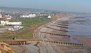
Ravenscar is a coastal village in the former Scarborough district of North Yorkshire, England. It is within the civil parish of Staintondale and the North York Moors National Park, and is 10 miles (16 km) north of Scarborough. The sea around the area hosts a seal colony.
Cringle Moor, at 432 m (1,417 ft), is the third-highest hill in the North York Moors, England, and the highest point west of Clay Bank.
Newton Dale Halt railway station is a request stop on the North Yorkshire Moors Railway and serves as a stopping off point for walkers around Newton Dale and Cropton Forest in the North York Moors National Park, North Yorkshire, England. When the station was opened, the station signs were written as Newtondale Halt.
Cod Beck Reservoir is a man-made lake situated within the North York Moors National Park and near the village of Osmotherley in the English county of North Yorkshire. The reservoir is named after Cod Beck, which is the small river that fills it.
The Cleveland Way is a National Trail in the historic area of Cleveland in North Yorkshire, Northern England. It runs 110 miles (177 km) between Helmsley and the Brigg at Filey, skirting the North York Moors National Park.
The White Rose Walk, a 35-mile (56 km) trail located in North Yorkshire, England, was devised in 1968 by the Yorkshire Wayfarers, It starts at the Kilburn White Horse and is completed by touching the trig point on top of Roseberry Topping. The walk whilst recognised by the Long Distance Walkers Association (LDWA) as a long distance walk in itself, mixes and crosses with several other long distance paths including the Cleveland Way, the Coast to Coast Walk, and the Lyke Wake Walk. The route takes in the highest peaks in the area such as Live Moor, Carlton Moor, Sutton Bank, Cold Moor, the Wainstones and Urra Moor. The walk also passes Captain Cooks Monument on Easby Moor.
Ravenscar was a railway station on the Scarborough & Whitby Railway and served the village of Ravenscar, North Yorkshire, England.
The Rosedale Railway was a 19.5-mile (31.4 km) goods-only railway line running from Battersby Junction via Ingleby Incline, across the heights of the North York Moors in North Yorkshire, England to reach iron ore deposits in the remote hills of the Rosedale valley. It opened to traffic as a narrow gauge railway to Ingleby Incline top in 1858, converted to standard gauge and opened to Rosedale West in 1861, and closed completely in 1929. Apart from Ingleby Incline, no major engineering works were constructed, and as such, particularly the east branch, the railway followed the contours of the surrounding hillside. The former trackbeds of the railway are in use by walkers and cyclists.
The Ainsty Bounds Walk is a 44-mile (71 km) long-distance footpath mostly in North Yorkshire, England, with a short section in West Yorkshire. It follows the boundaries of the ancient wapentake of The Ainsty, between the rivers Wharfe, Nidd and Ouse, and passes through the towns of Boston Spa, Wetherby, Moor Monkton, the outskirts of York, and Bolton Percy. As a circular walk it can be walked from any point, but it is considered to start and finish at Tadcaster.
Dalesman is a British monthly regional magazine, based in Skipton, serving the English county of Yorkshire. Its first edition was published in March 1939, under the original title of The Yorkshire Dalesman: A Monthly Magazine of Dales' Life and Industry.
William Reginald Mitchell was a British writer who was the editor of Dalesman magazine for twenty years and over a sixty-year period wrote over 200 books, hundreds of articles, and delivered many talks on the history and physical and natural evolution of North Britain, with particular emphasis on the Yorkshire Dales, Lancashire and the Lake District. These include the regions' biographies, social history, topography, and natural history. In the course of his career Mitchell made and collected many taped interviews with people of these regions - now housed at the Universities of Leeds and Bradford - representing a unique archive of dialect and history.
The A169 is an A road in North Yorkshire, England. It runs from the A64 at Malton on the edge of the Yorkshire Wolds through the Vale of Pickering and across the North York Moors to join the A171 just west of Whitby. It is a single carriageway for all of its 25-mile (40 km) route. Whilst it is not considered a Primary Route nationally, the Ryedale Local Transport Plan lists it as part of its Major Road Network alongside the A64, A166 and A171.
The Lion Inn is a public house at Blakey Ridge, near Kirkbymoorside, in North Yorkshire, England. The building was completed between 1553 and 1558, and has been used as an inn for four centuries, sitting adjacent to a road across the moors between Castleton and Hutton-le-Hole. During the ironstone industry boom in Rosedale, it catered mainly for those engaged in the mining industry. The inn is known for being subjected to extremes of weather, like Tan Hill Inn, also in North Yorkshire.
Lilla Cross is a marker on Lilla's Howe, Fylingdales Moor, in North Yorkshire, England. A story relates how King Edwin of Northumbria placed the cross there to mark the grave of Lilla, one of his thegns who saved his life during an assassination attempt. Whilst the current cross is believed to date to the 10th century, the original was placed there in 626. Even so, Lilla Cross is known for being the oldest marker of its type on the North York Moors. The ancient cross marks the intersection of pathways across the moor, the edges of four parishes and is also a waymarker on the Lyke Wake Walk.
References
↑ Cowley, Bill (1959). Lyke Wake Walk: Forty Miles Across the North Yorkshire Moors (1sted.). Skipton, Yorkshire: Dalesman Books.
↑ Cowley, Bill (1993). Lyke Wake Walk and the Lyke Wake Way (12thed.). Skipton, Yorkshire: Dalesman Books. ISBN1-85568-063-7.
↑ Cowley, Bill (1945). Tara Devi and Other Verses. India: Punjab Boy Scouts Association.
↑ "Obituary: Bill Cowley". The Guardian. 17 August 1994. ISSN0261-3077.
↑ Elgee, F. W. (1912). The Moorlands of North-East Yorkshire. London: Brown & Sons.
↑ Elgee, F. W. (1930). Early Man in North-East Yorkshire. Gloucester: John Bellows.
↑ Atkinson, John C. (1891). Forty years in a Moorland Parish: reminiscences and researches in Danby in Cleveland. London: Macmillan. Later editions: 1907, 1967 and 1983.
↑ Brown, Alfred J. (1952). Fair North Riding. London: Country Life.
↑ Brown, Alfred J. (1945). Striding Through Yorkshire. London: Country Life.
↑ Goodman, Jim (1997). The Lyke Wake Walk in Quarter Mile Steps. London: Minerva Press. ISBN1-8610-6368-7.
↑ Wilson, Ken; Gilbert, Richard (1980). The Big Walks: Challenging Mountain Walks and Scrambles in the British Isles. London: Diadem Books. ISBN0-906371-60-0.
↑ Smailes, Brian (2013). The Lyke Wake Walk Guide (4thed.). South Yorkshire: Challenge Publications. ISBN978-1-903568-70-5.
↑ Cleare, John (1988). Fifty Best Hill Walks of Britain. Exeter: Webb & Bower. ISBN978-0-86350-142-5.
↑ Smailes, Brian (1994). The Novices Guide to Completing the Lyke Wake Walk. Barnsley: Challenge Publications. Photographic Plates 3 & 4. ISBN978-0-95269-001-6.
This page is based on this Wikipedia article Text is available under the CC BY-SA 4.0 license; additional terms may apply. Images, videos and audio are available under their respective licenses.