Frank Elgee

Last updated

Frank Elgee
Born
Frank Watson Elgee

(1880-11-08)8 November 1880
Died7 August 1944(1944-08-07) (aged 63)
Alton, Hampshire, England
NationalityBritish
Scientific career
FieldsArcheology
Geology

Frank Watson Elgee (born 8 November 1880 in North Ormesby (Middlesbrough) Yorkshire, England) was a published archaeologist, geologist and naturalist. He wrote several books on the North York Moors such as The Moorlands of North-Eastern Yorkshire (1912), [1] [2] The Romans in Cleveland (1923) and Early Man in North East Yorkshire (1930). In 1933 Leeds University conferred on him an Honorary degree of Doctor of Philosophy. [3]

Contents

The North York Moors national park North York Moors - geograph.org.uk - 659785.jpg
The North York Moors national park

Early life and career

He was born in Kings Road, North Ormesby the eldest of four children – Frank Watson (1880), Allan (1883), Edward (1885), and Amy Maria (1887–1942). His father, Thomas (1851–1939) was Clerk and Bookkeeper at the local Pig iron works. His mother, Jane née Coates (1851–1907), was in poor health but dealt with his early education and he attended the local Public Elementary School in North Ormesby. In 1887 he went to Derwent Street Board School [4] [5] and then in 1893 'The Higher Grade School' that had just opened, later known as 'The Hugh Bell [Higher Grade] School' with his brother Allan, [6] on the corner of Albert Road and Grange Road in Middlesbrough.

In May 1888 he caught scarlet fever, resulting in his becoming short sighted and partially- deaf.

Albert Park, Middlesbrough West Bank of the Lower Lake, Albert Park - geograph.org.uk - 609324.jpg
Albert Park, Middlesbrough

In 1892, his family moved to Middlesbrough and it was Albert Park [7] that became his source of interest and his playground. It was here that he contracted pneumonia that rendered him very weak with empyema. For many years he had to use a bath chair.

In 1895 he worked at William Jacks & Co, Iron Merchants. This was after a further period of ill health when he was unable to take examinations. In April 1897 he had to leave to have a serious chest operation at North Riding Infirmary. [8] He remained for only a short period and being very weak he was carried by his father so he could die at home.

Boundary Stone at Urra Moor Boundary Stone, Urra Moor - geograph.org.uk - 11308.jpg
Boundary Stone at Urra Moor

His will to live was strong and he was taken to recuperate at Ingleby Greenhow near the foot of Urra Moor, North York Moors national park's highest point, here he took in the sights of the North Eastern moorland, the blue escarpments, the plant life, insects, birds and observed the Cleveland Hills from his wheelchair.

It was Ingleby Greenhow's Vicar, The Reverend John Hawell [9] - who was a natural history specimens collector, the choncology section secretary of "Clevelands Naturalists' Field Club" and later President in 1891, 1895, 1896, 1903 and 1904 [10] – that attracted him to the subject. [11] He joined the Cleveland Naturalists' Field Club on his return to Middlesbrough, becoming Honorary Assistant Secretary in 1899 until 1906 before he became Honorary Secretary in 1907 until 1921 then President in 1922 and 1923 [12] – he was a vice president from 1924 until 1932. [13] [14] [15] During the time he was not in work, he taught himself the languages Latin, French and German in addition to studying Botany, Geology, Conchology and Astrology. This three-month stay was a defining moment of his life, he resolved to investigate and understand the area's origins that increased and fired his curiosity. The areas near Eston Nab were close by and the main place for his future investigations.

He received a prize from The Northern Weekly Gazette for the best contribution on entomology or astronomy. He used this towards bus and train fares or to pay for a night's lodging at a remote moorland farm. This allowed him to cover the whole of the northeast moorland. Frank could investigate the moors in the summer and in the winter, and during bad weather, he would read and write keeping a careful record of his travels and investigations, and maintain his diaries – he referred to this as 'dry work'. [16] [17]

North York Moors and Dorman Museum

Dorman Museum Dorman Museum - geograph.org.uk - 764314.jpg
Dorman Museum

In 1904 Frank became Assistant Curator to the Dorman Museum and he held this post until 1923 when he became Curator. He then carried out carefully planned work that allowed him to cover greater distances across the 400 square miles (1,000 km2) of the moors. In 1905 he elaborated in a speech to the Yorkshire Naturalists Union [18] an account of the 'Problems of the Fauna of North-east Yorkshire'.

By 1907 he started writing and compiling information for his first book. After being unhappy about the outcome, he altered and rewrote the composition in 1910, revised again both in the winter of 1911 and again the following year. His book, The Moorlands of North-East Yorkshire, a regional survey that was the first published in the area.

The Yorkshire Post commented on Elgee's work 'The Moorlands of North East Yorkshire': 'Elgee may by his several studies historic and natural historical be conceded rights of pre-eminent domain over the moorlands of North Eastern Yorkshire, and he has added to his rights by this substantial and handsome book.'

In 1907 he read to the Cleveland Naturalist Field Club about The Origins of Cleveland Moors 'The Fauna of Cleveland Past and Present'. He also had published in 'The Naturalist' his findings and views on 'The Driftless Area of North-eastern Yorkshire and its Relationship to the Distribution of certain plants and animals, and Glacial Survivals' [19]

The Blue Man-i'-th'-Moss stands on Wheeldale Moor [20] and the name came from the Celtic word, Maen, meaning a 'standing stone'. Frank Elgee did consider that the Blue element of the stone's name came from the Cornish Plu which means 'parish as the Blue Man' acting as a boundary stone for the parish. The Moss part of the name is because the area can be extremely boggy. [21] Frank Elgee at The High Bridlestones. [22] [23]

Former Village Shop in Commondale Former Village Shop, Commondale - geograph.org.uk - 510639.jpg
Former Village Shop in Commondale
Wade's Causeway Wade's Causeway.jpg
Wade's Causeway

He lived from 1920 to 1931 with his wife Harriett Louisa née Wragg (1881–1972) – they met in Danby in August 1911 whilst on holiday and married in July 1914 in Middlesbrough – in the small village of Commondale on the North York Moors along the road between Kildale and Danby, North Yorkshire. He would travel to work on The Esk Valley Line from Commondale railway station. [24]

Frank Elgee became Curator of the Dorman Museum, Middlesbrough, in 1923, having been Assistant Curator since 1904. At this point he had turned his attentions mainly to Archaeology. In 1923 he published a handbook called 'The Romans in Cleveland' compiling a catalogue of the antiquities of North East Yorkshire. He published two books, the first in 1930 'Early Man in North East Yorkshire', and together with his wife Harriett, wrote 'Archaeology of Yorkshire'.

He was instrumental in the excavation of the Iron Age Hillfort at Eston Nab. Frank Elgee as curator of the Dorman Museum, in 1927, uncovered parts of an earthenware cremation urn, together with burnt bone and Flint. These possibly dated from 1800 BC. [25] He discovered The Sleddale Stone Circle, Wayworth Moor, [26] Cleveland. This is 30 yards in diameter and contains 16 stones each about 3 feet high, of which only six remained standing. [27] [28]

In 1929 Elgee reported on excavations at Eston Camp. These were carried out by subscriptions from members of the Cleveland Naturalists' Field Club. Seven weeks work through up information on the age and form of construction. Trenches revealed stone rubbers, quartzite Hammer-Stones, burnt sandstones, flint scrapers and chips. Fragments of calcined human bones, lines of sandstone blocks, an arrowhead of black chert, three stone discs, reddish pottery, a stone chopper, pear-shaped stones probably used in slings – all found on the south side of the higher central camp. A late Bronze Age was given for Eston pottery. [14] [29]

In 1933 Frank resigned as Curator due to ill health and his wife Harriett Wragg Elgee was appointed Curator, holding that position until 1938. Whenever possible he still played an active part in the development of the museum and led groups to Orkney and Holy Island, Anglesey. In 1937 he organised the excavation of the burial mound at Loose Howe but his failing health meant that the work was largely directed by his wife. In 1933 his work was recognised and he was awarded an Honorary Ph.D. by Leeds University. He was elected an Honorary Member of the Yorkshire Philosophical Society in 1936. In 1938, Dr. Frank Elgee and his wife Harriett moved to Alton, Hampshire, though he continued to communicate with his former local archaeologists right up until his death in 1944. His move because of deteriorating health was to be in a warmer climate. [16]

He was also a keen student and recorder of the North Yorkshire dialect and wrote poetry in the local dialect. The 'pannierman' is a poem about bygone life on the North York Moors, and refers to Pannierman Causeway and Wade's Causeway. [30] A member of the 'Yorkshire Dialect Society' he wrote the poem 'An Inheritor of the Earth'. [31]

The Dorman Museum has material including a library of archaeological journals and photographs taken by Frank Elgee during his excavations. Principally at the Bronze Age hill fort at Eston Nab and burial grounds at Loose Howe. [32] [33] [34] [25] A Dugout canoe recovered from the River Tees at a depth of eight feet in 1926 is on view at the museum. [35] There is only one item from Creswell Crags held at the museum. A single quartzite pebble from Pin Hole. [36]

Books, papers and poems

North York Moors map North York Moors map en.png
North York Moors map
Scarth Wood Moor Scarth Wood Moor - geograph.org.uk - 5544.jpg
Scarth Wood Moor
View from Pannierman's Causeway above Rosedale Intake View from Pannierman's Causeway above Rosedale Intake - geograph.org.uk - 82129.jpg
View from Pannierman's Causeway above Rosedale Intake

Death, memorials, epitaph and lasting legacy

Dr Frank Elgee died on 7 August 1944 in Alton, Hampshire; he was 63 years old. He was succeeded by his wife Harriet who worked with him and helped him as his health faded. She had hoped he could be brought back to be buried on his beloved moors but was laid to rest on a hill in Alton Cemetery. [15] [40] Elgee's grave was renovated in 2016 as it was in a dilapidated state. [41]

Elgee's wife Harriett gave her epitaph – 'His labours had been Herculean; his physical strength was nothing but frailty; his monetary resources were meagre and he stands for the triumph of mind over body; of spirit over matter, a scholar saint of Yorkshire Moorlands; as having entered fully into his rights of pre-Eminent domain as their Genius loci, unto whom all is revealed'. [42]

The Frank Elgee memorial was erected in 1953 at Blakey Ridge on the North York Moors, overlooking Loose Howe at Rosedale Head, Rosedale, North Yorkshire. [43] [44] The commemorative memorial stone to Frank Elgee, erected by Yorkshire Archaeological Society, carved by Danby Mason, Mr F Weatherall, is positioned near 'Ralph's Cross' on the highest point of the Moorland Road from Castleton, North Yorkshire to Hutton-le-Hole, over Blakey Ridge. [45] [46]

Elgee Memorial Lectures are held at The Dorman Museum every year. [47]

The Dorman Museum, opened in 1904, also has a green plaque dedicated to Frank Elgee the curator between 1923 and 1932. [48] [49]

Related Research Articles

<span class="mw-page-title-main">Lyke Wake Walk</span> Challenge walk in North Yorkshire, England

The Lyke Wake Walk is a 40-mile (64 km) challenge walk across the highest and widest part of the North York Moors National Park in North Yorkshire, England. The route remembers the many corpses carried over the moors on old coffin routes and the ancient burial mounds encountered on the way; the name derives from a lyke, the corpse and the wake - watching over the deceased. Its associated club has a social structure, culture and rituals based on the walk and Christian and folklore traditions from the area through which it passes.

<span class="mw-page-title-main">North York Moors</span> Upland area in North Yorkshire, England

The North York Moors is an upland area in north-eastern Yorkshire, England. It contains one of the largest expanses of heather moorland in the United Kingdom. The area was designated as a National Park in 1952, through the National Parks and Access to the Countryside Act 1949. Covering an area of 554 sq mi (1,430 km2), the National Park has a population of 23,380. It is administered by the North York Moors National Park Authority, which is based in Helmsley.

<span class="mw-page-title-main">Eston</span> Town in North Yorkshire, England

Eston is a former industrial town in the Redcar and Cleveland unitary area of North Yorkshire, England. The local authority ward covering the area had a population of 7,005 at the 2011 census. It is part of Greater Eston, which includes the outlying settlements of Grangetown, Normanby, South Bank, Teesville and part of Ormesby.

<span class="mw-page-title-main">Redcar and Cleveland</span> Borough in North Yorkshire, England

Redcar and Cleveland is a local government district with borough status in the ceremonial county of North Yorkshire, England. Its council has been a unitary authority since 1996, being a district council which also performs the functions of a county council.
<span class="mw-page-title-main">Normanby, Redcar and Cleveland</span> Area of Redcar and Cleveland, North Yorkshire, England

Normanby is an area in the borough of Redcar and Cleveland, North Yorkshire, England. A ward covering the area had a population of 6,930 at the 2011 census. It is part of Greater Eston, which includes the area and the outlying settlements of Eston, Grangetown, South Bank, Teesville and part of Ormesby.

<span class="mw-page-title-main">Ormesby</span> Area of Middlesbrough and Redcar and Cleveland, North Yorkshire, England

Ormesby is a village and area split between the unitary authority areas of Middlesbrough and Redcar and Cleveland in North Yorkshire, England. The Ormesby ward, including Overfields and Ormesby Hall, had a population of 5,942 at the 2011 census.

<span class="mw-page-title-main">South Bank, Redcar and Cleveland</span> Town in North Yorkshire, England

South Bank is a former industrial town in the Redcar and Cleveland borough in North Yorkshire, England on the south bank of the River Tees. It is 3 miles (4.8 km) east of Middlesbrough and 6 miles (9.7 km) south-west of Redcar. The town is served by South Bank railway station.

<span class="mw-page-title-main">Cringle Moor</span> Hill in Yorkshire, England

Cringle Moor, at 432 m (1,417 ft), is the third-highest hill in the North York Moors, England, and the highest point west of Clay Bank.

<span class="mw-page-title-main">Commondale railway station</span> Railway station in North Yorkshire, England

Commondale is a railway station on the Esk Valley Line, which runs between Middlesbrough and Whitby via Nunthorpe. The station, situated 16 miles 72 chains (27.2 km) south-east of Middlesbrough, serves the village of Commondale, Scarborough in North Yorkshire, England. It is owned by Network Rail and managed by Northern Trains.

<span class="mw-page-title-main">Wade's Causeway</span> Sinuous, linear monument in the North York Moors national park in North Yorkshire, England

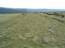
Wade's Causeway is a sinuous, linear structure of human construction located in the North York Moors national park in North Yorkshire, England. Its origins, age, purpose and extent are subject to ongoing research and debate and have not been reliably established: it was excavated in mid-20th century and dated to the Roman period, but 21st century re-interpretations have suggested a possible Neolithic origin. The name may be used to refer specifically to scheduled ancient monument number 1004876, a length of stone course just over 1 mile (1.6 km) long on Wheeldale Moor. It may be also be applied more broadly to include an additional postulated extension of this structure, incorporating ancient monuments numbers 1004108 and 1004104 which extend to the north and south of Wheeldale for up to 25 miles (40 km). The visible course on Wheeldale Moor consists of an embankment of soil, peat, gravel and loose pebbles 0.7 metres (2.3 ft) in height and 4 to 7 metres in width. The gently cambered embankment is capped with un-mortared and loosely abutted flagstones. Its original form is uncertain since it has been subjected to weathering and human damage.

<span class="mw-page-title-main">Dorman Museum</span> Museum in Middlesbrough, England

Dorman Museum is a local and social history museum on the town centre side of Albert Park, Linthorpe in Middlesbrough, North Yorkshire, England. It is one of two museums operated by the local borough council, along with the Captain Cook birthplace in Stewart Park. As of May 2024 the museum remains closed for renovations.

<span class="mw-page-title-main">Greater Eston</span> Unparished area in North Yorkshire, England

Greater Eston is part of the Borough of Redcar and Cleveland, North Yorkshire, England. The name is used by the borough council to describe the centres of Eston, Grangetown, Normanby, Ormesby, South Bank and Teesville.

<span class="mw-page-title-main">Cleveland Hills</span>

The Cleveland Hills are a range of hills on the north-west edge of the North York Moors in North Yorkshire, England, overlooking Cleveland and Teesside. They lie entirely within the boundaries of the North York Moors National Park. Part of the 110-mile (177 km) long Cleveland Way National Trail runs along the hills, and they are also crossed by a section of Wainwright's Coast to Coast Walk. The hills, which rise abruptly from the flat Tees Valley to the north, include distinctive landmarks such as the cone-shaped peak of Roseberry Topping, near the village of Great Ayton – childhood home of Captain James Cook.

<span class="mw-page-title-main">Rosedale, North Yorkshire</span> Valley in North Yorkshire, England

Rosedale is a valley located almost in the centre of the North York Moors national park in North Yorkshire, England. The nearest town is Kirkbymoorside, some 7 miles (11 km) to the south. Rosedale is surrounded by moorland. To the north-west sits Blakey Ridge at over 1,300 feet (400 m) above sea level. At Dale Head is the source of the River Seven,which flows down the valley to join the River Rye at Little Habton near Malton. At its southern end Rosedale is squeezed between Spaunton Moor and Hartoft Rigg, where the river flows out through Forestry Commission woodland before passing the village of Cropton to reach the plains of the Vale of Pickering.

<span class="mw-page-title-main">Yorkshire Philosophical Society</span> Charitable learned society in the City of York, North Yorkshire, England

The Yorkshire Philosophical Society (YPS) is a charitable learned society which aims to promote the public understanding of the natural sciences, the social sciences, and the archaeology and history of York and Yorkshire.

<span class="mw-page-title-main">Eston Nab</span> Rocky outcrop in North Yorkshire, England

Eston Nab is a rocky outcrop hill in the town of Eston, Redcar and Cleveland, North Yorkshire, England.

<span class="mw-page-title-main">Trolleybuses in Teesside</span>

The Teesside trolleybus system once served the conurbation of Teesside, in the North East of England. Opened on 8 November 1919, it was unusual in being a completely new system that was not replacing any previously operating tramway network.

<span class="mw-page-title-main">Bolckow, Vaughan</span> English ironmaking and mining company

Bolckow, Vaughan & Co., Ltd was an English ironmaking and mining company founded in 1864, based on the partnership since 1840 of its two founders, Henry Bolckow and John Vaughan. The firm drove the dramatic growth of Middlesbrough and the production of coal and iron in the north-east of England in the 19th century. The two founding partners had an exceptionally close working relationship which lasted until Vaughan's death.

<span class="mw-page-title-main">History of Middlesbrough</span>

Middlesbrough started as a Benedictine priory on the south bank of the River Tees, its name possibly derived from it being midway between the holy sites of Durham and Whitby. The earliest recorded form of Middlesbrough's name is "Mydilsburgh", containing the term burgh.
<span class="mw-page-title-main">Ironstone mining in Cleveland and North Yorkshire</span> Ironstone mines and quarries in Cleveland and North Yorkshire, England

Ironstone mining in Cleveland and North Yorkshire occurred on a sizeable scale from the 1830s to the 1960s in present day eastern parts of North Yorkshire but has been recorded as far back as Roman times in mostly a small-scale and intended for local use. This Cleveland is not to be confused with a smaller area covered by the county of Cleveland from 1974-96.

References

  1. 1 2 "The moorlands of north-eastern Yorkshire : their natural history and origin". 1912.
  2. 1 2 Elgee, Frank (1 January 1912). "The moorlands of north-eastern Yorkshire : their natural history and origin". London : A. Brown & Sons via Internet Archive.
  3. First portfolio pp.34–43
  4. "Third inquiry – a depth study: What remains of James Pennyman's North Ormesby? – Then and Now – education using images".
  5. "North Ormesby, Middlesbrough". Flickr. March 2008.
  6. "Nostalgia: Latest Nostalgia pieces from Gazette Live". Gazette Live.
  7. "Albert park and Linthorpe road conservation area draft appraisal & management plan" (PDF). middlesbrough.gov.uk. September 2012. Archived from the original (PDF) on 30 December 2013. Retrieved 2 January 2024.
  8. Video on YouTube
  9. Carter, W. Lower (1 January 1904). "In Memoriam: John Hawell". Proceedings of the Yorkshire Geological Society. 15 (2): 331–333. Bibcode:1904PYGS...15..331C. doi:10.1144/pygs.15.2.331.
  10. "Collectors and their finds". Archived from the original on 31 December 2013. Retrieved 29 December 2013.
  11. Record of proceedings 1903–1904 p.5
  12. Former Presidents of Cleveland Naturalists’ Field Club barlow.me.uk
  13. Proceedings of the Cleveland Naturalists’ Field Club barlow.me.uk
  14. 1 2 Record of proceedings 1928 to 1932
  15. 1 2 First Portfolio barlow.me.uk
  16. 1 2 "Archived copy" (PDF). Archived from the original (PDF) on 29 October 2013. Retrieved 27 October 2013.{{cite web}}: CS1 maint: archived copy as title (link)
  17. Voice of the Moors (The magazine of the North Yorkshire Moors Association) Issue 76, P8 to P11 of 20, A Tribute on the 60th anniversary year of his death, [Frank Elgee] – Spring – Summer 2004
  18. "HOME – The Yorkshire Naturalist Union".
  19. http://barlow.me.uk/clevelandnats/1907_8_.pdf http://barlow.me.uk/clevelandnats/1907_8_.pdf Pages 7 to 19
  20. Map of Wheeldale Moor Roman Road in North Yorkshire http://streetmap.co.uk/place/Wheeldale_Moor_Roman_Road_in_North_Yorkshire_591728_507999.htm
  21. The Blue Man I' the Moss | The smell of water http://teessidepsychogeography.wordpress.com/2013/11/19/the-blue-man-in-the-moss/
  22. High Bridestones | Image by fitzcoraldo | The Modern Antiquarian.com http://www.themodernantiquarian.com/post/9419
  23. The Bridestones (Burial Chamber) | UK | The Modern Antiquarian.com http://www.themodernantiquarian.com/site/94/
  24. Commondale, North Yorkshire: travel and leisure information http://www.eskvalleyrailway.co.uk/stations/commondale.html
  25. 1 2 First Portfolio barlow.me.uk pp.46–49
  26. Commondale Moor [Commondale] Stone Circle : The Megalithic Portal and Megalith Map: http://www.megalithic.co.uk/article.php?sid=798
  27. Elgee, Frank, Early Man in North-east Yorkshire, John Bellows: Gloucester 1930.
  28. Sleddale Stone Circle Wayworth Moor | The smell of water
  29. The smell of water teessidepsychogeography March 2014
  30. S.FW – Some Yorkshire Poets http://www.sfw.org/yorkshire.shtml
  31. Transactions 1921–1930 – Yorkshire Dialect Society http://www.yorkshiredialectsociety.org.uk/transaction/transactions-1921-1930/
  32. Loose Howe Cairn The Megalithic Portal and Megalith Map
  33. "Dorman Museum". Archived from the original on 11 December 2014. Retrieved 26 December 2013.
  34. Dorman Museum Archived 2014-12-11 at the Wayback Machine
  35. Proceedings pp. 23–26 and p.46, (p47 photo of Frank Elgee)
  36. Auty, Michael. "Partner – Creswell Crags Museum and Visitor Centre – Inspiring and educational guided cave tours".
  37. Elgee, Frank (1 January 1914). "The Vegetation of the Eastern Moorlands of Yorkshire". Journal of Ecology. 2 (1): 1–18. Bibcode:1914JEcol...2....1E. doi:10.2307/2255369. JSTOR   2255369.
  38. "Whitby Naturalists' Club" (PDF). Archived from the original (PDF) on 30 December 2013. Retrieved 28 December 2013.
  39. Elgee, Frank (1 January 1908). "The Glaciation of North Cleveland". Proceedings of the Yorkshire Geological Society. 16 (3): 372–382. Bibcode:1908PYGS...16..372E. doi:10.1144/pygs.16.3.372.
  40. "Cemetery Service Web – Alton Cemetery". Archived from the original on 1 January 2014. Retrieved 31 December 2013.
  41. Memorials to Frank Elgee ctlhs.co.uk
  42. Park, North York Moors National (11 January 2016). "A to Z – an exaggeration of Es".
  43. Photo i2.wp.com
  44. Photo i2.wp.com
  45. http://www.hidden-teesside.co.uk/2013/07/25/frank-elgee-memorial-blakey-ridge/ Frank Elgee memorial] Blakey Ridge. Hidden Teesside
  46. Annual report 1955 whitbynaturalists.co.uk p. 13
  47. "Middlesbrough Council – 26 November – Elgee Memorial lecture at the Dorman". Archived from the original on 26 December 2013. Retrieved 26 December 2013.
  48. Frank Elgee Plaque, Dorman Museum | Flickr – Photo Sharing! https://www.flickr.com/photos/11065676@N00/5352213579/
  49. chris.twigg (31 January 2011). "Hidden Teesside – Dorman Museum, Roman Coffin and Tees Stepping Stone".