The Lyke Wake Walk is a 40-mile (64 km) challenge walk across the highest and widest part of the North York Moors National Park in North Yorkshire, England. The route remembers the many corpses carried over the moors on old coffin routes and the ancient burial mounds encountered on the way; the name derives from a lyke, the corpse and the wake - watching over the deceased. Its associated club has a social structure, culture and rituals based on the walk and Christian and folklore traditions from the area through which it passes.
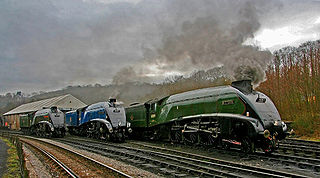
The North Yorkshire Moors Railway (NYMR) is a heritage railway in North Yorkshire, England, that runs through the North York Moors National Park. First opened in 1836 as the Whitby and Pickering Railway, the railway was planned in 1831 by George Stephenson as a means of opening up trade routes inland from the then important seaport of Whitby. The line between Grosmont and Rillington was closed in 1965 and the section between Grosmont and Pickering was reopened in 1973 by the North York Moors Historical Railway Trust Ltd. The preserved line is now a tourist attraction and has been awarded several industry accolades.

The North York Moors is an upland area in north-eastern Yorkshire, England. It contains one of the largest expanses of heather moorland in the United Kingdom. The area was designated as a National Park in 1952, through the National Parks and Access to the Countryside Act 1949. Covering an area of 554 sq mi (1,430 km2), the National Park has a population of 23,380. It is administered by the North York Moors National Park Authority, whose head office is based in Helmsley.

Fylingdales is a civil parish in the Scarborough district of North Yorkshire, England situated south of Whitby, within the North York Moors National Park. It contains the villages of Robin Hood's Bay and Fylingthorpe and Fyling Hall School.
The Coast to Coast Walk is a long-distance footpath between the west and east coasts of Northern England, nominally 190-mile (306 km) long. Devised by Alfred Wainwright, it passes through three contrasting national parks: the Lake District National Park, the Yorkshire Dales National Park, and the North York Moors National Park. The current actual measured distance is reported as 182-mile (293 km).

Royal Air Force Fylingdales or more simply RAF Fylingdales is a Royal Air Force station on Snod Hill in the North York Moors, England. Its motto is "Vigilamus". It is a radar base and is also part of the Ballistic Missile Early Warning System (BMEWS). As part of intelligence-sharing arrangements between the United States and United Kingdom, data collected at RAF Fylingdales are shared between the two countries. Its primary purpose is to give the British and US governments warning of an impending ballistic missile attack. A secondary role is the detection and tracking of orbiting objects; Fylingdales is part of the United States Space Surveillance Network. As well as its early-warning and space-tracking roles, Fylingdales has a third function – the Satellite Warning Service for the UK. It keeps track of spy satellites used by other countries, so that secret activities in the UK can be carried out when they are not overhead. The armed services, defence manufacturers and research organisations, including universities, take advantage of this facility.
Urra Moor is the highest moor in the North York Moors, North Yorkshire, England. At 1,490 feet (454 m) above sea level it is the highest point in Hambleton District and the North York Moors National Park, and the fourteenth most prominent hill in England. The name is a mix of Old English and Old Norse which means The Dirty Hill. The name of Urra Moor applies to the moor as a whole; the summit itself is known as Round Hill.

Cringle Moor, at 432 m (1,417 ft), is the third highest hill in the North York Moors, England, and the highest point west of Clay Bank.
Goathland is a village and civil parish in the Scarborough district of North Yorkshire, England. Historically part of the North Riding of Yorkshire, it is in the North York Moors national park due north of Pickering, off the A169 to Whitby. It has a station on the steam-operated North Yorkshire Moors Railway line.

Newton Dale Halt railway station is a request stop on the North Yorkshire Moors Railway and serves as a stopping off point for walkers around Newton Dale and Cropton Forest in the North York Moors National Park, North Yorkshire, England. When the station was opened, the station signs were written as Newtondale Halt.

Goathland railway station is a station on the North Yorkshire Moors Railway and serves the village of Goathland in the North York Moors National Park, North Yorkshire, England. It has also been used in numerous television and film productions. Holiday accommodation is available in the form of a camping coach.
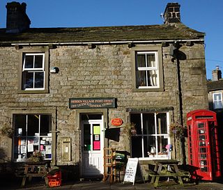
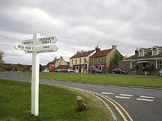
Hebden is a village and civil parish in the Craven District of North Yorkshire, England, and one of four villages in the ecclesiastical parish of Linton. It lies near Grimwith Reservoir and Grassington, in Wharfedale in the Yorkshire Dales National Park. In 2011 it had a population of 246.
The Cleveland Way is a National Trail in the historic area of Cleveland in North Yorkshire, northern England. It runs 110 miles (177 km) between Helmsley and the Brigg at Filey, skirting the North York Moors National Park.
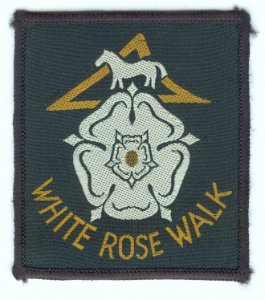
The White Rose Walk, a 35-mile / 56 km trail located in North Yorkshire, England, was devised in 1968 by the Yorkshire Wayfarers, It starts at the Kilburn White Horse and is completed by touching the trig point on top of Roseberry Topping. The walk whilst recognised by the Long Distance Walkers Association (LDWA) as a long distance walk in itself, mixes and crosses with several other long distance paths including the Cleveland Way, the Coast to Coast Walk, and the Lyke Wake Walk. The route takes in the highest peaks in the area such as Live Moor, Carlton Moor, Sutton Bank, Cold Moor, the Wainstones and Urra Moor. The walk also passes Captain Cooks Monument on Easby Moor.

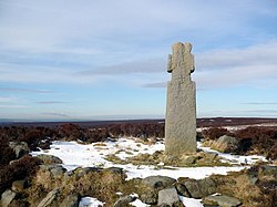
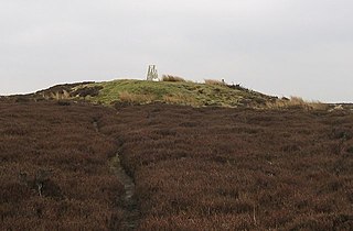
Blue Man-i'-th'-Moss is a standing stone in the North York Moors in northern England. It lies on Wheeldale Moor on the route of the Lyke Wake Walk.

The Scarborough and Ryedale Mountain Rescue Team provides Search and Rescue services in and around the Scarborough and Ryedale areas of North Yorkshire, England. The team has no formal southern boundary and has carried out searches in the urban fringe areas of the East Riding of Yorkshire

The A169 is an A road in North Yorkshire, England. It runs from the A64 at Malton on the edge of the Yorkshire Wolds through the Vale of Pickering and across the North York Moors to join the A171 just west of Whitby. It is a single carriageway for all of its 25-mile (40 km) route. Whilst it is not considered a Primary Route nationally, the Ryedale Local Transport Plan lists it as part of its Major Road Network alongside the A64, A166 and A171.

Newton Dale is a narrow dale within the North York Moors National Park in North Yorkshire, England. It was created by meltwater from a glacier carving the narrow valley. Water still flows through the dale and is known as Pickering Beck.

The Lion Inn is a public house at Blakey Ridge, near Kirkbymoorside, in North Yorkshire, England. The building was completed between 1553 and 1558, and has been used as an inn for four centuries, sitting adjacent to a road across the moors between Castleton and Hutton-le-Hole. During the ironstone industry boom in Rosedale, it catered mainly for those engaged in the mining industry. The inn is known for being subjected to extremes of weather, like Tan Hill Inn, also in North Yorkshire.

Raw is a hamlet in the Borough of Scarborough of North Yorkshire, England, near to the villages of Fylingthorpe, Robin Hood's Bay, and Hawsker. The hamlet is mostly agricultural in nature and it lies 0.5-mile (0.8 km) north-west of Fylingthorpe, 4.5 miles (7.2 km) south-east of Whitby, and due east of the A171 road.