Dere Street

Last updated

Dere Street
Roman Road
Dere Street.JPG
Route of Dere Street
Route information
Length226 mi (364 km)
[146 mi or 235 km Eboracum to Trimontium; 80 mi or 129 km Trimontium to Veluniate ]
Time period Roman Britain
Saxon Britain
Norman Britain
Margary number 8
Major junctions
From Eboracum
Major intersections Isurium, Cataractonium, Morbium, Vinovium, Longovicium, Vindomora, Coria, Onnum, Habitancum, Bremenium, Trimontium, Inveresk , Cramond
To Veluniate
Location
Country United Kingdom
Road network

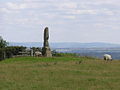
Dere Street or Deere Street is a modern designation of a Roman road which ran north from Eboracum (York), crossing the Stanegate at Corbridge (Hadrian's Wall was crossed at the Portgate, just to the north) and continuing beyond into what is now Scotland, later at least as far as the Antonine Wall. It was the Romans' major route for communications and supplies to the north and to Scotland. Portions of its route are still followed by modern roads, including the A1(M) (south of the River Tees), the B6275 road through Piercebridge, where Dere Street crosses the River Tees, and the A68 north of Corbridge in Northumberland.

Contents

Name

The Roman name for the route is lost. Its English name corresponds with the post-Roman Anglo-Saxon kingdom of Deira, through which the first part of its route lies. That kingdom possibly took its name from the Yorkshire River Derwent. The term "street" derives from its Old English sense (from Latin : via strata), which referred to any paved road and had no particular association with urban thoroughfares.

Portions of the road in Scotland were later known as St Cuthbert's Way and as the Royal Way (Medieval Latin : Via Regia).

"Watling Street"

The Antonine Itinerary's 2nd British route (called Watling Street) shared Dere Street's trunk road between Eboracum and Cataractonium (Catterick) before branching off to the northwest to communicate with Luguvalium (Carlisle). Owing to this, some stretches or the entirety of Dere Street is sometimes referenced as "Watling Street", a name that appears on the 1885-1900 edition of the Ordnance Survey map for the village of Oxnam. [1]

A small section of the old A68 route north in Corbridge is called Watling Street. [2] It should not, however, be confused with the traditional route between Canterbury and Wroxeter in the south nor with the Carlisle route to its west.

A map of the Roman north c. 84, including Dere Street between Eboracum and Veluniate near Camelon Roman.Britain.north.84.jpg
A map of the Roman north c.84, including Dere Street between Eboracum and Veluniate near Camelon

Roman route

Piercebridge Roman Bridge, remains thought to represent the old Roman bridge over the Tees Cliffe Roman Bridge 1.jpg
Piercebridge Roman Bridge, remains thought to represent the old Roman bridge over the Tees
Dere Street at Esh Winning Dere Street Esh Winning Durham.jpg
Dere Street at Esh Winning
Iron Age hill fort associated with Dere Street at Pennymuir Dere Street Woden Law Scottish Borders.jpg
Iron Age hill fort associated with Dere Street at Pennymuir

Dere Street roughly corresponds to the Antonine Itinerary's 1st British route as far as Hadrian's Wall, although it began further south than York: [3] [4]

Route I of the Antonine Itinerary
From north of Hadrian's Wall to Praetorium:156  Roman miles.
From Bremenium [ Rochester ], To Coria [ Corbridge ],20
To Vindomora [ Ebchester ],9
To Vinovia [ Binchester ],19
To Cataractonium [ Catterick ],22
Isurium [ Aldborough ],24
Eboracum [ York ], 6th Victorious Leg.,17
To Derventio [ Malton ],7
To Delgovicia [unknown],13
To Praetorium[unknown],25

The road served to allow supplies and troops such as the legion garrisoned in York quick access to the eastern borderlands and, later, the eastern posts on Hadrian's Wall. The Itinerary's 2nd and 5th British routes, which split off to reach the western territories, share the route between Eboracum and Cataractonium. Forts were built along Dere Street to protect the route. It crossed Hadrian's Wall through a large fortified gateway later called the "Portgate" which was still visible a few hundred years ago. [5] [6]

Margary notes that the last entry of the Itinerary, 25 (XXV) Roman miles, is probably in error and should be emended to 15 (XV) Roman miles. [9]

Modern route

The modern route omits the now-lost road south of York [10] but continues farther north along Roman roads either omitted by the compiler of the Antonine Itineraries or constructed after his time.

The route begins at York and crosses the River Ure near Aldborough close to Boroughbridge. It crosses the Swale near Catterick. (The ruins of Cataractonium lie just north of Catterick at Scotch Corner.) The A66 road preserves the route of the Roman-era Watling Street, branching off here to cross Stainmore to Penrith and Carlisle at the western end of Hadrian's Wall. [11]

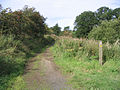
Dere Street crossed the River Tees over a stone arch bridge near the present-day Piercebridge Roman Fort ruins. Such bridges were rare in Roman Britain except for here in the far north. [12] The original bridge was replaced by one on a different alignment. [13] There is evidence of other minor realignments of Dere Street over the Roman period. [13]

The next river crossing occurred over the Wear near present-day Bishop Auckland. [14] At this point, the fort Vinovia guarded a branch road that turned off to the right heading for Durham, Chester-le-Street, and Newcastle. There, the Pons Aelius crossed the River Tyne. [15]

Dere Street, meanwhile, travels onward past Lanchester and Ebchester, the sites of the former forts of Longovicium and Vindomora. At Coria (modern Corbridge), it met the Stanegate road which runs parallel to Hadrian's Wall. [16] Stanegate and Dere Street were originally the same width (roughly 7.7 m or 25 ft) but the depth of metalling on Stanegate—72 cm (28 in) against Dere Street's 30 cm (12 in)—argues for a greater frequency of resurfacing and for greater or heavier traffic. [17] Crossing at Corbridge, the route passed through Portgate on the Wall and passed into lands only tenuously claimed by Rome. [18]

The route passes north into Redesdale and thence into the Cheviot Hills, where there are the remains of marching forts at Fourlaws, West Woodburn (Habitancum), Rochester (Bremenium), and at Chew Green. [18] Brementium was the last stop listed for Antonine Itinerary, but the Roman road's remains now lead further, past the present Anglo-Scottish border at Carter Fell near the present A68 road. Nearby, there are the remains of a camp at Pennymuir. [19] Further on, well-preserved sections of the road form part of St Cuthbert's Way to Trimontium near Melrose. There, the route crosses the Tweed and follows the Leader Water to the foot of the Lammermuirs, where there is evidence of Roman forts near Oxton.

Another well-preserved section rises through the Lammermuirs over Soutra Hill and on to Edinburgh, where Din Eidyn was a stronghold for the British Votadini tribe. Nearby, the Romans held garrisons at Cramond and Inveresk at the eastern end of the Antonine Wall. [20]

Archaeology

In 1994, construction of a garage at Cliffe exposed a section of the Roman road, and pottery and tile from the period were also found. [21] [22] Raymond Selkirk suggested that the ruins on the south side of the Tees at Cliffe are the remains of a dam; [23] the archaeological television programme Time Team investigated this in 2009. [24]

Excavations in 2007 by CFA Archaeology at Dun Law, in advance of the construction of a wind farm access road, uncovered a section of the Dere Street Roman road there. The excavations revealed that this section of the road was laid over a palaeochannel using a latticework of logs and a mat of branchwood. There are only a handful of examples of such engineering work in Roman road construction. The archaeologists found that the wood used was locally sourced from the then depleted forests. [25]

Excavations in 2007 by AOC Archaeology at Newbridge, Edinburgh, discovered a section of the road, providing solid evidence for the road's location in that area, which the milestone at Ingliston and the temporary camps at Gogar had intimated. [26]

History

Dere Street close to the Scottish Border Dere Street Nether Hindhope Scottish Borders.jpg
Dere Street close to the Scottish Border

During the High Middle Ages, the section of the route between Jedburgh and Edinburgh was known as the Royal Way (Latin : Via Regia). It connected the larger part of Scotland with the important ecclesiastic sites of the Scottish Borders. King Malcolm IV established his Church and Hospital of the Holy Trinity halfway along this section to provide succour for the many pilgrims using it. [27]

After the destruction of the Border Abbeys during the "Rough Wooing" of Mary, Queen of Scots, by the Earl of Hertford's forces and during the Reformation of the Scottish Church, the route fell into disuse and disrepair. It was used mainly for driving livestock and occasional travellers daring enough to venture into the lawless border region. [28]

Dere Street continued in use between Durham and York in medieval times. Being limited by daylight, "about thirty miles in a day in winter on horseback and between thirty-six and forty in summer was what a man could do." Tough, vigorous men could walk from Darlington to York, and it was said that the quality of a horse could make the difference between a possible thirty and fifty miles per day. A wish to hear mass or the organisation of a train by the rich could shorten the travelling day to twenty miles.

Roads were described as so muddy and difficult between November and February that to finish the journey by daylight one could barely stop to eat; however a "royal highway" or alta via regia strata was passable in winter between York and Durham, and this could have been Dere Street. Heavy packhorse loads were taken on the route, for example 20 stone (130 kg) of wool. Clerics, traders and the nobility were more likely to travel than others, and some people rarely travelled at all. Travelling in style involved the use of carts for luggage, but carts bogged down in winter mud, so traders with packhorses travelled more easily in winter than the rich. [29]

See also

Notes

  1. Watling Street, OS One Inch, 1885-1900, National Library of Scotland
  2. Watling Street, Area Information for Watling Street, Corbridge, NE45 5AG
  3. Itinerarium Antonini Augusti. Hosted at Latin Wikisource. (in Latin)
  4. "The Antonine Itinerary". Roman Britain.(in Latin and English)
  5. J C Bruce - The Handbook to the Roman Wall 8th edition 1927 Pg 67
  6. David Divine - The North East Frontier of Rome 1969 Pg97
  7. Margary, Ivan Donald (1973). Roman Roads in Britain (3rd ed.). London: John Baker. ISBN   9780212970018.
  8. Togodumnus. "Praesidivm/Praetorivm? Probable Roman Fort and Port". Roman Britain Online.
  9. Margary, [7] cited at Roman Britain Online. [8]
  10. Davies, Hugh (2002). Roman Roads in Britain. Stroud. pp. 20–21. ISBN   0-7524-2503-X.
  11. Hayton, Richard (2003). "Yorkshire History.com". Roman military sites in Yorkshire. Retrieved 16 January 2010.
  12. Davies, p. 93.
  13. 1 2 "From trackway to road". Archived from the original on 17 August 2010. Retrieved 9 August 2010.
  14. Laurie, Barbara (2005). "bishopaucklandhistory.co.uk". A Short History of Bishop Auckland. Archived from the original on 10 February 2009. Retrieved 16 January 2010.
  15. "Pastscape, English Heritage". Dere Street Investigation History. Archived from the original on 24 December 2012. Retrieved 16 January 2010. Publications : Full report Proceedings of the Society of Antiquaries of Newcastle upon Tyne 2/1925/12:94-6
  16. Bishop, M. C. "Durham.ac.uk resources" (PDF). Corbridge (archaeological resources). Archived from the original (PDF) on 11 December 2009. Retrieved 16 January 2010.
  17. Davies, p. 57.
  18. 1 2 "BBC". Dere Street – From York to Melrose in Seven Days. 10 June 2009. Retrieved 16 January 2010.
  19. "Pennymuir camps under snow".
  20. "Historic Scotland". Dere Street Roman Road. Retrieved 16 January 2010.
  21. "Heritage Gateway". Listed buildings online, and local records. Archived from the original on 25 September 2005. Retrieved 11 January 2010.
  22. NY SMR Number MNY12855; Old Sites & Monuments Record Number 12975.10000; Grid Reference NZ 212,155; SNY8056 Field recording Form, North Yorkshire County Council 15 November 1994, George Hotel Piercebridge (Dere Street Cottage), Campling, N. NYCC Observation Record
  23. Selkirk, Raymond (2000). Chester-le-Street & Its Place in History. Birtley, County Durham: Casdec Print & Design Centre. pp. 93–122. ISBN   1-900456-05-2.
  24. Lloyd, Chris (2 July 2009). "The Northern Echo". Piercebridge: Time Team investigates. Archived from the original on 27 September 2012. Retrieved 12 January 2010.
  25. "Vol 57 (2014): Excavation across the Dere Street Roman Road at Dun Law, Scottish Borders | Scottish Archaeological Internet Reports". journals.socantscot.org. Retrieved 25 August 2021.
  26. "Vol 59 (2016): A Roman Road Runs Through It: Excavations at Newbridge, Edinburgh | Scottish Archaeological Internet Reports". journals.socantscot.org. Retrieved 26 August 2021.
  27. Hunter, James, FSA (Scot)., Fala and Soutra, including a History of the Ancient "Domus de Soltre", Edinburgh, 1892.
  28. Scotways.com. "Heritage Paths". Dere Street. Archived from the original on 23 May 2022. Retrieved 16 January 2010.
  29. Harvey, Margaret M. (March 2005). "Travel from Durham to York (and back) in the fourteenth century" (PDF). Northern History. Durham University Library. 1 (XLII): 119–130. doi:10.1179/174587005X38462. S2CID   162308071 . Retrieved 16 January 2010.
  30. King's Inch, OS 1:10,560, Series 1949-1969, National Library of Scotland

Further reading

55°03′24″N2°03′56″W / 55.0566°N 2.06543°W / 55.0566; -2.06543

Related Research Articles

<span class="mw-page-title-main">Roman sites in Great Britain</span>

There are many Roman sites in Great Britain that are open to the public. There are also many sites that do not require special access, including Roman roads, and sites that have not been uncovered.

<span class="mw-page-title-main">Stanegate</span> Roman road that ran from Carlisle to Corbridge, England

The Stanegate was an important Roman road and early frontier built in what is now northern England. It linked many forts including two that guarded important river crossings: Corstopitum (Corbridge) on the River Tyne in the east and Luguvalium (Carlisle) in the west. The Stanegate ran through the natural gap formed by the valleys of the River Tyne in Northumberland and the River Irthing in Cumbria. It predated the Hadrian's Wall frontier by several decades; the Wall would later follow a similar route, albeit slightly to the north.

<span class="mw-page-title-main">Watling Street</span> Historic route in England

Watling Street is a historic route in England that crosses the River Thames at London and which was used in Classical Antiquity, Late Antiquity, and throughout the Middle Ages. It was used by the ancient Britons and paved as one of the main Roman roads in Britannia. The route linked Dover and London in the southeast, and continued northwest via St Albans to Wroxeter. The line of the road was later the southwestern border of the Danelaw with Wessex and Mercia, and Watling Street was numbered as one of the major highways of medieval England.

<span class="mw-page-title-main">Ermine Street</span> Roman road from London to York, England

Ermine Street is a major Roman road in England that ran from London (Londinium) to Lincoln and York (Eboracum). The Old English name was Earninga Strǣt (1012), named after a tribe called the Earningas, who inhabited a district later known as Armingford Hundred, around Arrington, Cambridgeshire, and Royston, Hertfordshire. "Armingford", and "Arrington" share the same Old English origin. The original Celtic and Roman names for the route remain unknown. It is also known as the Old North Road from London to where it joins the A1 Great North Road near Godmanchester.

<span class="mw-page-title-main">A68 road</span> Major road in the United Kingdom

The A68 is a major road in the United Kingdom, running from Darlington in England to the A720 in Edinburgh, the capital of Scotland. It crosses the Anglo-Scottish border at Carter Bar and is the only road to do so for some distance either way; the next major crossings are the A697 from Coldstream to Cornhill-on-Tweed in the east, and the A7 near Canonbie to the west.

<span class="mw-page-title-main">Roman roads in Britannia</span> Roads in the Province of Britannia, 43–410

Roman roads in Britannia were initially designed for military use, created by the Roman army during the nearly four centuries (AD 43–410) that Britannia was a province of the Roman Empire.

Stone Street may refer to:

<span class="mw-page-title-main">Quintus Lollius Urbicus</span> 2nd century senator, military commander and governor

Quintus Lollius Urbicus was a Berber governor of Roman Britain between the years 139 and 142, during the reign of the Emperor Antoninus Pius. He is named in the Historia Augusta, although it is not entirely historical, and his name appears on five Roman inscriptions from Britain; his career is set out in detail on a pair of inscriptions set up in his native Tiddis near Cirta, Numidia.

<span class="mw-page-title-main">Piercebridge</span> Human settlement in England

Piercebridge is a village and civil parish in the borough of Darlington and the ceremonial county of Durham, England. The population of the civil parish as of the 2011 census was 113. It is situated a few miles west of the town of Darlington. It is on the site of a Roman fort of AD 260–270, which was built at the point where Dere Street crossed the River Tees. Part of the fort is under the village green. The village is sited where the York-Newstead Roman road known as Dere Street crosses the River Tees.

<span class="mw-page-title-main">Bremenium</span> Roman fort in Northumberland, England

Bremenium is an ancient Roman fort (castrum) located at Rochester, Northumberland, England. The fort is part of the defensive system built along the extension of Dere Street, a Roman road running from York to Corbridge and onwards to Melrose. Significantly the fort is a long way north of Hadrian's Wall. It was one of the last forts north of Hadrian's wall to remain occupied until the 270s.

<span class="mw-page-title-main">Piercebridge Roman Fort</span> Roman fort in Durham, England

Piercebridge Roman Fort is a scheduled ancient monument situated in the village of Piercebridge on the banks of the River Tees in modern-day County Durham, England. There were Romans here from about AD 70 until at least the early 5th century. There was an associated vicus and bath house at Piercebridge, and another vicus and a villa south of the river at Cliffe. The Victorians used carved stones from this site when they built St Mary's church at Gainford. Part of the site is under Piercebridge village green.

<span class="mw-page-title-main">Magnis (Carvoran)</span> Roman fort in Northumberland, England

Magnis or Magna was a Roman fort near Hadrian's Wall in northern Britain. Its ruins are now known as Carvoran Roman Fort and are located near Carvoran, Northumberland, in northern England. It was built on the Stanegate frontier and Roman road, before the building of Hadrian's Wall.

Luguvalium was an ancient Roman city in northern Britain located within present-day Carlisle, Cumbria, and may have been the capital of the 4th-century province of Valentia. It deserves better recognition as the most northerly city of the Roman Empire.

<span class="mw-page-title-main">Coria (Corbridge)</span> Roman fort in Corbridge, England

Coria was a fort and town 2.5 miles (4.0 km) south of Hadrian's Wall, in the Roman province of Britannia on the junction of a major Roman north–south road with the River Tyne and another Roman road (Stanegate), which ran east–west between Coria and Luguvalium. Corbridge Roman Site is in the village of Corbridge in the county of Northumberland.

<span class="mw-page-title-main">Vindomora</span> Roman auxiliary fort in County Durham, England

Vindomora was an auxiliary fort on Dere Street, in the province of Lower Britain. Its ruins, now known as Ebchester Roman Fort, are situated at Ebchester in the English county of Durham, to the north of Consett and 12 miles (19 km) west-south-west from Newcastle upon Tyne.

<span class="mw-page-title-main">Concangis</span> Roman fort in Duram, England

Concangis was an auxiliary castra in the Roman province of Lower Britain. Its ruins are located in Chester-le-Street, Durham, in England, and are now known as Chester-le-Street Roman Fort. It is situated 6 miles (10 km) north of Durham and 8 miles (13 km) south of Newcastle upon Tyne.

<span class="mw-page-title-main">Hunnum</span> Roman fort in Northumberland, England

Hunnum was a Roman fort on Hadrian's Wall located north of the modern-day village of Halton, Northumberland in North East England. It was the fifth fort on Hadrian's Wall and is situated about 7.5 miles west of Vindobala fort, 5.9 miles east of Chesters fort and 2.5 miles north of the Stanegate fort of Coria (Corbridge). The site of the fort is bisected by the B6318 Military Road, which runs along the route of the wall at that point.

<span class="mw-page-title-main">Habitancum</span> Ancient Roman fort in Northumberland, England

Habitancum was an ancient Roman fort (castrum) located at Risingham, Northumberland, England. The fort was one of series of built along the extension of Dere Street, a Roman road running from York to Corbridge and onwards to Melrose, in Scotland.

Cataractonium was a fort and settlement in Roman Britain. The settlement evolved into Catterick, located in North Yorkshire, England.

<span class="mw-page-title-main">Portgate</span>

The Portgate was a fortified gateway, constructed as part of Hadrian's Wall where it crossed the Roman road now known as Dere Street, which preceded Hadrian's Wall by around 50 years. It was built to control traffic along Dere Street as it passed north through Hadrian's Wall. The gate's remains exist beneath the old B6318 Military Road to the south-west of the Stagshaw Roundabout.