Related Research Articles

Aberdeenshire is one of the 32 council areas of Scotland.
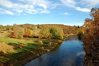
The River Don is a river in north-east Scotland. It rises in the Grampians and flows eastwards, through Aberdeenshire, to the North Sea at Aberdeen. The Don passes through Alford, Kemnay, Inverurie, Kintore, and Dyce. Its main tributary, the River Ury, joins at Inverurie.
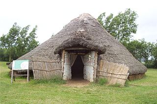
Flag Fen, east of Peterborough, England, is a Bronze Age site which was constructed about 3500 years ago and consists of more than 60,000 timbers arranged in five very long rows, creating a wooden causeway across the wet fenland. Part-way across the structure a small island was formed. Items associated with it have led scholars to conclude that the island was of religious significance. Archaeological work began in 1982 at the site, which is located 800 m east of Fengate. Flag Fen is now part of the Greater Fens Museum Partnership. A visitor centre has been constructed on site and some areas have been reconstructed, including a typical Iron Age roundhouse dwelling.

Doune is a burgh within Perthshire. The town is administered by Stirling Council. Doune is assigned Falkirk postcodes starting "FK". The village lies within the parish of Kilmadock and mainly within the area surrounded by the River Teith and Ardoch Burn.

Inverurie is a town in Aberdeenshire, Scotland at the confluence of the rivers Ury and Don, about 16 miles (26 km) north-west of Aberdeen.

The A96 is a major road in the north of Scotland.

Kintore is a town and former royal burgh near Inverurie in Aberdeenshire, Scotland, now bypassed by the A96 road between Aberdeen and Inverness. It is situated on the banks of the River Don.

Butser Ancient Farm is an archaeological open-air museum and experimental archaeology site located near Petersfield in Hampshire, southern England. Butser features experimental reconstructions of prehistoric, Romano-British and Anglo-Saxon buildings. Examples of Neolithic dwellings, Iron Age roundhouses, a Romano-British villa and an early Saxon house are on display. The site is used as both a tourist attraction and a site for the undertaking of experimental archaeology. In this latter capacity, it was designed so that archaeologists could learn more about the agricultural and domestic economy in Britain during the millennium that lasted from circa 400 BCE to 400 CE, in what was the Late British Iron Age and Romano-British periods.
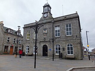
Oldmeldrum is a village and parish in the Formartine area of Aberdeenshire, not far from Inverurie in North East Scotland. With a population of around 2,187, Oldmeldrum falls within Scotland's top 300 centres of population. Oldmeldrum is home to one of the oldest whisky distilleries in Scotland, Glen Garioch, which was built in 1797. Local industries are agriculture and engineering services connected to the oil industry in Aberdeen.

Normandykes is the site of a Roman marching camp 1 mile (1.6 km) to the southwest of Peterculter, City of Aberdeen, Scotland. The near-rectangular site, measuring approximately 860 by 510 metres, covers about 106 acres (43 ha) of the summit and eastern slopes of a hill overlooking the River Dee and the B9077 road further south. Aerial photographs for Normandykes have been archived between 1947 and 1976. The camp is about 6 miles (10 km), or less than half a day's march, north of the Raedykes camp. It is possible that the actual route taken would have entailed one day's march, over a route likely chosen to avoid the Red Moss, a virtually uncrossable bog near the present day village of Netherley.

Ythan Wells, also known as Glenmailen, is the site of a Roman military camp, near the farm of Glenmellan, 2.1 kilometres (1.3 mi) east of the village of Ythanwells in Aberdeenshire, Scotland. The site is a designated scheduled monument.
Old Rayne is a small village in Aberdeenshire, Scotland, approximately 9 miles north west of Inverurie and 14 mi (23 km) south east of Huntly along the A96 road.
Mellor hill fort is a prehistoric site in North West England dating from the British Iron Age – about 800 BC to 100 AD. Situated on a hill in Mellor, Greater Manchester, on the western edge of the Peak District, the hill fort overlooks the Cheshire Plain. Although the settlement was founded during the Iron Age, evidence exists of activity on the site as far back as 8,000 BC; during the Bronze Age the hill may have been an area where funerary practices were performed. Artefacts such as a Bronze Age amber necklace indicate the site was high status and that its residents took part in long-distance trade. The settlement was occupied into the Roman period. After the site was abandoned, probably in the 4th century, it was forgotten until its rediscovery in the 1990s.
Deers may refer to:
Cataractonium was a fort and settlement in Roman Britain. The settlement evolved into Catterick, located in North Yorkshire, England.
Cecily Margaret Guido,, also known as Peggy Piggott, was an English archaeologist, prehistorian, and finds specialist. Her career in British archaeology spanned sixty years, and she is recognised for her field methods, her field-leading research into prehistoric settlements, burial traditions, and artefact studies, as well as her high-quality and rapid publication, contributing more than 50 articles and books to her field between the 1930s and 1990s.
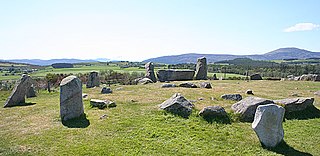
Tomnaverie stone circle is a recumbent stone circle set on the top of a small hill in lowland northeast Scotland. Construction started from about 2500 BC, in the Bronze Age, to produce a monument of thirteen granite stones including a massive 6.5-ton recumbent stone lying on its side along the southwest of the circle's perimeter. Within the 17-metre (56 ft) circle are kerb stones encircling a low 15-metre (49 ft) ring cairn but the cairn itself no longer exists.
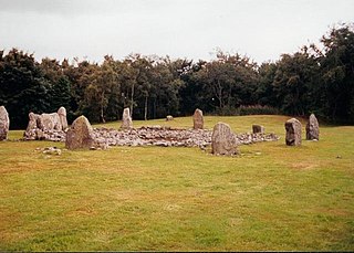
Loanhead of Daviot stone circle is a recumbent stone circle in Aberdeenshire in lowland northeast Scotland. The circle consists of the recumbent stone with its flankers and a complete set of eight orthostats about 21 metres (69 ft) in diameter surrounding a low kerbed ring cairn which has an open court. However, the present appearance has in part been produced by substantial restoration after archaeological excavation in 1934, and in 1989 by the removal of the stones covering the central court.

The Cornish Bronze Age is an era of the prehistory of Cornwall that spanned the period from c. 2400 BCE to c. 800 BCE. It was preceded by the Cornish Neolithic, and followed by the Cornish Iron Age. It is characterized by the introduction and widespread use of copper and copper-alloy (bronze) weapons and tools.
References
Cook, M and Dunbar, L Rituals, Roundhouses and Romans: Excavations at Kinore 2000-2006, Volume 1, Forest Road. Edinburgh.
- 1 2 3 "Deer's Den, roundhouses 195m and 250m south of A Scheduled Monument in East Garioch, Aberdeenshire". Ancient Monument. Retrieved 29 March 2020.
- ↑ Deer's Den, Kintore Temporary Camp 1
- 1 2 Aberdeenshire Council: Recent Archaeological Work at Deers Den Archived 2007-09-02 at the Wayback Machine
- ↑ Aberdeenshire Council: Deers Den, Kintore Archived 2007-09-27 at the Wayback Machine
- ↑ "Kintore". Undiscovered Scotland. Retrieved 29 March 2020.
- ↑ "The Deer's Den Bar & Diner". Royal Burgh of Kintore. 29 January 2019. Retrieved 29 March 2020.
- 1 2 Harley, Duncan (2019). The Little History of Aberdeenshire (Illustrated ed.). The History Press. ISBN 9780750991131 . Retrieved 29 March 2020.
- ↑ Forder, Simon (2019). The Romans in Scotland and the battle of Mons Graupius : 'they make a desolation and they call it peace' (illustrated ed.). Amberley Publishing Limited. ISBN 9781445690568 . Retrieved 29 March 2020.
- ↑ Johnson, Melanie (2010). "The Excavation of Bronze Age Roundhouses at Oldmeldrum, Aberdeenshire". Scottish Archaeological Internet Reports. 43.