Inveruglas

Last updated

Inveruglas
Inveruglas, Loch Lomond - geograph.org.uk - 120041.jpg
Inveruglas, Loch Lomond - geograph.org.uk - 120041
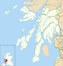
Argyll and Bute UK location map.svg
Red pog.svg
Inveruglas
Location within Argyll and Bute
OS grid reference NN 32000 09700
Council area
  • Argyll and Bute
Lieutenancy area
  • Argyll and Bute
Country Scotland
Sovereign state United Kingdom
Post town Alexandria
Postcode district G83
Dialling code 01301
UK Parliament
  • Argyll and Bute
Scottish Parliament
  • Argyll and Bute
List of places
UK
Scotland
56°15′00″N4°42′47″W / 56.250021°N 4.7131245°W / 56.250021; -4.7131245

Inveruglas (Scottish Gaelic : Inbhir Dhubhghlais) [1] is a hamlet on the west shore of Loch Lomond, fairly near the north end of the loch and is within the Loch Lomond and The Trossachs National Park. It is situated on the A82 trunk road, connecting Glasgow to Inverness. It is within the historic county of Dunbartonshire, and since 1996 it has been part of the Argyll and Bute council area.

Contents

Nearby isles include Inveruglas Isle and Wallace's Isle. Inversnaid is roughly opposite on the east shore, there is a pedestrian ferry.

The Inveruglas Water flows into the loch at the hamlet, flowing down from Loch Sloy. The name of this watercourse is a curious back-formation, since Inveruglas means "the mouth of the Douglas". It may have acquired this name to differentiate it from the Douglas Water a few miles further south.

Inveruglas Isle lies in Inveruglas Bay, an inlet of Loch Lomond. [2]
Loch Lomond and Cowal Way

The Loch Lomond and Cowal Way starts and finishes at Inveruglas. This 92-kilometre (57-mile) waymarked footpath terminates at Portavadie in the Cowal Peninsula, on the east shore of Loch Fyne. [3]

Loch Sloy Hydro-Electric Scheme

Loch Sloy hydro-electric power station - geograph.org.uk - 173508 Loch Sloy hydro-electric power station - geograph.org.uk - 173508.jpg
Loch Sloy hydro-electric power station - geograph.org.uk - 173508

The renewable hydroelectric schemes generation hall is located on the shore of Loch Lomond at Inveruglas, part of the Sloy/Awe Hydro-Electric Scheme. Opened by Queen Elizabeth, the Queen Mother (1900-2002) in 1950. [4]

Related Research Articles

<span class="mw-page-title-main">Loch Lomond</span> Loch In Scotland

Loch Lomond is a freshwater Scottish loch which crosses the Highland Boundary Fault, often considered the boundary between the lowlands of Central Scotland and the Highlands. Traditionally forming part of the boundary between the counties of Stirlingshire and Dunbartonshire, Loch Lomond is split between the council areas of Stirling, Argyll and Bute and West Dunbartonshire. Its southern shores are about 23 kilometres (14 mi) northwest of the centre of Glasgow, Scotland's largest city. The Loch forms part of the Loch Lomond and The Trossachs National Park which was established in 2002.

<span class="mw-page-title-main">Cowal</span> Peninsula in Argyll and Bute, Scotland

Cowal is a rugged peninsula in Argyll and Bute, on the west coast of Scotland. It is connected to the mainland to the north, and is bounded by Loch Fyne to the west, by Loch Long and the Firth of Clyde to the east, and by the Kyles of Bute to the south.

<span class="mw-page-title-main">Loch Long</span> Sea-loch in Argyll and Bute, Scotland, UK

Loch Long is a body of water in the council area of Argyll and Bute, Scotland. The Sea Loch extends from the Firth of Clyde at its southwestern end. It measures approximately 20 miles in length, with a width of between one and two miles. The loch also has an arm, Loch Goil, on its western side.

<span class="mw-page-title-main">Loch Lomond and The Trossachs National Park</span> National park in Scotland

Loch Lomond and The Trossachs National Park is a national park in Scotland centred on Loch Lomond and the hills and glens of the Trossachs, along with several other ranges of hills. It was the first of the two national parks established by the Scottish Parliament in 2002, the second being the Cairngorms National Park. The park extends to cover much of the western part of the southern highlands, lying to the north of the Glasgow conurbation, and contains many mountains and lochs. It is the fourth-largest national park in the British Isles, with a total area of 1,865 km2 (720 sq mi) and a boundary of some 350 km (220 mi) in length. It features 21 Munros and 20 Corbetts.

<span class="mw-page-title-main">Trossachs</span> Area of wooded hills and lochs in the southern part of the Scottish Highlands

The Trossachs generally refers to an area of wooded glens, braes, and lochs lying to the east of Ben Lomond in the Stirling council area of Scotland. The name is taken from that of a small woodland glen that lies at the centre of the area, but is now generally applied to the wider region.

Whistlefield is a hamlet on the east shore of Loch Eck on the Cowal Peninsula, in Argyll and Bute, West of Scotland. It is home to the Category C listed building, the Whistlefield Inn, which was established around 1801–1804. The hamlet is within the Argyll Forest Park, which is itself part of the Loch Lomond and The Trossachs National Park.

<span class="mw-page-title-main">Ardgartan</span> Human settlement in Scotland

Ardgartan is a hamlet, on the Cowal Peninsula, in Argyll and Bute, Scottish Highlands. It is located on the shores of Loch Long, at the bottom of Glen Croe.

<span class="mw-page-title-main">Loch Eck</span> Lake in Argyll and Bute, Scotland

Loch Eck is a freshwater loch located on the Cowal Peninsula, north of Dunoon, in Argyll and Bute, west of Scotland. It is seven miles long. It is oriented in a north-south direction. Its main inflow, at the northern end, is the River Cur, and its main outflow, at the southern end, is the River Eachaig, which meanders somewhat within the confines of the broad strath before flowing into the head of Holy Loch, about 5 km further south.

<span class="mw-page-title-main">Inversnaid</span> Human settlement in Scotland

Inversnaid is a small rural community on the east bank of Loch Lomond in Scotland, near the north end of the loch. It has a pier and a hotel, and the West Highland Way passes through the area. A small passenger ferry runs from Inversnaid to Inveruglas on the opposite shore of the loch, and also to Tarbet. There is a seasonal ferry that also operates between Ardlui and Ardleish as well, which is a walkable distance from Inversnaid. To reach Inversnaid by road involves a 15-mile (24-kilometre) route from Aberfoyle. Nearby is an alleged hideout of Rob Roy MacGregor known as Rob Roy's Cave. The cave is difficult to access, and is best seen from Loch Lomond, where there is white paint indicating the location of the hideout.

<span class="mw-page-title-main">Loch Chon</span> Freshwater loch in Stirlingshire, Scotland

Loch Chon is a freshwater loch situated west of the village of Aberfoyle, near the small village of Kinlochard, Stirling, Scotland, UK. Loch Chon lies upstream of Loch Ard and to the south of Loch Katrine.

<span class="mw-page-title-main">Inveruglas Isle</span> Island in Loch Lomond in Scotland

Inveruglas Isle is a small uninhabited island within Loch Lomond, and lies off the shore at Inveruglas opposite Inversnaid at the north end of the loch. It is opposite the Loch Sloy powerstation.

<span class="mw-page-title-main">Loch Sloy Hydro-Electric Scheme</span> Hydroelectric power station in Scotland

The Loch Sloy Hydro-Electric Scheme is a hydro-electric facility situated between Loch Sloy and Inveruglas on the west bank of Loch Lomond in Scotland. It is also within the Arrochar Alps.

Glen Falloch Halt railway station was a remote rural railway station in Glen Falloch, Stirlingshire, Scotland. Opened in 1946 by the LNER, it was located in Glen Falloch on the Ardlui side of the viaduct, but reported out of use by around 1948.

<span class="mw-page-title-main">Loch Lomond and Cowal Way</span>

The Loch Lomond and Cowal Way is a waymarked footpath through the Cowal Peninsula, in Argyll and Bute, between Portavadie on Cowal and Inveruglas on Loch Lomond side. It was formerly known as the Cowal Way, but was renamed in December 2018 to reflect the fact that half of the route lies with the Loch Lomond and The Trossachs National Park. The way is 92 kilometres (57 mi) long, and is suitable for both walkers and mountain bikers. Much of the route is also suitable for experienced horseriders, although in some places steps, narrow footbridges and gates may restrict access for horses. A review to identify these obstacles and suggest alternative routes and/or remedial measures was undertaken in 2016.

<span class="mw-page-title-main">Glenbranter</span> Human settlement in Scotland

Glenbranter is a hamlet and former estate, once owned by Sir Harry Lauder, on the northwest shore of Loch Eck in the Argyll Forest Park, on the Cowal Peninsula, in Argyll and Bute, West of Scotland.

Inveruglas was a remote temporary private railway station near the hamlet of Inveruglas, Argyll and Bute, Scotland. Opened in 1945 by the LNER, it was built in connection with the construction of the Sloy Hydro-Electric facility and was located on the Ardlui side of the Inveruglas Viaduct and recorded to be out of use by around 1948.

Faslane Platform railway station or Faslane Junction Platform railway station was a temporary private railway station located near the Stuckendoff PoW camp, Shandon, Argyll and Bute, Scotland. Opened in 1945 by the LNER in connection with the construction of the Loch Sloy Hydro-Electric facility and was located on the Shandon side of the Chapel Burn and recorded to be out of use by around 1949 in the British Railways era.

<span class="mw-page-title-main">Great Trossachs Path</span> Hiking path in Scotland

The Great Trossachs Path is a 48-kilometre (30 mi) long-distance footpath through the Trossachs, in the Stirling council area of Scotland. It runs between Callander in the east and Inversnaid on the banks of Loch Lomond in the west, passing along the northern shores of Loch Katrine and Loch Arklet. The path is suitable for walkers and cyclists; much of the route is also suitable for experience horse riders, although the middle section along the shoreline of Loch Katrine is tarmacked and so may not be ideal for horses.

<span class="mw-page-title-main">Three Lochs Way</span> Long-distance path in the west of Scotland

The Three Lochs Way is a 55-kilometre (34 mi) long-distance path in Argyll and Bute in Scotland that links Balloch and Inveruglas. The path crosses the Highland Boundary Fault, which divides the Scottish Highlands from the Lowlands, and is named for the three major lochs linked by the route: Loch Lomond, the Gare Loch and Loch Long. About 1,500 people use the path every year, of whom about 300 complete the entire route.

References

  1. "Inveruglas". Ainmean-Àite na h-Alba. Retrieved 26 December 2021.
  2. "Loch Lomond, Inveruglas Isle, Castle | Canmore". canmore.org.uk. Retrieved 25 February 2021.
  3. "Web Hosting, Reseller Hosting & Domain Names from Heart Internet". cowalway.co.uk. Retrieved 25 February 2021.
  4. "Sloy". Archived from the original on 21 April 2014.