London Outer Orbital Path

Last updated

London Outer Orbital Path
London Loop sign.JPG
The London LOOP's logo, a flying kestrel, can be seen on the signs marking the route
Length150 mi (242 km) [1]
Location London, England
Trailheads Circular
Use Hiking
SeasonAll year
Trail map
LOOP route map.jpg

The London Outer Orbital Path more usually the "London LOOP" is a 150-mile (242 km) signed walk along public footpaths, [1] and through parks, woods and fields around the edge of Outer London, England, described as "the M25 for walkers". The walk begins at Erith on the south bank of the River Thames and passes clockwise through Crayford, Petts Wood, Coulsdon, Banstead, Ewell, Kingston upon Thames, Uxbridge, Elstree, Cockfosters, Chingford, Chigwell, Grange Hill and Upminster Bridge before ending at Purfleet, almost directly across the Thames from its starting point. Between these settlements the route passes through green buffers and some of the highest points in Greater London.

Contents

History

The walk was first proposed at a meeting between The Ramblers and the Countryside Commission in 1990. It was given an official launch at the House of Lords in 1993. The first section was opened on 3 May 1996, with a ceremony on Farthing Downs, Coulsdon. Other sections followed at the rate of two or three per year as signs were installed and leaflets for individual sections published, the route becoming fully walkable in 2001. Following the election of Ken Livingstone as Mayor of London, the London Loop became one of his key routes, along with its sister route, the Capital Ring.

Route

Happy Valley Happy Valley (LOOP).jpg
Happy Valley
Stag in Bushy Park Stag in Bushy Park.jpg
Stag in Bushy Park
Wellingtonia Avenue Wellingtonia Avenue.jpg
Wellingtonia Avenue

The route is divided into 24 sections in three groups: the "blue" group in South London, the "green" group in north-west London, and the "yellow" group in north-east London. The sections vary in length, [1] from 3.8 miles (6.1 km) section 14 to 10 miles (16 km) section 16. Some sections start and/or end directly at public transport stops. However most sections have a further waymarked 'LOOP Link' to from their start and/or end to the nearest train or underground station. Additionally, there are waymarked 'LOOP Links' to train station midway along some sections. All these links are listed in the table below.

South London (sections 1–8)

The Loop officially begins by the River Thames in Erith. Points of interest in these sections south of the Thames include: Hall Place, the memorial to William Willett (advocate of summer time), the Wilberforce Oak, Shirley Windmill, Happy Valley, Farthing Downs, the Mayfield Lavender Farm and the Coronation Stone in Kingston.

North-west London (sections 9–16)

Having crossed the Thames at Kingston Bridge the Loop continues north of the river. Points of interest in these sections include: Bushy Park, the Shot Tower by the River Crane, the Grand Union Canal, the ancient woodland of Park Wood, Grim's Dyke and a cottage where David Livingstone once lived.

North-east London (sections 17–24)

Commencing at Cockfosters, the final third of the Loop heads south to its end at the Thames in Purfleet. Points of interest in these sections include: the New River, Forty Hall, Gilwell Park, Queen Elizabeth's Hunting Lodge in Epping Forest, the Wellingtonia Avenue in Havering Country Park, the valley of the River Ingrebourne, the Upminster Windmill, Hornchurch Country Park, the Concrete Barges by the Thames at Rainham and the RSPB Centre by the marshes at Purfleet.

Signposts, waymarks and information boards direct the walker along the route. In countryside locations the waymarks consist mostly of a simple white disc mounted on a wooden post, with a directional arrow and flying kestrel logo in blue and text in green. However, local authorities are responsible for funding these signs, so the quality varies from one borough to the next, with some sections not signed at all. The 54-mile blue route from Erith to Kingston is maintained by the Downlands Countryside Management Project, a joint initiative by several councils, and is complete with signs and information boards, in addition to maps available from Tourist Information Centres.

There is no way to cross the river between Purfleet and Erith to complete the loop, although there was once a ferry to Erith which was mainly used by pilgrims on their way to Canterbury. In 2011 a proposal for a ferry to link the ends, and to link to riverbuses upstream at Woolwich, was shortlisted in the RIBA Forgotten Spaces competition. [2]

The full route is also mapped on OpenStreetMap and available on the Go Jauntly app, in partnership with Transport for London.

Map all coordinates using: OpenStreetMap
SectionDescriptionDistance [1] Start coordinatesPublic transport links
mikmSection startSection endFurther signposted LOOP Links along the section
1 Erith to Old Bexley8.5 mi13.7 km 51°28′59″N0°10′41″E / 51.483144°N 0.177975°E / 51.483144; 0.177975 (Erith) link from Erith station link to Bexley station Slade Green station

Crayford station

2 Old Bexley to Petts Wood7 mi11 km 51°26′28″N0°08′56″E / 51.441233°N 0.148956°E / 51.441233; 0.148956 (Old Bexley) link from Bexley stationlink to Petts Wood station
3 Petts Wood to West Wickham Common9 mi14 km 51°23′36″N0°04′09″E / 51.393209°N 0.069081°E / 51.393209; 0.069081 (Petts Wood) link from Petts Wood stationlink to Hayes station
4 West Wickham Common to Hamsey Green10 mi16 km 51°22′15″N0°00′17″E / 51.370944°N 0.004860°E / 51.370944; 0.004860 (West Wickham Common) link from Hayes stationHamsey Green bus stop
5 Hamsey Green to Coulsdon South6 mi9.7 km 51°19′09″N0°03′48″W / 51.319035°N 0.063420°W / 51.319035; -0.063420 (Hamsey Green) Hamsey Green bus stop Coulsdon South station Whyteleafe station
6 Coulsdon South to Banstead Downs4.5 mi7.2 km 51°18′57″N0°08′12″W / 51.315728°N 0.136744°W / 51.315728; -0.136744 (Coulsdon South) Coulsdon South stationlink to Banstead station
7 Banstead Downs to Ewell3.5 mi5.6 km 51°19′56″N0°12′33″W / 51.332148°N 0.209290°W / 51.332148; -0.209290 (Banstead Downs) link from Banstead stationlink to Ewell West station
8 Ewell to Kingston Bridge7.3 mi11.7 km 51°21′06″N0°15′01″W / 51.351650°N 0.250176°W / 51.351650; -0.250176 (Ewell) link from Ewell West stationlink to Kingston station Malden Manor station
9 Kingston Bridge to Hatton Cross8.5 mi13.7 km 51°24′43″N0°18′30″W / 51.411854°N 0.308274°W / 51.411854; -0.308274 (Kingston Bridge) link from Kingston stationlink to Hatton Cross underground station Fulwell station
10 Hatton Cross to Hayes & Harlington3.5 mi5.6 km 51°28′12″N0°24′35″W / 51.469927°N 0.409793°W / 51.469927; -0.409793 (Hatton Cross) link from Hatton Cross underground stationlink to Hayes & Harlington station
11 Hayes & Harlington to Uxbridge7.5 mi12.1 km 51°30′18″N0°25′07″W / 51.505117°N 0.418654°W / 51.505117; -0.418654 (Hayes) link from Hayes & Harlington stationlink to Uxbridge underground station West Drayton station
12 Uxbridge to Harefield West4.5 mi7.2 km 51°33′03″N0°29′00″W / 51.550933°N 0.483414°W / 51.550933; -0.483414 (Uxbridge) link from Uxbridge underground stationlink to Hareford West / Belfry Avenue bus stop
13 Harefield West to Moor Park5 mi8.0 km 51°36′38″N0°29′56″W / 51.610477°N 0.498761°W / 51.610477; -0.498761 (Harefield) link from Hareford West / Belfry Avenue bus stoplink to Moor Park underground station
14 Moor Park to Hatch End3.8 mi6.1 km 51°37′26″N0°25′39″W / 51.623932°N 0.427529°W / 51.623932; -0.427529 (Moor Park) link from Moor Park underground stationlink to Hatch End station
15 Hatch End to Elstree10 mi16 km 51°36′39″N0°22′49″W / 51.610702°N 0.380326°W / 51.610702; -0.380326 (Hatch End) link from Hatch End stationlink to Elstree & Borehamwood station Stanmore underground station
16 Elstree to Cockfosters10 mi16 km 51°39′12″N0°16′55″W / 51.653365°N 0.281950°W / 51.653365; -0.281950 (Elstree) link from Elstree & Borehamwood stationshort link to Cockfosters underground station High Barnet underground station
17 Cockfosters to Enfield Lock9.5 mi15.3 km 51°39′08″N0°08′56″W / 51.652244°N 0.148998°W / 51.652244; -0.148998 (Cockfosters) short link from Cockfosters underground stationlink to Enfield Lock station Gordon Hill station
18 Enfield Lock to Chingford4 mi6.4 km 51°40′06″N0°01′42″W / 51.668264°N 0.028316°W / 51.668264; -0.028316 (Enfield Lock) link from Enfield Lock stationlink to Chingford station
19 Chingford to Chigwell4 mi6.4 km 51°38′04″N0°00′44″E / 51.634306°N 0.012118°E / 51.634306; 0.012118 (Chingford) link from Chingford stationlink to Chigwell underground station
20 Chigwell to Havering-atte-Bower6 mi9.7 km 51°37′17″N0°04′41″E / 51.621468°N 0.078004°E / 51.621468; 0.078004 (Chigwell) link from Chigwell underground stationshort link to Havering Green bus stop
21 Havering-atte Bower to Harold Wood4.5 mi7.2 km 51°37′01″N0°11′00″E / 51.616860°N 0.183245°E / 51.616860; 0.183245 (Havering-atte-Bower) short link from Havering Green bus stop Harold Wood station
22 Harold Wood to Upminster Bridge4 mi6.4 km 51°35′36″N0°14′03″E / 51.593421°N 0.234098°E / 51.593421; 0.234098 (Harold Wood) Harold Wood station Upminster Bridge underground station
23 Upminster Bridge to Rainham4 mi6.4 km 51°33′33″N0°14′12″E / 51.559197°N 0.236748°E / 51.559197; 0.236748 (Upminster Bridge) Upminster Bridge underground station Rainham station
24 Rainham to Purfleet 5 mi8.0 km 51°31′01″N0°11′29″E / 51.516886°N 0.191433°E / 51.516886; 0.191433 (Rainham) Rainham stationlink to Purfleet station

Further reading

Related Research Articles

<span class="mw-page-title-main">Itchen Way</span> Long-distance footpath in Hampshire, England

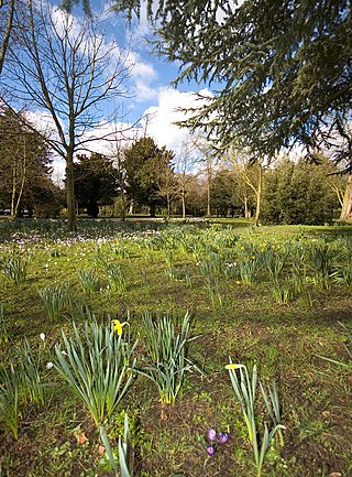
The Itchen Way is a 31.80-mile (51.18 km) long-distance footpath following the River Itchen in Hampshire, England, from its source near Hinton Ampner House to its mouth at Woolston. The walk finishes at Sholing railway station. The route has been promoted by the Eastleigh Group of the Ramblers with grant aid from Hampshire County Council and Eastleigh Borough Council. The route was altered and improved in 2008.

<span class="mw-page-title-main">Capital Ring</span> 78-mile circular walk around London

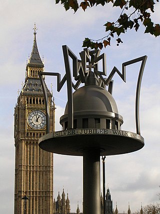
The Capital Ring is a strategic circular walking route in London, around 125 km (78 mi) in length. It is promoted by London's 33 local councils, led by the City of London Corporation in partnership with the Greater London Authority and its functional body for regional transport, Transport for London, through which much of the funding is provided. It is called a "ring" because the route completely encircles inner and central London. The official start of the route is the Woolwich foot tunnel, but the nature of the route means that it can be started or finished at any point. The route signs feature a logo showing Big Ben in a ring of arrows.

<span class="mw-page-title-main">Oaks Park (London)</span>

Oaks Park is a public park in Carshalton in the London Borough of Sutton. It is bounded on the south by Croydon Lane (A2022), and on the east by Woodmansterne Road; smaller roads lie to the west and north.

<span class="mw-page-title-main">Essex Way</span> Long-distance footpath in Essex, England

The Essex Way is a waymarked long-distance footpath 81 miles (130 km) long, along footpaths and roads in Essex, England.

<span class="mw-page-title-main">Walking in London</span>

Walking is a popular recreational activity in London, despite traffic congestion. There are many streets that provide interesting walks, especially within historic central London, In addition there are attractive commons, parks, canals, and disused railway tracks that provide space for walks. This includes Wimbledon Common, Epping Forest, Hampstead Heath, and the eight Royal Parks: Hyde Park, Regent's Park, Richmond Park, etc. In recent years access to canals and rivers, including the Regent's Canal, and the River Thames has been greatly improved, and as well a number of long-distance walking routes have been created that link green spaces.

<span class="mw-page-title-main">Thames Path</span> National Trail following the River Thames in England

The Thames Path is a National Trail following the River Thames from one of its sources near Kemble in Gloucestershire to the Woolwich foot tunnel, south east London. It is about 185 miles (298 km) long. A path was first proposed in 1948 but it only opened in 1996.

<span class="mw-page-title-main">South East London Green Chain</span>

The South East London Green Chain, also known as the Green Chain Walk, is a linked system of open spaces between the River Thames and Crystal Palace Park in London, England. In 1977 four London boroughs and the Greater London Council created this Green Chain of 300 open spaces to protect them from building activity. The four London boroughs are Bexley, Bromley, Lewisham and Greenwich. More recently it has been extended to include sections in Southwark. Many parts of the system are also part of the Capital Ring route.

<span class="mw-page-title-main">Parks and open spaces in the London Borough of Croydon</span>

The London Borough of Croydon has over 120 parks and open spaces within its boundaries, ranging from the 200 acre (80ha) Selsdon Wood Nature Reserve to many recreation grounds and sports fields scattered throughout the Borough. Croydon covers an area of 86.52 km², the 256th largest district in England. Croydon's physical features consist of many hills and rivers that are spread out across the borough and into the North Downs, Surrey and the rest of South London. Some of the open spaces in Croydon form part of the well-known London LOOP walks where the first section was opened on 3 May 1996 with a ceremony on Farthing Downs in Coulsdon. As a borough in Outer London it also contains some open countryside in the form of country parks. Croydon Council is associated with several other boroughs who are taking part in the Downlands Countryside Management Project. These boroughs are Sutton; and by Surrey County Council; the City of London Corporation; the Surrey districts of Reigate and Banstead and Tandridge; and the Countryside Agency. An additional partner is Natural Britain.

<span class="mw-page-title-main">E1 European long distance path</span>

The E1 European long-distance path, or just E1 path, is one of the European long-distance paths designated by the European Ramblers' Association. It has a total length of some 7,000 kilometres (4,300 mi). It begins in Norway at Nordkapp, and crosses the Kattegat between Sweden and Denmark by ferry. It passes through Denmark, Germany, and Switzerland to finish at Capo Passero, Italy. This path was extended southwards to Sicily, in Italy, in 2018.

<span class="mw-page-title-main">Lea Valley Walk</span> Long-distance footpath in South East England

The Lea Valley Walk is a 50-mile (80 km) long-distance path located between Leagrave, the source of the River Lea near Luton, and the Thames, at Limehouse Basin, Limehouse, east London. From its source much of the walk is rural. At Hertford the path follows the towpath of the River Lee Navigation, and it becomes increasingly urbanised as it approaches London. The walk was opened in 1993 and is waymarked throughout using a swan logo.

<span class="mw-page-title-main">Cambrian Way</span> Long distance footpath in Wales

The Cambrian Way, initially an unofficial long distance footpath in Wales running from Cardiff to Conwy, was officially recognised in 2019. Primarily a mountain walk, it runs over many of the highest and most scenically beautiful areas of Wales. It was pioneered in the 1960s and 1970s by walker Tony Drake, who later produced a guidebook of the walk.

<span class="mw-page-title-main">Walking in the United Kingdom</span> Aspect of outdoor activities in the UK

Walking is one of the most popular outdoor recreational activities in the United Kingdom, and within England and Wales there is a comprehensive network of rights of way that permits access to the countryside. Furthermore, access to much uncultivated and unenclosed land has opened up since the enactment of the Countryside and Rights of Way Act 2000. In Scotland the ancient tradition of universal access to land was formally codified under the Land Reform (Scotland) Act 2003. In Northern Ireland, however, there are few rights of way, or other access to land.

<span class="mw-page-title-main">Hertfordshire Way</span> Circular walk around the County of Hertfordshire, England

The Hertfordshire Way is a circular walk around the county of Hertfordshire, England. The total length is 312 km (194 mi) which was originally fully waymarked in the anticlockwise direction but is now waymarked in both directions. One section has two optional routes reducing the possible length to 271 km (168 mi).

<span class="mw-page-title-main">Coldharbour, Havering</span> Human settlement in England

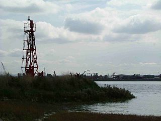
Coldharbour is an area of the London Borough of Havering by the River Thames and southwest of the Rainham Marshes Nature Reserve. It is the location of Coldharbour Point, where there has been a lighthouse since 1885. This point is adjacent to the town of Erith in Bexley, across the Thames. The nearest accessible settlement on land is the town of Rainham, which is connected by Coldharbour Lane; the village of Wennington is also nearby but not accessible by road. The area around the point is mainly industrial land known as the Freightmaster Estate depot. The London Loop passes through Coldharbour on its way east to Purfleet in Thurrock.

Public transport in the London Borough of Havering, in east London, England, is a mix of National Rail, London Underground, London Overground and Elizabeth line and London Buses services. Rail services are primarily radial to central London with bus services providing most of the orbital connections. The public transport authority is Transport for London and the local authority is Havering London Borough Council.

<span class="mw-page-title-main">Farthing Downs</span>

Farthing Downs is an open space in Coulsdon in the London Borough of Croydon. Together with Eight Acres Common and New Hill to the south-east, it is owned and managed by the Corporation of London. Farthing Downs and Eight Acres Common are part of the Farthing Downs and Happy Valley Site of Special Scientific Interest. Happy Valley Park is a green space to the south owned by Croydon Council. Farthing Downs is also a scheduled monument.

<span class="mw-page-title-main">New River Path</span>

The New River Path is a long-distance footpath which follows the course of the 17th-century aqueduct, the New River, for 28 miles (45 km) from its source in Hertfordshire to its original end in Islington, London. The path is waymarked and all signs display the words "New River Path" on a green background.

<span class="mw-page-title-main">Thames Down Link</span>

The Thames Down Link is a 24 km (15 mi) official walking route linking the Thames Path and the North Downs Way. It starts in the town centre of Kingston upon Thames and finishes at Box Hill & Westhumble railway station.

<span class="mw-page-title-main">Harcamlow Way</span> Long-distance footpath in East of England

The Harcamlow Way is a waymarked walking route in England running in a figure-of-eight from Harlow to Cambridge and back again, hence its portmanteau name. On the way it runs through Essex, Hertfordshire and Cambridgeshire. The route is 141 miles (227 km) long.

References

  1. 1 2 3 4 "London LOOP". Transport for London. Retrieved 14 August 2018.
  2. "Pilgrim Ferry". Forgotten Spaces shortlist 2011. RIBA. Archived from the original on 19 January 2012.