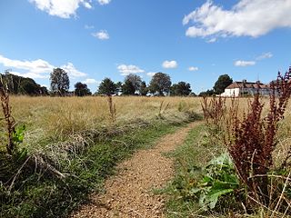
Banstead Downs is a 126.7-hectare (313-acre) biological Site of Special Scientific Interest in Banstead in Surrey.[1][2] There are Saxon burial mounds on the site and they are a Scheduled Monument[3]Today, with wooded areas and wide open fields, Banstead Downs are predominately used for walks by local residents. The downs also form a pathway from Belmont Village and Brighton Road to Banstead.
Archaeological finds on Banstead Downs include Roman and Iron Age pottery and Bronze Age axes. Saxon bowl barrows have been found at the "Gally Hills" site to the west of Brighton Road. The name Gally Hills possibly indicates the former position of a gallows and a gibbet is said to have stood nearby. The northern most barrow of the remaining Gally Hill barrows was excavated during May 1972, after extensive damage, and was thought to contain the remains of a Saxon warrior. Other secondary burials, in which were found two intact skeletons with dislocated necks, suggest that gallows victims were also buried nearby.[4]
The Downs have long formed a largely open grass chalkland attraction, physically separated since the early 20th century by housing at Burgh Heath from their neighbouring geographical continuation, Epsom Downs. It is a section of the North Downs which is not so eroded or indented as elsewhere on the Downs and marks a relatively abrupt rise of the tall North Downs less than 15 miles (24km) from the City of London.
Banstead Downs are still a wide extent of open land, though much reduced since the time when they made one unbroken expanse with Epsom Downs; the old four mile racecourse ran from a point between Banstead village and the railway station into the present 'straight' of Epsom racecourse. Banstead Downs are recorded in the Domesday Book in 1086, when they were the property of Bishop Odo, the half-brother of William the Conqueror.[5]
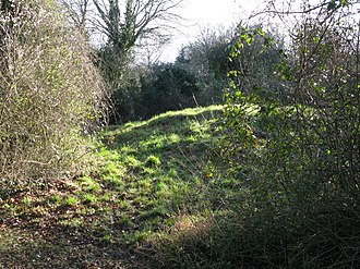
Gally Hills
The Downs, now appropriated chiefly for golf, formerly fed sheep in abundance. The old inn in Banstead village, a building which may well date from the 17th century, is called the 'Wool Pack,' a survival of a past trade. In 1324 the Abbot of Chertsey impleaded John de la Lane, bailiff to Isabella the Queen at Banstead, and others, for taking 1,500 of his sheep at Evesham (Epsom), driving them to Banstead and imparking (i.e. impounding) them, until some died from want of food. The bailiff answered that he took them on Banstead Down by way of distress as the abbot had been impleaded for trespass in the queen's manorial court at Banstead, but had not answered. In the king's court, to which the case was transferred, the abbot obtained damages. In 1338 it was ordered that the officers taking wool for purveyance should exact none from the queen's (Philippa's) manors of Witley and Banstead. The high quality of the wool is shown by a petition of the House of Commons in 1454, in which they prayed that a sack of wool of the growth of Banstead Down might not be sold for less than 100 shillings, as the price of such wool was greatly decayed. The reputation of Banstead Downs for sheep is referred to by Alexander Pope in his Imitations of Horace, and by others.
Historically Banstead Downs were the scene of sport. The sheep-cropped Downs turf and dry chalky subsoil adapted itself admirably to sporting pursuits; vast crowds assembled for foot and horse races, prize fights, wrestling, hawking and hunting. Sutton was the nearest place providing refreshments for animals and man; there was no water on the Downs. Royal horses were stabled at Belmont, where also a range of training stables existed. Nonsuch Palace in the near proximity supplied its quota of royal visitors, and the Royal Hare Warren on the Downs was visited by at least four kings.
When the Earl of Holland's ill-contrived royalist rising of 1648 took place at Kingston, the original plan had included a muster of adherents, as for a horse race, on Banstead Downs. Rumour was rife at the time of such an assembly being formed, and that Holland had marched thither from Kingston. But in fact he had marched to Dorking, and Major Audeley, who was on his track, went over Banstead Downs without finding him or the assembly. The rising had in fact exploded prematurely.
There is evidence of races at Banstead as early as 1625, when the Banstead Downs Plate of £20 value was run on 24 August of that year. A notable footrace was run in 1663, and a famous prize-fight is recorded in 1669. When the great question of the exclusion of James, Duke of York from the succession was before the House of Lords, in 1678, the Duke of Ormonde wrote to Colonel Cooke that he tried to delay the first reading by pointing out the thinness of the House owing to a Dog Match at Hampton Court, and a Horse Match on Banstead Downs. He himself did not attend the Horse Match, where 12 horses ran for 3 plates, 'owners up,' apparently, but he sent a description of it. Two horses fell, one nearly killing his jockey, and it was reported that "the Duke of Monmouth escaped narrowly," so apparently he was also riding.[6]
Hares and partridges were also preserved on the Downs. Henry Saunders was made keeper of a portion of the Downs at £30 a year under The Protectorate, as a reward for trying to seize a highwayman, and in 1668 a gamekeeper was appointed by the Duchy of Lancaster, at the same salary, to preserve hares and partridges. In 1669 the King (Charles II) was hawking there, it not being then the custom to shoot partridges.
The Downs were also used as a muster-place for the Surrey Militia in 1670, when an inspection of the troops was made by the King and Prince Rupert. The formation of a camp of the regular army under the Duke of York or the Duke of Monmouth was discussed in 1678, but it is uncertain whether the plan was carried out.[7]
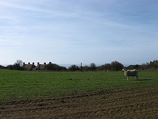
Track on Banstead Downs
During the 17th and 18th centuries, Banstead Downs gained notoriety for the number of highwaymen who lurked there to attack wealthy people enjoying the Downs, attending the races, going to the fashionable spa town of Epsom or travelling from London to Brighton. In July 1731, The Grub-Street Journal reported:
On tuesday Miss Worsley, Niece to the Lady Scawen, being out on Banstead Downs in an open Chaise, having a footman on horseback following, was attacked by one Highwayman, who shew'd his pistol after the usual greeting: the footman was disabled by the fright, but the young Lady struck at him with her whip several times, and company coming up, he thought fit to march off without any booty.[8]
In another account of a more successful robbery from May 1735:
Last week, in the dusk of the Evening, a Gentleman and his Lady going down to Betchworth in Surrey in a Coach, were stopt in Potter's Lane, between Banstead Downs and Walton Heath, by a single Highwayman, who threatened to shoot the Coachman if he stirred, and robbed the Gentleman of a Silver Watch and some Money, and then rode off with his Booty in a great hurry.[9]
Features
The Downs is one of four green areas in the area, which are overall referred to as Banstead Commons. The other areas are Burgh Heath (87 acres), Banstead Heath (760 acres) and Park Downs (74 acres). These areas were the focus of a protracted legal battle in the 19th century.
Surrey is a county in South East England which borders Kent to the east, East Sussex to the southeast, West Sussex to the south, Hampshire to the west, Berkshire to the northwest, and Greater London to the northeast. With about 1.2 million people, Surrey is the twelfth most populous English county, the third most populous home county, after Kent and Essex, and the third most populous in the Southeast, after Hampshire and Kent.
Belmont is a village at the southern end of the town of Sutton in the southwest London Borough of Sutton, England. It is located off the A217 road and near to Banstead Downs in Surrey. It is a suburban development situated 10.8 miles (17.4 km) south-southwest of Charing Cross.
Reigate and Banstead is a local government district with borough status in east Surrey, England. It includes the towns of Reigate, Redhill, Horley and Banstead. The borough borders the Borough of Crawley to the south, the Borough of Epsom and Ewell and District of Mole Valley to the west, Tandridge District to the east and the London Boroughs of Sutton and Croydon to the north.
Epsom is the principal town of the Borough of Epsom and Ewell in Surrey, England, approximately 13.5 mi (21.7 km) south of central London. The town is recorded as Ebbesham in the 13th century and its name probably derives from that of a Saxon landowner. Founded as a spring line settlement where the permeable chalk of the North Downs meets the impermeable London Clay, Epsom developed as a spa town in the Georgian period. The mineral waters were found to be rich in magnesium sulphate, which became known as Epsom salts.
Reigate is a town in Surrey, England, approximately 30 km (19 mi) south of central London. It is in the London commuter belt and one of four towns in the borough of Reigate and Banstead. It is sited at the foot of the North Downs and extends over part of the Greensand Ridge. Reigate has a medieval castle and has been a market town since the medieval period, when it also became a parliamentary borough.
Epsom and Ewell is a local government district with borough status in Surrey, England, covering the towns of Epsom and Ewell. The borough was formed as an urban district in 1894, and was known as Epsom until 1934. It was made a municipal borough in 1937. The district was considered for inclusion in Greater London in 1965 but was left unaltered by the London Government Act 1963 and the Local Government Act 1972 in 1974. However, despite being outside modern Greater London the borough was in the Metropolitan Police District until it was transferred to Surrey Police in 2000. In the May 2019 elections, the borough was held by the Epsom and Ewell Residents Association with 32 seats, Labour with 3 seats, Liberal Democrats with 2 seats, and Conservatives with 1 seat.
Tadworth is a large suburban village in Surrey, England in the south-east of the Epsom Downs, part of the North Downs. It forms part of the Borough of Reigate and Banstead. At the 2011 census, Tadworth had a population of 7,123
Merstham is a town in the borough of Reigate and Banstead in Surrey, England. It is north of Redhill and is contiguous with it. Part of the North Downs Way runs along the northern boundary of the town. Merstham has community associations, an early medieval church and a football club.
Walton-on-the-Hill, Surrey, is a village in England midway between the market towns of Reigate and Epsom. The village is a dispersed cluster on the North Downs centred less than one mile inside of the M25 motorway. The village hosts the Walton Heath Golf Club, whose former members include King Edward VIII, Winston Churchill and David Lloyd George.
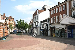
Banstead is a town bordering Greater London in the borough of Reigate and Banstead in Surrey, England. It is 2.5 miles (4 km) south of Sutton, 5 miles (8 km) south-west of Croydon, 7.5 miles (12 km) south-east of Kingston-upon-Thames, and 13.3 miles (21 km) south of Central London.
Tattenham Corner is a neighbourhood in north Surrey, UK, but the name is principally associated with Epsom Racecourse. It is in the Tattenhams ward of Reigate and Banstead Borough.
Nork is a residential area of the borough of Reigate and Banstead in Surrey and borders Greater London, England. Nork is separated from its post town Banstead only by the A217 dual carriageway, and the built-up area is also contiguous with similar parts of Tattenham Corner and Burgh Heath. A thin belt of more open land separates it from the communities to the north: Epsom, Ewell, Cheam and Belmont. There are two parades of shops, one called the Driftbridge and another at the north-eastern end of Nork Way, the street which runs centrally through the residential area. Nork lies on chalk near the top of the gentle north-facing slope of the North Downs, 175 m (575 ft) above sea level at its highest point.
Kingswood or Kingswood with Burgh Heath is a residential area on the North Downs in the Borough of Reigate and Banstead in Surrey, England. Part of the London commuter belt, Kingswood is just to the east of the A217 separating it from Tadworth and has a railway station. Burgh Heath in its north is combined with it to form a ward. Reigate is 3.6 miles (5.8 km) south of its centre and London is 15.5 miles (24.9 km) to the north northeast. Kingswood with Burgh Heath had a population of 6,891 in 2011.
Headley is a village and civil parish in the North Downs in Surrey, England. The nearest settlements are, to the west, Mickleham and Leatherhead; to the north, Ashtead and Langley Vale; to the east, Walton-on-the-Hill; and to the south, Box Hill. It is just outside the M25 motorway encircling London.
Woodmansterne is a village in the borough of Reigate and Banstead, Surrey, bordering Greater London, England. It sits on a small plateau of and a southern down slope of the North Downs and its ecclesiastical parish borders continue to span old boundaries and reach into Chipstead, Coulsdon and Wallington.
Balsdean is a deserted hamlet in a remote downland valley east of Brighton, East Sussex, England, on record since about 1100. It was formerly a chapelry of the parish of Rottingdean, and its territory touched that of the mother parish only at a single point. Despite its remoteness, it falls within the boundaries of the city of Brighton and Hove.
Margery is a heavily buffered, lightly populated hamlet in the Reigate and Banstead district, in the English county of Surrey. It sits on the North Downs, is bordered by the London Orbital Motorway, at a lower altitude, and its predominant land use is agriculture.
Farthing Downs is an open space in Coulsdon in the London Borough of Croydon. Together with Eight Acres Common and New Hill to the south-east, it is owned and managed by the Corporation of London. Farthing Downs and Eight Acres Common are part of the Farthing Downs and Happy Valley Site of Special Scientific Interest. Happy Valley Park is a green space to the south owned by Croydon Council. Farthing Downs is also a scheduled ancient monument.
Sutton Common is the name of former common land and a district and neighbourhood located in Sutton, London. The area is mostly located within the London Borough of Sutton, with some of the streets to the north and west of Sutton Common Park adjoining Lower Morden and Morden within the London Borough of Merton. Much of the area is taken up by the large Kimpton Park commercial and industrial estate, adjoining the A217. It is served by Sutton Common railway station. The area to the south and east of Oldfields Road uses an SM1 postcode and the area to the north and west uses SM3.
This page is based on this Wikipedia article Text is available under the CC BY-SA 4.0 license; additional terms may apply. Images, videos and audio are available under their respective licenses.