Dollis Valley Greenwalk

Last updated

Dollis Valley Greenwalk
Dollis valley greenwalk post.png
The Dollis Valley Greenwalk's logo, a white arrow on green, marks the route
Length10 mi (16 km)
Location London Borough of Barnet, England
Use Hiking
SeasonAll year

The Dollis Valley Greenwalk (or Green Walk) is a footpath [1] route in the London Borough of Barnet in London, England, between Moat Mount Nature Reserve in Mill Hill and Hampstead Heath. The route is designed to act as a link between the Capital Ring and the London Loop, [2] and between the many green spaces and wildlife corridors along the way. It is approximately 10 miles (16 km) long. [3] [4] It mainly follows the Dollis Brook and is one of the many parks and open spaces in Barnet. [5]

Contents

History

Dollis Valley Greenwalk is based on the Brookside Walk, built by Finchley Council (now part of Barnet) in the 1930s. [6] It was the brainchild of leading Finchley Councillor, Alfred Pike, and followed Mutton Brook west from Falloden Way to its junction with Dollis Brook, and then the Dollis north to the Finchley boundary in Wyatts Farm Open Space, opposite Walfield Avenue. Mutton Brook was the southern boundary of the borough and Dollis Brook the western one, and the walk was almost all built on the Finchley side. At Westbury Road, the gardens come down to the brook, so Pike persuaded Hendon Councillors to acquire the land on their side of the brook so that the walk could cross over to the Hendon side for this stretch. [7]

The Greenwalk itself was developed by the London Borough of Barnet with the Countryside Commission (now Natural England) and the Countryside Management Service. In March 2009, the Dollis Valley Greenwalk won a £400,000 grant from the Mayor of London's Help a London park scheme by public vote. [5] [8] The grant was planned to be used to improve footpaths, cycle paths, lighting, entrances for safer walking, accessibility, which includes making it a safe route for walking between communities and play facilities. It was also used for the improvement of existing habitats and the creation of new ones such as wetland woodland and reedbed, enhancement of hay meadows, landscaping, and finally the addition of information boards, fingerposts and other features to increase enjoyability and awareness of points of interest. [5]

Route

Starting at the northern end, the route commences in Moat Mount Open Space. [9] It then skirts Barnet Gate Wood, and goes through Totteridge Fields nature reserve, and by fields and public open spaces through Totteridge, Whetstone and Woodside Park. It passes under Dollis Brook Viaduct and through Windsor Open Space, and on to the end of Dollis Brook where it merges with Mutton Brook to become the River Brent. It then follows Mutton Brook and goes through Little Wood and Big Wood, ending at Hampstead Heath Extension in Hampstead Garden Suburb. The waymarks consist mostly of a simple green disc with a directional white arrow mounted on a wooden post. From Woodside Park south, the walk is mainly flat and partly surfaced, and is thought to be suitable for wheelchair users and pushchairs, but some sections between Woodside Park and Mill Hill can get very muddy and walking shoes may be advisable.

The southern end starts on the edge of Hampstead Heath Extension at the end of a short pathway from Meadway Close, Hampstead Garden Suburb. It goes along Meadway Close and Bigwood Road to Big Wood and Denman Drive South. It then goes through Little Wood Nature Reserve to Addison Way. It turns left along Addison Way and right into a path opposite Erskine Hill. It follows Mutton Brook across Finchley Road at Henlys Corner and under North Circular Road, and turns right where Mutton Brook meets Dollis Brook near Bridge Lane. From here it follows Dollis Brook under Hendon Lane to Windsor Open Space. It crosses Waverley Grove to leave Windsor Open Space at Thornfield Avenue. It then turns right along Dollis Road under Dollis Brook Viaduct, and left to follow the brook to Fursby Avenue and through Riverside Walk to Argyle Road.

In the next section, the route turns right to a footbridge across the brook and then turns left along Holden Road, left again down Tillingham Way and then right to rejoin Dollis Brook in Laurel Way Open Space. It crosses Laurel Way and then goes through the meadowland and trees of Whetstone Stray to Totteridge Lane. It turns right along the Lane and then left just before Totteridge and Whetstone Underground station. This is the only place on the route with shops and toilets.

The route continues through Brook Farm Open Space and Wyatts Farm Open Space to Western Way, and then through Barnet Playing Fields to Barnet Lane and Dollis Brook Walk. It then keeps to the right of the brook through Ducks Island until a narrow metal bridge. It crosses the bridge and turns right through fields for 1000 yards (leaving Dollis Brook, which now goes through private land) until it reaches a playing field, which is exited by a gap in the hedge on the left, It then goes through Totteridge Fields (a nature reserve which is a Site of Metropolitan Importance run by London Wildlife Trust) to Hendon Wood Lane. It turns right along Hendon Wood Lane and after about 500 yards continues along a path on the left, which skirts Barnet Gate Wood. At the end of the Wood the path bears left between hedges. A small pond on the right with a pipe under the path to a stream, which is often dry, is one of the sources of the Dollis Brook. The path then goes through fields to Moat Mount Local Nature Reserve. (When a route marker points half left off the main track, the path goes through the kissing gate opposite.) The route then goes through fields and a wood to wooden steps, where it turns right, finishing at the nature reserve's closed car park on the east side of Barnet Way, part of the A1, and a dual carriageway with no access from the northbound lane.

See also

Related Research Articles

<span class="mw-page-title-main">Finchley</span> District of London, England

Finchley is a large district of north London, England, in the London Borough of Barnet. Finchley is on high ground, 7 mi (11 km) north of Charing Cross.

<span class="mw-page-title-main">Mill Hill</span> Human settlement in England

Mill Hill is a suburb in the London Borough of Barnet, England. It is situated around 10 miles (16 km) northwest of Charing Cross. It was in the historic county of Middlesex until 1965, when it became part of Greater London. Its population was 18,451 in 2011.

<span class="mw-page-title-main">Totteridge</span> Area of the London Borough of Barnet

Totteridge is a residential area and former village in the London Borough of Barnet, England. It is a mixture of suburban development and open land situated 8 miles (13 km) north north-west of Charing Cross. It is part of the Whetstone postal district (N20).

<span class="mw-page-title-main">London Borough of Barnet</span> Borough in the United Kingdom

The London Borough of Barnet is a local authority area on the northern outskirts of London. The borough was formed in 1965 from parts of the ceremonial counties of Middlesex and Hertfordshire. It is the second largest London borough by population with 389,344 inhabitants as of 2021, also making it the 17th largest district in England. The borough covers an area of 86.74 square kilometres (33 sq mi), the fourth highest of the 32 London boroughs, and has a population density of 45.8 people per hectare, which ranks it 25th.

<span class="mw-page-title-main">Whetstone, London</span> Human settlement in England

Whetstone is a suburb of London, in the London Borough of Barnet, bearing the postcode N20. It is served by an Underground station called Totteridge and Whetstone. Whetstone is around 7.8 miles North of Charing Cross and is a settlement in the London Borough of Barnet, previously part of the Borough of Finchley prior to the 1960s. The combined areas of Totteridge and Whetstone was, at the outset of the 21st century, found to be the 63rd-richest of the more than 9,000 wards of the United Kingdom.

<span class="mw-page-title-main">River Brent</span> River in London, England

The River Brent is a river in west and northwest London, England, and a tributary of the River Thames. 17.9 miles (28.8 km) in length, it rises in the Borough of Barnet and flows in a generally south-west direction before joining the Tideway stretch of the Thames at Brentford.

<span class="mw-page-title-main">Totteridge & Whetstone tube station</span> London Underground station

Totteridge & Whetstone is a London Underground station in Whetstone in the London Borough of Barnet, North London. It is on the High Barnet branch of the Northern line, between High Barnet and Woodside Park stations, in Travelcard Zone 4. It was first built in 1872.

<span class="mw-page-title-main">Dollis Brook</span>

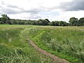
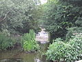
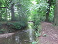
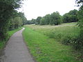
Dollis Brook runs through the London Borough of Barnet in north London. It is a tributary of the River Brent, which is itself a tributary of the River Thames. The Dollis Valley Greenwalk follows almost all of Dollis Brook, apart from a short section at the beginning which passes through private land, and the London Loop follows it as far as Barnet Lane. The name Dollis is probably derived from the Middle English word 'dole', meaning the shares of land in the common field.

<span class="mw-page-title-main">Walking in London</span>

Walking is a popular recreational activity in London, despite traffic congestion. There are many streets that provide interesting walks, especially within historic central London, In addition there are attractive commons, parks, canals, and disused railway tracks that provide space for walks. This includes Wimbledon Common, Epping Forest, Hampstead Heath, and the eight Royal Parks: Hyde Park, Regent's Park, Richmond Park, etc. In recent years access to canals and rivers, including the Regent's Canal, and the River Thames has been greatly improved, and as well a number of long-distance walking routes have been created that link green spaces.

<span class="mw-page-title-main">Edgware, Highgate and London Railway</span> Former railway in North London

The Edgware, Highgate and London Railway was a railway in North London, England. The railway was a precursor of parts of London Underground's Northern line and was, in the 1930s, the core of an ambitious expansion plan for that line which was thwarted by the Second World War. Parts of the line were closed in the 1950s and have since been removed.

The London Borough of Barnet, located on the northern periphery of London and having much of the area within its boundaries in the Metropolitan Green Belt, has many parks and open spaces. In addition there are large areas taken over by cemeteries and golf courses, and part of Hampstead Heath.

<span class="mw-page-title-main">Folly Brook</span>

Folly Brook is a 2+14-mile (3.6 km) long brook in the London Borough of Barnet. It is a tributary of Dollis Brook, which is a tributary of the River Brent, which is a tributary of the River Thames. Folly Brook is lined for most of its length by narrow strips of woodland and scrub, with a good variety of trees and shrubs. It is one of the best streams in Barnet for small aquatic invertebrates, including several species of caddis fly and a stonefly, which are only found in unpolluted waters.

<span class="mw-page-title-main">Barnet Gate</span> Human settlement in England

Barnet Gate is a hamlet on the northern edge of the London Borough of Barnet to the west of Arkley, in England. There was a settlement there during the Roman occupation of Britain and in the Anglo-Saxon period it was known as Grendeles Gatan after Grendel, the monster in the epic poem Beowulf. Manor courts were held there and brickmaking was an important local industry. It was on the edge of Southaw wood which was cleared when nearby Chipping Barnet was developed after which it was known as Barnet Gate. The Gate referred to no longer exists but was either a gate used to prevent cattle straying onto Barnet Common or a gate that marked the boundary between Hertfordshire and Middlesex.

<span class="mw-page-title-main">Moat Mount Open Space</span> Park and nature reserve in London

Moat Mount Open Space is a 110-hectare park and nature reserve in Mill Hill in the London Borough of Barnet. It is part of Moat Mount Open Space and Mote End Farm Site of Borough Importance for Nature Conservation, Grade II, which includes Barnet Gate Wood and Scratchwood Countryside Park, but is separate from Scratchwood itself, which is a neighbouring park and nature reserve. Most of the site is open to the public, but Mote End Farm and some other areas are private. Scratchwood and Moat Mount are a Local Nature Reserve.

<span class="mw-page-title-main">Cherry Tree Wood</span> Park in London, England

Cherry Tree Wood is a 5.3-hectare park in East Finchley in the London Borough of Barnet. It is a Site of Local Importance for Nature Conservation. Located opposite East Finchley Underground station, it contains woodland and grassland, a playground, tennis courts, a cafe and toilets.

<span class="mw-page-title-main">Dollis Brook Viaduct</span> Railway viaduct in Finchley, London

The Dollis Brook Viaduct, also known as the Dollis Road Viaduct, Dollis Viaduct or Mill Hill Viaduct, is a railway viaduct to the west of Finchley, North London, United Kingdom. It carries the London Underground's Northern line from Mill Hill East station to Finchley Central station. It is the highest point on the London Underground above ground level, reaching nearly 60 feet (18 m). It is located on a branch that was formerly part of the Edgware, Highgate and London Railway.

<span class="mw-page-title-main">Totteridge Fields</span>

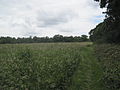
Totteridge Fields is a 97-hectare Site of Metropolitan Importance for Nature Conservation (SINC) in Totteridge in the London Borough of Barnet. The SINC includes the privately owned Highwood Hill, and at the western end is a seven-hectare Local Nature Reserve owned by Barnet Council and managed by the London Wildlife Trust.

<span class="mw-page-title-main">Barnet Gate Wood</span>

Barnet Gate Wood is a public open space in Barnet Gate, Barnet, London. It is owned and managed by the London Borough of Barnet, and is part of the Watling Chase Community Forest.

<span class="mw-page-title-main">Mutton Brook</span>

Mutton Brook is a stream which runs between East Finchley and Hendon in the London Borough of Barnet. It is a tributary of the River Brent, which is itself a tributary of the River Thames.

References

  1. "Dollis Valley Greenwalk – Path Details". Long Distance Walkers Association Ltd. Retrieved 10 June 2009.
  2. "Dollis Valley Greenwalk (Barnet)". Hertfordshire County Council. Archived from the original on 12 September 2012. Retrieved 10 June 2009.
  3. "Barnet Council staff walk to talk about the Dollis Valley Green Walk". Edgware & Mill Hill Times. 16 April 2009. Retrieved 21 May 2009.
  4. "Dollis Valley Greenwalk". The Long Distance Walkers Association. 2008. Retrieved 21 May 2009.
  5. 1 2 3 "Barnet Online – Dollis Valley Green Walk". London Borough of Barnet. Archived from the original on 17 March 2009. Retrieved 10 June 2009.
  6. Following the Brent quotes a letter of complaint about the construction work in 1937.
  7. Reminiscence of Alfred Pike in Percy Reboul compiler, Barnet Voices, Tempus 1999, p. 25.
  8. Bradford, Kevin (11 March 2009). "Residents delighted at £400,000 green spaces grant". Barnet Times. Retrieved 10 June 2009.
  9. The Greenwalk follows the same route as the London Loop between Moat Mount and Barnet Lane, and the London Loop 16 guide Archived 16 July 2011 at the Wayback Machine gives instructions for following this part of the Greenwalk

51°36′09″N0°12′23″W / 51.6025°N 0.2065°W / 51.6025; -0.2065