South East London Green Chain

Last updated

Green Chain Walk signs in Beckenham, Cator Park Footpaths across Cator Park, Beckenham. - geograph.org.uk - 59155.jpg
Green Chain Walk signs in Beckenham, Cator Park

The South East London Green Chain, also known as the Green Chain Walk, is a linked system of open spaces between the River Thames and Crystal Palace Park in London, England. In 1977 four London boroughs and the Greater London Council created this Green Chain of 300 open spaces to protect them from building activity. The four London boroughs are Bexley, Bromley, Lewisham and Greenwich. More recently it has been extended to include sections in Southwark. Many parts of the system are also part of the Capital Ring route.

Contents

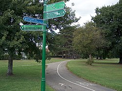
The system begins at three places on the River Thames: Thames Barrier, Thamesmead, and the riverside at Erith. There are various circular walks along the route, and there is an offshoot from the main route to Chislehurst; and the next section reaches Crystal Palace via Bromley. From there it goes north with branches to Dulwich and Nunhead.

Shrewsbury Park, with Green Chain Walk marker post Shrewsbury Park, Shooter's Hill, London.jpg
Shrewsbury Park, with Green Chain Walk marker post

The major open spaces in the Chain are:

The complete list and the routes are to be found on TfL's Walk London site. [1]

See also

Related Research Articles

<span class="mw-page-title-main">Chislehurst</span> Settlement in South East England

Chislehurst is a suburban district of south-east London, England, in the London Borough of Bromley. It lies east of Bromley, south-west of Sidcup and north-west of Orpington, 10 miles (16 km) south-east of Charing Cross. Before the creation of Greater London in 1965, it was in Kent.

<span class="mw-page-title-main">Crystal Palace, London</span> Residential area in London, England

Crystal Palace is a leafy and hilly area in South London, named after the Crystal Palace Exhibition building which stood in the area from 1854, until it was destroyed by fire in 1936. About 7 miles (11 km) southeast of Charing Cross, it includes one of the highest points in London, at 367 feet (112 m), offering views over the capital.

<span class="mw-page-title-main">Penge</span> Suburb of south-east London

Penge is a suburb of South East London, England, now in the London Borough of Bromley, 3.5 miles (5.6 km) west of Bromley, 3.7 miles (6.0 km) north east of Croydon and 7.1 miles (11.4 km) south east of Charing Cross.

<span class="mw-page-title-main">Sydenham, London</span> Human settlement in England

Sydenham is a district of south-east London, England, which is shared between the London boroughs of Lewisham, Bromley and Southwark. Prior to the creation of the County of London in 1889, Sydenham was located in Kent, bordering Surrey. Historically, the area was very affluent, with the Crystal Palace being relocated to Sydenham Hill in 1854. Today, Sydenham is a diverse area, with a population of 28,378 and borders Forest Hill, Dulwich, Crystal Palace, Penge, Beckenham, Catford and Bellingham.

<span class="mw-page-title-main">London Borough of Bromley</span> Borough in United Kingdom

The London Borough of Bromley is the southeasternmost of the London boroughs that make up Greater London, bordering the ceremonial county of Kent, which most of Bromley was part of before 1965. The borough's population is an estimated 332,336. It is named after Bromley, its principal town; other major towns are Penge, Hayes, West Wickham, Chislehurst, Beckenham and Orpington. The local authority is Bromley London Borough Council.

<span class="mw-page-title-main">London Borough of Lewisham</span> Borough of London

Lewisham is a London borough in south-east London; it forms part of Inner London. The principal settlement of the borough is Lewisham. The local authority is Lewisham London Borough Council, based in Catford. The Prime Meridian passes through Lewisham. Blackheath, Goldsmiths, University of London and Millwall F.C. are located within the borough.

<span class="mw-page-title-main">Bromley</span> Area of south east London

Bromley is a large town in Greater London, England, within the London Borough of Bromley. It is 9+12 miles southeast of Charing Cross, and had an estimated population of 339,883 as of 2023.

<span class="mw-page-title-main">Eltham</span> District of southeast London, England

Eltham is a district of southeast London, England, within the Royal Borough of Greenwich. It is 8.7 miles (14.0 km) east-southeast of Charing Cross, and is identified in the London Plan as one of 35 major centres in Greater London. The three wards of Eltham North, South and West have a total population of 35,459. 88,000 people live in Eltham.

<span class="mw-page-title-main">Grove Park, Lewisham</span> Human settlement in England

Grove Park is a district of South East London, England within the London Borough of Lewisham. It is located north east of Bromley and south east of Lewisham.

<span class="mw-page-title-main">New Eltham</span> Human settlement in England

New Eltham is a suburban area of South East London, England, primarily in the Royal Borough of Greenwich with some parts in the London Borough of Bexley. It is located south east of Eltham and north west of Sidcup.

<span class="mw-page-title-main">Parliamentary constituencies in London</span>

The region of Greater London, including the City of London, is divided into 73 parliamentary constituencies which are sub-classified as borough constituencies, affecting the type of electoral officer and level of expenses permitted.

<span class="mw-page-title-main">Walking in London</span>

Walking is a popular recreational activity in London, despite traffic congestion. There are many streets that provide interesting walks, especially within historic central London, In addition there are attractive commons, parks, canals, and disused railway tracks that provide space for walks. This includes Wimbledon Common, Epping Forest, Hampstead Heath, and the eight Royal Parks: Hyde Park, Regent's Park, Richmond Park, etc. In recent years access to canals and rivers, including the Regent's Canal, and the River Thames has been greatly improved, and as well a number of long-distance walking routes have been created that link green spaces.

<span class="mw-page-title-main">Parks and open spaces in the Royal Borough of Greenwich</span>

The Royal Borough of Greenwich has over fifty parks and open spaces within its boundaries. They include:

The London Borough of Bromley in Greater London, England has over one hundred parks and open spaces within its boundaries: some large, like Crystal Palace Park, and some small, such as recreation grounds. Some of the open spaces form part of the South East London Green Chain. As a borough in Outer London it also contains some open countryside in the form of country parks.

<span class="mw-page-title-main">Parks and open spaces in the London Borough of Lewisham</span>

Lewisham parks and open spaces are part of the "green lung" of London and include a diverse range of sites, from small urban parks and gardens to one of the most historic natural landscapes in Greater London at Blackheath. While overall control rests with London Borough of Lewisham, management of borough-owned parks and their facilities is contracted out to Glendale Grounds Management.

<span class="mw-page-title-main">Lewisham West and Penge (UK Parliament constituency)</span> Parliamentary constituency in the United Kingdom

Lewisham West and Penge is a constituency in Greater London created in 2010 and represented in the House of Commons of the UK Parliament since 2017 by Ellie Reeves of the Labour Party.

<span class="mw-page-title-main">Sydenham Hill</span> Affluent locality in southeast London

Sydenham Hill forms part of a longer ridge and is an affluent locality in southeast London. It is also the name of a road which runs along the northeastern part of the ridge, demarcating the London Boroughs of Southwark, Bromley, and Lewisham. Its highest part is the apex of the Boroughs of Southwark and Lewisham and the 15th-highest peak in London, at 367 feet (112 m).

<span class="mw-page-title-main">Horn Park</span> Area of south east London

Horn Park is an area of south east London south west of Eltham. It is located 12.5 km (7.8 mi) southeast of Charing Cross on the southwest edge of the Royal Borough of Greenwich and borders both the London Borough of Lewisham and the London Borough of Bromley. There is a public park also named Horn Park and two schools in the area. The River Quaggy flows northward though Horn Park, and the suburb is covered by the postcode district SE12, which was previously called the Lee postal district. There is community centre located in Horn Park Estate on Sibthorpe Road, that hosts a number of activities, such as Christian, council and MP meetings, and numerous classes including dance, karate and English.

<span class="mw-page-title-main">Mid-Kent line</span> Railway line in the UK

The Mid-Kent line is a British railway line running from Courthill Loop North junction to Hayes railway station in the London Borough of Bromley. Despite its name, none of the line is in the present-day county of Kent.

<span class="mw-page-title-main">Waterlink Way</span>

Waterlink Way is a cyclepath and walking route in South East London. It extends from South Norwood Country Park to the Cutty Sark ship in Greenwich, a total of eight miles.

References

51°28′N0°01′E / 51.47°N 0.01°E / 51.47; 0.01


Sydenham Wells Park ( Borough of Lewisham) is in the Green chain walk. It is one of the most attractive parks in the borough with a fine water feature, ponds, water play, flowerbeds and fine species of trees and shrubs. It is on route from Crystal Palace to Sydenham Hill Woods with a Noticeboard and well signed markings...