Esher is a town in Surrey, England, to the east of the River Mole.

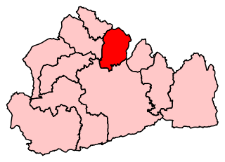
Elmbridge is a local government district with borough status in Surrey, England. Its principal towns and villages are Esher, Cobham, Walton-on-Thames, Weybridge and Molesey. It directly borders the London Borough of Richmond upon Thames and the London Royal Borough of Kingston upon Thames. Some areas of the borough form a continuation of the Greater London Built-up Area, formerly falling into the Metropolitan Police District.

The River Wandle is a right-bank tributary of the River Thames in south London, England. With a total length of about 9 miles (14 km), the river passes through the London boroughs of Croydon, Sutton, Merton and Wandsworth, where it reaches the Thames. A short headwater – the Caterham Bourne – is partially in Surrey, the historic county of the river's catchment. Tributaries of the Wandle include Carshalton Ponds and Norbury Brook.
Long Ditton is a residential suburb in the Borough of Elmbridge, Surrey, England on the boundary with the Royal Borough of Kingston upon Thames, London. In medieval times it was a village, occupying a narrow strip of land. Neighbouring settlements include Hinchley Wood, Thames Ditton and Surbiton.

Thames Ditton is a suburban village on the River Thames, in the Elmbridge borough of Surrey, England. Apart from a large inhabited island in the river, it lies on the southern bank, centred 12.2 miles (19.6 km) southwest of Charing Cross in central London. Thames Ditton is just outside Greater London but within the Greater London Urban Area as defined by the Office for National Statistics. Its clustered village centre and shopping area on a winding High Street is surrounded by housing, schools and sports areas. Its riverside faces the Thames Path and Hampton Court Palace Gardens and golf course in the London Borough of Richmond upon Thames. Its most commercial area is spread throughout its conservation area and contains restaurants, cafés, shops and businesses.

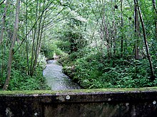
The Hogsmill River in Surrey and Greater London, England is a small chalk stream tributary of the River Thames. It rises in Ewell and flows into the Thames at Kingston upon Thames on the lowest non-tidal reach, that above Teddington Lock.

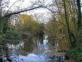
The River Ember is a short river in the north of Surrey, England — a channel of the River Mole which splits in two south of Island Barn Reservoir, between East Molesey and Lower Green, Esher. The Ember, the larger channel, flows in an easterly and then northerly direction around the reservoir, past part of Esher; the Mole flows around the other side past West Molesey. The two rivers then flow side by side approximately north east and merge 400 metres before joining the River Thames at the eastern end of East Molesey opposite Hampton Court Palace on the south side of the last non-tidal reach, which is above Teddington Lock.

Oxshott Heath and Woods is an area of woods and heathland in Oxshott, Surrey, England covering approximately 200 acres (81 ha), as an area of common land. It is owned by a local authority, however historic rights of access and gathering dead wood where necessary for individual fires are shared and exercised by landowners in the parish of Oxshott which has existed since the end of the 19th century, created from the east of the village of Stoke D'Abernon which in this area was extremely scantly populated until the construction of Oxshott railway station.
Esher and Walton is a constituency in Surrey represented in the House of Commons of the UK Parliament. Since 2010, it has been represented by Dominic Raab of the Conservative Party, who served as deputy prime minister before resigning from that role in April 2023 due to bullying allegations. In May he announced he would be standing down as an MP at the next general election.

Claygate is an affluent suburban village in Surrey, England, 14 miles southwest of central London. It is the only civil parish in the borough of Elmbridge. Adjoining Esher and Hinchley Wood to the west and north respectively, and bordered by green belt land to the south and east, Claygate lies within the Greater London Built-up Area.
The River Ash is a small, shallow river in Surrey, England. Its course of 10 kilometres (6.2 mi) is just outside Greater London. Work has been carried out to re-align, clear and build up a small, Littleton head of water and create two backwaters. One backwater dates to the medieval period; the other to the 1990s. It flows as one of the six distributaries of the River Colne from the south of Staines Moor immediately south of the Staines Bypass eastwards through the rest of the borough of Spelthorne before meeting the River Thames.
Esher was a borough constituency represented in the House of Commons of the Parliament of the United Kingdom. It elected one Member of Parliament (MP) by the first past the post system of election. In the general elections during its 47-year lifetime it was won by three Conservatives successively. In area it shrank in 1974, then regrew in 1983 taking in four sparsely inhabited wards which proved to be temporary, as omitted from the successor seat, Esher and Walton.

Weston Green is a small suburban village and a ward in the Elmbridge borough of Surrey. This area was, until 1901, a part of Thames Ditton with which it remains contiguous and associated. Weston Green is also contiguous with Esher, which provides the village's closest railway station. The village forms a rough triangle of land along the west side of the midsection of the Hampton Court Branch Line next to Thames Ditton railway station and down to Esher railway station, with the split between the two being the part dual-carriageway, the A309.
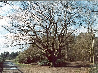
Esher Commons is a 360.1-hectare (890-acre) biological Site of Special Scientific Interest south-west of Esher in Surrey. It includes Esher Common, Fairmile Common, West End Common and Oxshott Heath. Esher Common and West End Common are Local Nature Reserves.

Malden Rushett is a small village in the Royal Borough of Kingston upon Thames, London. It is located at the southernmost tip of the Royal Borough, surrounded by woodland and farmland, and between the larger suburban villages and towns of Claygate, Chessington, Epsom, Ashtead, Leatherhead and Oxshott.

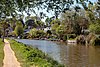
The River Wey is a main tributary of the River Thames in south east England. Its two branches, one of which rises near Alton in Hampshire and the other in West Sussex to the south of Haslemere, join at Tilford in Surrey. Once combined, the flow is eastwards then northwards via Godalming and Guildford to meet the Thames at Weybridge. Downstream the river forms the backdrop to Newark Priory and Brooklands. The Wey and Godalming Navigations were built in the 17th and 18th centuries, to create a navigable route from Godalming to the Thames.

The Elmbridge Guardian is a weekly free local newspaper covering the borough of Elmbridge, in Surrey. It is published once a week, on a Thursday, and is distributed free of charge.

The geology of Surrey is dominated by sedimentary strata from the Cretaceous, overlaid by clay and superficial deposits from the Cenozoic.