Knight Reservoir

Last updated

Knight Reservoir
BessboroughKnight01.JPG
Input station for Knight and Bessborough Reservoirs
Surrey UK relief location map.jpg
Red pog.svg
Knight Reservoir
Location Surrey
Coordinates 51°23′56.6″N0°23′36.2″W / 51.399056°N 0.393389°W / 51.399056; -0.393389
Type reservoir
Basin  countriesUnited Kingdom
Surface area50.5 ha (125 acres)
Water volume5.46 Gl (1.20×10^9 imp gal)

The Knight Reservoir is a large pumped storage reservoir located in the Borough of Elmbridge in Surrey. It was inaugurated in 1907 and stores up to 2,180 million litres of raw water abstracted from the River Thames prior to its treatment and supply to London and north Surrey. It is located south of the River Thames, west of West Molesey, and between Hurst Road (A3050) and Walton Road (B369). It is adjacent to, and west of, its twin Bessborough Reservoir.

Contents

History

In 1898 the Southwark and Vauxhall Waterworks Company operated a water works at Hampton, Middlesex. To increase the raw water storage capacity the company sought legal powers to construct two reservoirs across the river from the Hampton works. [1] This was achieved through the provisions of the Southwark and Vauxhall Water Act 1898 (61 & 62 Vict. c. cxv) [2] which empowered the company to build two storage reservoirs; an intake from the river Thames; a pump house, and filter beds. [1] Work began in 1898 on the site of an old mansion called Apps Court.

Construction was incomplete when, in 1902, the Metropolitan Water Board (MWB) was formed under the terms of the Metropolitan Water Act 1902 (2 Edw. 7. c.41). The MWB took over the assets of several companies including the Southwark and Vauxhall Waterworks Company and the partly built reservoirs at Walton.

The MWB continued the construction and the reservoirs were inaugurated in 1907. [1]

Specification

The Knight and Bessborough reservoirs have a combined area of 125.5 acres (0.508 km2) and hold 1,198 million gallons. [3] Other key details of the reservoirs are as follows. [1]

ParameterKnight ReservoirBessborough Reservoir
Capacity2,180 Mega litres3,260 Ml
Surface area20.8 ha30 ha
Perimeter1,800 m2,000 m
Total excavation1.15 million cubic metres
Puddle clay used153,000 cubic metres
Concrete57,000 cubic metres

The embankment walls of the reservoirs have a puddle clay core extending down to the underlying blue London clay. [1]

The inlet pipes and water discharge tower are adjacent to the north embankment.

Water from the reservoirs was piped under the river and flowed by gravity to the filter beds at Hampton Water Works. [1]

The Metropolitan Water Board operated the reservoirs until the Board was abolished in 1974 under the provisions of the Water Act 1973 (c. 37). [4] Ownership and control was transferred to the Thames Water Authority (TWA). The water supply industry was privatised in 1989, [5] and the TWA became Thames Water.

Knight and Bessborough Reservoirs are a Site of Special Scientific Interest.

Operations

Water was abstracted from the river Thames through an open intake channel (139 m long, 6.7 m wide, with a water depth of 2.4 m) and pumped into the reservoirs. [6] There were four lift pumps which were originally driven by triple-expansion steam engines each rated at 373 kW at 135 rpm. Each engine was coupled to a two-stage centrifugal pump capable of delivering 114 million litres/day. [6] The reservoirs allowed some settlement of suspended solids, biological cleaning through exposure to sunlight, and provided a buffer storage volume to maintain capacity at times of low flow in the river.

The water quality changes which took place during reservoir storage are as follows. [7]

Water quality before and after storage in Walton reservoirs
QuarterSourceAmmoniacal N.Albumin N.NitratePhosphateTurbidityAgar colony per ml.E. Coli per 100 ml.
March to MayRiver Thames before storage0.250.234.71.81853875298
Walton reservoir outlet0.260.164.81.6523655
June to AugustRiver Thames before storage0.120.253.92.31918802576
Walton reservoir outlet0.210.173.82.13687
Sept. to Nov.River Thames before storage0.270.244.02.41765204850
Walton reservoir outlet0.240.173.82.3322687
Dec. to FebruaryRiver Thames before storage0.310.264.62.13197375288
Walton reservoir outlet0.230.144.61.84324108

As originally conceived water from the reservoirs was piped under the river and flowed by gravity to the filter beds at Hampton Water Works. The difference in level between the reservoirs and the filter beds was 9.7 m. The flow of water drove three hydraulic turbines coupled to centrifugal pumps which were used to lift river water into the reservoirs. [1] In addition to the Knight and Bessborough reservoirs there were four smaller rectangular reservoirs (each 750 ft by 550 ft, 229 m by 167 m) located east of the intake channel. [8]

In the 1920s a water treatment works was constructed to the north of the reservoirs. By 1933 this comprised six slow sand filters (each 220 ft by 170 ft, 67 m by 52 m) located west of the intake channel. [9]

In 1926 the steam engines were converted to single cylinder triple expansion steam pumps and steam turbines. [6] Further filter beds were added in 1950 west of the pump house.

Further plant was added as the demand for water grew, and when the Queen Elizabeth II reservoir was commissioned in 1962. The steam engines were replaced with electric motors in 1964. [6]

See also

Related Research Articles

<span class="mw-page-title-main">Borough of Elmbridge</span> Local government district in Surrey, England

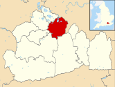
Elmbridge is a local government district with borough status in Surrey, England. Its council is based in Esher, and other notable towns and villages include Cobham, Walton-on-Thames, Weybridge and Molesey. The borough lies just outside the administrative boundary of Greater London, but is mostly within the M25 motorway which encircles London. Many of the borough's urban areas form part of the wider Greater London Built-up Area.

<span class="mw-page-title-main">Seething Wells</span> Human settlement in England

Seething Wells is a neighbourhood in southwest London on the border between Surbiton in the Royal Borough of Kingston upon Thames in Greater London, and Elmbridge in Surrey. The area was historically a waterworks that supplied London with water from the River Thames. Nowadays it is mainly a residential area, with the notable exception of decommissioned filter beds — the Seething Wells Filter Beds — in the northwest part of the area that borders the Thames.

<span class="mw-page-title-main">Molesey</span> District in Surrey, England

Molesey is a suburban district comprising two villages, East Molesey and West Molesey, in the Borough of Elmbridge, Surrey, England, and is situated on the south bank of the River Thames.

<span class="mw-page-title-main">Metropolitan Water Board</span> Public utility supplying water to London 1903–1974

The Metropolitan Water Board was a municipal body formed in 1903 to manage the water supply in London, UK. The members of the board were nominated by the local authorities within its area of supply. In 1904 it took over the water supply functions from the eight private water companies which had previously supplied water to residents of London. The board oversaw a significant expansion of London's water supply infrastructure, building several new reservoirs and water treatment works.

<span class="mw-page-title-main">Molesey Lock</span> Lock on the River Thames in Surrey, England

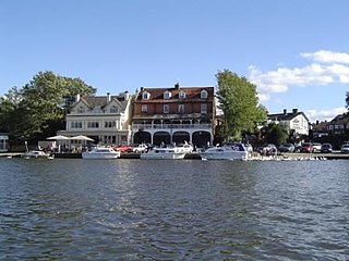
Molesey Lock is a lock on the River Thames in England at East Molesey, Surrey on the right bank.

<span class="mw-page-title-main">Staines Reservoirs</span> Storage reservoirs in the United Kingdom

The Staines Reservoirs are two large pumped storage reservoirs sitting to the east of the King George VI Reservoir near Heathrow airport in Surrey within the Colne Valley regional park. The village of Stanwell is mainly to the north east, and the town of Staines is to the south.

<span class="mw-page-title-main">Molesey Reservoirs</span> Reservoirs in Surrey, England

The Molesey Reservoirs were a group of reservoirs in England near Molesey, Surrey, in the western suburbs of London. There was an adjacent water treatment works.

<span class="mw-page-title-main">Stain Hill Reservoirs</span>

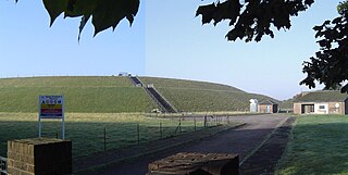
The Stain Hill Reservoirs in London, England with embankments occupy 0.175 square kilometres. They are a pair which sit high between others; Kempton Nature Reserve; riverside houses in Sunbury-on-Thames; and a low area of flood meadow to the west alongside the closing stretch of the Port Lane Brook. Other nearby settlements are Molesey, Hampton and Hanworth.

<span class="mw-page-title-main">Bessborough Reservoir</span> Reservoir in Surrey

The Bessborough Reservoir is an embanked storage reservoir south of the River Thames in Surrey adjacent to the Knight Reservoir. To the south lies Queen Elizabeth II Reservoir and to the north the now disused Molesey Reservoirs. The A3050 runs to the north of the reservoir and the neighbouring town is Molesey to the east. It forms part the green buffer between Molesey and Walton on Thames. The reservoir is in the borough of Elmbridge.

<span class="mw-page-title-main">Island Barn Reservoir</span> Reservoir in Elmbridge, Surrey

The Island Barn Reservoir lies south of the River Thames in England at West Molesey and north of Lower Green, Esher. The reservoir has a surface area of 122 acres (0.49 km2) and a capacity of 922 million gallons. Managed by Thames Water, it is in the Borough of Elmbridge and is surrounded by the River Mole to the west and the River Ember to the east. Queen Elizabeth II Reservoir is a larger reservoir to the West.

<span class="mw-page-title-main">Queen Elizabeth II Reservoir</span> Reservoir in Greater London, England

The Queen Elizabeth II Reservoir lies to the south of the River Thames and to the west of the Island Barn Reservoir. To the north are the Bessborough and Knight reservoirs. The A3050 runs to the north of the reservoir and it is situated in Walton on Thames. It is managed by Thames Water.

Sunnyside Reservoir is a reservoir forming part of the Hampton waterworks complex within the London borough of Richmond-upon-Thames.

<span class="mw-page-title-main">London water supply infrastructure</span>

London's water supply infrastructure has developed over the centuries in line with the expansion of London.

<span class="mw-page-title-main">Grand Junction Isle</span>

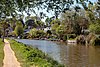
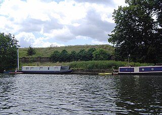
Grand Junction Isle is a small island in the River Thames on the reach above Molesey Lock at Sunbury-on-Thames, Surrey, England. It is just downstream of Sunbury Court Island, which is three times longer and also close to the north bank.

The Southwark and Vauxhall Waterworks Company was a utility company supplying water to parts of south London in England. The company was formed by the merger of the Southwark and Vauxhall water companies in 1845 and became part of the publicly owned Metropolitan Water Board in 1904.

The Lambeth Waterworks Company was a utility company supplying water to parts of south London in England. The company was established in 1785 with works in north Lambeth and became part of the publicly owned Metropolitan Water Board in 1904.

The West Middlesex Waterworks Company was a utility company supplying water to parts of west London in England. The company was established in 1806 with works at Hammersmith and became part of the publicly owned Metropolitan Water Board in 1904.

The Walton water treatment works are an advanced purification works supplied with raw water and producing and delivering potable water to the locality and into the Thames Water ring main. The Walton water treatment works were initially built in 1907 north of the Bessborough and Knight reservoirs which supply the water works.

The Kempton Park water treatment works, in the London Borough of Hounslow and Kempton Park Surrey, takes raw settled water abstracted from the River Thames and supplies treated potable water to consumers in north and west London. The works were inaugurated in 1906 and continue to provide treated water.

<span class="mw-page-title-main">Hampton Water Treatment Works</span> A water treatment works in Hampton, London

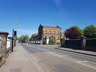
Hampton Water Treatment Works are water treatment works located on the River Thames in Hampton, London. Built in the second half of the 19th Century to supply London with fresh water, the Waterworks was in the past a significant local employer, and its brick pumphouses dominate the local landscape. The Waterworks are currently owned and operated by Thames Water, occupying a 66 ha site located between the Upper Sunbury Road (A308) and the River Thames. The Waterworks currently has a maximum output of 700 megalitres a day, and supplies ~30% of London's fresh water.

References

  1. 1 2 3 4 5 6 7 "Walton Reservoirs". Engineering Timelines. Retrieved 23 June 2020.
  2. "Southwark and Vauxhall Water Act 1898". legislation.gov.uk. 1898. Retrieved 23 June 2020.
  3. A Guide to the Industrial Archaeology of the Borough of Elmbridge
  4. "Water Act 1973". legislation.co.uk. 1973. Retrieved 23 June 2020.
  5. "Water Act 1989". legislation.gov.uk. 1989. Retrieved 24 June 2020.
  6. 1 2 3 4 "Walton Pumping Station". Engineering Timelines. Retrieved 23 June 2020.
  7. Water Research Centre (1977). Water Purification in the EEC. Oxford: Pergamon. p. 373. ISBN   0080212255.
  8. Ordnance Survey 25-inch Surrey XII.1 (Sunbury; Walton Upon Thames) Revised: 1912
  9. Ordnance Survey 6-inch Surrey XII.NW (includes: East Molesey; Esher; Walton upon Thames; West Molesey.) Revised: 1938