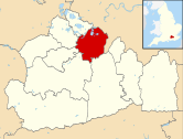
Weston Green

Last updated

Weston Green
Weston Green - geograph.org.uk - 1212512.jpg
The narrow western section of Weston Green has the main through route and the retail/dining/entertainment roads of the village. The local council offset the A309 road with daffodils in spring time.
Surrey UK location map.svg
Red pog.svg
Weston Green
Location within Surrey
Area1.5 km2 (0.58 sq mi)
Population3,876 (2011 census) [1]
  Density 2,584/km2 (6,690/sq mi)
OS grid reference TQ1566
Civil parish
  • n/a
District
Shire county
Region
Country England
Sovereign state United Kingdom
Post town THAMES DITTON
Postcode district KT7
Post townESHER
Postcode district KT10
Dialling code 020
01372
Police Surrey
Fire Surrey
Ambulance South East Coast
UK Parliament
List of places
UK
England
Surrey
51°23′02″N0°21′04″W / 51.384°N 0.351°W / 51.384; -0.351 Coordinates: 51°23′02″N0°21′04″W / 51.384°N 0.351°W / 51.384; -0.351

Weston Green is a small suburban village [n 1] and a ward in the Elmbridge borough of Surrey. This area was, until 1901, a part of Thames Ditton with which it remains contiguous and associated. Weston Green is also contiguous with Esher, which provides the village's closest railway station. The village forms a rough triangle of land along the west side of the midsection of the Hampton Court Branch Line next to Thames Ditton railway station and down to Esher railway station (which is on the South West Main Line), with the split between the two being the part dual-carriageway, the A309.

Contents

History

Farm and manors

The name is derived from Westun, a farmstead covering land in the west of Thames Ditton.

Weston Green appears in Domesday Book of 1086 as Westone held by Barking Abbey (a nunnery). Its domesday assets were: 3 ploughs. It rendered £2 per year to its feudal system overlords. [2]

The village occupies part of the lands of two manors of medieval Thames Ditton:

According to the Chancery Rolls of 1212, King John was entertained at a residence of some size in Ditton belonging to Geoffrey Fitz Pierre, the Chief Justice, during a royal journey from Chertsey to London. It was likely the house of one of these two manors.

A curious reminder of the ancient lordship of Weston is given by a notice board, which used to stand on the common, headed 'Manor of Weston otherwise Barking'. The alternative name of Barking Manor appears in surveys before the 20th century of Imber Court.

The manor of Weston was annexed by Act of Parliament in 1539 and leased in the following year to John Baker. In later times, the Crown usually demised it upon lease to the owner of Imber Court. In the great Onslow sale of Imber Court in 1778, William Speer (who had acquired property in Westminster and Fulham on marrying heiress Katherine Wilson) bought the largest parcel of land, Manor Farm. In 1801 his son William bought the remains of the manor of Weston from the Crown. This comprised waste (infertile land) that was common land and also came with the Lordship of the Manor of Weston "alias Barking". William passed on the title of Lord of the Manor of Weston to his son Wilfred Speer, and later it was inherited by Wilfred's son Wilfred Dakins Speer and then Hannibal son of Cecilia Speer and Hannibal Sandys, who took the name of Speer to conform with William's will. At about the same time that Speer bought the manor of Weston, he bought extensive 'wastes' or common lands belonging to the manors of Claygate and Imber Court, which has since been treated as part of the manor of Weston.

The barn of Weston Manor Farm, built to Henry VIII's order, was said to be a 'huge and splendid building'. During the reign of his younger daughter Elizabeth I the farm belonged to Thomas Fanshawe. It was demolished in 1962.

Towards the end of the 18th century, an amateur police force of about 80 men was formed at Weston Green. In 1792, a group of vigilantes was formed and based at the Harrow Inn. Their backers included William Speer of Weston Grange, Thomas Bracey and William Chauncey.

From 1901 until 1939 a plain, red brick, chapel of ease here existed to the church of Thames Ditton. Weston Green was the birthplace of Felicia Browne (1904–1936).

Amenities

A green buffer, including the Esher and Thames Ditton Golf Course, separate it from the Littleworth Common part of Claygate that was also once a manor of Thames Ditton. East Molesey and Esher's part of the Imber Court and Sandown Park neighbourhoods directly adjoin. Its relatively small green is adjoined by the larger Old Cranleighan (Sports) Club, see Cranleigh School.

Weston Green has an Anglican church, All Saints, built in 1939 having been designed by Edward Maufe who designed Guildford Cathedral. [3] and an unusually rounded Catholic church. Hampton Court Way was built 1928–32. It bisects the village and became the division between the Esher and Thames Ditton post towns.

All Saints - Edward Maufe's brick built church showing features and proportions typical of his designs and part of Marney's Pond AllSaintsWGreen27Ja6-3272.jpg
All Saints – Edward Maufe's brick built church showing features and proportions typical of his designs and part of Marney's Pond

The three pub-restaurants are joined by a restaurant forming a cluster, indeed a small number of shops (such a motor outlet and an estate agents) form the only non-residential cluster here, all facing or almost facing Hampton Court Way. The cluster comprises:

Demography and housing

2011 Census Homes
Output areaDetachedSemi-detachedTerracedFlats and apartmentsCaravans/temporary/mobile homesShared between households [1]
(ward)8043983013410

The average level of accommodation in the region composed of detached houses was 28%, the average that was apartments was 22.6%.

2011 Census Key Statistics
Output areaPopulationHouseholds% Owned outright% Owned with a loanhectares [1]
(ward)3,8761,3674048150

The proportion of households in the settlement who owned their home outright compares to the regional average of 35.1%. The proportion who owned their home with a loan compares to the regional average of 32.5%. The remaining % is made up of rented dwellings (plus a negligible % of households living rent-free).

Local government

At Surrey County Council, one of the 81 representatives represents the area, that for The Dittons division. At the two tiers levels of local government, to date representatives have been from the Conservative more often lately a usually allied to the others Thames Ditton & Weston Green Residents' Association but sometimes acting independently from the other residents associations, as currently professed at the county level by Nick Darby. [5]

At Elmbridge Borough Council the ward is a smaller one than its average and elects two councillors. [6]

Elmbridge Borough Councillor
ElectionMember [6]

Ward

2016Tannia ShipleyWeston Green
2016Jane TurnerWeston Green
2016Nigel Haig-BrownWeston Green
Surrey County Councillor
ElectionMember [7]

Electoral Division

2017Nick DarbyThe Dittons

Notes and references

Notes
  1. An almost identical definition is the parish of Weston, which officially gives the village a status as one of the villages in England
References
  1. 1 2 3 Key Statistics; Quick Statistics: Population Density United Kingdom Census 2011 Office for National Statistics Retrieved 21 November 2013
  2. Surrey Domesday Book Archived 30 October 2007 at the Wayback Machine
  3. All Saints, Weston or Weston Green The Church of England. Retrieved 14 December 2013
  4. Google maps Retrieved 14 December 2013
  5. Electoral Divisions Archived 2 December 2013 at the Wayback Machine Surrey County Council. Retrieved 6 November 2013
  6. 1 2 Your local councillors Elmbridge Borough Council. Retrieved 14 December 2013
  7. Your Councillor Surrey County Council. Retrieved 6 November 2013

Related Research Articles

Esher Town in Surrey, England

Esher is a town in Surrey, England, to the east of the River Mole.

Borough of Elmbridge Non-metropolitan district in England

Elmbridge is a local government district with borough status in Surrey, England. Its principal towns are Esher, Cobham, Walton-on-Thames, Weybridge and Molesey. It directly borders the London Borough of Richmond upon Thames and the London Royal Borough of Kingston upon Thames. Areas of the borough form a continuation of the Greater London built-up area, formerly falling into the Metropolitan Police District.

Long Ditton Human settlement in England

Long Ditton is a residential suburb in the Borough of Elmbridge, Surrey, England on the boundary with the Royal Borough of Kingston upon Thames, London. In medieval times it was a village, occupying a narrow strip of land. Neighbouring settlements include Hinchley Wood, Thames Ditton and Surbiton.

Thames Ditton Human settlement in England

Thames Ditton is a suburban village by and on the River Thames, in the Elmbridge borough of Surrey, England. Apart from a large inhabited island in the river, it lies on the southern bank, centred 12.2 miles (19.6 km) southwest of Charing Cross in central London. Thames Ditton is just outside Greater London but within the Greater London Urban Area as defined by the Office for National Statistics. Its clustered village centre and shopping area on a winding High Street is surrounded by housing, schools and sports areas. Its riverside faces the Thames Path and Hampton Court Palace Gardens and golf course in the London Borough of Richmond upon Thames. Its most commercial area is spread throughout its conservation area and contains restaurants, cafés, shops and businesses.

Hersham Human settlement in England

Hersham is a village in Surrey, within the M25. Its housing is relatively low-rise and diverse and it has four technology/trading estates. The only contiguous settlement is Walton-on-Thames, its post town.

River Ember

The River Ember is a short river in the north of Surrey, England — a channel of the River Mole which splits in two south of Island Barn Reservoir, between East Molesey and Lower Green, Esher. The Ember, the larger channel, flows in an easterly and then northerly direction around the reservoir, past part of Esher; the Mole flows around the other side past West Molesey. The two rivers then flow side by side approximately north east and merge 400 metres before joining the River Thames at the eastern end of East Molesey opposite Hampton Court Palace on the south side of the last non-tidal reach, which is above Teddington Lock.

Esher and Walton (UK Parliament constituency) Parliamentary constituency in the United Kingdom, 1997 onwards

Esher and Walton is a constituency represented in the House of Commons of the UK Parliament. It is currently represented by Dominic Raab of the Conservative Party, who is the current Secretary of State for Foreign, Commonwealth and Development Affairs and First Secretary of State.

Claygate Human settlement in England

Claygate is a suburban village in Surrey, England, 13 miles southwest of central London. It is the only civil parish in the borough of Elmbridge. Surrounded by green belt, it lies inside the Greater London Built-up Area.

Molesey Human settlement in England

Molesey is a suburban district comprising two towns, East Molesey and West Molesey, in Surrey, England, and is situated on the south bank of the River Thames.

Thames Ditton Island

Three river islands (aits) form a linear group, close to the junction of the two main old streets of Thames Ditton village, in the River Thames in a corner of modern Surrey, on the Kingston reach above Teddington Lock. Thames Ditton Island, the dominant ait, is 350 yards (320 m) long and has 48 houses with gardens ; Boyle Farm Island has one house; Swan Island, between the two, is the smallest.

Church of St Nicholas, Thames Ditton Church in Surrey, United Kingdom

St Nicholas Church in Thames Ditton, Surrey, England, is a Grade I listed Anglican parish church that has parts that date back to the 12th century.

Hinchley Wood Human settlement in England

Hinchley Wood is a suburban village in the Elmbridge borough of Surrey, England, approximately 13 miles south-west of Charing Cross in central London, and within the Greater London Urban Area. It developed largely around its railway station at its heart on the New Guildford Line — and many of its homes house at least one commuter to Central London. The village has one main parade of convenience shops, local services and a petrol station; throughout the area is a light smattering of small businesses.

A309 road

The A309 is a partially primary status A-road that runs in two sections, a short section in Twickenham and Teddington as a non-primary status A-road, as well as the much longer second section that runs from Hampton Court to Hook.

Hundred of Elmbridge

The Hundred of Elmbridge or Elmbridge/Emley Hundred was a geographic subdivision in the north of the county of Surrey, England. The majority of its area forms the modern Borough of Elmbridge, with the remainder forming part of the Royal Borough of Kingston upon Thames in Greater London.

Hinchley Wood School is a secondary school with academy status in Hinchley Wood Surrey, England.

The 2012 Elmbridge Council election took place on 3 May 2012 to elect members of Elmbridge Council in England. This was on the same day as other 2012 United Kingdom local elections.

<i>Elmbridge Guardian</i>

The Elmbridge Guardian is a weekly free local newspaper covering the borough of Elmbridge, in Surrey. It is published once a week, on a Thursday, and is distributed free of charge.

Lower Green, Esher Human settlement in England

Lower Green is a residential and commercial area within Esher, in Surrey, England, and is situated on the bank of the River Ember and River Mole. There is no high street, however there is a cafe, corner shop and brewery that has a tap room open to the public. There are many businesses located in Lower Green, most of which are located in the commercial complex comprising Sandown Industrial Complex and Royal Mills where the historic Royal Mills were once located. There is a retail restaurant-lined street to the south west, which is a 10-minute walk. Lower Green is divided into two wards of the United Kingdom: Hinchley Wood & Weston Green and Esher both in Surrey.