Little Heath, Surrey

Last updated

Little Heath
Little heath pond surrey.jpg
A view over the lake at Little Heath. Formerly the site of a clay pit and brickworks.
Surrey UK location map.svg
Red pog.svg
Little Heath
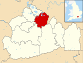
Location within Surrey
OS grid reference TQ1327
  London 17 mi (27 km)
Civil parish
  • n/a
District
Shire county
Region
Country England
Sovereign state United Kingdom
Post town Cobham
Postcode district KT11
Dialling code 01932
Police Surrey
Fire Surrey
Ambulance South East Coast
UK Parliament
List of places
UK
England
Surrey
51°19′41″N0°22′26″W / 51.328°N 0.374°W / 51.328; -0.374

Little Heath, sometimes spelt as "Littleheath", is an area of Cobham in the borough of Elmbridge in Surrey, England. It boarders the nearby villages of Oxshott and Stoke d'Abernon.

History

The area is best known as the site of a Diggers settlement in 1649 when a group expelled from St George's Hill, Weybridge, successfully established a short lived community. The Diggers cultivated 11 acres, constructed six houses, and began publishing pamphlets. Despite initial sympathy from the local lord, Parson John Platt, the community faced opposition as Platt, along with local landowners, mobilized gangs to thwart support and, ultimately, drove them out in April 1650. [1] [2]

During the 19th century a brickworks and clay pit occupied much of the Little Heath area. During the First World War the area was used as an ammunition dump with the brickworks resuming after the war. The site was occupied by the Canadian army during the Second World War. Following the war the brickworks reopened and continued until its final closure and the demolition of its buildings in 1958 after which the land was rehabilitated and the old claypit turned into a lake. [3] Housing was developed around on the northern end of the lake whilst the southern end was made into a public park accessible from paths at Heathield Road and Blundel Lane. [3]

Related Research Articles

<span class="mw-page-title-main">Cobham, Surrey</span> Village in the Borough of Elmbridge in Surrey, England

Cobham is a large village in the Borough of Elmbridge in Surrey, England, centred 17 miles (27 km) south-west of London and 10 miles (16 km) northeast of Guildford on the River Mole. It has a commercial/services High Street, a significant number of primary and private schools and the Painshill landscape park.

<span class="mw-page-title-main">Diggers</span> Group of Protestant agrarian socialists in 17th-century England

The Diggers were a group of religious and political dissidents in England, associated with agrarian socialism. Gerrard Winstanley and William Everard, amongst many others, were known as True Levellers in 1649, in reference to their split from the Levellers, and later became known as Diggers because of their attempts to farm on common land.

<span class="mw-page-title-main">North Downs</span> Range of hills in south east England, UK

The North Downs are a ridge of chalk hills in south east England that stretch from Farnham in Surrey to the White Cliffs of Dover in Kent. Much of the North Downs comprises two Areas of Outstanding Natural Beauty (AONBs): the Surrey Hills and the Kent Downs. The North Downs Way National Trail runs along the North Downs from Farnham to Dover.

<span class="mw-page-title-main">Borough of Elmbridge</span> Local government district in Surrey, England

Elmbridge is a local government district with borough status in Surrey, England. Its principal towns and villages are Esher, Cobham, Walton-on-Thames, Weybridge and Molesey. It directly borders the London Borough of Richmond upon Thames and the London Royal Borough of Kingston upon Thames. Some areas of the borough form a continuation of the Greater London Built-up Area, formerly falling into the Metropolitan Police District.

<span class="mw-page-title-main">Newton Heath</span> Area of Manchester, England

Newton Heath is an area of Manchester, England, 2.8 miles (4.5 km) north-east of Manchester city centre and with a population of 9,883.

Swanwick is a village in Hampshire, England, east of the River Hamble and north of the M27 motorway. The village is located within the borough of Fareham and is the site of the London Area Control Centre (LACC) and the London Terminal Control Centre (LTCC), part of National Air Traffic Services Air Traffic Control Centre, and Bursledon Brickworks, the last remaining example of a Victorian steam-powered brickworks.

<span class="mw-page-title-main">Moston, Manchester</span> Human settlement in England

Moston is a suburb of Manchester, in North West England, approximately 3 miles (4.8 km) north-east of the city centre. Historically in Lancashire, Moston is a predominantly residential area, with a population of 14,518 at the 2011 census and an area of approximately 1,300 acres (5.3 km2).

<span class="mw-page-title-main">Oxshott</span> Human settlement in England

Oxshott is a suburban village in the borough of Elmbridge in Surrey, England. Oxshott includes hilly acidic heath which is partly wooded and occupies the land between the large towns of Esher and Leatherhead. The Oxshott section of the single carriageway north-south A244 runs through its middle and briefly forms its high street, centred two miles from the A3 and the M25.

<span class="mw-page-title-main">Oxshott Heath and Woods</span> Area in Oxshott, Surrey, England

Oxshott Heath and Woods is an area of woods and heathland in Oxshott, Surrey, England covering approximately 200 acres (81 ha), as an area of common land. It is owned by a local authority, however historic rights of access and gathering dead wood where necessary for individual fires are shared and exercised by landowners in the parish of Oxshott which has existed since the end of the 19th century, created from the east of the village of Stoke D'Abernon which in this area was extremely scantly populated until the construction of Oxshott railway station.

<span class="mw-page-title-main">Bradford-with-Beswick</span>

Beswick is an inner city area in Manchester, England. It consists of the ancient township off Beswick, Manchester, which is in small land and in the ancient parish of Manchester and hundred of Salford.

<span class="mw-page-title-main">Earlswood</span> Human settlement in England

Earlswood is a suburb of Redhill in Surrey, England, which lies on the A23 between Redhill and Horley. Earlswood Common is a local nature reserve that separates the suburb from the southern outskirts of Reigate and has two lakes and picnic areas. Earlswood station is on the Brighton Main Line. To the east of the line are Royal Earlswood Park, the East Surrey Hospital and Whitebushes.

<span class="mw-page-title-main">Chailey</span> Village in East Sussex, England

Chailey is a village and civil parish in the Lewes District of East Sussex, England. It is located 7 miles north of Lewes, on the A272 road from Winchester to Canterbury. The Prime Meridian passes just to the east of Chailey.

<span class="mw-page-title-main">Nonsuch Park</span> Public park in Stoneleigh, Surrey, England

Nonsuch Park is a public park between Stoneleigh, Cheam, and Ewell in the borough of Epsom and Ewell in Surrey, England. It borders the London Borough of Sutton. It is the last surviving part of the Little Park of Nonsuch, a deer hunting park established by Henry VIII surrounding the former Nonsuch Palace.

<span class="mw-page-title-main">North Holmwood</span> Human settlement in England

North Holmwood is a residential area on the outskirts of Dorking, in Surrey, England. The village is accessible from the A24, the village's historic heart is the road Spook Hill. The 2011 census for the broader area Holmwoods shows a population of 6,417 and that North Holmwood forms part of the Dorking Built-up Area.

<span class="mw-page-title-main">Rushall, West Midlands</span> Suburban Village in Walsall, West Midlands, England

Rushall is a suburb in the Metropolitan Borough of Walsall in the West Midlands, England. It is centred on the main road between Walsall and Lichfield. It is mentioned in the Domesday Book but has mostly developed since the 1920s. Rushall was historically a part of the county of Staffordshire before it was incorporated with much of the old Aldridge-Brownhills Urban District into the modern-day Walsall district.

<span class="mw-page-title-main">Platt Fields Park</span> Public park in Manchester, England

Platt Fields Park is a large public park in Fallowfield, Manchester, England which is home to Platt Hall. Fallowfield lies to the south and Wilmslow Road runs along its eastern edge. Its north-eastern corner is close to the start of the Curry Mile.

<span class="mw-page-title-main">Mather & Platt</span>

Mather & Platt is the name of several large engineering firms in Europe, South Africa and Asia that are subsidiaries of Wilo SE, Germany or were founded by former employees. The original company was founded in the Newton Heath area of Manchester, England, where it was a major employer. That firm continues as a food processing and packaging business, trading as M & P Engineering in Trafford Park, Manchester.

<span class="mw-page-title-main">Highfield Country Park</span> Local Nature Reserve in Manchester, England

Highfield Country Park is a 70-acre (280,000 m2) area of open land, situated on the east side of Levenshulme, Manchester, that stretches to the east of Broom Avenue across to the rear of Reddish Golf Course and to the junction of Longford Road, Reddish and Nelstrop Road, Levenshulme.

<span class="mw-page-title-main">Moston Brook</span> Stream in Greater Manchester, England

Moston Brook is a stream in Greater Manchester in north-west England and a tributary of the River Irk. The brook is formed at the confluence of Bower Brook and Hole Bottom Brook. This occurs near the Rochdale Canal in Failsworth in the Metropolitan Borough of Oldham. It flows southwest, forming the border between Moston, Manchester and Failsworth before being culverted almost all of the remaining route to its meeting the River Irk. It has a total length of about 3.7 miles.

<span class="mw-page-title-main">Apex Leisure and Wildlife Park</span>

Apex Leisure and Wildlife Park is an urban park and wildlife centre in Highbridge, Somerset, England. The park was created on the site of a former clay pit and brickwork manufacturing site and provides a link between Highbridge and Burnham-on-Sea. There are various facilities including an outdoor gym, a lake and birdlife.

References

  1. "Little Heath – Surrey Diggers Trail". www.diggerstrail.org.uk. Archived from the original on 13 August 2020. Retrieved 15 January 2020.
  2. Gurney, John (July 2012). 'The Diggers and the local community', Brave Community: The Digger Movement in the English Revolution. Manchester: Manchester Scholarship Online.{{cite book}}: CS1 maint: date and year (link)
  3. 1 2 "Fedora - Clay Pit". www.fedora.org.uk. Retrieved 29 December 2023.