Related Research Articles

Cranleigh is a village and civil parish, about 8 miles (13 km) southeast of Guildford in Surrey, England. It lies on a minor road east of the A281, which links Guildford with Horsham. It is in the north-west corner of the Weald, a large remnant forest, the main local remnant being Winterfold Forest directly north-west on the northern Greensand Ridge.

The Weald is an area of South East England between the parallel chalk escarpments of the North and the South Downs. It crosses the counties of Hampshire, Surrey, Sussex and Kent. It has three separate parts: the sandstone "High Weald" in the centre; the clay "Low Weald" periphery; and the Greensand Ridge, which stretches around the north and west of the Weald and includes its highest points. The Weald once was covered with forest, and its name, Old English in origin, signifies "woodland". The term is still used today, as scattered farms and villages sometimes refer to the Weald in their names.

Farley Green is a small hamlet of Albury in the Greensand Ridge where it forms the south of the Surrey Hills AONB, to the south east of Guildford.

The High Weald Area of Outstanding Natural Beauty is in south-east England. Covering an area of 1,450 square kilometres (560 sq mi), it takes up parts of the counties of East Sussex, Kent, West Sussex and Surrey in order of respective contribution. It is the fourth largest Area of Outstanding Natural Beauty (AONB) in England and Wales. It has an attractive landscape with a mosaic of small farms and woodlands, historic parks, sunken lanes and ridge-top villages.

The Surrey Hills is a 422 km2 (163 sq mi) Area of Outstanding Natural Beauty (AONB), which principally covers parts of the North Downs and Greensand Ridge in Surrey, England. The AONB was designated in 1958 and adjoins the Kent Downs AONB to the east and the South Downs National Park in the south west.

Abinger is a large, well-wooded and mostly rural civil parish that lies between the settlements of Dorking, Shere and Ewhurst in the district of Mole Valley, Surrey, England.

St Martha's Hill is a landmark in St Martha in Surrey, England between the town of Guildford and village of Chilworth. It is the 18th highest hill in the county and on the Greensand Ridge, in this case at the closest point to the North Downs, commencing to the immediate north at the Guildown-Merrow Down in the parishes of Guildford and Merrow. The top of the hill provides a semi-panorama of Newland's Corner also in the Surrey Hills AONB. Its church is the main amenity of the small parish extending to the south into the streets of Chilworth, with some medieval stone incorporations from a 12th-century predecessor and is a wedding venue mainly to outside the sparsely populated parish.
Holmbury St. Mary is a village in Surrey, England centered on shallow upper slopes of the Greensand Ridge. Its developed area is a clustered town 4.5 miles (7 km) southwest of Dorking and 8 miles (13 km) southeast of Guildford. Most of the village is in the borough of Guildford, within Shere civil parish. Much of the east side of the village street is in the district of Mole Valley, within Abinger civil parish.

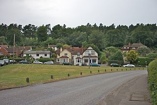
Ewhurst is a rural village and civil parish in the borough of Waverley in Surrey, England. It is located 8.3 miles (13.4 km) south-east of Guildford, 2 miles (3.2 km) east of Cranleigh and 4.5 miles (7.2 km) south of Shere.

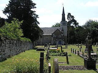
Wonersh is a village and civil parish in the Waverley district of Surrey, England and Surrey Hills Area of Outstanding Natural Beauty. Wonersh contains three Conservation Areas and spans an area three to six miles SSE of Guildford. In the outer London commuter belt, the village is 28 miles (45 km) southwest of London. Wonersh's economy is predominantly a service sector economy. Three architecturally-listed churches are within its boundaries as are a number of notable homes such as Frank Cook's 1905 hilltop mansion, which is a hotel, business and wedding venue.

Peaslake, Hoe, and Colman's Hill are in the centre of the Surrey Hills AONB and mid-west of the Greensand Ridge about 5 miles (8.0 km) ESE of Guildford. Surrounded by denser pine and other coniferous forest-clad hills, the three conjoined settlements have a small core in Peaslake itself with the amenities of a village, but are otherwise lightly scattered settlements at a higher elevation than the centre of Shere, the civil parish.

Warnham is a village and civil parish in the Horsham district of West Sussex, England. The village is centred 2 miles (3.2 km) north-northwest of Horsham, 31 miles (50 km) from London, to the west of the A24 road. Other named settlements within the parish include the hamlets of Goosegreen, Kingsfold and Winterfold as well as parts of Strood Green and Rowhook. The area is in the northwest of the Weald, a gently sloped remnant forest in southeast England and largely a plain by erosion.

Gomshall is a village in the borough of Guildford in Surrey, England.

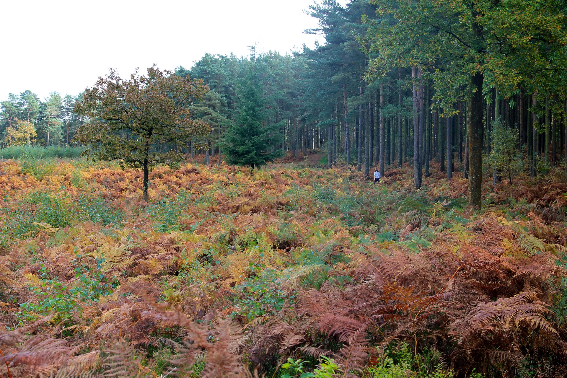
The Greensand Ridge, also known as the Wealden Greensand is an extensive, prominent, often wooded, mixed greensand/sandstone escarpment in south-east England. Forming part of the Weald, a former dense forest in Sussex, Surrey and Kent, it runs to and from the East Sussex coast, wrapping around the High Weald and Low Weald. It reaches its highest elevation, 294 metres (965 ft), at Leith Hill in Surrey—the second highest point in south-east England, while another hill in its range, Blackdown, is the highest point in Sussex at 280 metres (919 ft). The eastern end of the ridge forms the northern boundary of Romney Marsh.
The western Weald is an area of undulating countryside in Hampshire and West Sussex containing a mixture of woodland and heathland areas.
Gatton is a former village and borough in Surrey, England, and an ancient parish. It survives as a sparsely populated, predominantly rural locality, which includes Gatton Park, no more than 12 houses, and two farms on the slopes of the North Downs near Reigate.
Holmbury Hill is a wooded area of 261 metres (856 ft) above sea level in Surrey, England, and the site of an Iron Age-period hillfort. The Old Saxon word "holm" can be translated as hill and "bury" means fortified place. It sits along the undulating Greensand Ridge, its summit being 805 feet (245 m) from the elevated and tightly clustered small village of Holmbury St. Mary which was traditionally part of Shere, 8 kilometres (5.0 mi) away.

The Law Brook or Postford Brook is a stream in the Surrey Hills AONB which feeds the Tillingbourne which in turn feeds the River Wey. It is notable in its own right chiefly for its industrial vestiges and records.
The Pipp Brook is a left-bank tributary of the River Mole, Surrey, England. It rises at two main springs north of Leith Hill on the Greensand Ridge, then descends steeply in a northward direction, before flowing eastwards along the Vale of Holmesdale. It runs to the north of Dorking High Street, before discharging into the Mole at Pixham.
Winterfold House is one of the few private country properties to be designed by London architect Edward Blakeway I'Anson, F.R.I.B.A., M.A. Cantab of St Laurence Pountney Hill, E.C. He was the elder son of Edward I'Anson JP, born in London and educated at Cheltenham College and Cambridge University. He followed his father's profession and was architect and surveyor to St Bartholomew's Hospital in London. The Architect’s practice continued by him was one of the oldest established in the country, and many of the finest buildings in the City of London including the new Corn Exchange in Mark Lane, London are of his design. He was Master of the Worshipful Company of Merchant Taylors in 1908. In partnership with his father Edward I'Anson they had earlier made a successful major refurbishment to Fetcham Park House Surrey.
References
- ↑ Cranfield University National Soil Resources Institute
- ↑ Database of British and Irish Hills Retrieved 2015-03-06
