
Ashwell Springs is a 0.3-hectare (0.74-acre) biological Site of Special Scientific Interest in Ashwell in Hertfordshire, England. The local planning authority is North Hertfordshire District Council.

Ashridge Commons and Woods is a 640.1 hectare biological Site of Special Scientific Interest in Buckinghamshire and Hertfordshire. It is located in Little Gaddesden, and is part of the National Trust Ashridge Estate in the Chilterns Area of Outstanding Natural Beauty.

Wormley-Hoddesdonpark Wood South is a 192.5 hectares is a biological site of Special Scientific Interest near Cheshunt in Hertfordshire. It is part of Broxbourne Woods National Nature Reserve, and is listed in A Nature Conservation Review. Wormley Wood is owned and managed by the Woodland Trust. The site is also a Special Area of Conservation.

Wormley-Hoddesdonpark Wood North is a 143.9-hectare (356-acre) woodland area in Hertfordshire which has been designated as a biological site of Special Scientific Interest. The site is listed as Grade 1 in A Nature Conservation Review, and is also designated a Special Area of Conservation. It is in Hoddesdon in the borough of Broxbourne, but part of the site is in East Hertfordshire.

Rye Meads is a 58.5-hectare (145-acre) biological Site of Special Scientific Interest (SSSI) in Rye House, Hoddesdon, Hertfordshire. It is one of series of wetlands and reservoirs situated along the River Lea, to the north-east of London. It is part of the Lea Valley Ramsar site and a Special Protection Area.

Tring Reservoirs is a group of four reservoirs close to Tring on the border of Hertfordshire and Buckinghamshire, England. Their purpose is to feed the Grand Union Canal.

Frogmore Meadows is a 4.6-hectare (11-acre) biological Site of Special Scientific Interest in Hertfordshire and Buckinghamshire, north of the village of Chenies. It consists of two meadows in the Chilterns Area of Outstanding Natural Beauty, next to the River Chess, one of which is a Hertfordshire and Middlesex Wildlife Trust nature reserve. The planning authorities are Three Rivers District Council, Dacorum Borough Council and Chiltern District Council.

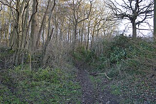
Sarratt Bottom nature Reserve in Hertfordshire is a 3.2-hectare (7.9-acre) biological Site of Special Scientific Interest. The site is a meadow beside the River Chess. It is an example of damp grassland which has been traditionally managed for grazing. There are also areas of swamp and marsh. The main plants in grassland areas include sweet vernal grass and meadow foxtail, and marsh horsetail and common spike-rush are common in damper areas. The site has hedgehogs and a wide variety of wetland birds and invertebrates.

Amwell Quarry or Amwell Nature Reserve is a 37 hectare biological Site of Special Scientific Interest in Great Amwell in Hertfordshire. The planning authority is East Hertfordshire District Council. It is also part of the Lee Valley Ramsar Site and Special Protection Area, and is owned and managed by the Hertfordshire and Middlesex Wildlife Trust.

Northaw Great Wood is a 223.6-hectare (553-acre) biological Site of Special Scientific Interest (SSSI) near Cuffley in Hertfordshire, England. It covers Northaw Great Wood Country Park, which is managed by Welwyn Hatfield Borough Council, Well Wood, Justice Hill and Grimes Bottom. Part of the site is managed by Hertfordshire County Council as a schools' park. The country park is also a local nature reserve.
Benington High Wood is a 20.7-hectare (51-acre) biological Site of Special Scientific Interest in Benington, Hertfordshire. The planning authority is East Hertfordshire District Council.

Knebworth Woods is a 120.8-hectare (299-acre) biological Site of Special Scientific Interest in Knebworth, immediately south of Stevenage in Hertfordshire. The planning authority is North Hertfordshire District Council.

Moor Hall Meadows is a 24.4-hectare (60-acre) biological Site of Special Scientific Interest in Moor Green in Hertfordshire. The local planning authority is East Hertfordshire District Council.

Blagrove Common is a 4.0-hectare (9.9-acre) Site of Special Scientific Interest in Green End near Sandon in Hertfordshire. It is managed by the Hertfordshire and Middlesex Wildlife Trust, and the planning authority is North Hertfordshire District Council.

Tring Woodlands is a 23.8-hectare (59-acre) biological Site of Special Scientific Interest in Tring in Hertfordshire. It is part of the Chilterns Area of Outstanding Natural Beauty and the local planning authority is Dacorum District Council. The wood has a rich flora, showing that it is well established. It is a good example of a semi-natural beech wood in Hertfordshire. Plants that are abundant include woodruff, wood anemone and dog's mercury, and there are a variety of woodland birds. There is access to the wood from Hastoe Hill.

Redwell Wood is a 52.8-hectare (130-acre) biological Site of Special Scientific Interest near South Mimms in Hertfordshire. The local planning authority is Welwyn Hatfield District Council.

Hertford Heath nature reserve is a 28 hectare biological Site of Special Scientific Interest in Hertford Heath in Hertfordshire. It is managed by the Herts and Middlesex Wildlife Trust and the local planning authority is East Hertfordshire District Council.

Tewinbury is a 7.5-hectare (19-acre) biological Site of Special Scientific Interest near Tewin in Hertfordshire. The local planning authority is East Hertfordshire District Council, and the site is managed by the Herts and Middlesex Wildlife Trust

Moorend Common is a 28-hectare (69-acre) Site of Special Scientific Interest in the hamlet Moor End, west of High Wycombe in Buckinghamshire. It is in the Chilterns Areas of Outstanding Natural Beauty, and it is owned and managed by Lane End Parish Council.
